|
Sterling Ranch, Colorado
Sterling Ranch is an unincorporated community and a census-designated place (CDP) located in and governed by Douglas County, Colorado, United States. The population was 1,789 at the 2020 census. The CDP is a part of the Denver–Aurora–Lakewood, CO Metropolitan Statistical Area. Douglas County governs the unincorporated community and the Sterling Ranch Community Authority Board provides services through several metropolitan districts. The Littleton post office ( Zip Code 80125) serves the area. History Construction of Sterling Ranch development began in early 2016, with eight builders offering single-family homes. The development comprises 3,400 acres and was to eventually house 33,000 residents. The full buildout for the community is projected to take 20 years and will include nine villages with a town center. Sterling Ranch will include 30 miles of internal trails connecting to Chatfield State Park and Roxborough State Park and three regional parks. Nearly 40 percen ... [...More Info...] [...Related Items...] OR: [Wikipedia] [Google] [Baidu] |
Census-designated Place
A census-designated place (CDP) is a Place (United States Census Bureau), concentration of population defined by the United States Census Bureau for statistical purposes only. CDPs have been used in each decennial census since 1980 as the counterparts of incorporated places, such as self-governing city (United States), cities, town (United States), towns, and village (United States), villages, for the purposes of gathering and correlating statistical data. CDPs are populated areas that generally include one officially designated but currently unincorporated area, unincorporated community, for which the CDP is named, plus surrounding inhabited countryside of varying dimensions and, occasionally, other, smaller unincorporated communities as well. CDPs include small rural communities, Edge city, edge cities, colonia (United States), colonias located along the Mexico–United States border, and unincorporated resort and retirement community, retirement communities and their environs. ... [...More Info...] [...Related Items...] OR: [Wikipedia] [Google] [Baidu] |
Denver–Aurora–Lakewood, CO Metropolitan Statistical Area
Denver is the central city of a conurbation region in the U.S. state of Colorado. The conurbation includes one continuous region consisting of the six central counties of Adams, Arapahoe, Broomfield, Denver, Douglas, and Jefferson. The Denver region is part of the Front Range Urban Corridor. The United States Office of Management and Budget has delineated the Denver–Aurora–Lakewood, CO Metropolitan Statistical Area consisting of ten Colorado counties: the City and County of Denver, Arapahoe County, Jefferson County, Adams County, Douglas County, the City and County of Broomfield, Elbert County, Park County, Clear Creek County, and Gilpin County. The population, as of the 2020 Census, is 2,963,821, an increase of 16.5% since 2010. The Office of Management and Budget also delineated the more extensive 12-county Denver–Aurora, CO Combined Statistical Area comprising the Denver-Aurora-Lakewood Metropolitan Statistical Area, the Boulder, CO Metropolitan Statist ... [...More Info...] [...Related Items...] OR: [Wikipedia] [Google] [Baidu] |
Colorado Cities And Towns
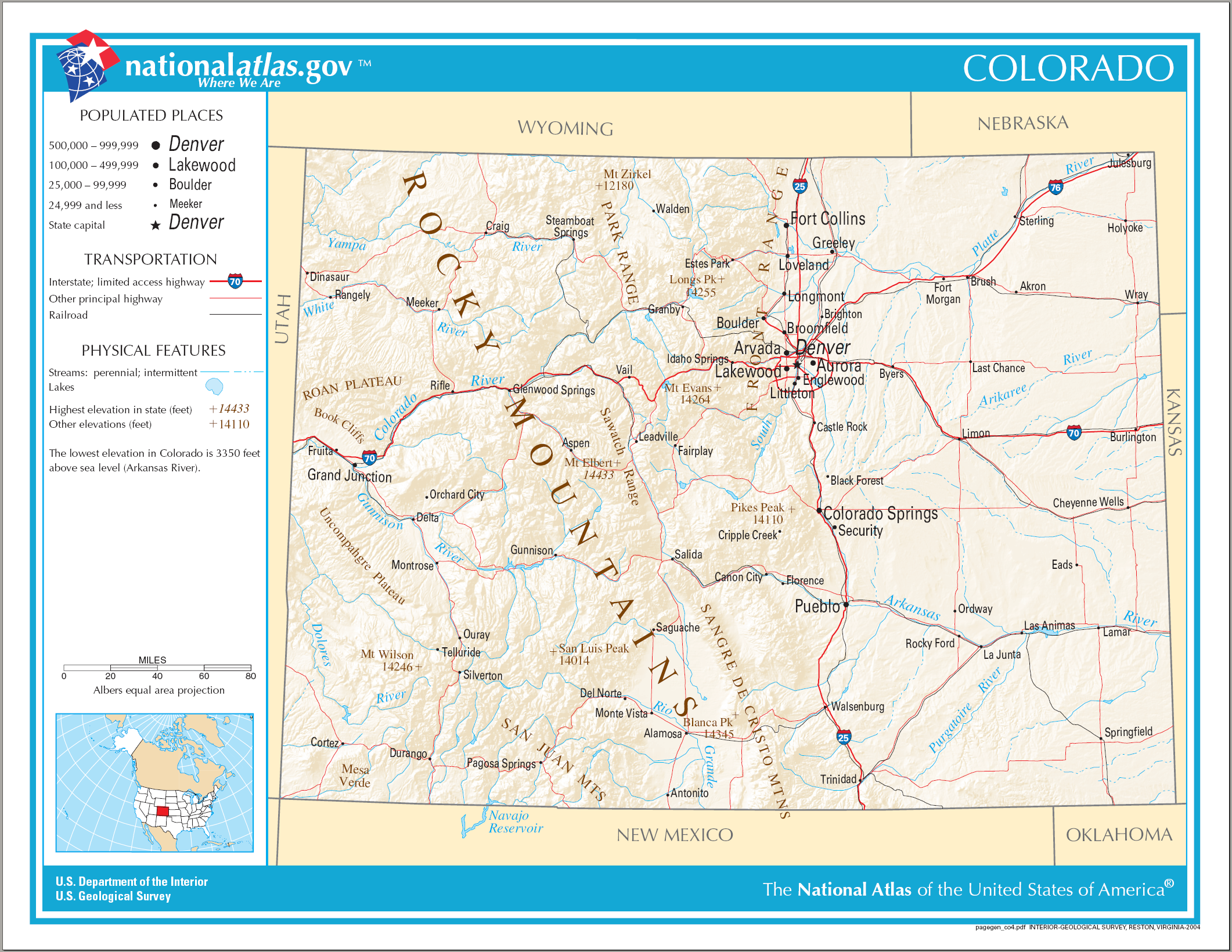
The U.S. State of Colorado has 272 active incorporated municipalities, comprising 197 towns, 73 cities, and two consolidated city and county governments. At the 2020 United States Census, 4,299,942 of the 5,773,714 Colorado residents (74.47%) lived in one of these 272 municipalities. Another 714,417 residents (12.37%) lived in one of the 210 census-designated places, while the remaining 759,355 residents (13.15%) lived in the many rural and mountainous areas of the state. Colorado municipalities range in population from the City and County of Denver, the state capital, with a 2020 population of 715,522, to the Town of Carbonate, which has had no year-round population since the 1890 Census due to its severe winter weather and difficult access. The City of Black Hawk with a 2020 population of 127 is the least populous Colorado city, while the Town of Castle Rock with a 2020 population of 73,158 is the most populous Colorado town. Only of Colorado's of land area (1.90%) ... [...More Info...] [...Related Items...] OR: [Wikipedia] [Google] [Baidu] |
State Of Colorado
Colorado (, other variants) is a state in the Mountain West subregion of the Western United States. It encompasses most of the Southern Rocky Mountains, as well as the northeastern portion of the Colorado Plateau and the western edge of the Great Plains. Colorado is the eighth most extensive and 21st most populous U.S. state. The 2020 United States census enumerated the population of Colorado at 5,773,714, an increase of 14.80% since the 2010 United States census. The region has been inhabited by Native Americans and their ancestors for at least 13,500 years and possibly much longer. The eastern edge of the Rocky Mountains was a major migration route for early peoples who spread throughout the Americas. "''Colorado''" is the Spanish adjective meaning "ruddy", the color of the Fountain Formation outcroppings found up and down the Front Range of the Rocky Mountains. The Territory of Colorado was organized on February 28, 1861, and on August 1, 1876, U.S. President Ulysses ... [...More Info...] [...Related Items...] OR: [Wikipedia] [Google] [Baidu] |
Index Of Colorado-related Articles
This is an alphabetical list of articles related to the U.S. State of Colorado. 0–9 * .co.us – Internet second-level domain for the State of Colorado * 4 Corners ** 4 Corners Monument * 6th Principal Meridian * 10-mile Range * 10th Mountain Division (United States) * 16th Street Mall * 25th meridian west from Washington * 32nd meridian west from Washington * 37th parallel north * 38th parallel north * 39th parallel north * 40th parallel north * 41st parallel north * 64 counties of the State of Colorado * 100 km isolated peaks of Colorado * 103rd meridian west * 104th meridian west * 105th meridian west * 106th meridian west * 107th meridian west * 108th meridian west * 109th meridian west * 1500 meter prominent peaks of Colorado * 4000 meter peaks of Colorado * 5280 magazinebr>website* 14,000-foot peaks of Colorado A * Adams County, Colorado * Adams-Onís Treaty of 1819 * Adjacent States: (seven, the third most of the 50 states) ** ** ** ** ** ** ** ... [...More Info...] [...Related Items...] OR: [Wikipedia] [Google] [Baidu] |
Outline Of Colorado
The following outline is provided as an overview of and topical guide to the U.S. state of Colorado: Colorado – 22nd most populous, the eighth most extensive, and the highest in average elevation of the 50 United States. Colorado is one of the western Mountain States. The 30 highest major summits of the Rocky Mountains all rise within Colorado. The Territory of Colorado joined the Union as the 38th state on August 1, 1876. General reference * Names ** Common name: Colorado *** Pronunciation: ** Official name: State of Colorado ** Abbreviations and name codes *** Postal symbol: CO *** ISO 3166-2 code: US-CO *** Internet second-level domain: .co.us ** Nicknames ***Buffalo Plains State (in disuse) ***Centennial State (previously used on license plates) ***Colorful Colorado (previously used on license plates) ***Columbine State ***Highest State ***Lead State (in disuse) ***Mother of Rivers ***Rocky Mountain Empire ***Rocky Mountain State ***Silver Stat ... [...More Info...] [...Related Items...] OR: [Wikipedia] [Google] [Baidu] |
Water Treatment
Water treatment is any process that improves the quality of water to make it appropriate for a specific end-use. The end use may be drinking, industrial water supply, irrigation, river flow maintenance, water recreation or many other uses, including being safely returned to the environment. Water treatment removes contaminants and undesirable components, or reduces their concentration so that the water becomes fit for its desired end-use. This treatment is crucial to human health and allows humans to benefit from both drinking and irrigation use. Water is the most crucial compound for life on Earth, and having drinkable water is a key worldwide concern for the twenty-first century. All living things require clean, uncontaminated water as a basic requirement. Water covers more than 71 percent of the earth’s surface, but only around 1% of it is drinkable according to international standards due to various contaminations . Waste water discharge from industries, agricultural ... [...More Info...] [...Related Items...] OR: [Wikipedia] [Google] [Baidu] |
Douglas County School District RE-1
Douglas County School District Re. 1 is a school district that serves Douglas County, Colorado. The district was formed in 1958 by the consolidation of 17 smaller school districts, adding the "Re. 1" to its name to note the district's first reorganization. In August 2019, the Arapahoe Community College Sturm Collaboration Campus at Castle Rock, Colorado has opened. This is a partnership with the district and Colorado State University. Classes at the new 43,000-square-foot facility at 4500 Limelight Ave. begins Aug. 19. Initial educational offerings will be in the areas of business and entrepreneurship, health care, cybersecurity and secure software, information technology/programming, general education and workforce training. Schools Castle Rock area *Academy Charter School *American Academy Castle Pines *Aspen View Academy *Cantril Preschool *Castle Rock Elementary School *Castle Rock Middle School *Castle View High School *Cherry Valley Elementary School *Clear Sky Elementary ... [...More Info...] [...Related Items...] OR: [Wikipedia] [Google] [Baidu] |
United States Census 2020
The United States census of 2020 was the twenty-fourth decennial United States census. Census Day, the reference day used for the census, was April 1, 2020. Other than a pilot study during the 2000 census, this was the first U.S. census to offer options to respond online or by phone, in addition to the paper response form used for previous censuses. The census was taken during the COVID-19 pandemic, which affected its administration. The census recorded a resident population of 331,449,281 in the fifty states and the District of Columbia, an increase of 7.4 percent, or 22,703,743, over the preceding decade. The growth rate was the second-lowest ever recorded, and the net increase was the sixth highest in history. This was the first census where the ten most populous states each surpassed 10 million residents as well as the first census where the ten most populous cities each surpassed 1 million residents. Background As required by the United States Constitution, the U.S. census ... [...More Info...] [...Related Items...] OR: [Wikipedia] [Google] [Baidu] |
Roxborough State Park
Roxborough State Park is a state park of Colorado, United States, known for dramatic red sandstone formations. Located in Douglas County south of Denver, Colorado, the park was established in 1975. In 1980 it was recognized as a National Natural Landmark. Geography Roxborough State Park, a Colorado State Park, is known for dramatic red sandstone formations. Located in Douglas County south of Denver, Colorado. In 1980 it was recognized as a National Natural Landmark because of the number of ecological systems and geological formations. It is also a State Historic Site and National Cultural District because of the number of archaeological sites. Climate According to the Köppen Climate Classification system, Roxborough State Park has an oceanic climate, abbreviated "Cfb" on climate maps. The hottest temperature recorded in Roxborough State Park was on July 17, 1997, and July 21, 1997, while the coldest temperature recorded was on February 2, 2011. Geology Roxboroug ... [...More Info...] [...Related Items...] OR: [Wikipedia] [Google] [Baidu] |
Chatfield State Park
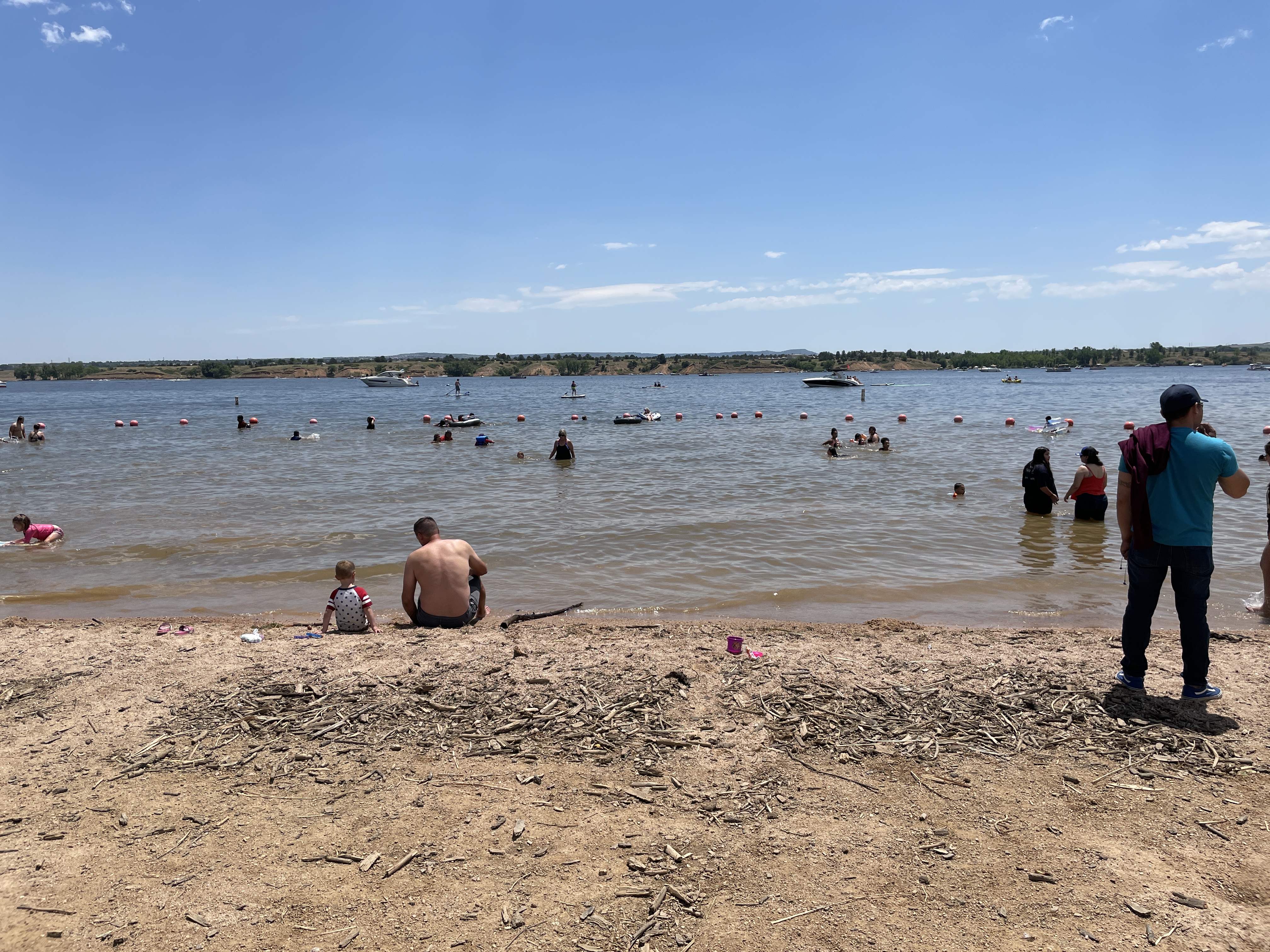
Chatfield State Park is a state park located in Douglas and Jefferson counties of Colorado, United States. The park centers on Chatfield Reservoir, a 1,423 acre surface area lake fed by the South Platte River and two other creeks, including Plum Creek. Reservoir Expansion Project The Chatfield Reservoir Reallocation Project, a million construction project that took place between 2017 and 2020, created an additional of water storage in the reservoir, raising its level by about . The project involved moving some of the surrounding park's facilities back from the new, higher lake levels. Wildlife Over three hundred bird species both migrant and resident frequent Chatfield. Also a variety of mammals roam the park, including whitetail and mule deer, coyote, red fox, cottontail rabbit, prairie dogs and weasels. Audubon Center at Chatfield State Park The Audubon Society of Greater Denver operates the Audubon Center at Chatfield State Park, a nature education center that offers ... [...More Info...] [...Related Items...] OR: [Wikipedia] [Google] [Baidu] |


