|
St Peter Island (South Australia)
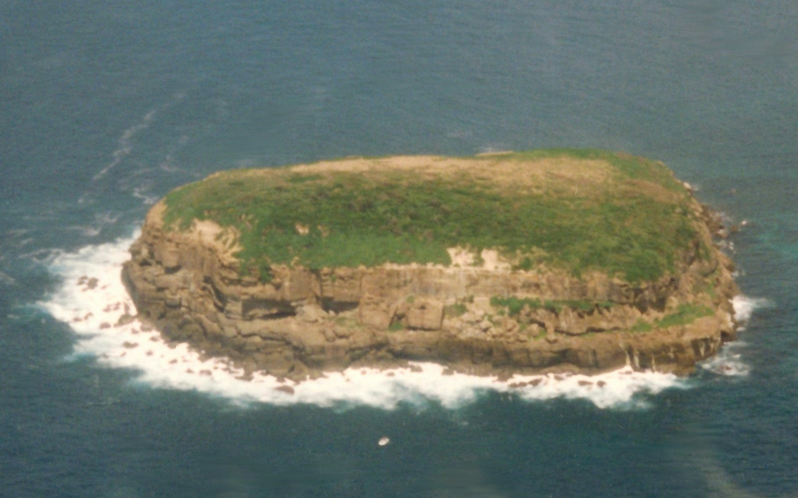
St Peter Island (originally in Dutch: ''Eyland St. Pierre'') is an island in the Nuyts Archipelago on the west coast of Eyre Peninsula in South Australia near Ceduna. It is the second largest island in South Australia and about long. It was one of the first parts of South Australia to be discovered and named by Europeans, along with St Francis Island, mapped by François Thijssen in 't Gulden Zeepaert in 1627. Seal hunting took place on the island in the 1820s and 1830s. Archaeological investigations have also located whale vertebra at the site. The historic St Peter Island Whaling Sites are listed on the South Australian Heritage Register as a designated place of archaeological significance. Protected area status Statutory reserves The island is part of the Nuyts Archipelago Conservation Park while the waters surrounding its shores are in the Nuyts Archipelago Marine Park. Non-statutory arrangements Important Bird Area The island is part of the Nuyts Archipelago Import ... [...More Info...] [...Related Items...] OR: [Wikipedia] [Google] [Baidu] |
Nuyts Archipelago
The Nuyts Archipelago is an island group located in South Australia in the Great Australian Bight to the south of the town of Ceduna on the west coast of the Eyre Peninsula. It consisting of mostly granitic islands and reefs that provide breeding sites for Australian sea lions and support colonies of short-tailed shearwater. It also includes the island group known as the Isles of St Francis. All the islands with exception of a part of Evans Island, are located with the following protected areas - the Nuyts Archipelago Wilderness Protection Area and the Nuyts Archipelago Conservation Park. Description Of the roughly 30 islands and reefs in the archipelago, those lying furthest from the coast of the Eyre Peninsula are known as the Isles of St Francis, after the largest. Most of the islands are formed of calcarenite lying on granite; where the softer calcarenite is close to sea level it has been heavily eroded by wave action. The area is biologically unique in Sout ... [...More Info...] [...Related Items...] OR: [Wikipedia] [Google] [Baidu] |
Nuyts Archipelago Important Bird Area
The Nuyts Archipelago is an island group located in South Australia in the Great Australian Bight to the south of the town of Ceduna on the west coast of the Eyre Peninsula. It consisting of mostly granitic islands and reefs that provide breeding sites for Australian sea lions and support colonies of short-tailed shearwater. It also includes the island group known as the Isles of St Francis. All the islands with exception of a part of Evans Island, are located with the following protected areas - the Nuyts Archipelago Wilderness Protection Area and the Nuyts Archipelago Conservation Park. Description Of the roughly 30 islands and reefs in the archipelago, those lying furthest from the coast of the Eyre Peninsula are known as the Isles of St Francis, after the largest. Most of the islands are formed of calcarenite lying on granite; where the softer calcarenite is close to sea level it has been heavily eroded by wave action. The area is biologically unique in Sou ... [...More Info...] [...Related Items...] OR: [Wikipedia] [Google] [Baidu] |
Greater Stick-nest Rat
The greater stick-nest rat, also known as the house-building rat and wopilkara (''Leporillus conditor'') is a species of rodent in the family Muridae. They are about the size of a small rabbit and construct large nests of interwoven sticks. Once widespread across southern Australia, the population was reduced after European colonisation to a remnant outpost on South Australia's Franklin Islands. The species has since been reintroduced to a series of protected and monitored areas, with varying levels of success. Taxonomy A description of the species was given in a report of the explorer Charles Sturt, and published in 1848. The species was placed as genus '' Mus'', and later assigned to '' Leporillus'', and so allied to the murid family of rodents. The type was collected in vegetation on the Darling River, around 45 miles from Laidley Ponds, the disposition of this specimen is unknown. Description The species has a broad and short head, with wide and rounded ears. The length o ... [...More Info...] [...Related Items...] OR: [Wikipedia] [Google] [Baidu] |
Woylie
The woylie or brush-tailed bettong (''Bettongia penicillata'') is a small, critically endangered, gerbil-like mammal native to forests and shrubland of Australia. A member of the rat-kangaroo family (Potoroidae), it moves by hopping and is active at night, digging for fungi to eat. It is also a marsupial and carries its young in a pouch. Once widespread, the woylie mostly died out from habitat loss and introduced predators such as foxes. It is currently restricted to two small areas in Western Australia. There are two subspecies: ''B. p. ogilbyi'' in the west, and the now-extinct ''B. p. penicillata'' in the southeast. Taxonomy A species was first described by J. E. Gray in 1837, based on the skin and skull of an adult male obtained by the Zoological Society of London, and placed with the British Museum of Natural History. The origin of the holotype has not been determined, but it is presumed to be New South Wales. The two subspecies recognised are: * ''Bettongia penicilla ... [...More Info...] [...Related Items...] OR: [Wikipedia] [Google] [Baidu] |
List Of Islands Of Australia
This is a list of selected Australian islands grouped by State or Territory. Australia has 8,222 islands within its maritime borders. Largest islands The islands larger than are: * Tasmania (Tas) ; * Melville Island, Northern Territory (NT), ; * Kangaroo Island, South Australia (SA), ; * Groote Eylandt (NT), ; * Bathurst Island (NT), ; * Fraser Island, Queensland (Qld), ; * Flinders Island (Tas), ; * King Island (Tas), ; and * Mornington Island (Qld), . New South Wales * Amherst Island, in Lake Mummuga * Bare Island, near the north headland of Botany Bay * Belowla Island, off Kioloa Beach * Bird Island, located near Budgewoi, east of the Central Coast * Boondelbah Island, at the mouth of Port Stephens * Brisbane Water: ** Pelican Island ** Riley's Island ** St Hubert's Island (largely artificial, created by raising an inter-tidal wetland above high water level) * Broughton Island, located north of Port Stephens * Broulee Island, located off the coast at ... [...More Info...] [...Related Items...] OR: [Wikipedia] [Google] [Baidu] |
Tourville And Murat Bays Important Bird Area
Tourville and Murat Bays Important Bird Area is an important bird area in South Australia with a combined area of , located west to the town of Ceduna on the north-west corner of the Eyre Peninsula in the Great Australian Bight. It is considered to be an important area because of the resident populations of waders, or shorebirds. Description The Important Bird Area (IBA) consists of two separate areas - one on the west side of Murat Bay and the other covering the full extent of Tourville Bay. Both bays open to Denial Bay which itself is bounded by St Peter Island, a member of the Nuyts Archipelago, on its east side. Tourville Bay has a relatively narrow neck and contains extensive intertidal flats and saltmarsh. Murat Bay is more open to the sea. They are separated by about of headland. The important bird area includes the intertidal zone and extends inland to take in other coastal features such as wetlands, including mangroves and playa lakes. Criteria for nominatio ... [...More Info...] [...Related Items...] OR: [Wikipedia] [Google] [Baidu] |
Pied Oystercatcher
The pied oystercatcher (''Haematopus longirostris'') is a species of oystercatcher. It is a wading bird native to Australia and commonly found on its coastline. The similar South Island pied oystercatcher (''H. finschi'') occurs in New Zealand. Description The name "oystercatcher" is something of a misnomer for this species, because they seldom eat oysters, which are found mainly on rocky coastlines. Pied oystercatchers frequent sandy coastlines, where they feed mainly on bivalve molluscs, which are prised apart with their specially adapted bill. These adaptations allow the Pied oystercatchers to slip their bills between the ventral edges of these shelled organisms, further allowing them to sever the shells and reach the edible flesh inside. This Australian species is easily recognized by the characteristic 5–8 cm long orange-red beak, slender pink legs and black and white plumage. With the wings extended, a white wing-stripe is also visible. The male and female show ... [...More Info...] [...Related Items...] OR: [Wikipedia] [Google] [Baidu] |
White-faced Storm-petrel
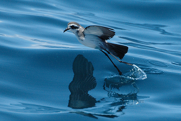
The white-faced storm petrel (''Pelagodroma marina''), also known as white-faced petrel is a small seabird of the austral storm petrel family Oceanitidae. It is the only member of the monotypic genus ''Pelagodroma''. Description The white-faced storm petrel is in length with a wingspan. It has a pale brown to grey back, rump and wings with black flight feathers. It is white below, unlike other north Atlantic petrels, and has a white face with a black eye mask like a phalarope. Its plumage makes it one of the easier petrels to identify at sea. Behaviour The white-faced storm petrel is strictly pelagic outside the breeding season, and this, together with its often-remote breeding sites, makes this petrel a difficult bird to see from land. Only in severe storms might this species be pushed into headlands. There have been a handful of western Europe records from France, the United Kingdom and the Netherlands. It has a direct gliding flight and will patter on the water surface as i ... [...More Info...] [...Related Items...] OR: [Wikipedia] [Google] [Baidu] |
Short-tailed Shearwater
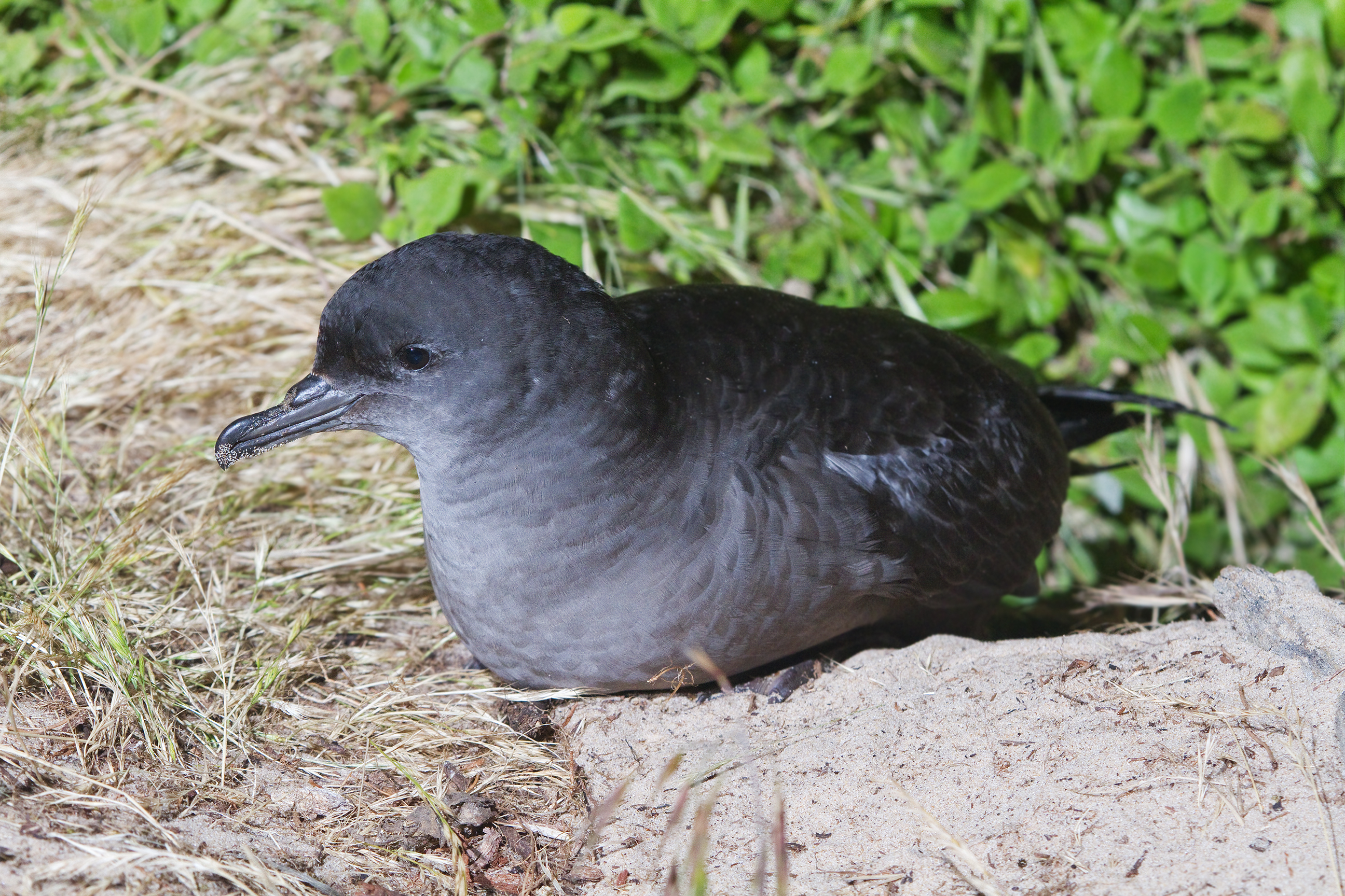
The short-tailed shearwater or slender-billed shearwater (''Ardenna tenuirostris''; formerly ''Puffinus tenuirostris''), also called yolla or moonbird, and commonly known as the muttonbird in Australia, is the most abundant seabird species in Australian waters, and is one of the few Australian native birds in which the chicks are commercially harvested. It is a migratory species that breeds mainly on small islands in Bass Strait and Tasmania and migrates to the Northern Hemisphere for the boreal summer. Taxonomy This shearwater appears to be related to the sooty and great shearwaters, which are also blunt-tailed, black-billed species, but its precise relationships are obscure (Austin, 1996; Austin ''et al.'', 2004). These are among the larger species of shearwater, which have been moved to a separate genus, ''Ardenna'' based on a phylogenetic analysis of mitochondrial DNA (Penhallurick & Wink, 2004). Ecology Each parent feeds the single chick for 2–3 days and then leaves f ... [...More Info...] [...Related Items...] OR: [Wikipedia] [Google] [Baidu] |
BirdLife International
BirdLife International is a global partnership of non-governmental organizations that strives to conserve birds and their habitats. BirdLife International's priorities include preventing extinction of bird species, identifying and safeguarding important sites for birds, maintaining and restoring key bird habitats, and empowering conservationists worldwide. It has a membership of more than 2.5 million people across 116 country partner organizations, including the Royal Society for the Protection of Birds, the Wild Bird Society of Japan, the National Audubon Society and American Bird Conservancy. BirdLife International has identified 13,000 Important Bird and Biodiversity Areas and is the official International Union for Conservation of Nature’s Red List authority for birds. As of 2015, BirdLife International has established that 1,375 bird species (13% of the total) are threatened with extinction ( critically endangered, endangered or vulnerable). BirdLife International ... [...More Info...] [...Related Items...] OR: [Wikipedia] [Google] [Baidu] |
Nuyts Archipelago Conservation Park
Nuyts Archipelago Conservation Park is a protected area in the Australian state of South Australia located on Eyre Island and St Peter Island in the Nuyts Archipelago located off the west coast of Eyre Peninsula about south and south-east respectively of Ceduna. The land first received protected area status as a fauna conservation reserves proclaimed on 16 March 1967 under the ''Crown Lands Act 1929'' in respect to Eyre Island. Additional fauna conservation reserves were proclaimed on 4 November 1967 in respect to the Franklin Islands, Goat Island, Lacy Islands, Lound Island and Purdie Island. On 27 April 1972, all of the land proclaimed as fauna conservation reserves was reconstituted as the ''Nuyts Archipelago Conservation Park'' under the ''National Parks and Wildlife Act 1972''. On 14 January 1988, St Peter Island was added to the conservation park. On 19 December 1991, additional land was added to the conservation park to extend protection over land located betwe ... [...More Info...] [...Related Items...] OR: [Wikipedia] [Google] [Baidu] |
Great Australian Bight
The Great Australian Bight is a large oceanic bight, or open bay, off the central and western portions of the southern coastline of mainland Australia. Extent Two definitions of the extent are in use – one used by the International Hydrographic Organization (IHO) and the other used by the Australian Hydrographic Service (AHS). The IHO defines the Great Australian Bight as having the following limits: ''On the North.'' The south coast of the Australian mainland. ''On the South.'' A line joining West Cape Howe () Australia to South West Cape, Tasmania. ''On the East.'' A line from Cape Otway, Victoria to King Island and thence to Cape Grim, the northwest extreme of Tasmania. The AHS defines the bight with a smaller area, from Cape Pasley, Western Australia, to Cape Carnot, South Australia - a distance of . Much of the bight lies due south of the expansive Nullarbor Plain, which straddles South Australia and Western Australia. The Eyre Highway passes close to t ... [...More Info...] [...Related Items...] OR: [Wikipedia] [Google] [Baidu] |


