|
Socho
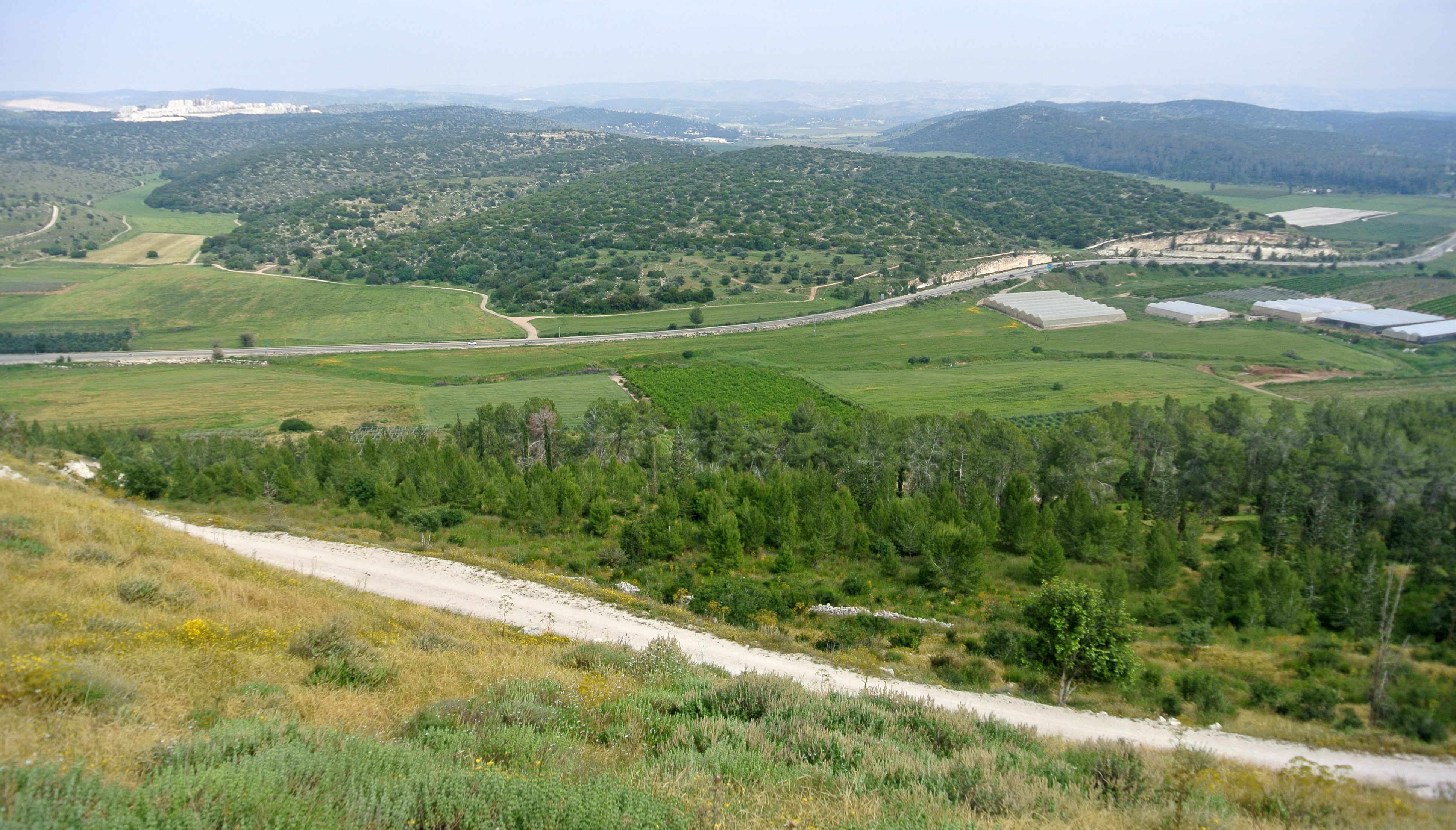
Sokho (alternate spellings: Sokhoh, Sochoh, Soco, Sokoh; he, שׂוֹכֹה ,שׂוֹכ֖וֹ ,שֹׂכֹ֖ה) is the name given to two ancient towns in the territorial domain of Judah as mentioned in the Hebrew Bible, west of the Judean hills. Both towns were given the name ''Shuweikah'' in Arabic, a diminutive of the Arabic ''shawk'', meaning "thorn". The remains of both have since been identified. One is located about southwest of Hebron and has been identified with the twin ruins known as ''Khirbet Shuwaikah Fauka'' and ''Tahta'' (Upper and Lower Shuwaikah), southwest of Eshtamoa in the Hebron Hills district (grid position 150/091 PAL)(). The other ruin is situated on a hilltop overlooking the Elah Valley between Adullam and Azekah (), in the lower stratum of the Judaean foothills (grid position 147/121 PAL). Today it is a popular tourist attraction better known as Givat HaTurmusim. The site, occupied as early as the Iron Age, was visited by Claude Conder in ... [...More Info...] [...Related Items...] OR: [Wikipedia] [Google] [Baidu] |
Valley Of Elah
The Valley of Elah or Ella Valley ("the valley of the terebinth"; from the he, עמק האלה ''Emek HaElah''), called in ar, وادي السنط, Wadi es-Sunt, is a long, shallow valley in Israel and the West Bank best known as the place described in the Hebrew Bible (or Old Testament of Christianity) where the Israelites were encamped when David fought Goliath (; ). It is home to several important archaeological sites, including those identified as the ancient towns of Azekah and Socho (). Rising up from the valley on its extreme southeast end lies the hilltop ruin Adullam, and on its north lie the ruins of the ancient fortress city of Khirbet Qeiyafa, which is identified with the ancient town of Sha'araim (). The valley is named after the large and shady terebinth trees (''Pistacia atlantica'') which are indigenous to it. On the west side of the valley, near Socho, there is a very large and ancient tree of this kind, in height with a trunk in circumference and a ca ... [...More Info...] [...Related Items...] OR: [Wikipedia] [Google] [Baidu] |
Adullam
Adullam () is an ancient ruin, formerly known by the Arabic appellation ''ʿAīd el Mâ'' (or ''`Eîd el Mieh''), built upon a hilltop overlooking the Elah Valley, straddling the Green Line between Israel and the West Bank. In the late 19th century, the town was still in ruins. The hilltop ruin is also known by the name ''Khurbet esh-Sheikh Madkour'', named after Madkour, one of the sons of the Sultan Beder, for whom is built a shrine (''wely'') and formerly called by its inhabitants ''Wely Madkour''. The hilltop is mostly flat, with cisterns carved into the rock. The remains of stone structures which once stood there can still be seen. Sedimentary layers of ruins from the old Canaanite and Israelite eras, mostly potsherds, are noticeable everywhere, although olive groves now grow atop of this hill, enclosed within stone hedges. The villages of Aderet, Aviezer and Khirbet al-Deir are located nearby. The ruin lies about south of Moshav Neve Michael. The area around ancient Adul ... [...More Info...] [...Related Items...] OR: [Wikipedia] [Google] [Baidu] |
Azekah
Azekah ( he, עֲזֵקָה, ''ʿazēqā'') was an ancient town in the Shfela ("lowlands of Judea") guarding the upper reaches of the Valley of Elah, about 26 km (16 mi) northwest of Hebron. The current '' tell'' (ruin) by that name, also known as Tel Azeka ( he, תל עזקה, ''ʿtel azēqā'') or Tell Zakariya, has been identified with the biblical Azekah, dating back to the Canaanite period. Today, the site lies on the purlieu of Britannia Park. According to Epiphanius of Salamis, the name meant "white" in Hebrew. The ''tell'' is pear shaped with the tip pointing northward. Due to its location in the Elah Valley it functioned as one of the main Judahite border cities, sitting on the boundary between the lower and higher Shfela.Gadot, ''et al.'' (2012), pp. 196–206 Although listed in Joshua 15:35 as being a city in the plain, it is actually partly in the hill country, partly in the plain. Biblical history In the Bible, it is said to be one of the places where ... [...More Info...] [...Related Items...] OR: [Wikipedia] [Google] [Baidu] |
Kingdom Of Judah
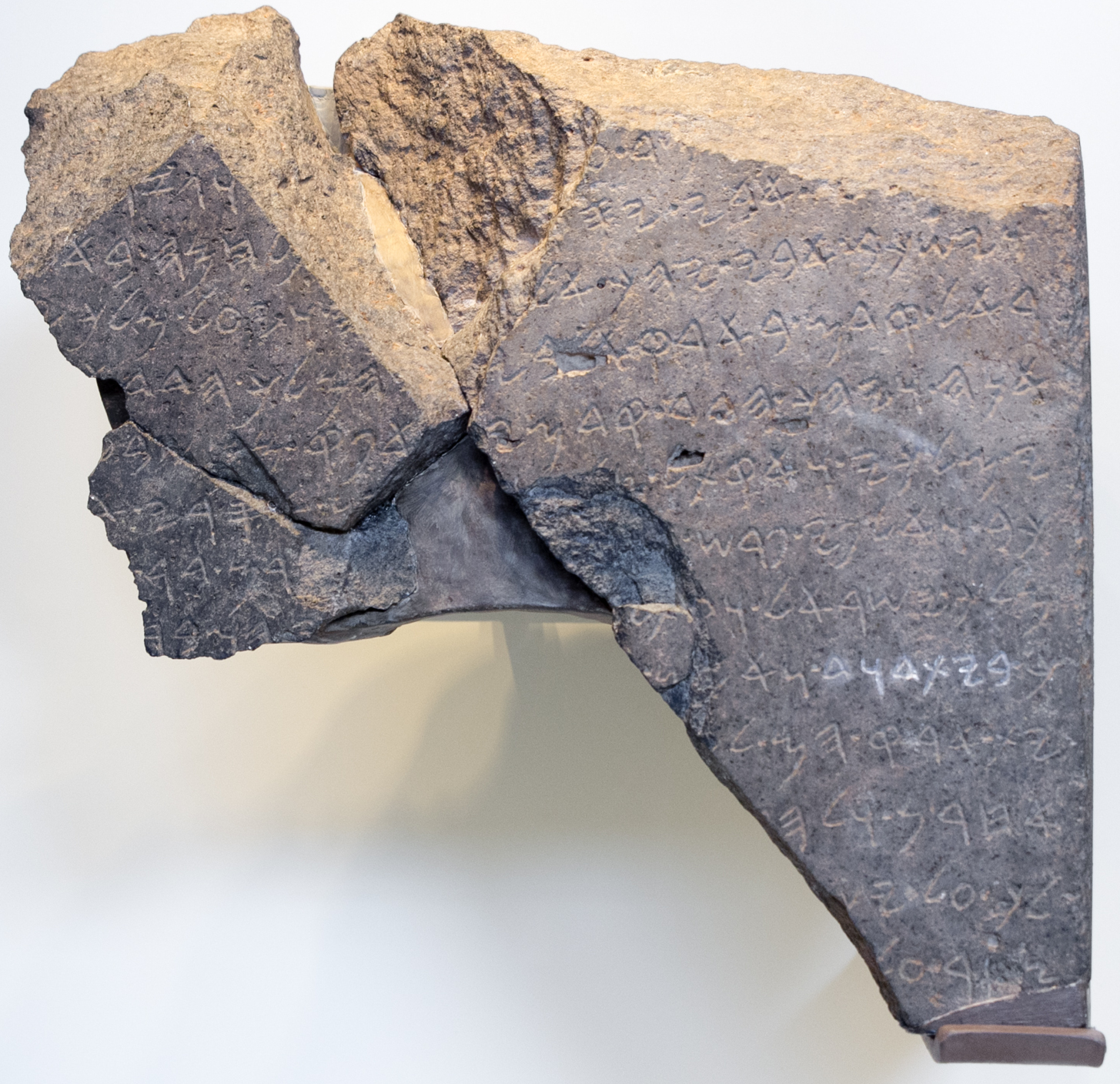
The Kingdom of Judah ( he, , ''Yəhūdā''; akk, 𒅀𒌑𒁕𒀀𒀀 ''Ya'údâ'' 'ia-ú-da-a-a'' arc, 𐤁𐤉𐤕𐤃𐤅𐤃 ''Bēyt Dāwīḏ'', " House of David") was an Israelite kingdom of the Southern Levant during the Iron Age. Centered in Judea, the kingdom's capital was Jerusalem. The other Israelite polity, the Kingdom of Israel, lay to the north. Jews are named after Judah and are primarily descended from it. The Hebrew Bible depicts the Kingdom of Judah as a successor to the United Kingdom of Israel, a term denoting the united monarchy under biblical kings Saul, David and Solomon and covering the territory of Judah and Israel. However, during the 1980s, some biblical scholars began to argue that the archaeological evidence for an extensive kingdom before the late-8th century BCE is too weak, and that the methodology used to obtain the evidence is flawed. In the 10th and early 9th centuries BCE, the territory of Judah appears to have been sparsely populated ... [...More Info...] [...Related Items...] OR: [Wikipedia] [Google] [Baidu] |
Lupinus Pilosus (Zachi Evenor For Wiki)
''Lupinus pilosus'', commonly known as blue lupine, ( he, תורמוס ההרים, ar, ترمس برّي) is a species of flowering plant from the family Fabaceae which is endemic to Israel where it is found in Mediterranean scrubland. It has a long stem and long legume. The species blooms from February to May. The species have white coloured flowers which are long and pods the diameter of which is . In Israel the Lupinus pilosus has blue flowers with white vertical spot at the middle. Culinary uses Around the South Tyrolean village of Altrei (Anterivo), ''L. pilosus'' was historically grown. The seeds were roasted and mixed with malt grains and infused in boiling water to produce a coffee-like but caffeine-free hot beverage, ''Altreier Kaffee'' ("Altrei coffee"). Interesting not only from a cultural and historical but also from a botanical standpoint, since 2006 a local initiative is re-establishing ''L. pilosus'' cultivation in the Altrei region to revive this culinary spec ... [...More Info...] [...Related Items...] OR: [Wikipedia] [Google] [Baidu] |
David
David (; , "beloved one") (traditional spelling), , ''Dāwūd''; grc-koi, Δαυΐδ, Dauíd; la, Davidus, David; gez , ዳዊት, ''Dawit''; xcl, Դաւիթ, ''Dawitʿ''; cu, Давíдъ, ''Davidŭ''; possibly meaning "beloved one". was, according to the Hebrew Bible, the Kings of Israel and Judah, third king of the Kingdom of Israel (united monarchy), United Kingdom of Israel. In the Books of Samuel, he is described as a young shepherd and Lyre, harpist who gains fame by slaying Goliath, a champion of the Philistines, in southern Canaan. David becomes a favourite of Saul, the first king of Israel; he also forges David and Jonathan, a notably close friendship with Jonathan (1 Samuel), Jonathan, a son of Saul. However, under the paranoia that David is seeking to usurp the throne, Saul attempts to kill David, forcing the latter to go into hiding and effectively operate as a fugitive for several years. After Saul and Jonathan are both killed in battle against the Philistin ... [...More Info...] [...Related Items...] OR: [Wikipedia] [Google] [Baidu] |
Rehoboam
Rehoboam (; , ; , ; la, Roboam, ) was, according to the Hebrew Bible, the last monarch of the United Kingdom of Israel and the first monarch of the Kingdom of Judah after the former's split. He was a son of and the successor to Solomon and a grandson of David. In the account of I Kings and II Chronicles, Rehoboam was initially a king of the United Monarchy, but later saw his rule limited to only the Kingdom of Judah in the south following a rebellion by the ten northern tribes of Israel in 932/931 BCE, which led to the formation of the independent Kingdom of Israel under the rule of Jeroboam in the north. Biblical background According to the '' Jewish Encyclopedia'', "Solomon's wisdom and power were not sufficient to prevent the rebellion of several of his border cities. Damascus under Rezon secured its independence romSolomon; and Jeroboam, a superintendent of works, his ambition stirred by the words of the prophet Ahijah (), fled to Egypt. Thus before the death of Solom ... [...More Info...] [...Related Items...] OR: [Wikipedia] [Google] [Baidu] |
Ahaz
Ahaz (; gr, Ἄχαζ, Ἀχάζ ''Akhaz''; la, Achaz) an abbreviation of Jehoahaz II (of Judah), "Yahweh has held" (; akk, 𒅀𒌑𒄩𒍣 ''Ya'úḫazi'' 'ia-ú-ḫa-zi'' Hayim Tadmor and Shigeo Yamada, ''The Royal Inscriptions of Tiglath-pileser III (744-727 BC) and Shalmaneser V (726-722 BC), Kings of Assyria''. (The Royal Inscriptions of the Neo-Assyrian Period 1; Winona Lake, IN: Eisenbrauns, 2011), Tiglath-Pileser III 47 r 11'. was the twelfth king of Judah, and the son and successor of Jotham. Ahaz was 20 when he became king of Judah and reigned for 16 years. Ahaz is portrayed as an evil king in the Second Book of Kings (2 Kings 16:2). In Edwin R. Thiele's opinion Ahaz was co-regent with Jotham from 736/735 BC, and his sole reign began in 732/731 and ended in 716/715 BC. However, William F. Albright has dated his reign to 744–728 BC. The Gospel of Matthew lists Ahaz of Judah in the genealogy of Jesus. He is also mentioned in Isaiah 7 and . Reig ... [...More Info...] [...Related Items...] OR: [Wikipedia] [Google] [Baidu] |
LMLK Seal
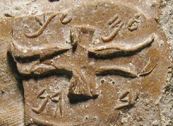
LMLK seals (with LMLK meaning 'of the king') are ancient Hebrew seals stamped on the handles of large storage jars first issued in the reign of King Hezekiah (circa 700 BC) and discovered mostly in and around Jerusalem. Several complete jars were found '' in situ'' buried under a destruction layer caused by Sennacherib at Lachish. While none of the original seals have been found, some 2,000 impressions made by at least 21 seal types have been published. The iconography of the two and four winged symbols are representative of royal symbols whose meaning "was tailored in each kingdom to the local religion and ideology". Text LMLK stands for the Hebrew letters '' lamedh mem lamedh kaph'' (vocalized, ''lamelekh''; Phoenician ''lāmed mēm lāmed kāp'' — 𐤋𐤌𐤋𐤊), which can be translated as: * " elongingto the king" (of Judah) * " elongingto King" (name of a person or deity) * " elongingto the government" (of Judah) * "o be sentto the King" As a prepositional pre ... [...More Info...] [...Related Items...] OR: [Wikipedia] [Google] [Baidu] |
Mishnah
The Mishnah or the Mishna (; he, מִשְׁנָה, "study by repetition", from the verb ''shanah'' , or "to study and review", also "secondary") is the first major written collection of the Jewish oral traditions which is known as the Oral Torah. It is also the first major work of rabbinic literature. The Mishnah was redacted by Judah ha-Nasi probably in Beit Shearim or Sepphoris at the beginning of the 3rd century CE in a time when, according to the Talmud, the persecution of the Jews and the passage of time raised the possibility that the details of the oral traditions of the Pharisees from the Second Temple period (516 BCE – 70 CE) would be forgotten. Most of the Mishnah is written in Mishnaic Hebrew, but some parts are in Aramaic. The Mishnah consists of six orders (', singular ' ), each containing 7–12 tractates (', singular ' ; lit. "web"), 63 in total, and further subdivided into chapters and paragraphs. The word ''Mishnah'' can also indicate a single para ... [...More Info...] [...Related Items...] OR: [Wikipedia] [Google] [Baidu] |
Palestine Grid
The Palestine grid was the geographic coordinate system used by the Survey Department of Palestine. The system was chosen by the Survey Department of the Government of Palestine in 1922. The projection used was the Cassini-Soldner projection. The central meridian (the line of longitude along which there is no local distortion) was chosen as that passing through a marker on the hill of Mar Elias Monastery south of Jerusalem. The false origin (zero point) of the grid was placed 100 km to the south and west of the Ali el-Muntar hill that overlooks Gaza city. The unit length for the grid was the kilometre; the British units were not even considered. At the time the grid was established, there was no intention of mapping the lower reaches of the Negev Desert, but this did not remain true. Those southern regions having a negative north-south coordinate then became a source of confusion, which was solved by adding 1000 to the northern coordinate in that case. For some military pu ... [...More Info...] [...Related Items...] OR: [Wikipedia] [Google] [Baidu] |
Philistines
The Philistines ( he, פְּלִשְׁתִּים, Pəlīštīm; Koine Greek ( LXX): Φυλιστιείμ, romanized: ''Phulistieím'') were an ancient people who lived on the south coast of Canaan from the 12th century BC until 604 BC, when their polity, after having already been subjugated for centuries by the Neo-Assyrian Empire, was finally destroyed by King Nebuchadnezzar II of the Neo-Babylonian Empire. After becoming part of his empire and its successor, the Persian Empire, they lost their distinct ethnic identity and disappeared from the historical and archaeological record by the late 5th century BC.. The Philistines are known for their biblical conflict with the Israelites. Though the primary source of information about the Philistines is the Hebrew Bible, they are first attested to in reliefs at the Temple of Ramses III at Medinet Habu, in which they are called (accepted as cognate with Hebrew ); the parallel Assyrian term is , , or . Etymology The Engl ... [...More Info...] [...Related Items...] OR: [Wikipedia] [Google] [Baidu] |
.jpg)


