|
Slioch
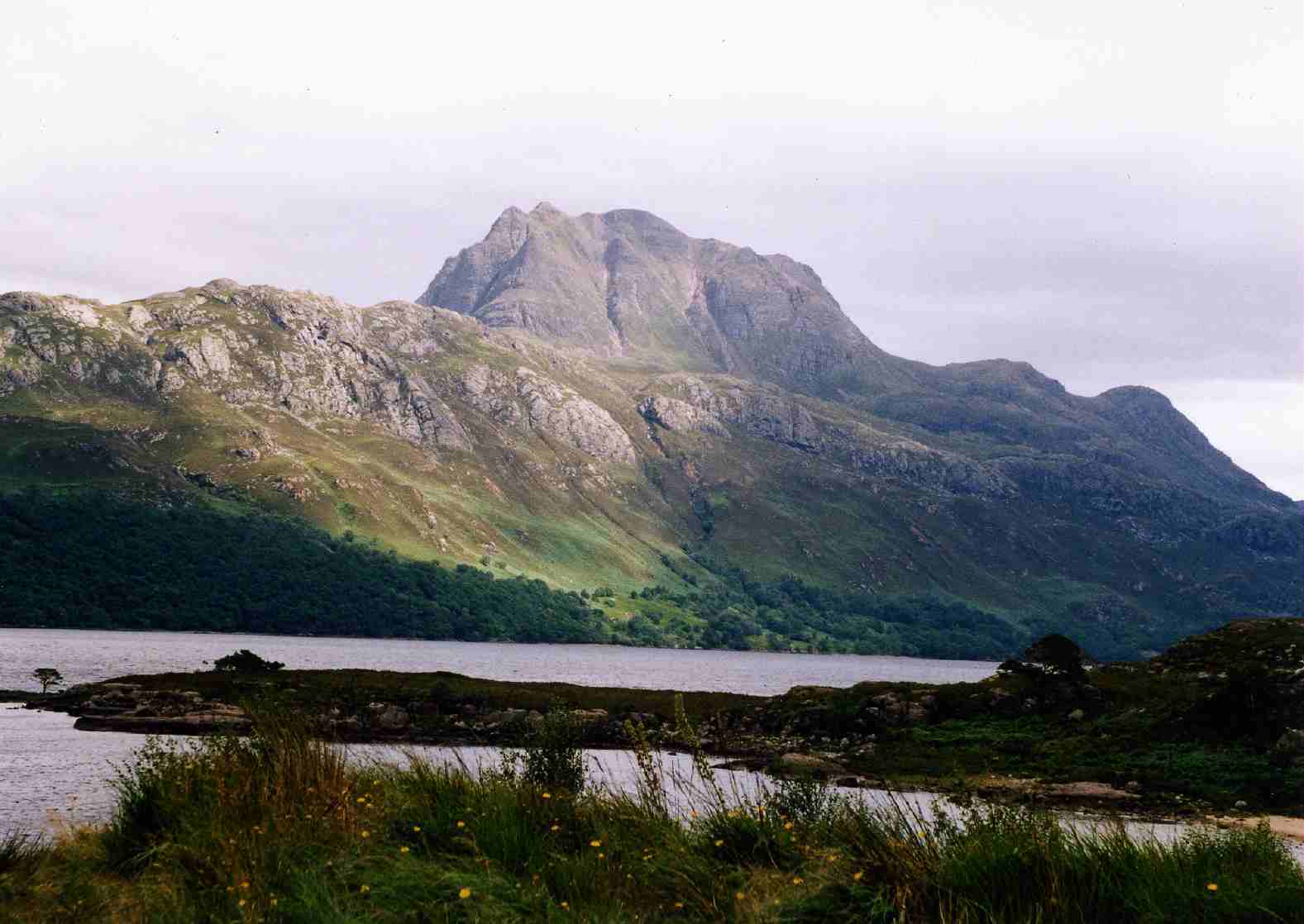
, photo = Slioch_from_Loch_Maree.jpg , photo_caption = Slioch seen from the shores of Loch Maree. , elevation_m = 981 , elevation_ref = , prominence_m = 626 , prominence_ref = , parent_peak = Sgurr Mor , listing = Munro, Marilyn , translation = the spear , language = Gaelic , pronunciation = , location = Wester Ross, Scotland , range = , grid_ref_UK = NH004688 , topo = OS ''Landranger'' 19, OS ''Explorers'' 433, 435 , first_ascent = , easiest_route = Slioch ( gd, Sleaghach) is a mountain in the Scottish Highlands situated in Wester Ross, eight kilometres north of the village of Kinlochewe. Slioch reaches a height of 981 metres (3218 feet) and towers above the south east end of Loch Maree to give one of the best known and most photographed sights (from the A832 road) in the Highlands. VisitScotland, the Scottish national tourist agency, has used video footage of Slioch in its television advertisements. The mountain is composed of Torridonian sand ... [...More Info...] [...Related Items...] OR: [Wikipedia] [Google] [Baidu] |
Loch Maree
Loch Maree ( gd, Loch Ma-ruibhe) is a loch in Wester Ross in the Northwest Highlands of Scotland. At long and with a maximum width of , it is the fourth-largest freshwater loch in Scotland; it is the largest north of Loch Ness. Its surface area is . Loch Maree contains five large wooded islands and over 60 smaller ones, many of which have their own lochans. The largest island, Eilean Sùbhainn, contains a loch that itself contains an island,Ordnance Survey. 1:25000 ''Explorer'' map. Sheet 433, Torridon - Beinn Eighe & Liathach. a situation that occurs nowhere else in Great Britain. Isle Maree holds the remains of a chapel believed to be the 8th century hermitage of Saint Máel Ruba (d. 722), who founded the monastery of Applecross in 672. It is after him that Loch Maree is named; prior to the saint's arrival in the area the loch is believed to have been named Loch Ewe, as evidenced by the name of the village of Kinlochewe ( gd, Ceann Loch Iù, meaning "Head of Loch Ewe") ... [...More Info...] [...Related Items...] OR: [Wikipedia] [Google] [Baidu] |
Kinlochewe
Kinlochewe ( gd, Ceann Loch Iù or ) is a village in Wester Ross in the Northwest Highlands of Scotland. It is in the parish of Gairloch, the community of Torridon and Kinlochewe and the Highland council area. It lies near the head of Loch Maree in its magnificent valley, and serves as a junction between the main Ullapool road north, and that which heads west to the coast at Loch Torridon. Loch Maree was at one time also known as Loch Ewe, hence the village's apparently confused name. Community Kinlochewe has a couple of shops, a hotel and bunkhouse, mountain chalets, several bed and breakfasts, a post office (with internet café), and one of very few petrol filling stations for many miles in any direction. Buses connect the village with Gairloch, the railhead at Achnasheen, Dingwall and Inverness. The village contains two churches, Kinlochewe Free Church, built in 1873, and the Church of Scotland. To the north of the village, by the car park, is a First World War (1914� ... [...More Info...] [...Related Items...] OR: [Wikipedia] [Google] [Baidu] |
Wester Ross
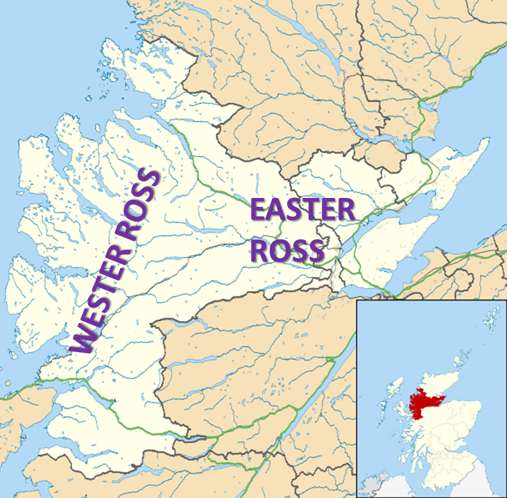
Wester Ross () is an area of the Northwest Highlands of Scotland in the council area of Highland. The area is loosely defined, and has never been used as a formal administrative region in its own right, but is generally regarded as lying to the west of the main watershed of Ross (the eastern part of Ross being Easter Ross), thus forming the western half of the county of Ross and Cromarty. The southwesternmost part of Ross and Cromarty, Lochalsh, is not considered part of Wester Ross by the local tourist organisation, ''Visit Wester Ross'', but is included within the definition used for the Wester Ross Biosphere Reserve.Wester Ross Biosphere Reserve Application. p. 2. Wester Ross has one of the lowest population densities in Europe, with just 1.6 people per km2, who live mostly in small crofting townships along the coastline of the region. The area is renowned for the scenic splendour of its mountains and coastline, and the range of wildlife that can be seen. It is a popula ... [...More Info...] [...Related Items...] OR: [Wikipedia] [Google] [Baidu] |
Torridonian
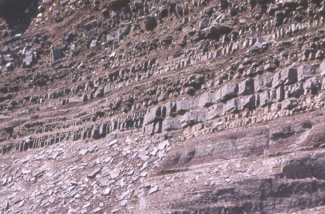
In geology, the term Torridonian is the informal name for the Torridonian Group, a series of Mesoproterozoic to Neoproterozoic arenaceous and argillaceous sedimentary rocks, which occur extensively in the Northwest Highlands of Scotland. The strata of the Torridonian Group are particularly well exposed in the district of upper Loch Torridon, a circumstance which suggested the name Torridon Sandstone, first applied to these rocks by James Nicol. Stratigraphically, they lie unconformably on gneisses of the Lewisian complex and their outcrop extent is restricted to the Hebridean Terrane. Rock type The rocks are mainly red and brown sandstones, arkoses and shales with coarse conglomerates locally at the base. Some of the materials of these rocks were derived from the underlying Lewisian gneiss, upon the uneven surface of which they rest, but the bulk of the material was obtained from rocks that are nowhere now exposed. Upon this ancient denuded land surface the Torridonian strata ... [...More Info...] [...Related Items...] OR: [Wikipedia] [Google] [Baidu] |
Munro
A Munro () is defined as a mountain in Scotland with a height over , and which is on the Scottish Mountaineering Club (SMC) official list of Munros; there is no explicit topographical prominence requirement. The best known Munro is Ben Nevis (Beinn Nibheis), the highest mountain in the British Isles at . Munros are named after Sir Hugh Munro, 4th Baronet (1856–1919), who produced the first list of such hills, known as ''Munro's Tables'', in 1891. Also included were what Munro considered lesser peaks, now known as Munro Tops, which are also over 3,000 feet but are lower than the nearby primary mountain. The publication of the original list is usually considered to be the epoch event of modern peak bagging. The list has been the subject of subsequent variation and as of 10 December 2020, the Scottish Mountaineering Club has listed 282 Munros and 226 Munro Tops. "Munro bagging" is the activity of climbing all the listed Munros. As of 31 December 2021, 7,098 people had re ... [...More Info...] [...Related Items...] OR: [Wikipedia] [Google] [Baidu] |
Munros
A Munro () is defined as a mountain in Scotland with a height over , and which is on the Scottish Mountaineering Club (SMC) official list of Munros; there is no explicit topographical prominence requirement. The best known Munro is Ben Nevis (Beinn Nibheis), the highest mountain in the British Isles at . Munros are named after Sir Hugh Munro, 4th Baronet (1856–1919), who produced the first list of such hills, known as ''Munro's Tables'', in 1891. Also included were what Munro considered lesser peaks, now known as Munro Tops, which are also over 3,000 feet but are lower than the nearby primary mountain. The publication of the original list is usually considered to be the epoch event of modern peak bagging. The list has been the subject of subsequent variation and as of 10 December 2020, the Scottish Mountaineering Club has listed 282 Munros and 226 Munro Tops. "Munro bagging" is the activity of climbing all the listed Munros. As of 31 December 2021, 7,098 people had report ... [...More Info...] [...Related Items...] OR: [Wikipedia] [Google] [Baidu] |
Drumblade
Drumblade is a hamlet in north-western Aberdeenshire, Scotland, which lies 4¾ miles east of the town of Huntly. Schools Drumblade Primary School is a primary school with a nursery unit, and a total roll of 53 as of 2013. It is a feeder school for The Gordon Schools, Huntly. It made the national news in 2012 when its pet ducks disappeared, presumed stolen. History Drumblade Stone Circle, or Ston(e)yfield, is the remains of an ancient stone circle. It is about east of Huntly. Drumblade is the site of the Battle of Slioch in December 1307, involving Robert the Bruce. Notable residents *William Garden Blaikie minister, later Free Church moderator *George Ramsay Davidson George Ramsay Davidson (1801–1890) was a Scottish minister in the 19th century who was senior minister of the influential Lady Glenorchy's Church and Lady Glenorchy's Free Church. Life He was born in Brechin in 1801 the son of David Da ... minister of Drumblade from 1828 to 1842 References Ha ... [...More Info...] [...Related Items...] OR: [Wikipedia] [Google] [Baidu] |
Dundonnell And Fisherfield Forest
Fisherfield Forest The Dundonnell and Fisherfield Forest covers a large mountainous area of Wester Ross in the Northwest Highlands of Scotland, lying between Loch Maree and Little Loch Broom. It is sometimes nicknamed ''The Great Wilderness'', as the area is entirely devoid of permanent settlements. Although termed a ''forest'' the area has very few trees. It is in fact a deer forest; an area maintained by the owners primarily for deer stalking. Three estates cover the principal area of the forest. Dundonnell Estate (134 km2) covers the northwest part of the forest, including the northwestern flanks of An Teallach, whilst Eilean Darach estate covers 262 km2 in the northeast, including the northeast flank of An Teallach. The majority of the area, including all the southern and central sections, forms the 323 km2 Letterewe estate. Mountains Three of the most famous mountains in the area are An Teallach, which lies to the southwest of Dundonnell, A' Mhaighdean, w ... [...More Info...] [...Related Items...] OR: [Wikipedia] [Google] [Baidu] |
A832 Road
The A832 is a road in the Scottish Highlands, linking Cromarty, on the east coast, to Gairloch on the west coast, and beyond Gairloch to Braemore Junction. It is long and runs entirely in the former county of Ross and Cromarty. The road forms part of the Wester Ross Coastal Trail. Cromarty to Gorstan Starting in Cromarty on the Black Isle, the A832 travels south alongside the Moray Firth to Fortrose, then turns west, heading inland. It crosses the A9 and A835 at Tore and continues to Muir of Ord, passing near to the Beauly Firth. Five miles after Muir of Ord, the A832 meets the A835 again at a T-junction, and turning left, multiplexes with the A835 for nine miles (14 km) to Gorstan. On this stretch it passes Contin, the Rogie Falls and Loch Garve. Gorstan to Gairloch At Gorstan the A832 and A835 diverge again. They meet again later on at Braemore Junction, where the A832 terminates at the A835. From Gorstan to Braemore Junction on the A835 is , however on the A832 ... [...More Info...] [...Related Items...] OR: [Wikipedia] [Google] [Baidu] |
Marilyns Of Scotland
This is a list of Marilyn hills and mountains in the United Kingdom, Isle of Man and Ireland by height. Marilyns are defined as peaks with a prominence of or more, regardless of height or any other merit (e.g. topographic isolation, as used in Munros). Thus, Marilyns can be mountains, with a height above , or relatively small hills. there were 2,011 recorded Marilyns. Definition The Marilyn classification was created by Alan Dawson in his 1992 book ''The Relative Hills of Britain''. The name Marilyn was coined by Dawson as a punning contrast to the ''Munro'' classification of Scottish mountains above , but which has no explicit prominence threshold, being homophonous with (Marilyn) '' Monroe''. The list of Marilyns was extended to Ireland by Clem Clements. Marilyn was the first of several subsequent British Isles classifications that rely solely on prominence, including the P600s, the HuMPs, and the TuMPs. Topographic prominence is a more difficult to estimate than ... [...More Info...] [...Related Items...] OR: [Wikipedia] [Google] [Baidu] |
Marilyn (hill)
This is a list of Marilyn hills and mountains in the United Kingdom, Isle of Man and Ireland by height. Marilyns are defined as peaks with a prominence of or more, regardless of height or any other merit (e.g. topographic isolation, as used in Munros). Thus, Marilyns can be mountains, with a height above , or relatively small hills. there were 2,011 recorded Marilyns. Definition The Marilyn classification was created by Alan Dawson in his 1992 book ''The Relative Hills of Britain''. The name Marilyn was coined by Dawson as a punning contrast to the '' Munro'' classification of Scottish mountains above , but which has no explicit prominence threshold, being homophonous with (Marilyn) '' Monroe''. The list of Marilyns was extended to Ireland by Clem Clements. Marilyn was the first of several subsequent British Isles classifications that rely solely on prominence, including the P600s, the HuMPs, and the TuMPs. Topographic prominence is a more difficult to estimate tha ... [...More Info...] [...Related Items...] OR: [Wikipedia] [Google] [Baidu] |
Highland (council Area)
Highland ( gd, A' Ghàidhealtachd, ; sco, Hieland) is a council area in the Scottish Highlands and is the largest local government area in the United Kingdom. It was the 7th most populous council area in Scotland at the 2011 census. It shares borders with the council areas of Aberdeenshire, Argyll and Bute, Moray and Perth and Kinross. Their councils, and those of Angus and Stirling, also have areas of the Scottish Highlands within their administrative boundaries. The Highland area covers most of the mainland and inner-Hebridean parts of the historic counties of Inverness-shire and Ross and Cromarty, all of Caithness, Nairnshire and Sutherland and small parts of Argyll and Moray. Despite its name, the area does not cover the entire Scottish Highlands. Name Unlike the other council areas of Scotland, the name ''Highland'' is often not used as a proper noun. The council's website only sometimes refers to the area as being ''Highland'', and other times as being '' ... [...More Info...] [...Related Items...] OR: [Wikipedia] [Google] [Baidu] |


.jpg)


