|
Sanirajak
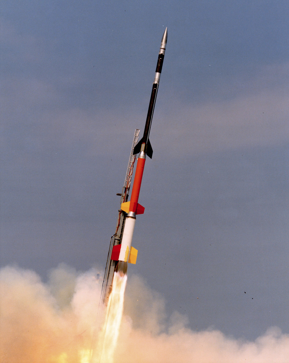
Sanirajak (Inuktitut meaning ''the shoreline''), Syllabics: ᓴᓂᕋᔭᒃ), formerly known as Hall Beach until 27 February 2020, is an Inuit settlement within the Qikiqtaaluk Region of Nunavut, Canada, approximately south of Igloolik. History It was established in 1957 during the construction of a Distant Early Warning (DEW) site. Currently the settlement is home to a North Warning System () radar facility and the Hall Beach Airport. In 1971, seven sounding rockets of the Tomahawk Sandia type were launched from Sanirajak, some reaching altitudes of . Demographics In the 2021 Census of Population conducted by Statistics Canada, Sanirajak (Hall Beach) had a population of living in of its total private dwellings, a change of from its 2016 population of . With a land area of , it had a population density of in 2021. Geography Climate The climate is tundra ( Köppen: ''ET''), without the presence of trees In botany, a tree is a perennial plant with an ... [...More Info...] [...Related Items...] OR: [Wikipedia] [Google] [Baidu] |
Hall Beach Airport
Hall Beach Airport is located at Sanirajak, formerly Hall Beach, Nunavut, Canada, and is operated by the government of Nunavut. Airlines and destinations Canadian Helicopters Canadian Helicopters Limited, formerly a part of the Canadian operations of CHC Helicopter Corporation, operates 112 aircraft from 26 bases across Canada and provides a broad range of helicopter services to support the following activities: emerg ... operates flights as part of the North Warning System. References External links Airports in the Arctic Certified airports in the Qikiqtaaluk Region {{Nunavut-airport-stub ... [...More Info...] [...Related Items...] OR: [Wikipedia] [Google] [Baidu] |
Qikiqtaaluk Region
The Qikiqtaaluk Region, Qikiqtani Region (Inuktitut syllabics: ᕿᑭᖅᑖᓗᒃ ) or Baffin Region is the easternmost, northernmost, and southernmost administrative region of Nunavut, Canada. Qikiqtaaluk is the traditional Inuktitut name for Baffin Island. Although the Qikiqtaaluk Region is the most commonly used name in official contexts, several notable public organizations, including Statistics Canada prefer the older term Baffin Region. With a population of 18,988 and an area of , it is the largest and most populated of the three regions. The region consists of Baffin Island, the Belcher Islands, Akimiski Island, Mansel Island, Prince Charles Island, Bylot Island, Devon Island, Baillie-Hamilton Island, Cornwallis Island, Bathurst Island, Amund Ringnes Island, Ellef Ringnes Island, Axel Heiberg Island, Ellesmere Island, the Melville Peninsula, the eastern part of Melville Island, and the northern parts of both Prince of Wales Island and Somerset Island, plus ... [...More Info...] [...Related Items...] OR: [Wikipedia] [Google] [Baidu] |
Joelie Kaernerk
Joelie Kaernerk is a Canadian Inuk politician from Hall Beach, Nunavut. He was elected to the Legislative Assembly of Nunavut in the 2017 general election. Canadian Press via , October 31, 2017. He represents the electoral district of Amittuq
Amittuq ( iu, ᐊᒥᑦᑐᕐᒃ) is a territorial electoral district ( riding) for the Legislative Assembly of Nunavut, Canada.
The riding consists of the communiti ...
[...More Info...] [...Related Items...] OR: [Wikipedia] [Google] [Baidu] |
List Of X Postal Codes Of Canada
__NOTOC__ This is a list of postal codes in Canada where the first letter is X. Postal codes beginning with X are located within the Canadian territories of Nunavut and the Northwest Territories. Only the first three characters are listed, corresponding to the Forward Sortation Area. Canada Post provides a free postal code look-up tool on its website, and its mobile applications. Many vendors also sell validation tools, which allow customers to properly match addresses and postal codes. Hard-copy directories can also be consulted in all post offices, and some libraries. Nunavut and the Northwest Territories - 6 FSAs References {{Canadian postal codes Communications in Nunavut Communications in the Northwest Territories X Postal codes Postal codes A postal code (also known locally in various English-speaking countries throughout the world as a postcode, post code, PIN or ZIP Code) is a series of letters or digits or both, sometimes including spaces or punctuation, in ... [...More Info...] [...Related Items...] OR: [Wikipedia] [Google] [Baidu] |
1991 Canadian Census
The 1991 Canadian census was a detailed enumeration of the Canadian population. Census day was June 4, 1991. On that day, Statistics Canada Statistics Canada (StatCan; french: Statistique Canada), formed in 1971, is the agency of the Government of Canada commissioned with producing statistics to help better understand Canada, its population, resources, economy, society, and cultu ... attempted to count every person in Canada. The total population count of Canada was 27,296,859. This was a 7.9% increase over the 1986 census of 25,309,331. The previous census was the 1986 census and the following census was in 1996 census. Canada by the numbers A summary of information about Canada. Population by province References {{People of Canada Censuses in Canada 1991 censuses 1991 in Canada ... [...More Info...] [...Related Items...] OR: [Wikipedia] [Google] [Baidu] |
Sounding Rocket
A sounding rocket or rocketsonde, sometimes called a research rocket or a suborbital rocket, is an instrument-carrying rocket designed to take measurements and perform scientific experiments during its sub-orbital flight. The rockets are used to launch instruments from 48 to 145 km (30 to 90 miles) above the surface of the Earth, the altitude generally between weather balloons and satellites; the maximum altitude for balloons is about 40 km (25 miles) and the minimum for satellites is approximately 121 km (75 miles). Certain sounding rockets have an apogee between 1,000 and 1,500 km (620 and 930 miles), such as the Black Brant X and XII, which is the maximum apogee of their class. Sounding rockets often use military surplus rocket motors. NASA routinely flies the Terrier Mk 70 boosted Improved Orion, lifting 270–450-kg (600–1,000-pound) payloads into the exoatmospheric region between 97 and 201 km (60 and 125 miles). Etymology The origin of the te ... [...More Info...] [...Related Items...] OR: [Wikipedia] [Google] [Baidu] |
TE-416 Tomahawk
The TE-416 Tomahawk is a rocket developed by the American company Thiokol at the beginning of the 1960s for Sandia National Laboratories. Although the TE-416 Tomahawk can be launched alone, it was started predominantly as upper stage in connection with other rockets, for example with a Nike rocket as first stage (Nike Tomahawk The Nike stage or Nike booster, a solid fuel rocket motor, was created by Hercules Aerospace for the Nike Ajax (M5) Nike Hercules (M5E1) (and M88 late in Hercules career). It was developed for use as the first stage of the Nike Ajax and Nike He ...). The TE-416 Tomahawk has a thrust of and a burn time of 9.5 seconds. The diameter of the TE-416 tomahawk is and the fin span is . References External linkshttp://www.designation-systems.net/dusrm/app4/tomahawk.html Rockets and missiles {{rocket-stub es:Misil Tomahawk ... [...More Info...] [...Related Items...] OR: [Wikipedia] [Google] [Baidu] |
Sandia National Laboratories
Sandia National Laboratories (SNL), also known as Sandia, is one of three research and development laboratories of the United States Department of Energy's National Nuclear Security Administration (NNSA). Headquartered in Kirtland Air Force Base in Albuquerque, New Mexico, it has a second principal facility next to Lawrence Livermore National Laboratory in California and a test facility in Waimea, Kauai, Hawaii. Sandia is owned by the U.S. federal government but privately managed and operated by National Technology and Engineering Solutions of Sandia, a wholly owned subsidiary of Honeywell International. Established in 1949, SNL is a "multimission laboratory" with the primary goal of advancing U.S. national security by developing various science-based technologies. Its work spans roughly 70 areas of activity, including nuclear deterrence, arms control, nonproliferation, hazardous waste disposal, and climate change. Sandia hosts a wide variety of research initiatives, includ ... [...More Info...] [...Related Items...] OR: [Wikipedia] [Google] [Baidu] |
Hamlet (place)
A hamlet is a human settlement that is smaller than a town or village. Its size relative to a parish can depend on the administration and region. A hamlet may be considered to be a smaller settlement or subdivision or satellite entity to a larger settlement. The word and concept of a hamlet has roots in the Anglo-Norman settlement of England, where the old French ' came to apply to small human settlements. Etymology The word comes from Anglo-Norman ', corresponding to Old French ', the diminutive of Old French ' meaning a little village. This, in turn, is a diminutive of Old French ', possibly borrowed from (West Germanic) Franconian languages. Compare with modern French ', Dutch ', Frisian ', German ', Old English ' and Modern English ''home''. By country Afghanistan In Afghanistan, the counterpart of the hamlet is the qala ( Dari: قلعه, Pashto: کلي) meaning "fort" or "hamlet". The Afghan ''qala'' is a fortified group of houses, generally with its own co ... [...More Info...] [...Related Items...] OR: [Wikipedia] [Google] [Baidu] |
Distant Early Warning Line
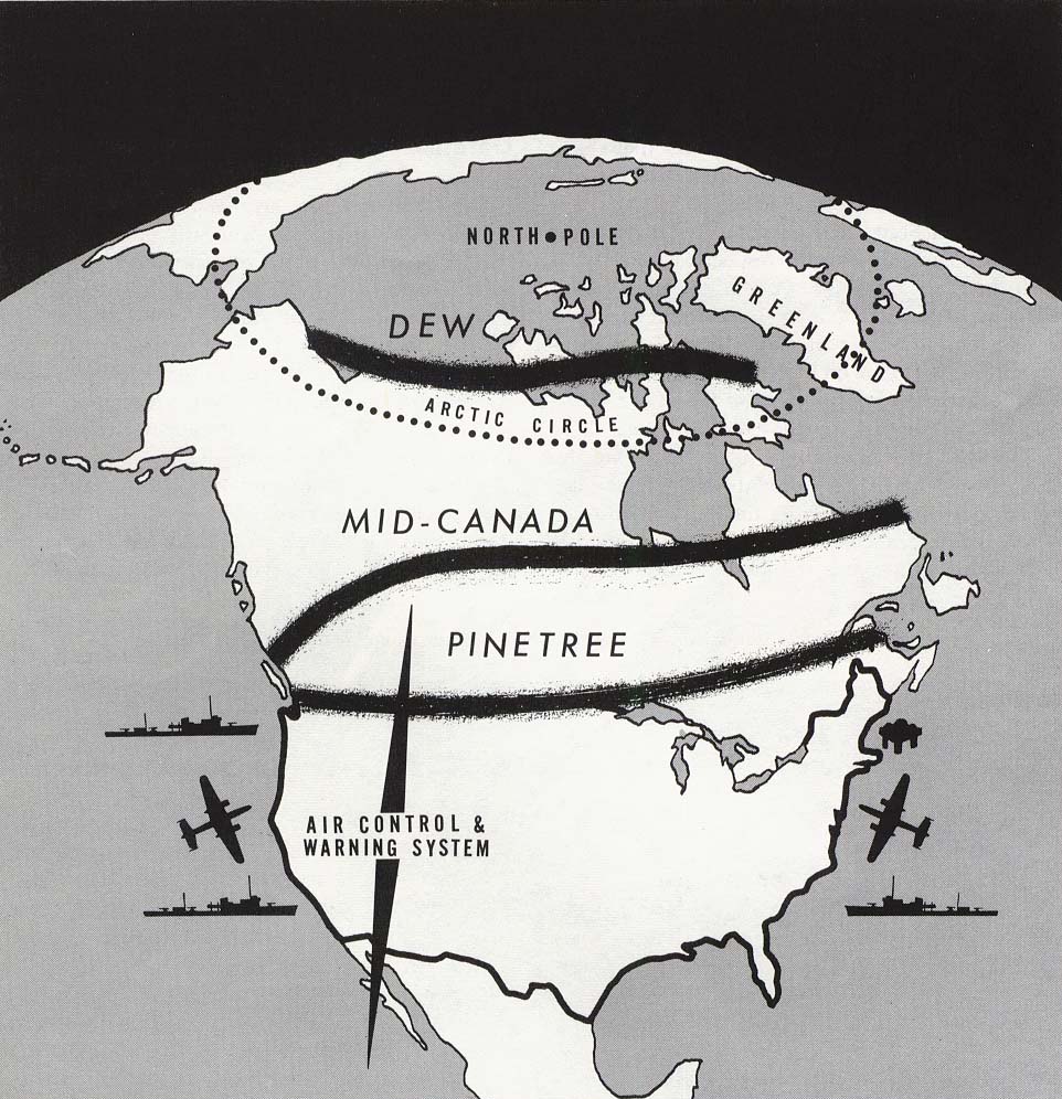
The Distant Early Warning Line, also known as the DEW Line or Early Warning Line, was a system of radar stations in the northern Arctic region of Canada, with additional stations along the north coast and Aleutian Islands of Alaska (see Project Stretchout and Project Bluegrass), in addition to the Faroe Islands, Greenland, and Iceland. It was set up to detect incoming bombers of the Soviet Union during the Cold War, and provide early warning of any sea-and-land invasion. The DEW Line was the northernmost and most capable of three radar lines in Canada and Alaska. The first of these was the joint Canadian-United States Pinetree Line, which ran from Newfoundland to Vancouver Island just north of the Canada–United States border, but even while it was being built there were concerns that it would not provide enough warning time to launch an effective counterattack. The Mid-Canada Line (MCL) was proposed as an inexpensive solution using bistatic radar. This provided a "trip ... [...More Info...] [...Related Items...] OR: [Wikipedia] [Google] [Baidu] |


