|
Sandwell Provincial Park
Sandwell Provincial Park is a provincial park in British Columbia, Canada. Sandwell Provincial Park is a small oceanfront site at Lock Bay, on the northeast shore of Gabriola Island. Hiking, swimming and beach-walking are popular activities here. There are also petroglyphs carved into the sandstone boulders on Lock Bay's foreshore. Facilities are limited to a picnic area and a pit toilet only. Sandwell Provincial Park is located on Gabriola Island in the Southern Gulf Islands of British Columbia. Access to the park is via North Road, Barrett Road and left onto Strand Road, continuing to the park. Access to Gabriola Island is by a 20-minute ferry trip from Nanaimo Nanaimo ( ) is a city on the east coast of Vancouver Island, in British Columbia, Canada. As of the 2021 census, it had a population of 99,863, and it is known as "The Harbour City." The city was previously known as the "Hub City," which was ... on Vancouver Island to Descanso Bay on Gabriola Island. Other p ... [...More Info...] [...Related Items...] OR: [Wikipedia] [Google] [Baidu] |
British Columbia
British Columbia (commonly abbreviated as BC) is the westernmost province of Canada, situated between the Pacific Ocean and the Rocky Mountains. It has a diverse geography, with rugged landscapes that include rocky coastlines, sandy beaches, forests, lakes, mountains, inland deserts and grassy plains, and borders the province of Alberta to the east and the Yukon and Northwest Territories to the north. With an estimated population of 5.3million as of 2022, it is Canada's third-most populous province. The capital of British Columbia is Victoria and its largest city is Vancouver. Vancouver is the third-largest metropolitan area in Canada; the 2021 census recorded 2.6million people in Metro Vancouver. The first known human inhabitants of the area settled in British Columbia at least 10,000 years ago. Such groups include the Coast Salish, Tsilhqotʼin, and Haida peoples, among many others. One of the earliest British settlements in the area was Fort Victoria, established ... [...More Info...] [...Related Items...] OR: [Wikipedia] [Google] [Baidu] |
Canada
Canada is a country in North America. Its ten provinces and three territories extend from the Atlantic Ocean to the Pacific Ocean and northward into the Arctic Ocean, covering over , making it the world's second-largest country by total area. Its southern and western border with the United States, stretching , is the world's longest binational land border. Canada's capital is Ottawa, and its three largest metropolitan areas are Toronto, Montreal, and Vancouver. Indigenous peoples have continuously inhabited what is now Canada for thousands of years. Beginning in the 16th century, British and French expeditions explored and later settled along the Atlantic coast. As a consequence of various armed conflicts, France ceded nearly all of its colonies in North America in 1763. In 1867, with the union of three British North American colonies through Confederation, Canada was formed as a federal dominion of four provinces. This began an accretion of provinces an ... [...More Info...] [...Related Items...] OR: [Wikipedia] [Google] [Baidu] |
Nanaimo, British Columbia
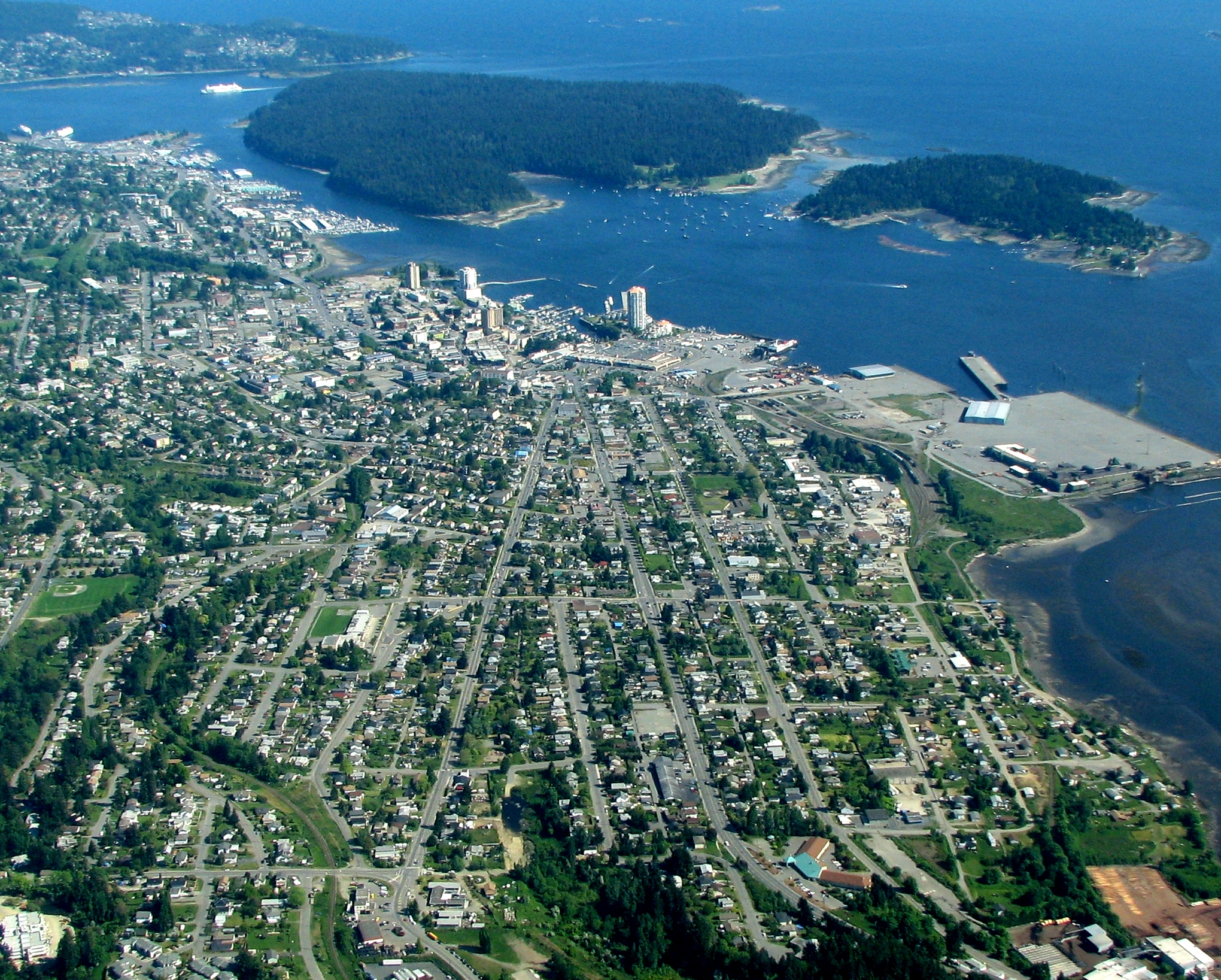
Nanaimo ( ) is a city on the east coast of Vancouver Island, in British Columbia, Canada. As of the 2021 census, it had a population of 99,863, and it is known as "The Harbour City." The city was previously known as the "Hub City," which was attributed to its original layout design, whose streets radiated from the shoreline like the spokes of a wagon wheel, and to its central location on Vancouver Island. Nanaimo is the headquarters of the Regional District of Nanaimo. Nanaimo is served by the coast-spanning Island Highway, the Island Rail Corridor, the BC Ferries system, and a local airport. History The Indigenous peoples of the area that is now known as Nanaimo are the Snuneymuxw. An anglicised spelling and pronunciation of that word gave the city its current name. The first Europeans known to reach Nanaimo Harbour were members of the 1791 Spanish voyage of Juan Carrasco, under the command of Francisco de Eliza. They gave it the name ''Bocas de Winthuysen'' after n ... [...More Info...] [...Related Items...] OR: [Wikipedia] [Google] [Baidu] |
BC Parks
BC Parks is an agency of the British Columbia Ministry of Environment and Climate Change Strategy that manages all of the, as of 2020, 1,035 provincial parks and other conservation and historical properties of various title designations within the province's Parks oversaw of the British Columbia Parks and Protected Areas System. The Lieutenant Governor-in-Council created the agency on March 1, 1911, through the Strathcona Park Act. The agency is charged with a dual role of preserving the ecological and historical integrity of the places entrusted to its management, while also making them available and accessible for public use and enjoyment. History In July 1910, a party of the British Columbia Provincial Government Expedition led by the Chief Commissioner of Lands Price Ellison explored the region surrounding Crown Mountain on Vancouver Island for the purposes of setting aside land to establish British Columbia's first provincial park. Ellison then reported his findings to ... [...More Info...] [...Related Items...] OR: [Wikipedia] [Google] [Baidu] |
Provincial Park
Ischigualasto Provincial Park A provincial park (or territorial park) is a park administered by one of the provinces of a country, as opposed to a national park. They are similar to state parks in other countries. They are typically open to the public for recreation. Their environment may be more or less strictly protected. Argentina Provincial parks ( es, Parques Provinciales) in the Misiones Province of Argentina include the Urugua-í Provincial Park and Esmeralda Provincial Park. The Ischigualasto Provincial Park, also called Valle de la Luna ("Valley of the Moon" or "Moon Valley"), due to its otherworldly appearance, is a provincial protected area in the north-east of San Juan Province, north-western Argentina. The Aconcagua Provincial Park is in Mendoza Province. The highest point is the north summit of the Cerro Aconcagua at . The Parque Provincial Pereyra Iraola is the largest urban park in the Buenos Aires Province. It is the richest center of biodiversity in t ... [...More Info...] [...Related Items...] OR: [Wikipedia] [Google] [Baidu] |
Gabriola Island
Gabriola Island is one of the Gulf Islands in the Strait of Georgia in British Columbia (BC), Canada. It is about east of Nanaimo on Vancouver Island, to which it is linked by a 20-minute ferry service. It has a land area of about and a resident population of 4,500. Gabriola has public beaches and forests, shopping centres, restaurants, a library, an elementary school and a museum. It is known as the Isle of the Arts due to its high percentage of working artists, and its many cultural events include annual festivals related to art, poetry, gardens, music, boating and fishing. The Gabriola Arts Council produces three large annual events: the Isle of the Arts Festival (April), Gabriola Theatre Festival (now defunct) and Thanksgiving Studio Tour (October). History Pre-contact Gabriola is part of the traditional territory of the Snunéymux (of whose name the nearby city of Nanaimo was given an anglicized form). The earliest archeological record on Gabriola is a cave burial da ... [...More Info...] [...Related Items...] OR: [Wikipedia] [Google] [Baidu] |
Petroglyphs
A petroglyph is an image created by removing part of a rock surface by incising, picking, carving, or abrading, as a form of rock art. Outside North America, scholars often use terms such as "carving", "engraving", or other descriptions of the technique to refer to such images. Petroglyphs are found worldwide, and are often associated with prehistoric peoples. The word comes from the Greek prefix , from meaning "stone", and meaning "carve", and was originally coined in French as . Another form of petroglyph, normally found in literate cultures, a rock relief or rock-cut relief is a relief sculpture carved on "living rock" such as a cliff, rather than a detached piece of stone. While these relief carvings are a category of rock art, sometimes found in conjunction with rock-cut architecture, they tend to be omitted in most works on rock art, which concentrate on engravings and paintings by prehistoric or nonliterate cultures. Some of these reliefs exploit the rock's na ... [...More Info...] [...Related Items...] OR: [Wikipedia] [Google] [Baidu] |
Southern Gulf Islands
The Gulf Islands are a group of islands in the Salish Sea between Vancouver Island and the mainland coast of British Columbia. Etymology The name "Gulf Islands" comes from "Gulf of Georgia," the original term used by George Vancouver in his mapping of the southern part of the archipelago and which before the San Juan Island dispute also was taken to include what have since been called the San Juan Islands. Strictly speaking, the Strait of Georgia is only the wide, open waters of the main strait between the mainland and Vancouver Island, and does not officially refer to the adjoining waters between the islands and Vancouver Island but has become a common misnomer for the entire Gulf, which includes waters such as Active Pass (between Galiano Island and Mayne Island), Trincomali Channel (between Galiano Island and Saltspring Island), Sansum Narrows (between Saltspring Island and Vancouver Island), and Malaspina Strait (between Texada Island and the mainland around Powell River ... [...More Info...] [...Related Items...] OR: [Wikipedia] [Google] [Baidu] |
Nanaimo
Nanaimo ( ) is a city on the east coast of Vancouver Island, in British Columbia, Canada. As of the 2021 census, it had a population of 99,863, and it is known as "The Harbour City." The city was previously known as the "Hub City," which was attributed to its original layout design, whose streets radiated from the shoreline like the spokes of a wagon wheel, and to its central location on Vancouver Island. Nanaimo is the headquarters of the Regional District of Nanaimo. Nanaimo is served by the coast-spanning Island Highway, the Island Rail Corridor, the BC Ferries system, and a local airport. History The Indigenous peoples of the area that is now known as Nanaimo are the Snuneymuxw. An anglicised spelling and pronunciation of that word gave the city its current name. The first Europeans known to reach Nanaimo Harbour were members of the 1791 Spanish voyage of Juan Carrasco, under the command of Francisco de Eliza. They gave it the name ''Bocas de Winthuysen'' after n ... [...More Info...] [...Related Items...] OR: [Wikipedia] [Google] [Baidu] |
Descanso Bay , a botanical garden in La Cañada Flintridge, California
{{disambig, geo ...
Descanso may refer to: * Descanso (roadside memorial) * ''Descanso'' (spider), a genus of jumping spider * Descanso, California, an unincorporated community in the United States * Descanso, Santa Catarina, a town and municipality in Brazil * Descanso Gardens Descanso Gardens is a botanical garden located in La Cañada Flintridge, Los Angeles County, California. Descanso gardens features a wide area, mostly forested, with artificial streams, ponds, and lawns. Descanso Gardens has a wide collect ... [...More Info...] [...Related Items...] OR: [Wikipedia] [Google] [Baidu] |
Drumbeg Provincial Park
Drumbeg Provincial Park is a provincial park on Gabriola Island in British Columbia, Canada. References Regional District of Nanaimo Provincial parks of British Columbia Year of establishment missing {{BritishColumbia-park-stub ... [...More Info...] [...Related Items...] OR: [Wikipedia] [Google] [Baidu] |
Gabriola Sands Provincial Park
Gabriola Sands Provincial Park is a provincial park in British Columbia, Canada. The park is located on an isthmus An isthmus (; ; ) is a narrow piece of land connecting two larger areas across an expanse of water by which they are otherwise separated. A tombolo is an isthmus that consists of a spit or bar, and a strait is the sea counterpart of an isthmus ... between Taylor Bay and Pilot Bay, and includes the beaches and waters of each. It has a day-use area with a fielded area that can be used for picnicking. External links *BC Geographical Names: Gabriola Sands Park Regional District of Nanaimo Provincial parks of British Columbia Year of establishment missing {{BritishColumbia-park-stub ... [...More Info...] [...Related Items...] OR: [Wikipedia] [Google] [Baidu] |


