|
Saint Uny
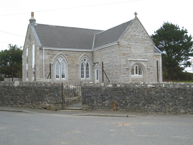
Saint Euny or Uny (6th century) is the patron saint of the churches of Lelant and Redruth in west Cornwall, England, UK. Life William Worcester in his account of travels in Cornwall in 1478 records that St Uny, the brother of St Herygh, was buried at the parish church of St Uny near the town of Lelant, and that his feast day was 1 February. According to him Uny and Herygh (patron of St Erth) were the brothers of St Ia, patron of St Ives (St Ia was an Irish princess who evangelised part of Cornwall). This account is the first record of the spelling "Uny", no doubt because it was recorded as spoken rather than written. The correct spelling is "Euny" though the spelling "Uny" is used after the mid 16th century. As well as being the patron of Lelant and Redruth Euny is the joint patron of Crowan. In all three churches the feast day is the Sunday nearest to 1 February, the day mentioned by William Worcester. In some 18th-century documents there is evidence that the parish of Crowan w ... [...More Info...] [...Related Items...] OR: [Wikipedia] [Google] [Baidu] |
Lelant
Lelant ( kw, Lannanta) is a village in west Cornwall, England, UK. It is on the west side of the Hayle Estuary, about southeast of St Ives and one mile (1.6 km) west of Hayle.Ordnance Survey: Landranger map sheet 203 ''Land's End'' The village is part of St Ives civil parish (meaning that it falls within the parish area of St Ives Town Council), the Lelant and Carbis Bay ward on Cornwall Council, and also the St Ives Parliamentary constituency. The birth, marriage, and death registration district is Penzance. Its population at the 2011 census was 3,892 The South West Coast Path, which follows the coast of south west England from Somerset to Dorset passes through Lelant, along the estuary and above Porth Kidney Sands. History The name is derived from the Cornish language, Cornish ''lann'' and ''Anta'', meaning ''church-site of Anta''. The earliest attested spelling is Lananta in about 1170. Nothing is known about Anta, and St Uny's Church, Lelant, Lelant parish church ... [...More Info...] [...Related Items...] OR: [Wikipedia] [Google] [Baidu] |
Wendron
Wendron ( kw, Egloswendron (village), Pluw Wendron (parish); historically St. Wendron) is a village and civil parish in Cornwall, England, United Kingdom, to the north of Helston. The parish population at the 2011 census was 2,743. The electoral ward of Wendron had a 2011 population of 4,936. History The parish of Wendron was part of the Hundred of Kerrier and was originally bounded by the parishes of Illogan, Gwennap, Stithians, Constantine, Mawgan-in-Meneage, Gunwalloe, Sithney and Crowan. Until the mid 19th-century the parish of Wendron included the town of Helston and what are now the parishes of Carnmenellis and Pencoys. The parish of Carnmenellis was created in 1846; Helston in 1848; and Pencoys in 1881. Before 1284 Edmund, Earl of Cornwall, gave the church of Wendron, with its chapels, to Rewley Abbey near Oxford. Before this it had belonged to the Earl's, Manor of Helston, which included the whole parish. The church is cruciform but was enlarged in the 15th-century ... [...More Info...] [...Related Items...] OR: [Wikipedia] [Google] [Baidu] |
Medieval Irish Saints Of Cornwall
In the history of Europe, the Middle Ages or medieval period lasted approximately from the late 5th to the late 15th centuries, similar to the post-classical period of global history. It began with the fall of the Western Roman Empire and transitioned into the Renaissance and the Age of Discovery. The Middle Ages is the middle period of the three traditional divisions of Western history: classical antiquity, the medieval period, and the modern period. The medieval period is itself subdivided into the Early, High, and Late Middle Ages. Population decline, counterurbanisation, the collapse of centralized authority, invasions, and mass migrations of tribes, which had begun in late antiquity, continued into the Early Middle Ages. The large-scale movements of the Migration Period, including various Germanic peoples, formed new kingdoms in what remained of the Western Roman Empire. In the 7th century, North Africa and the Middle East—most recently part of the Eastern R ... [...More Info...] [...Related Items...] OR: [Wikipedia] [Google] [Baidu] |
6th-century Christian Saints
The 6th century is the period from 501 through 600 in line with the Julian calendar. In the West, the century marks the end of Classical Antiquity and the beginning of the Middle Ages. The collapse of the Western Roman Empire late in the previous century left Europe fractured into many small Germanic kingdoms competing fiercely for land and wealth. From the upheaval the Franks rose to prominence and carved out a sizeable domain covering much of modern France and Germany. Meanwhile, the surviving Eastern Roman Empire began to expand under Emperor Justinian, who recaptured North Africa from the Vandals and attempted fully to recover Italy as well, in the hope of reinstating Roman control over the lands once ruled by the Western Roman Empire. In its second Golden Age, the Sassanid Empire reached the peak of its power under Khosrau I in the 6th century.Roberts, J: "History of the World.". Penguin, 1994. The classical Gupta Empire of Northern India, largely overrun by the Huna, ended i ... [...More Info...] [...Related Items...] OR: [Wikipedia] [Google] [Baidu] |
Joseph Loth
Joseph Loth (27 December 1847 – 1 April 1934) was a French linguist and historian who specialised in the study of Celtic languages. Early life Loth was born in Guémené-sur-Scorff, Brittany. After his studies at Sainte-Anne-d'Auray, he became a teacher at Pontivy, then Quimper and Saumur until the outbreak of the Franco-Prussian War in 1870. After the end of the conflict, he worked in various institutions in Paris. At this time he made the acquaintance of Henri d'Arbois de Jubainville, who encouraged him to study Celtic languages. Career In 1883 he was appointed to the Faculty of Arts at Rennes University, where he taught Celtic. That same year he founded the journal ''Annales de Bretagne'', in which he published numerous studies and edited until 1910. He was appointed professor at the Collège de France in 1910 and was elected member of the Académie des Inscriptions et Belles-Lettres in 1919. Loth published numerous articles in the ''Revue Celtique'', re-edited Pier ... [...More Info...] [...Related Items...] OR: [Wikipedia] [Google] [Baidu] |
Plouyé
Plouyé (; "Parish of Ia") is a commune in the Finistère department of Brittany in northwestern France. Population Inhabitants of Plouyé are called in French ''Plouyéziens''. See also *Communes of the Finistère department The following is a list of the 277 communes of the Finistère department of France. The communes cooperate in the following intercommunalities (as of 2022):Mayors of Finistère Association External links Official website Communes of Finistè ... [...More Info...] [...Related Items...] OR: [Wikipedia] [Google] [Baidu] |
Carn Euny
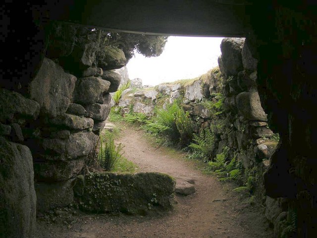
, alternate_name = , image = CarnEuny1.jpg , alt = Fragments of stone round-houses , caption = Carn Euny ancient village , map_type = Southwest Cornwall , map_alt = , map_size = , location = Brane, Cornwall , region = , coordinates = , type = Ancient village , part_of = , length = , width = , area = , height = , builder = , material = , built = c. 200 BC , abandoned = c. 400 AD , epochs = Iron Age/Roman , cultures = Romano-British , dependency_of = , occupants = , event = , excavations = , archaeologists = , condition = Ruins , ownership = Cornwall Heritage Trust , public_access = Yes , website = , notes = Carn Euny (from kw, Karn Uni)Place-names in the Standard Written Form (SWF) [...More Info...] [...Related Items...] OR: [Wikipedia] [Google] [Baidu] |
Sancreed
Sancreed (''Cornish: Eglossankres'') is a village and civil parish in Cornwall, England, approximately three miles (5 km) west of Penzance. Sancreed civil parish encompasses the settlements of Bejouans, Bosvennen, Botreah, Drift, Sancreed Churchtown, Trenuggo, and Tregonnebris. It is bounded by St Just parish to the west, Madron parish to the northeast, and St Buryan and Paul parishes to the south. The parish comprises of land including Drift Reservoir, which provides drinking water for the area. Geography Sancreed (Cornish: Eglossankres) is an inland parish in the former Hundred of Penwith, about three miles from Penzance. The civil parish encompasses the settlements of Bejouans, Bosvennen, Botreath, Drift, Sancreed Churchtown, Trenuggo and Tregonnebris. It is bounded by St Just to the west, Madron parish to the north-east and St Buryan and Paul parishes to the south. Within the parish is a noteworthy prehistoric settlement at Carn Euny. A few hundred metres west of ... [...More Info...] [...Related Items...] OR: [Wikipedia] [Google] [Baidu] |
English Reformation
The English Reformation took place in 16th-century England when the Church of England broke away from the authority of the pope and the Catholic Church. These events were part of the wider European Protestant Reformation, a religious and political movement that affected the practice of Christianity in Western Europe, Western and Central Europe. Ideologically, the groundwork for the Reformation was laid by Renaissance humanism, Renaissance humanists who believed that the Bible, Scriptures were the only source of Christian faith and criticized religious practices which they considered superstitious. By 1520, Martin Luther, Martin Luther's new ideas were known and debated in England, but Protestants were a religious minority and heretics under the law. The English Reformation began as more of a political affair than a theological dispute. In 1527, Henry VIII requested an annulment of his marriage, but Pope Clement VII refused. In response, the English Reformation Parliament, Refo ... [...More Info...] [...Related Items...] OR: [Wikipedia] [Google] [Baidu] |
Merther Uny
Wendron ( kw, Egloswendron (village), Pluw Wendron (parish); historically St. Wendron) is a village and civil parish in Cornwall, England, United Kingdom, to the north of Helston. The parish population at the 2011 census was 2,743. The electoral ward of Wendron had a 2011 population of 4,936. History The parish of Wendron was part of the Hundred of Kerrier and was originally bounded by the parishes of Illogan, Gwennap, Stithians, Constantine, Mawgan-in-Meneage, Gunwalloe, Sithney and Crowan. Until the mid 19th-century the parish of Wendron included the town of Helston and what are now the parishes of Carnmenellis and Pencoys. The parish of Carnmenellis was created in 1846; Helston in 1848; and Pencoys in 1881. Before 1284 Edmund, Earl of Cornwall, gave the church of Wendron, with its chapels, to Rewley Abbey near Oxford. Before this it had belonged to the Earl's, Manor of Helston, which included the whole parish. The church is cruciform but was enlarged in the 15th-century an ... [...More Info...] [...Related Items...] OR: [Wikipedia] [Google] [Baidu] |
Carn Brea, Redruth
Carn Brea ( kw, Karnbre) is a civil parish and hilltop site in Cornwall, England, United Kingdom. The population of Carn Brea including Bosleake and Church Coombe was 8,013 at the 2011 census. The hilltop site is situated approximately one mile (1.6 km) southwest of Redruth. The settlements of Bosleake, Brea, Broad Lane, Carn Arthen, Carn Brea Village, Carnkie, Four Lanes, Grillis, Illogan Highway, Pencoys, Penhallick, Piece, Pool, Tolskithy, Tregajorran, Treskillard, Tuckingmill and West Tolgus are in the parish. Neolithic settlement The Neolithic settlement at Carn Brea was a tor enclosure occupied between around 3700 and 3400 BC. Roger Mercer directed archaeological excavations of the site in 1970. https://cornisharchaeology.org.uk/volume-9-1970/ and 1972. https://cornisharchaeology.org.uk/volume-11-1972/ A two-acre (0.8 ha) inner enclosure was surrounded by one of eleven acres (4.5 ha). The ramparts consisted of stone walls with an earth bank and ditch. T ... [...More Info...] [...Related Items...] OR: [Wikipedia] [Google] [Baidu] |


