|
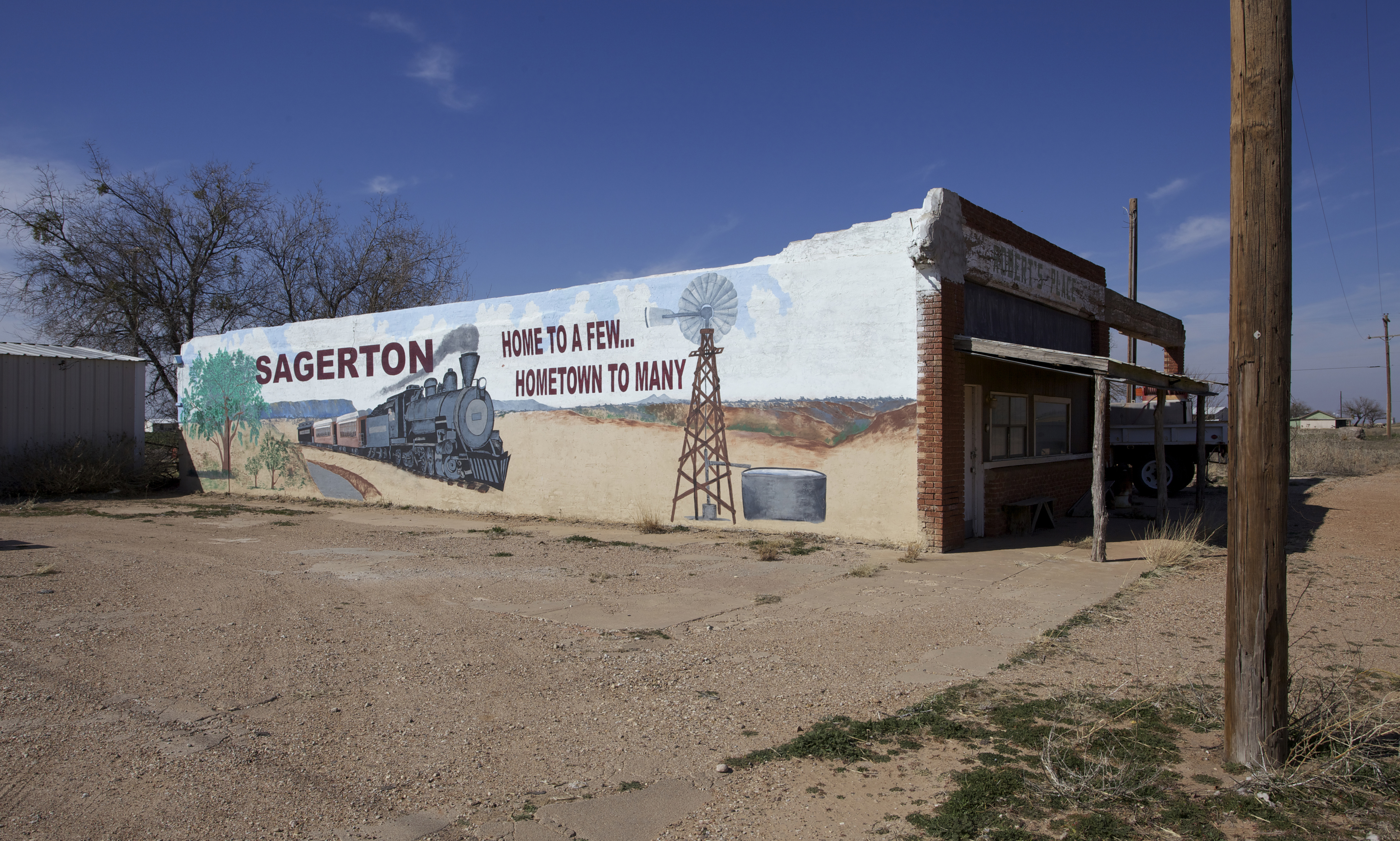
Sagerton, Texas
Sagerton is an unincorporated community in Haskell County, Texas, United States. History According to the Handbook of Texas, the community was established in 1905 and named for W. M. Sager, the townsite donor. It was a shipping point for locally grown agricultural products such as cotton, cattle, and poultry on the newly constructed . Beginning in 1909, the Stamford and Northwestern Railway, stretching from Stamford to Spur, also provided rail service. Fires in 1917 and 1926 caused extensive property damage, and the town's bank, organized in 1908, failed in 1931. Geography Sagerton is located at the intersection of Texas State Highway 283 and Farm to Market Road 1661 in the Rolling Plains region of West Texas West Texas is a loosely defined region in the U.S. state of Texas, generally encompassing the arid and semiarid lands west of a line drawn between the cities of Wichita Falls, Abilene, and Del Rio. No consensus exists on the boundary betwee ..., about to the eas ... [...More Info...] [...Related Items...] OR: [Wikipedia] [Google] [Baidu] |
List Of Sovereign States
The following is a list providing an overview of sovereign states around the world with information on their status and recognition of their sovereignty. The 206 listed states can be divided into three categories based on membership within the United Nations System: 193 member states of the United Nations, UN member states, 2 United Nations General Assembly observers#Present non-member observers, UN General Assembly non-member observer states, and 11 other states. The ''sovereignty dispute'' column indicates states having undisputed sovereignty (188 states, of which there are 187 UN member states and 1 UN General Assembly non-member observer state), states having disputed sovereignty (16 states, of which there are 6 UN member states, 1 UN General Assembly non-member observer state, and 9 de facto states), and states having a political status of the Cook Islands and Niue, special political status (2 states, both in associated state, free association with New Zealand). Compi ... [...More Info...] [...Related Items...] OR: [Wikipedia] [Google] [Baidu] |
Handbook Of Texas
The ''Handbook of Texas'' is a comprehensive encyclopedia of Texas geography, history, and historical persons published by the Texas State Historical Association (TSHA). History The original ''Handbook'' was the brainchild of TSHA President Walter Prescott Webb of The University of Texas history department. It was published as a two-volume set in 1952, with a supplemental volume published in 1976. In 1996, the New Handbook of Texas was published, expanding the encyclopedia to six volumes and over 23,000 articles. In 1999, the Handbook of Texas Online went live with the complete text of the print edition, all corrections incorporated into the handbook's second printing, and about 400 articles not included in the print edition due to space limitations. The handbook continues to be updated online, and contains over 25,000 articles. The online version includes entries on general topics, such as "Texas Since World War II", biographies such as notable Texans Samuel Houston and W. ... [...More Info...] [...Related Items...] OR: [Wikipedia] [Google] [Baidu] |
Salt Fork Brazos River
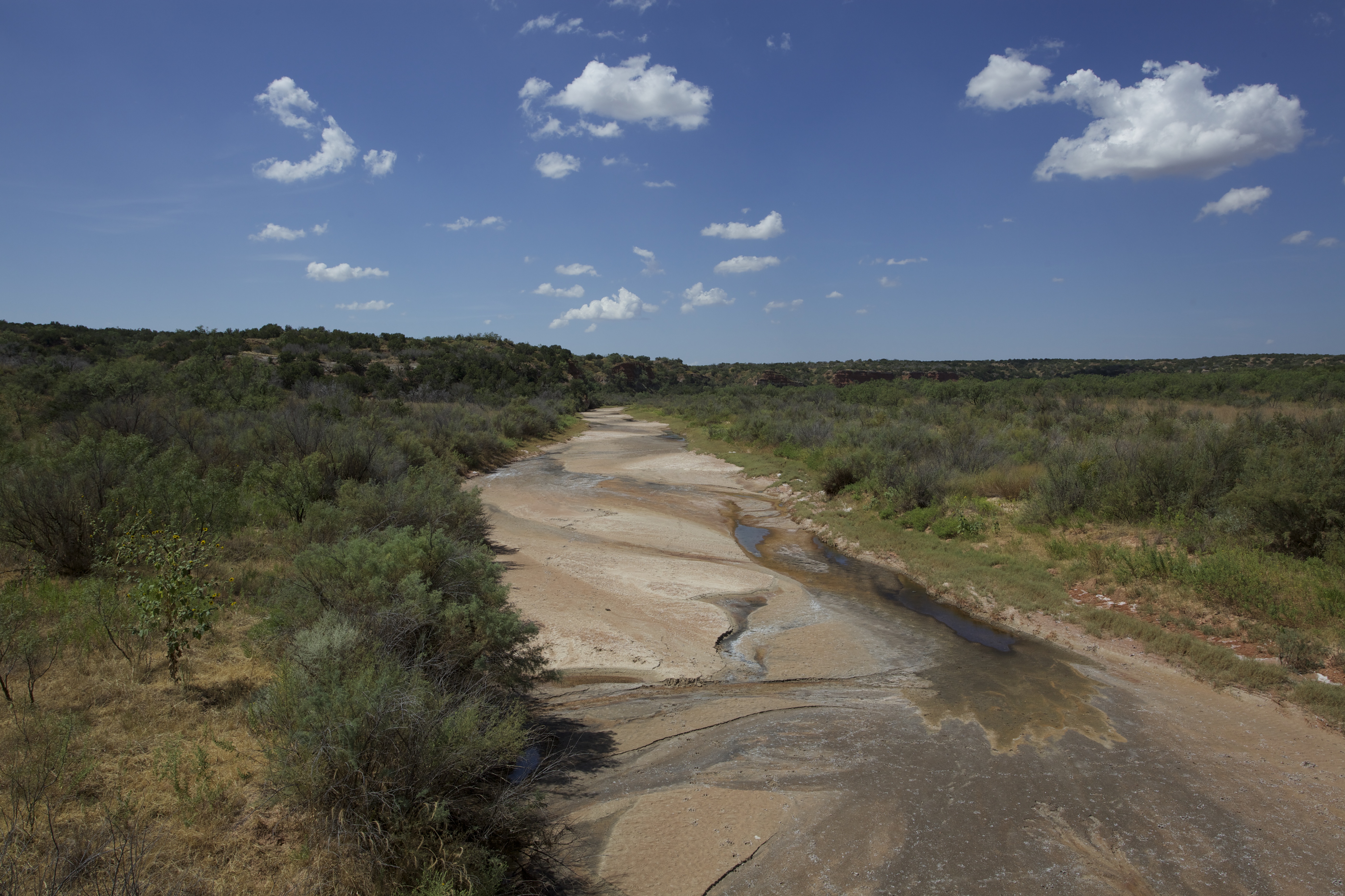
The Salt Fork Brazos River is a braided, highly intermittent stream about long, heading along the edge of the Llano Estacado about east-southeast of Lubbock, Texas. From its source, it flows generally east-southeastward to join the Double Mountain Fork to form the Brazos River about west-northwest of Haskell, Texas.United States Board on Geographical Names. 1964. Decisions on Geographical Names in the United States, Decision list no. 6402, United States Department of the Interior, Washington DC, p. 53. The Salt Fork stretches across portions of Crosby, Garza, Kent, and Stonewall counties of West Texas. Geography The Salt Fork Brazos River begins as a dry channel (draw) near the edge of the Llano Estacado in Crosby County, about southwest of the cotton gin in the small farming community of Cap Rock, Texas. From the edge of the Caprock Escarpment, the stream channel generally runs southeastward across southern Crosby County, passing to the east of Courthouse Mountain and cr ... [...More Info...] [...Related Items...] OR: [Wikipedia] [Google] [Baidu] |
Brazos River
The Brazos River ( , ), called the ''Río de los Brazos de Dios'' (translated as "The River of the Arms of God") by early Spanish explorers, is the 11th-longest river in the United States at from its headwater source at the head of Blackwater Draw, Roosevelt County, New Mexico to its mouth at the Gulf of Mexico with a drainage basin. Being one of Texas' largest rivers,"Brazos River." Britannica Academic, Encyclopædia Britannica, 11 Aug. 2018. academic.eb.com/levels/collegiate/article/Brazos-River/16291. Accessed 27 Nov. 2018. it is sometimes used to mark the boundary between East Texas and West Texas. The river is closely associated with Texas history, particularly the Austin settlement and Texas Revolution eras. Today major Texas institutions such as Texas Tech University, Baylor University, and Texas A&M University are located close to the river's basin, as are parts of metropolitan Houston. Geography The Brazos proper begins at the confluence of the Salt Fork and Doub ... [...More Info...] [...Related Items...] OR: [Wikipedia] [Google] [Baidu] |
Double Mountain Fork Brazos River
The Double Mountain Fork Brazos River is an ephemeral, sandy-braided stream about long, heading on the Llano Estacado of West Texas about southeast of Tahoka, Texas, flowing east-northeast across the western Rolling Plains to join the Salt Fork, forming the Brazos River about west-northwest of Haskell, Texas.United States Board on Geographical Names. 1964. Decisions on Geographical Names in the United States, Decision list no. 6402, United States Department of the Interior, Washington DC, p. 51. Geography The Double Mountain Fork Brazos River begins as a shallow draw near the eastern edge of the Llano Estacado in Lynn County, about northeast of the small farming community of Draw, Texas. The stream generally runs eastward across southern Garza County, where it is fed by springs, providing a minimal base flow that is intermittently punctuated by rainfall and associated runoff. At the western edge of Kent County, about east-northeast of Justiceburg, the Double Mountain F ... [...More Info...] [...Related Items...] OR: [Wikipedia] [Google] [Baidu] |
West Texas
West Texas is a loosely defined region in the U.S. state of Texas, generally encompassing the arid and semiarid lands west of a line drawn between the cities of Wichita Falls, Abilene, and Del Rio. No consensus exists on the boundary between East Texas and West Texas. While most Texans understand these terms, no boundaries are officially recognized and any two individuals are likely to describe the boundaries of these regions differently. Walter Prescott Webb, American historian and geographer, suggested that the 98th meridian separates East and West Texas; Texas writer A.C. Greene proposed that West Texas extends west of the Brazos River. Use of a single line, though, seems to preclude the use of other separators, such as an area— Central Texas. Unlike East Texas, West Texas is not generally considered to be part of the American South, and the dry, desert climate is often more associated with the American Southwest. West Texas is often subdivided according to disti ... [...More Info...] [...Related Items...] OR: [Wikipedia] [Google] [Baidu] |


