|
Sycamore Shoals
The Sycamore Shoals of the Watauga River, usually shortened to Sycamore Shoals, is a rocky stretch of river rapids along the Watauga River in Elizabethton, Tennessee. Archeological excavations have found Native Americans lived near the shoals since prehistoric times, and Cherokees gathered there. As Europeans began settling the Trans-Appalachian frontier, the shoals proved strategic militarily, as well as shaped the economies of Tennessee and Kentucky. Today, the shoals are protected as a National Historic Landmark and are maintained as part of Sycamore Shoals State Historic Park.Carroll Van WestSycamore Shoals State Historic Park ''Tennessee Encyclopedia of History and Culture'', 2002. Retrieved: 28 June 2009.Polly Rettig and Hugh Lawing (form preparation), . 11 February 1976. Retrieved: 28 June 2009. PDF file. Explorer James Robertson (later a founder of Nashville) identified the alluring flatlands at Sycamore Shoals, known as the Watauga Old Fields, in 1770, and le ... [...More Info...] [...Related Items...] OR: [Wikipedia] [Google] [Baidu] |
Fort Watauga
Fort Watauga, more properly Fort Caswell, was an American Revolutionary War fort that once stood at the Sycamore Shoals of the Watauga River in what is now Elizabethton, Tennessee. The fort was originally built in 1775–1776 by the area's frontier government, the Watauga Association, to help defend Watauga settlers from Native American (primarily Cherokee) attacks, which were in part instigated by the British. Fort Watauga was originally named Fort Caswell after North Carolina Governor Richard Caswell.Benjamin NanceFort Watauga ''Tennessee Encyclopedia of History and Culture'', 2002. Retrieved: 18 June 2009. In the 1970s, as part of the nation's bicentennial celebrations, the state of Tennessee authorized a reconstruction of Fort Watauga. Archaeologists conducted excavations in the Sycamore Shoals area and uncovered several trenches believed to have been part of the fort's walls. The fort was then rebuilt based on information gained about the fort's design from th ... [...More Info...] [...Related Items...] OR: [Wikipedia] [Google] [Baidu] |
Elizabethton, Tennessee
Elizabethton is a city in, and the county seat of Carter County, Tennessee, United States. Elizabethton is the historical site of the first independent American government (known as the Watauga Association, created in 1772) located west of both the Eastern Continental Divide and the original Thirteen Colonies. The city is also the historical site of the Transylvania Purchase (1775), a major muster site during the American Revolutionary War for both the Battle of Musgrove Mill (1780) and the Battle of Kings Mountain (1780). It was within the secessionist North Carolina "State of Franklin" territory (1784–1788). The population of Elizabethton was enumerated at 14,176 during the 2010 census. Geography Northeast Tennessee location Elizabethton is located within the "Tri-Cities" area (encompassed by Bristol, Johnson City, and Kingsport) of northeast Tennessee. Time offset from Coordinated Universal Time (UTC): UTC-5 (Eastern Time). According to the United States Census Bu ... [...More Info...] [...Related Items...] OR: [Wikipedia] [Google] [Baidu] |
American Revolutionary War
The American Revolutionary War (April 19, 1775 – September 3, 1783), also known as the Revolutionary War or American War of Independence, was a major war of the American Revolution. Widely considered as the war that secured the independence of the United States, fighting began on April 19, 1775, followed by the Lee Resolution on July 2, 1776, and the Declaration of Independence on July 4, 1776. The American Patriots were supported by the Kingdom of France and, to a lesser extent, the Dutch Republic and the Spanish Empire, in a conflict taking place in North America, the Caribbean, and the Atlantic Ocean. Established by royal charter in the 17th and 18th centuries, the American colonies were largely autonomous in domestic affairs and commercially prosperous, trading with Britain and its Caribbean colonies, as well as other European powers via their Caribbean entrepôts. After British victory over the French in the Seven Years' War in 1763, tensions between the motherla ... [...More Info...] [...Related Items...] OR: [Wikipedia] [Google] [Baidu] |
Jonesborough, Tennessee
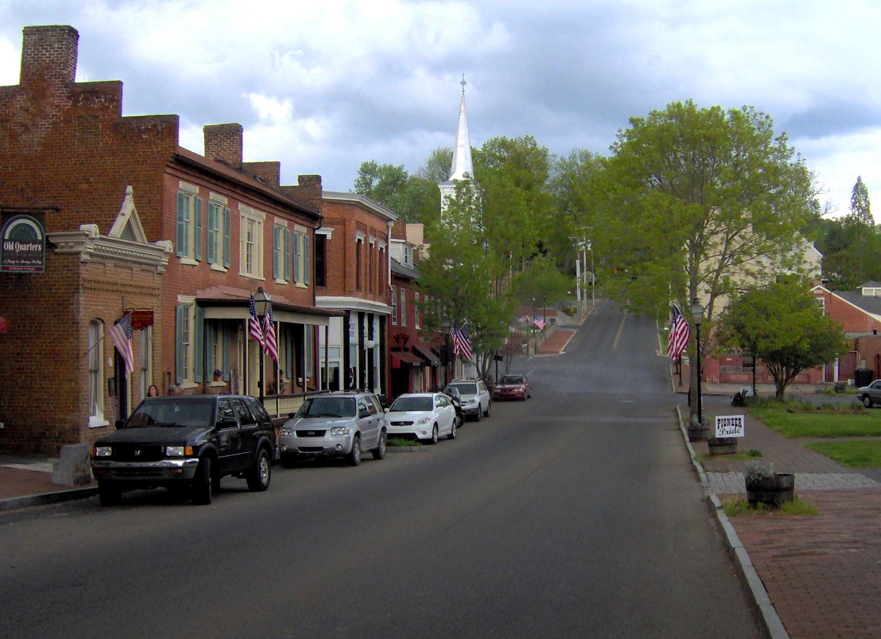
Jonesborough (historically also Jonesboro) is a town in, and the county seat of, Washington County, Tennessee, in the Southeastern United States. Its population was 5,860 as of 2020. It is "Tennessee's oldest town". Jonesborough is part of the Johnson City metropolitan statistical area, which is a component of the Johnson City–Kingsport–Bristol, TN and VA combined statistical area – commonly known as the "Tri-Cities" region. History Located in the far northeast corner of the state, Jonesborough was founded by European Americans in 1779, 17 years before Tennessee became a state and while the area was under the jurisdiction of North Carolina. It was named after North Carolina legislator Willie Jones, who had supported the state's westward expansion across the Appalachian Mountains. The town was renamed "Jonesboro" for a period of time, but it took back its historic spelling. Jonesborough was originally a part of the Washington District. In 1784, it became the ... [...More Info...] [...Related Items...] OR: [Wikipedia] [Google] [Baidu] |
Chisca
The Chisca were a tribe of Native Americans living in present-day eastern Tennessee and southwestern Virginia in the 16th century, and in present day Alabama, Georgia, and Florida in the 17th, 18th, and early 19th centuries, by which time they were known as Yuchi. The Hernando de Soto expedition heard of, and may have had brief contact with, the Chisca in 1540. The Juan Pardo expeditions of 1566 and 1568 encountered the Chisca, and engaged in battles with them. By early in the 17th century, Chisca people were present in several parts of Spanish Florida, engaged at various times and places in alternately friendly or hostile relations with the Spanish and the peoples of the Spanish mission system. After the capture of a fortified Chisca town by the Spanish and Apalachee in 1677, some Chisca took refuge in northern Tennessee, where they were absorbed into the Shawnee, and in Muscogee towns in Alabama. Around the turn of the 18th century some Chisca, by then generally called Yuchi ... [...More Info...] [...Related Items...] OR: [Wikipedia] [Google] [Baidu] |
Nolichucky River
The Nolichucky River is a river that flows through Western North Carolina and East Tennessee, in the southeastern United States. Traversing the Pisgah National Forest and the Cherokee National Forest in the Blue Ridge Mountains, the river's watershed is home to some of the highest mountains in the Appalachians, including Mount Mitchell in North Carolina, the highest point in the eastern United States. The river is a tributary of the French Broad River, and is impounded by Nolichucky Dam near Greeneville, Tennessee. Hydrography The Nolichucky River rises as the confluence of the North Toe River and the Cane River near the community of Huntdale, North Carolina. The stream succeeds the North Toe as the boundary between Yancey County and Mitchell County, North Carolina. Trending roughly westward, it flows along the northern base of Flattop Mountain. The gorge is especially steep on its north side. Geologically, the area is predominantly underlain by metamorphic rock of Precambria ... [...More Info...] [...Related Items...] OR: [Wikipedia] [Google] [Baidu] |
Juan Pardo (explorer)
Juan Pardo was a Spanish explorer who was active in the later half of the sixteenth century. He led a Spanish expedition from the Atlantic coast through what is now North and South Carolina and into eastern Tennessee on the orders of Pedro Menéndez de Avilés, in an attempt to find an inland route to a silver-producing town in Mexico. Menéndez had built Fort San Felipe (1566), and established Santa Elena, on present-day Parris Island; these were the first Spanish settlements in what is now South Carolina. While leading his expedition deeper into the interior, Pardo founded Fort San Juan at Joara, the first European settlement (1567–1568) in the interior of North Carolina, and five additional forts in what are the modern US states of North Carolina, Tennessee, and South Carolina. These five forts were Fort San Pedro near Chiaha, Fort San Pablo on the French Broad River, Fort Santiago near modern Salisbury, North Carolina, Fort Santo Tomás near Cofitachequi, and Fuerta de N ... [...More Info...] [...Related Items...] OR: [Wikipedia] [Google] [Baidu] |
Mississippian Culture
The Mississippian culture was a Native American civilization that flourished in what is now the Midwestern, Eastern, and Southeastern United States from approximately 800 CE to 1600 CE, varying regionally. It was known for building large, earthen platform mounds, and often other shaped mounds as well. It was composed of a series of urban settlements and satellite villages linked together by loose trading networks. The largest city was Cahokia, believed to be a major religious center located in what is present-day southern Illinois. The Mississippian way of life began to develop in the Mississippi River Valley (for which it is named). Cultures in the tributary Tennessee River Valley may have also begun to develop Mississippian characteristics at this point. Almost all dated Mississippian sites predate 1539–1540 (when Hernando de Soto explored the area), with notable exceptions being Natchez communities. These maintained Mississippian cultural practices into the 18th cen ... [...More Info...] [...Related Items...] OR: [Wikipedia] [Google] [Baidu] |
Woodland Period
In the classification of archaeological cultures of North America, the Woodland period of North American pre-Columbian cultures spanned a period from roughly 1000 BCE to European contact in the eastern part of North America, with some archaeologists distinguishing the Mississippian period, from 1000 CE to European contact as a separate period. The term "Woodland Period" was introduced in the 1930s as a generic term for prehistoric sites falling between the Archaic hunter-gatherers and the agriculturalist Mississippian cultures. The Eastern Woodlands cultural region covers what is now eastern Canada south of the Subarctic region, the Eastern United States, along to the Gulf of Mexico. This period is variously considered a developmental stage, a time period, a suite of technological adaptations or "traits", and a "family tree" of cultures related to earlier Archaic cultures. It can be characterized as a chronological and cultural manifestation without any massive changes in ... [...More Info...] [...Related Items...] OR: [Wikipedia] [Google] [Baidu] |
Boone Lake
Boone Lake is a reservoir in Sullivan and Washington counties in northeastern Tennessee, formed by the impoundment of the South Fork Holston River and Watauga River behind Boone Dam.Boone Reservoir information , Tennessee Valley Authority The dam and reservoir are maintained and operated by the (TVA). The lake has a surface area of about and a -storage capacity of . Water levels in the reservoir fluctuate over a range of about over the course of a year. [...More Info...] [...Related Items...] OR: [Wikipedia] [Google] [Baidu] |
Tennessee Department Of Environment And Conservation
The Tennessee Department of Environment and Conservation (TDEC) is a Cabinet-level agency within the government of the U.S. state of Tennessee, headed by the Tennessee Commissioner of Environment and Conservation. The Department of Conservation was first created in 1937 by the State Government Reorganization Act of 1937. All areas used for state parks, monuments, and recreation were brought under a Division of Parks within the department later that year. For a short while in the late 1950s and early 1960s the department existed as the Department of Conservation and Commerce, but it was soon split, with the Department of Conservation regaining its name. The modern TDEC was created in 1991, with programs in the Department of Health and Environment shifted into the new department. TDEC is legally responsible for the protection of Tennessee's air, water, and soil quality. As of 2006, the department had at least fourteen divisions: the Division of Air Pollution Control, the Division ... [...More Info...] [...Related Items...] OR: [Wikipedia] [Google] [Baidu] |
Wilbur Dam
Wilbur Dam is a hydroelectric dam on the Watauga River in Carter County, in the U.S. state of Tennessee. It is one of two dams on the river owned and operated by the Tennessee Valley Authority. The dam impounds Wilbur Lake, which extends for about up the Watauga to the base of Watauga Dam.Tennessee Valley Authority, ''The Upper Holston Projects: Watauga, South Holston, Boone, and Fort Patrick Henry; a Comprehensive Report on the Planning, Design, Construction, Initial Operations, and Costs of Four Hydro Projects in the Holston Basin at the Eastern Tip of Tennessee'', Technical Report No. 14 (Washington, D.C.: U.S. Government Printing Office, 1958), pp. 1141-1143. Wilbur Dam was completed in 1912 making it the second oldest dam in the TVA system behind Ocoee Dam No. 1 Ocoee Dam Number 1 is a hydroelectric dam on the Ocoee River in Polk County in the U.S. state of Tennessee. The dam impounds the Parksville Reservoir (often called Ocoee Lake), and is the farthest downstream of f ... [...More Info...] [...Related Items...] OR: [Wikipedia] [Google] [Baidu] |


