|
Swakoppoort Dam
Swakoppoort Dam is a dam outside of Okahandja, Otjozondjupa Region, Namibia. It dams the Swakop River and occasionally receives inflow from the Omatako Dam on Swakop's tributary Omatako. Its capacity is . Completed in 1978, it is one of three dams to supply water to the capital Windhoek. It also supplies the Navachab mine and the town of Karibib Karibib () is a town in the Erongo Region of western Namibia. It has 8,434 inhabitants. Karibib is the district capital of the Karibib Constituency, Karibib electoral constituency. It is situated on the Khan River, halfway between Windhoek and S .... References Okahandja Dams in Namibia Dams completed in 1978 1978 establishments in South West Africa Buildings and structures in Otjozondjupa Region Windhoek {{Africa-dam-stub ... [...More Info...] [...Related Items...] OR: [Wikipedia] [Google] [Baidu] |
Swakop River
The Swakop River () is a major river in western central Namibia. Its source is in the Khomas Highland. From there it flows westwards through the town of Okahandja, the historic mission station at Gross Barmen, and the settlement of Otjimbingwe. It then crosses the Namib desert and reaches the Atlantic Ocean at Swakopmund (). The Swakop is an ephemeral river; its run-off is roughly 40 million cubic metres per annum. It has reached the Atlantic Ocean most recently in 2011, 2022, and 2025. The Swakop River, along with its main tributary Khan, is one of the largest temporary water-bearing rivers in the dry western part of Namibia. It is long and has a large catchment area (including its tributaries). The area around the river mouth and the surrounding dunes are also known for rich bird life and some unusual plant species (like the Welwitschia) that use the regular fog drifting in from the sea to sustain themselves in the absence of other moisture. Groundwater levels in ... [...More Info...] [...Related Items...] OR: [Wikipedia] [Google] [Baidu] |
Okahandja
Okahandja is a city of 45,159 inhabitants in Otjozondjupa Region, central Namibia, and the district capital of the Okahandja electoral constituency. It is known as the ''Garden Town of Namibia''. It is located 70 km north of Windhoek on the B1 road. It was founded around 1800, by two local groups, the Herero and the Nama. History Okahandja means ''the place where two rivers'' (Okakango and Okamita) ''flow into each other to form one wide one'' in Otjiherero. A German pastor, Heinrich Schmelen, became the first European to visit the town in 1827. In 1844, two missionaries were permanently assigned to the town, Heinrich Kleinschmidt and Hugo Hahn. A church dates from this period. A military post was established at the initiative of Theodor Leutwein in 1894, and it is this date that is officially recognized as the town's founding.Okahandja Hist ... [...More Info...] [...Related Items...] OR: [Wikipedia] [Google] [Baidu] |
Otjozondjupa Region
Otjozondjupa is one of the fourteen regions of Namibia. Its capital is Otjiwarongo. The region further contains the municipalities of Okahandja and Grootfontein and the towns Okakarara and Otavi. , Otjozondjupa had 97,945 registered voters. Geography A landmark within this region is the Waterberg Plateau Park. Twenty four kilometres west of Grootfontein lies the huge Hoba meteorite. At over 60 tons, it is the largest known meteorite on Earth, as well as the largest naturally occurring mass of iron known to exist on the planet's surface. In the east, Otjozondjupa borders the North-West District (Botswana), North-West District of Botswana. Domestically, it borders more regions than any other region of Namibia: *Omaheke – southeast *Khomas Region, Khomas – south *Erongo Region, Erongo – southwest *Kunene Region, Kunene – northwest *Oshikoto Region, Oshikoto – north *Kavango Region, Kavango – northeast Economy and infrastructure Otjiwarongo, Grootfontein, Otavi, and Ok ... [...More Info...] [...Related Items...] OR: [Wikipedia] [Google] [Baidu] |
Namibia
Namibia, officially the Republic of Namibia, is a country on the west coast of Southern Africa. Its borders include the Atlantic Ocean to the west, Angola and Zambia to the north, Botswana to the east and South Africa to the south; in the northeast, approximating a quadripoint, Zimbabwe lies less than 200 metres (660 feet) away along the Zambezi, Zambezi River near Kazungula, Zambia. Namibia's capital and largest city is Windhoek. Namibia is the driest country in sub-Saharan Africa, and has been inhabited since prehistoric times by the Khoekhoe, Khoi, San people, San, Damara people, Damara and Nama people. Around the 14th century, immigration, immigrating Bantu peoples arrived as part of the Bantu expansion. From 1600 the Ovambo people#History, Ovambo formed kingdoms, such as Ondonga and Oukwanyama. In 1884, the German Empire established rule over most of the territory, forming a colony known as German South West Africa. Between 1904 and 1908, German troops waged a punitive ... [...More Info...] [...Related Items...] OR: [Wikipedia] [Google] [Baidu] |
Omatako Dam
Omatako Dam is an earth-fill embankment dam about north of Okahandja in the Otjozondjupa Region of Namibia. It is named after the Omatako Mountains, and it dams the ephemeral Omatako River, with ''Omatako'' meaning "butt" in Oshiwambo, the name referring to the shape of the Omatako Mountains. The dam has a capacity of . Completed in 1981, it was originally envisaged to become part of the ''Eastern National Water Carrier'', a scheme to supply water to Namibia's capital Windhoek from the Okavango River, to the north on the Angola Angola, officially the Republic of Angola, is a country on the west-Central Africa, central coast of Southern Africa. It is the second-largest Portuguese-speaking world, Portuguese-speaking (Lusophone) country in both total area and List of c ...n border. The scheme was never completed. Omatako Dam today only contains floods and supplies water to the Von Bach Dam. As such, it is one of three dams supplying the capital Windhoek with water. Refere ... [...More Info...] [...Related Items...] OR: [Wikipedia] [Google] [Baidu] |
Omatako River
{{disambiguation ...
Omatako may refer to the following places and jurisdictions in central Namibia: * Omatako Constituency * Omatako Mountains * Omatako Dam Omatako Dam is an earth-fill embankment dam about north of Okahandja in the Otjozondjupa Region of Namibia. It is named after the Omatako Mountains, and it dams the ephemeral Omatako River, with ''Omatako'' meaning "butt" in Oshiwambo, the name ... [...More Info...] [...Related Items...] OR: [Wikipedia] [Google] [Baidu] |
The Namibian
''The Namibian'' is the largest daily newspaper in Namibia. It is published in English and Oshiwambo. History The newspaper was established in 1985 by journalist Gwen Lister as a weekly newspaper reliant on support of donors, which aimed to promote Namibian independence from South Africa. Its first edition appeared on 30 August of that year with a print run of 10,000. ''The Namibian'' became a daily newspaper on 1 April 1989. It is owned by the private trust Free Press of Namibia, managed by its founding editor. On the 15th anniversary of its foundation, United Nations Secretary-General Kofi Annan praised the newspaper: "''The Namibian'' worked courageously in difficult and often dangerous conditions. Since then, it has contributed immeasurably to press freedom and nation-building in Namibia. Throughout, it has maintained its integrity and independent stance." Relations to government Prior to Namibian independence The newspaper exposed human rights violations by South Af ... [...More Info...] [...Related Items...] OR: [Wikipedia] [Google] [Baidu] |
Windhoek
Windhoek (; ; ) is the capital and largest city of Namibia. It is located in central Namibia in the Khomas Highland plateau area, at around above sea level, almost exactly at the country's geographical centre. The population of Windhoek, which was 486,169 in 2023, is constantly growing due to a continued migration from other regions in Namibia. Windhoek is the social, economic, political, and cultural centre of the country. Nearly every Namibian national enterprise, governmental body, educational and cultural institution is headquartered there. The city developed at the site of a permanent hot spring known to the local pastoral tribes. It developed rapidly after Jonker Afrikaner, Tribal chief, Captain of the Orlam, settled there in 1840 and built a stone church for his community. In the decades following, multiple wars and armed hostilities resulted in the neglect and destruction of the new settlement. Windhoek was founded a second time in 1890 by Imperial German Army Major Cu ... [...More Info...] [...Related Items...] OR: [Wikipedia] [Google] [Baidu] |
Navachab Mine
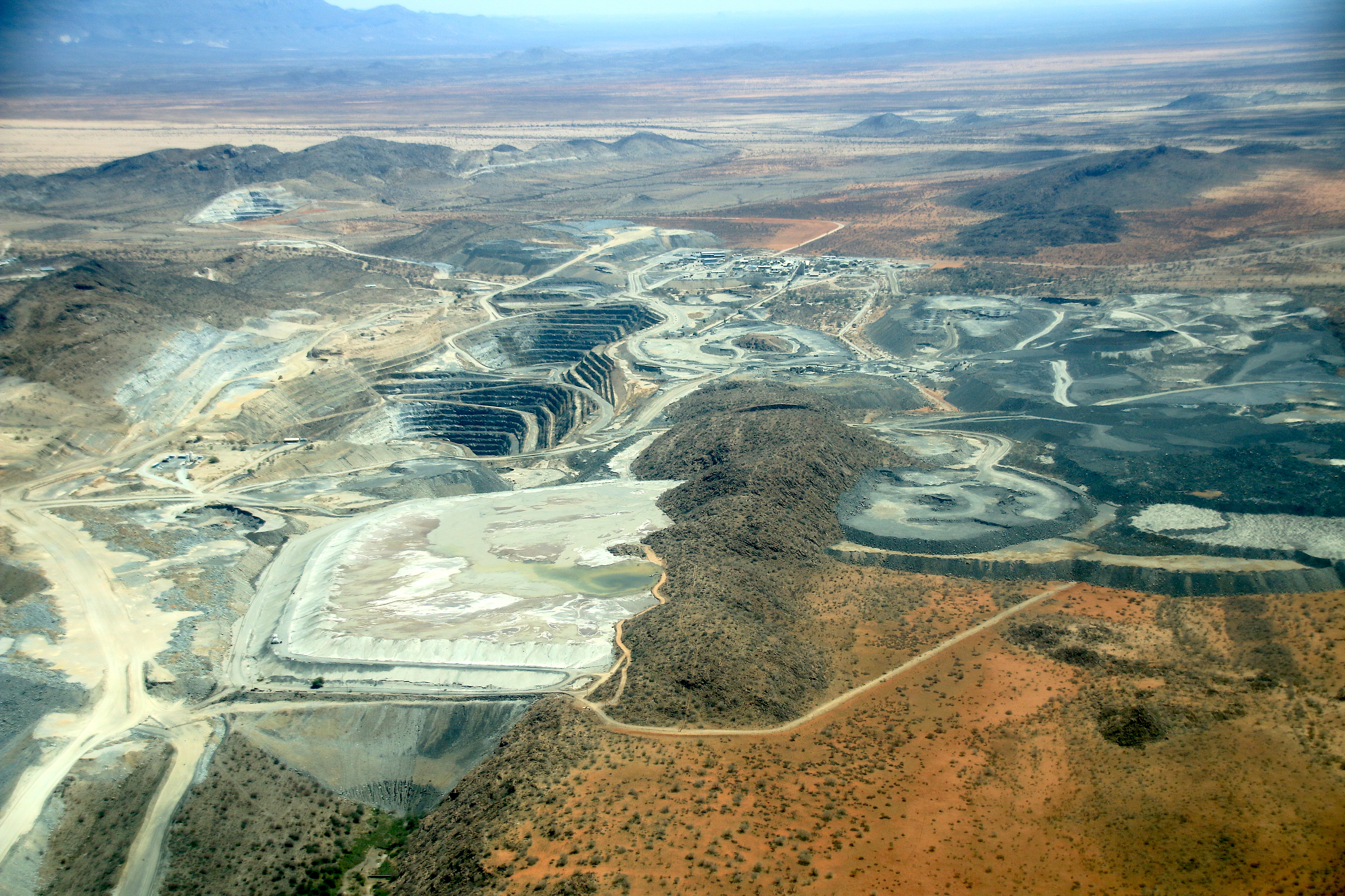
The Navachab Gold Mine is an open-pit gold mine situated near Karibib, in the Erongo Region of Namibia. The operation is owned by QKR. QKR website, accessed: 8 July 2014 Navachab, the oldest gold mine in Namibia, takes its name from the local Navachab farm, where the gold deposit was found. The deposit is located 6 km south of the - road. History The first gold discoveries in Namibia were made in 1899. Gold mining began in the country in 1933, but was later abandoned because of low grades.[...More Info...] [...Related Items...] OR: [Wikipedia] [Google] [Baidu] |
Karibib
Karibib () is a town in the Erongo Region of western Namibia. It has 8,434 inhabitants. Karibib is the district capital of the Karibib Constituency, Karibib electoral constituency. It is situated on the Khan River, halfway between Windhoek and Swakopmund on the B2 road (Namibia), B2 (Trans-Kalahari Highway), the main road between Walvis Bay and Johannesburg. The town is known for its aragonite marble quarry, quarries and the Navachab Gold Mine. Geography Karibib comprises of town land. Economy and Infrastructure The Navachab Gold Mine owned by QKR Namibia is located 10 km from Karibib town. The mine is the major tax payer, employer and property owner of the town, providing more than 750 jobs and owning 240 residential properties. In 2008, proposals surfaced for a new Cement in Africa, cement works. Karibib is home to the Usab Stadium. and there is a golf course at the Klippenberg Country Club. Transport Karibib is situated on the B2 road (Namibia), B2 national roa ... [...More Info...] [...Related Items...] OR: [Wikipedia] [Google] [Baidu] |
Dams In Namibia
A dam is a barrier that stops or restricts the flow of surface water or underground streams. Reservoirs created by dams not only suppress floods but also provide water for activities such as irrigation, human consumption, industrial use, aquaculture, and navigability. Hydropower is often used in conjunction with dams to generate electricity. A dam can also be used to collect or store water which can be evenly distributed between locations. Dams generally serve the primary purpose of retaining water, while other structures such as floodgates or levees (also known as dikes) are used to manage or prevent water flow into specific land regions. The word ''dam'' can be traced back to Middle English, and before that, from Middle Dutch, as seen in the names of many old cities, such as Amsterdam and Rotterdam. Ancient dams were built in Mesopotamia and the Middle East for water control. The earliest known dam is the Jawa Dam in Jordan, dating to 3,000 BC. Egyptians also built dams, ... [...More Info...] [...Related Items...] OR: [Wikipedia] [Google] [Baidu] |


