|
Stratocumulus
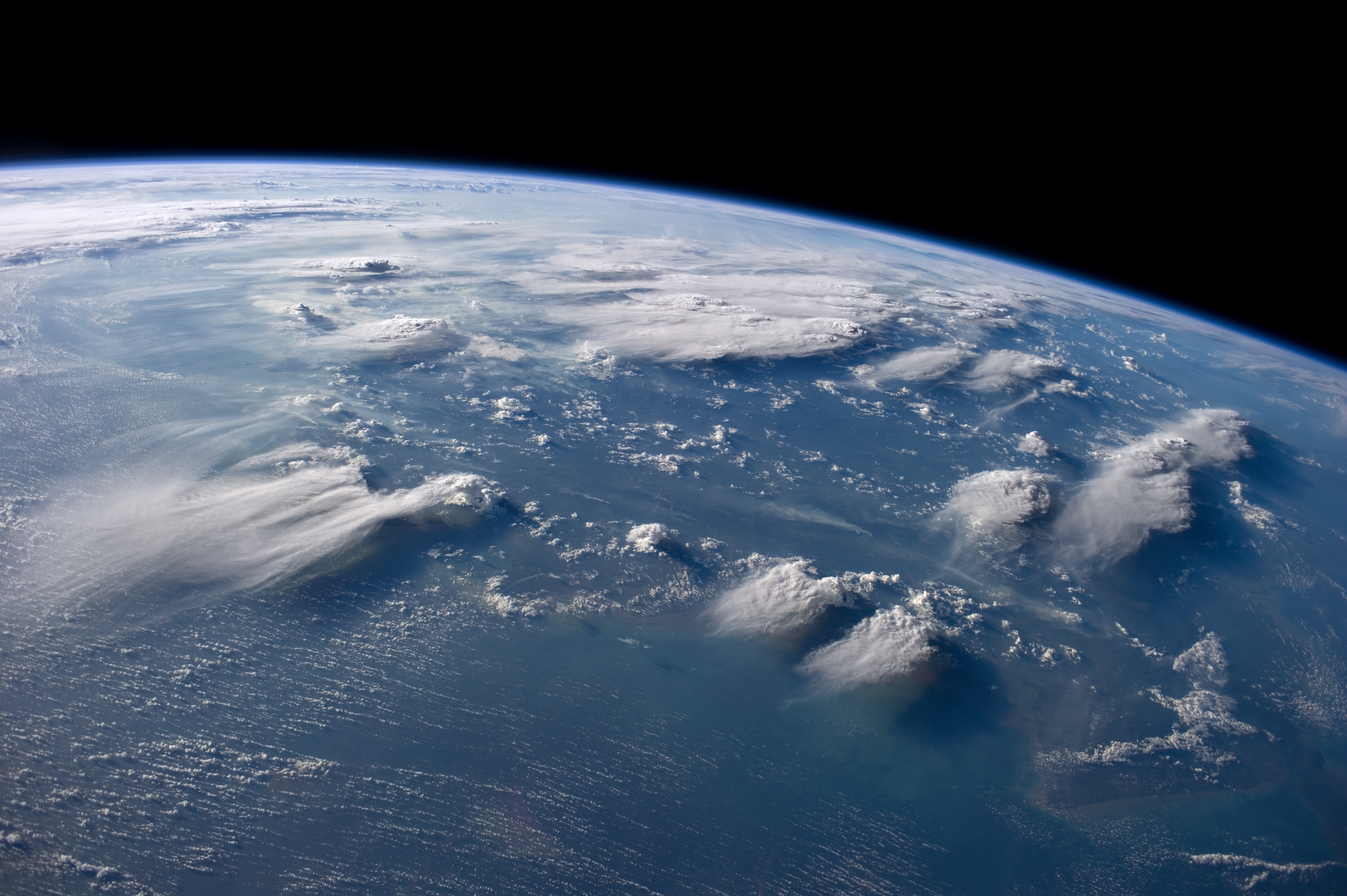
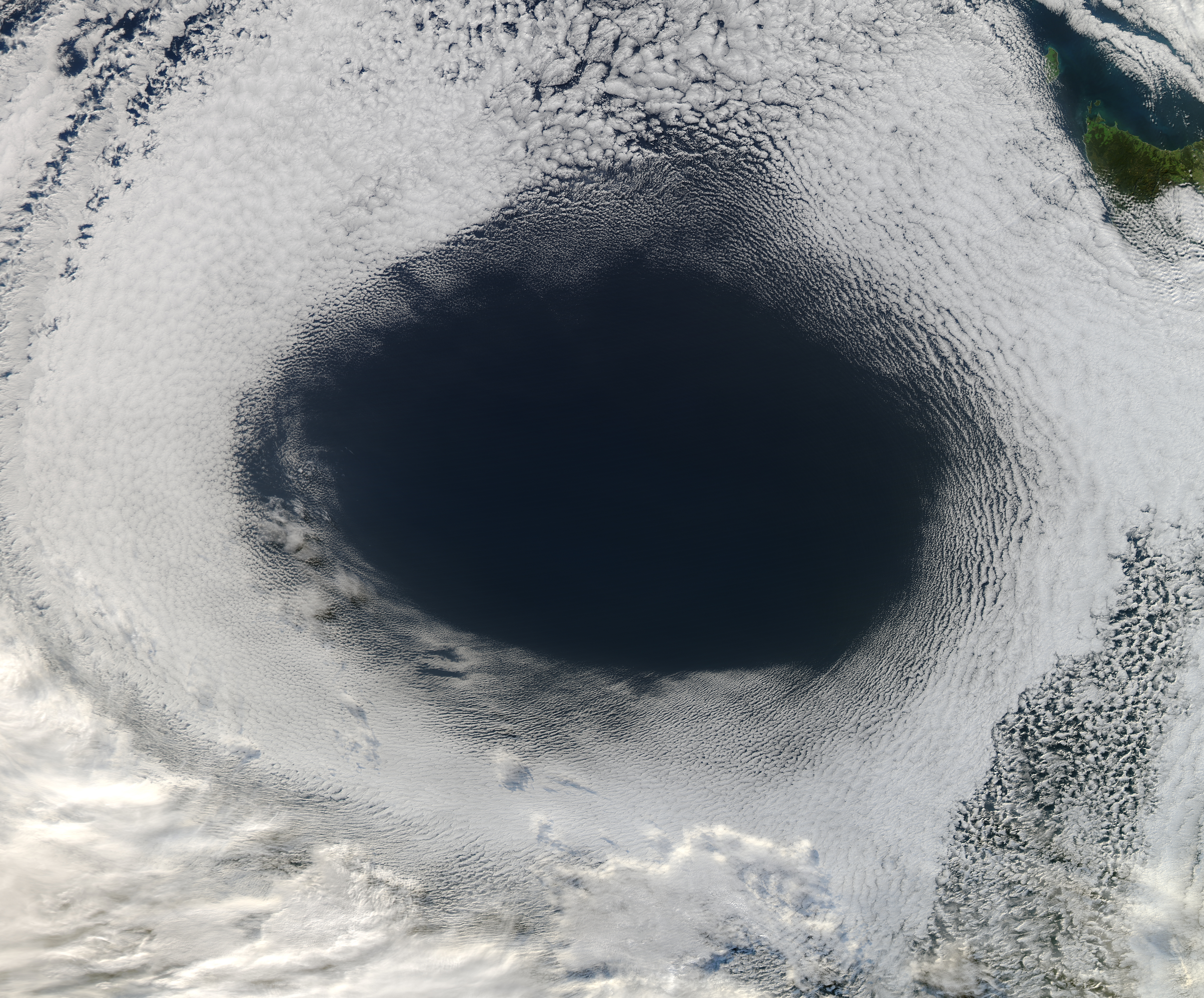
A stratocumulus cloud, occasionally called a cumulostratus, belongs to a genus-type of clouds characterized by large dark, rounded masses, usually in groups, lines, or waves, the individual elements being larger than those in altocumulus, and the whole being at a lower height, usually below . Weak convective currents create shallow cloud layers because of drier, stable air above preventing continued vertical development. Historically, in English, this type of cloud has been referred to as a twain cloud for being a combination of two types of clouds. Description Occurrence Vast areas of subtropical and polar oceans are covered with massive sheets of stratocumulus. These may organize into distinctive patterns which are currently under active study. In subtropics, they cover the edges of the horse latitude climatological highs, and reduce the amount of solar energy absorbed in the ocean. When these drift over land the summer heat or winter cold is reduced. 'Dull weather' is a commo ... [...More Info...] [...Related Items...] OR: [Wikipedia] [Google] [Baidu] |
Cloud
In meteorology, a cloud is an aerosol consisting of a visible mass of miniature liquid droplets, frozen crystals, or other particles suspended in the atmosphere of a planetary body or similar space. Water or various other chemicals may compose the droplets and crystals. On Earth, clouds are formed as a result of saturation of the air when it is cooled to its dew point, or when it gains sufficient moisture (usually in the form of water vapor) from an adjacent source to raise the dew point to the ambient temperature. They are seen in the Earth's homosphere, which includes the troposphere, stratosphere, and mesosphere. Nephology is the science of clouds, which is undertaken in the cloud physics branch of meteorology. There are two methods of naming clouds in their respective layers of the homosphere, Latin and common name. Genus types in the troposphere, the atmospheric layer closest to Earth's surface, have Latin names because of the universal adoption of L ... [...More Info...] [...Related Items...] OR: [Wikipedia] [Google] [Baidu] |
Cumulus Cloud
Cumulus clouds are clouds which have flat bases and are often described as "puffy", "cotton-like" or "fluffy" in appearance. Their name derives from the Latin ''cumulo-'', meaning ''heap'' or ''pile''. Cumulus clouds are low-level clouds, generally less than in altitude unless they are the more vertical cumulus congestus form. Cumulus clouds may appear by themselves, in lines, or in clusters. Cumulus clouds are often precursors of other types of clouds, such as cumulonimbus, when influenced by weather factors such as instability, moisture, and temperature gradient. Normally, cumulus clouds produce little or no precipitation, but they can grow into the precipitation-bearing congests or cumulonimbus clouds. Cumulus clouds can be formed from water vapour, supercooled water droplets, or ice crystals, depending upon the ambient temperature. They come in many distinct subforms and generally cool the earth by reflecting the incoming solar radiation. Cumulus clouds are part of the la ... [...More Info...] [...Related Items...] OR: [Wikipedia] [Google] [Baidu] |
Stratus Cloud
Stratus clouds are low-level clouds characterized by horizontal layering with a uniform base, as opposed to convective or cumuliform clouds that are formed by rising thermals. More specifically, the term ''stratus'' is used to describe flat, hazy, featureless clouds at low altitudes varying in color from dark gray to nearly white. The word ''stratus'' comes from the Latin prefix ''strato-'', meaning "layer". Stratus clouds may produce a light drizzle or a small amount of snow. These clouds are essentially above-ground fog formed either through the lifting of morning fog or through cold air moving at low altitudes over a region. Some call these clouds "high fog" for their fog-like form. While light rain may fall, this cloud does not indicate much meteorological precipitation. Formation Stratus clouds form when weak vertical currents lift a layer of air off the ground and it depressurizes, following the lapse rate. This causes the relative humidity to increase due to the adi ... [...More Info...] [...Related Items...] OR: [Wikipedia] [Google] [Baidu] |
Altostratus Cloud
Altostratus is a middle-altitude cloud genus made up of water droplets, ice crystals, or a mixture of the two. Altostratus clouds are formed when large masses of warm, moist air rise, causing water vapor to condense. Altostratus clouds are usually gray or blueish featureless sheets, although some variants have wavy or banded bases. The sun can be seen through thinner altostratus clouds, but thicker layers can be quite opaque. Altostratus clouds usually predict the arrival of warm fronts. Once altostratus clouds associated with a warm front arrive, continuous rain or snow will usually follow in the next 12 to 24 hours. Although altostratus clouds predict the arrival of warmer, wetter weather, they themselves do not produce significant precipitation. Thunderstorms can be embedded in altostratus clouds; however, bringing showers. Because altostratus clouds can contain ice crystals, they can produce some optical phenomena like iridescence and coronas. Description Altostratus c ... [...More Info...] [...Related Items...] OR: [Wikipedia] [Google] [Baidu] |
Warm Sector
A warm front is a density discontinuity located at the leading edge of a homogeneous warm air mass, and is typically located on the equator-facing edge of an isotherm gradient. Warm fronts lie within broader troughs of low pressure than cold fronts, and move more slowly than the cold fronts which usually follow because cold air is denser and less easy to remove from the Earth's surface. This also forces temperature differences across warm fronts to be broader in scale. Clouds ahead of the warm front are mostly stratiform, and rainfall defiantly increases as the front approaches. Fog can also occur preceding a warm frontal passage. Clearing and warming is usually rapid after frontal passage. If the warm air mass is unstable, thunderstorms may be embedded among the stratiform clouds ahead of the front, and after frontal passage thundershowers may continue. On weather maps, the surface location of a warm front is marked with a red line of semicircles pointing in the directio ... [...More Info...] [...Related Items...] OR: [Wikipedia] [Google] [Baidu] |
Altocumulus Cloud
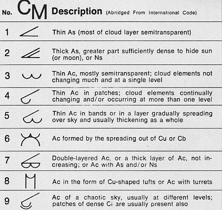
Altocumulus (From Latin ''Altus'', "high", ''cumulus'', "heaped") is a middle-altitude cloud genus that belongs mainly to the ''stratocumuliform'' physical category characterized by globular masses or rolls in layers or patches, the individual elements being larger and darker than those of cirrocumulus and smaller than those of stratocumulus. However, if the layers become tufted in appearance due to increased airmass instability, then the altocumulus clouds become more purely ''cumuliform'' in structure. Like other cumuliform and stratocumuliform clouds, altocumulus signifies convection. A sheet of partially conjoined altocumulus perlucidus is sometimes found preceding a weakening warm front Front may refer to: Arts, entertainment, and media Films * ''The Front'' (1943 film), a 1943 Soviet drama film * '' The Front'', 1976 film Music *The Front (band), an American rock band signed to Columbia Records and active in the 1980s and e ..., where the altostratus is starting t ... [...More Info...] [...Related Items...] OR: [Wikipedia] [Google] [Baidu] |
Lenticular Cloud
Lenticular clouds (Latin: ''Lenticularis'' lentil-shaped, from ''lenticula'' lentil) are stationary clouds that form mostly in the troposphere, typically in parallel alignment to the wind direction. They are often comparable in appearance to a lens or saucer. Nacreous clouds that form in the lower stratosphere sometimes have lenticular shapes. There are three main types of lenticular clouds: altocumulus standing lenticular (ACSL), stratocumulus standing lenticular (SCSL), and cirrocumulus standing lenticular (CCSL), varying in altitude above the ground. Because of their unique appearance, they have been suggested as an explanation for some unidentified flying object ( UFO) sightings. Formation and appearance As air travels along the surface of the Earth, obstructions are often encountered, including natural features, such as mountains or hills, and artificial structures, such as buildings and other constructions, which disrupt the flow of air into "eddies", or areas of ... [...More Info...] [...Related Items...] OR: [Wikipedia] [Google] [Baidu] |
Altocumulus Cloud
Altocumulus (From Latin ''Altus'', "high", ''cumulus'', "heaped") is a middle-altitude cloud genus that belongs mainly to the ''stratocumuliform'' physical category characterized by globular masses or rolls in layers or patches, the individual elements being larger and darker than those of cirrocumulus and smaller than those of stratocumulus. However, if the layers become tufted in appearance due to increased airmass instability, then the altocumulus clouds become more purely ''cumuliform'' in structure. Like other cumuliform and stratocumuliform clouds, altocumulus signifies convection. A sheet of partially conjoined altocumulus perlucidus is sometimes found preceding a weakening warm front Front may refer to: Arts, entertainment, and media Films * ''The Front'' (1943 film), a 1943 Soviet drama film * '' The Front'', 1976 film Music *The Front (band), an American rock band signed to Columbia Records and active in the 1980s and e ..., where the altostratus is starting t ... [...More Info...] [...Related Items...] OR: [Wikipedia] [Google] [Baidu] |
Cumulus Congestus
Cumulus congestus clouds, also known as towering cumulus, are a form of cumulus that can be based in the low or middle height ranges. They achieve considerable vertical development in areas of deep, moist convection. They are an intermediate stage between cumulus mediocris and cumulonimbus, sometimes producing showers of snow, rain, or ice pellets. Precipitation that evaporates before reaching the surface is virga. Description Cumulus congestus clouds are characteristic of unstable areas of the atmosphere which are undergoing convection. They are often characterized by sharp outlines and great vertical development. Because they are produced by (and primarily composed of) strong updrafts, they are typically taller than they are wide, and cloud tops can reach , or higher in the tropics. Cumulus congestus clouds are formed by the development of cumulus mediocris generally, though they can also be formed from altocumulus castellanus or stratocumulus castellanus, which are forms o ... [...More Info...] [...Related Items...] OR: [Wikipedia] [Google] [Baidu] |
Anticyclones
An anticyclone is a weather phenomenon defined as a large-scale circulation of winds around a central region of high atmospheric pressure, clockwise in the Northern Hemisphere and counterclockwise in the Southern Hemisphere as viewed from above (opposite to a cyclone). Effects of surface-based anticyclones include clearing skies as well as cooler, drier air. Fog can also form overnight within a region of higher pressure. Mid-tropospheric systems, such as the subtropical ridge, deflect tropical cyclones around their periphery and cause a temperature inversion inhibiting free convection near their center, building up surface-based haze under their base. Anticyclones aloft can form within warm-core lows such as tropical cyclones, due to descending cool air from the backside of upper troughs such as polar highs, or from large-scale sinking such as a subtropical ridge. The evolution of an anticyclone depends upon variables such as its size, intensity, and extent of moist co ... [...More Info...] [...Related Items...] OR: [Wikipedia] [Google] [Baidu] |


