|
Stockholm City Line
The Stockholm City Line () is a railway tunnel beneath central Stockholm in Sweden which is used by the Stockholm commuter rail. The line is long, double track and electrified. It has two stations: Stockholm City station, which is connected to Stockholm Central Station and located directly below T-Centralen metro station; and Stockholm Odenplan station which is also served by the Green Line of the Metro. The line and its stations opened on 10 July 2017. Route and stations From north to south, the tunnel begins at Tomteboda, where it branches off from the East Coast Line (). It then runs under Vasastan, passing through Stockholm Odenplan station, and continues under Norrmalm to Stockholm City station. From there, it runs beneath the Norrström waterway, beneath the island of Riddarholmen, and then under lake Mälaren at Riddarfjärden. The tunnel then reaches Södermalm, where it joins the Western Main Line () at Stockholm Södra Station. Stations * Stock ... [...More Info...] [...Related Items...] OR: [Wikipedia] [Google] [Baidu] |
Stockholm Commuter Rail
Stockholm commuter rail () is the commuter rail system in Stockholm County, Sweden. The system is an important part of the public transport in Stockholm, and is controlled by Storstockholms Lokaltrafik. The tracks are state-owned and administered by the Swedish Transport Administration, while the operation of the Stockholm commuter rail services itself has been contracted to SJ AB since March 2024. History Initial operations and early routes Local trains have been operated on the mainline railways around Stockholm since the late nineteenth century. At the beginning, local rail services were part of the Statens Järnvägar, Swedish State Railways, but in the late-1960s, the responsibility for these services was transferred to Stockholm County, which incorporated it with the ticketing system of Stockholm Transport. New trains were bought, stations were modernised, and the Stockholm commuter rail network was developed with an aim of making it more metro-like. Originally the syst ... [...More Info...] [...Related Items...] OR: [Wikipedia] [Google] [Baidu] |
Södermalm
Södermalm, often shortened to just Söder, is the southern district of Stockholm City Centre. Overview The Södermalm district covers the island of the same name (formerly called ''Åsön''), which, however, is not fully separated from the peninsula of Södertörn (or the rest of the Swedish mainland), as water to both its north and south does not flow freely but passes through a Karl Johansslussen, lock and a Hammarbyleden, man-made waterway. Södermalm is connected to its surrounding areas by a number of bridges. It connects to Gamla stan to the north by Slussenområdet, Slussen, a grid of road and rail and a lock separating the lake Mälaren from the Baltic Sea, to Långholmen to the northwest by one of the city's larger bridges, Västerbron, to the islet Reimersholme to the west, to Liljeholmen to the southwest by the bridge Liljeholmsbron, to Årsta by Årstabroarna, Årstabron and Skansbron, to Johanneshov by Johanneshovsbron and Skanstullsbron to the south, and, fin ... [...More Info...] [...Related Items...] OR: [Wikipedia] [Google] [Baidu] |
Riddarfjärden
Riddarfjärden (, "The Knight Firth") is the easternmost bay of Lake Mälaren in central Stockholm. Stockholm was founded in 1252 on an island in the stream where Lake Mälaren (from the west) drains into the Baltic Sea (to the east); today the island is called Stadsholmen and constitutes Stockholm's Old Town. The panorama picture featured in this article was taken from the heights of Södermalm, west of Stadsholmen, looking down on Riddarfjärden. Left to right are viewable: * Västerbron bridge * Kungsholmen Island * Stockholm City Hall, a red brick building with a bell tower, where the Nobel Prize dinner is served * The tower of Klara Kyrka on Norrmalm, with its green copper roof * five white skyscrapers between Sergels torg and Hötorget * construction cranes * iron tower of Riddarholmen Church on Riddarholmen Island * yellow tower of Storkyrkan on Stadsholmen, in front of the flat roof of the Stockholm Palace * narrow tower of Tyska Kyrkan on Stadsholmen * distant ra ... [...More Info...] [...Related Items...] OR: [Wikipedia] [Google] [Baidu] |
Mälaren
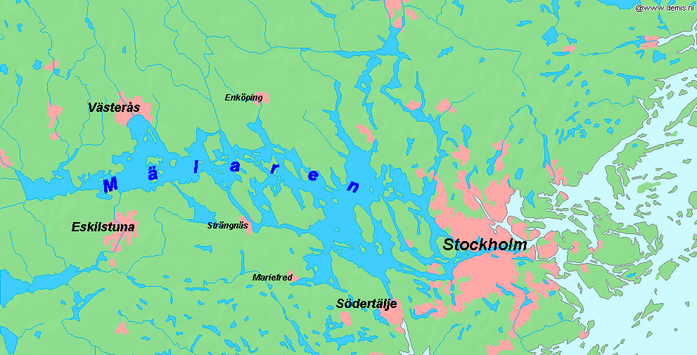
Mälaren ( , , or ), historically referred to as Lake Malar in English, is the third-largest freshwater lake in Sweden (after Vänern and Vättern). Its area is and its greatest depth is 64 m (210 ft). Mälaren spans from east to west. The lake drains, from south-west to north-east, into the Baltic Sea through its natural outlets Norrström and Söderström (as it flows around Stadsholmen island) and through the artificial Södertälje Canal and Hammarbyleden waterway. The easternmost bay of Mälaren, in central Stockholm, is called Riddarfjärden. The lake is located in Svealand and bounded by the provinces of Uppland, Södermanland and Västmanland. The two largest islands in Mälaren are Selaön () and Svartsjölandet (). Mälaren is low-lying and mostly relatively shallow. Being a quite narrow and shallow lake, Mälaren has bridge crossings between Eskilstuna and Västerås with two crossings on the western end at Kvicksund and three separate bridges between St ... [...More Info...] [...Related Items...] OR: [Wikipedia] [Google] [Baidu] |
Riddarholmen
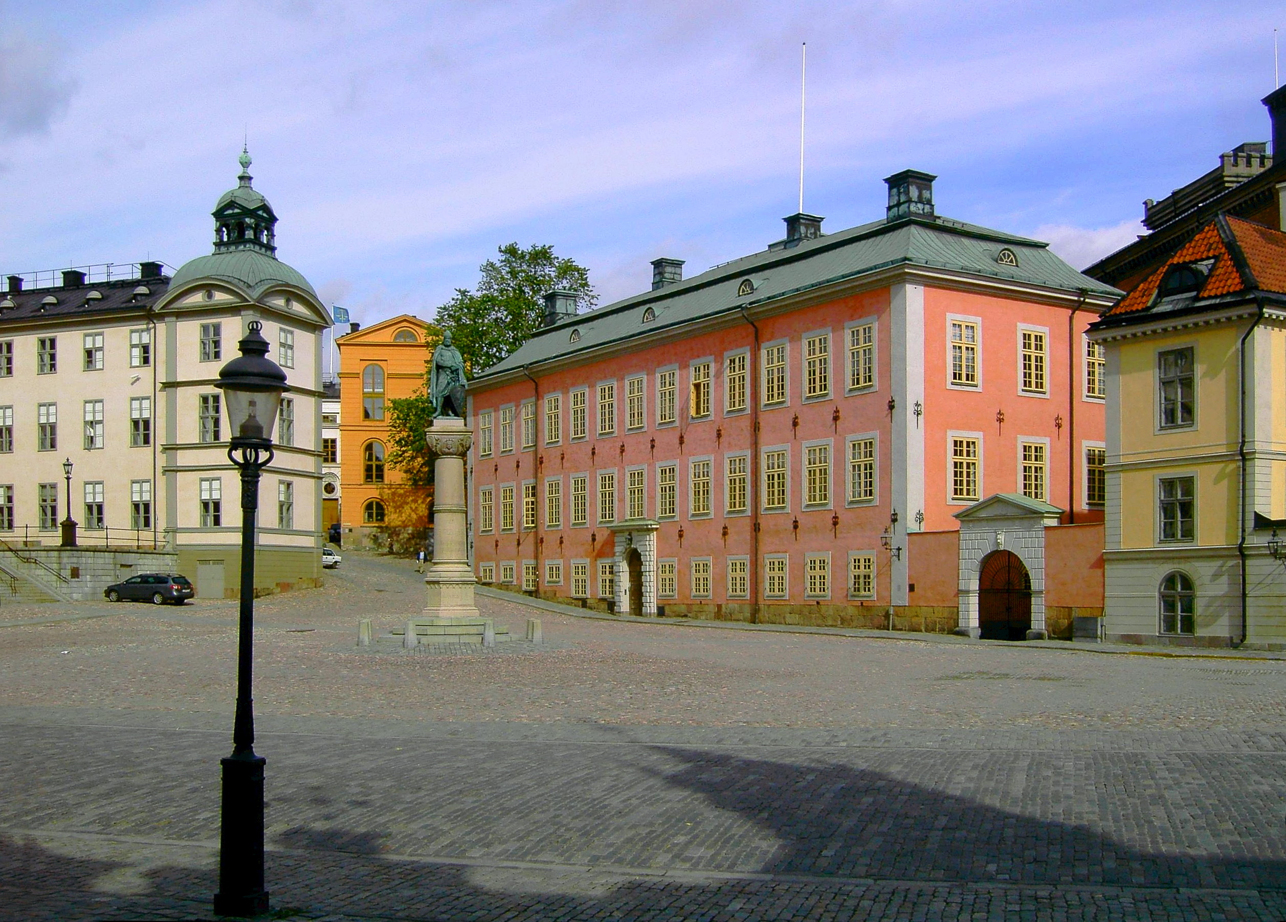
Riddarholmen (, "The Knights' Islet") is a small islet in central Stockholm, Sweden. The island forms part of Gamla Stan, the old town, and houses a number of private palaces dating back to the 17th century. The main landmark is the church Riddarholmskyrkan, used as Sweden's royal burial church from the 17th century to 1950, and where a number of earlier Swedish monarchs also lie buried. The western end of the island gives a magnificent panoramic and photogenic view of the bay Riddarfjärden, often used by TV journalists with Stockholm City Hall in the background. A statue of Birger Jarl, traditionally considered the founder of Stockholm, stands on a pillar in front of the Bonde Palace, north of Riddarholm Church. Other notable buildings include the Old Parliament Building in the south-eastern corner, the Gamla Riksarkivet, Old National Archive on the eastern shore, and the Norstedt Building, the old printing house of the publisher Norstedts Förlag, Norstedts, the tower roof of w ... [...More Info...] [...Related Items...] OR: [Wikipedia] [Google] [Baidu] |
Norrström
Norrström is one of the shortest rivers in Europe in central Stockholm. It connects Lake Mälaren with the Baltic Sea. It runs from Riddarfjärden, north of Gamla stan, to Stockholms ström (the western part of Saltsjön). Two islands lie within it, Strömsborg and Helgeandsholmen. It is one of two natural waterways between Mälaren and the Baltic sea, the other being Söderström south of Gamla stan. Norrström is crossed by Centralbron and the adjacent pedestrian bridge, Vasabron, Riksbron north of Helgeandsholmen which continues into Riksgatan and Stallbron south of the island, Norrbro crossing Helgeandsholmen, and Strömbron. While the majority of the river flows north of Helgeandsholmen, a small controlled portion known as the runs south of the island, between it and Gamla stan. As the water level of Mälaren is usually higher than that of the Baltic, the current normally runs from west to east. Norrström is not navigable for traffic between Mälaren and the Ba ... [...More Info...] [...Related Items...] OR: [Wikipedia] [Google] [Baidu] |
Norrmalm
Norrmalm is a city district in Stockholm, Sweden. History Norrmalm is a part of the larger borough of Norrmalm (''Norrmalms stadsdelsområde''). The southern part of the district, Lower Norrmalm (''Nedre Norrmalm''), also known as the City, constitutes the most central part of Stockholm, while Upper Norrmalm (''Övre Norrmalm'') is more residential. The name Norrmalm is first mentioned in 1288. In 1602, Norrmalm became an independent city with its own mayor and administration called the Northern Suburb (''Norra Förstaden''). The town was short-lived, and in 1635 it was incorporated with Stockholm again. Norrmalm is today considered to be the central part of Stockholm. Redevelopment of Norrmalm In the 1950s and 1960s, large parts of Lower Norrmalm were torn down to build a new and modern city. The demolitions were carried out swiftly, and many Stockholmers still miss "old Klara" (Klara is a part of Lower Norrmalm). Among the new features created as a result of the clearan ... [...More Info...] [...Related Items...] OR: [Wikipedia] [Google] [Baidu] |
Vasastan, Stockholm
Vasastan, or formally Vasastaden, ( Swedish for "Vasa town") is a 3.00 km2 large city district in central Stockholm, Sweden, being a part of Norrmalm borough. The major parks in Vasastaden are Vasaparken and Observatorielunden near the centre and Vanadislunden and Bellevueparken in the north. History Vasastaden proper The city district, most likely named after the street Vasagatan, in its turn named after King Gustav Vasa in 1885, was still a peripheral part of the city in the early 1880s. Before the end of that decade, however, some 150 buildings had been built and only the properties along Odengatan remained vacant. The expansion was preceded by a city plan established in 1879, a slightly more modest edition of the 1866 intentions of city planner Albert Lindhagen, in its turn largely a continuation north of an original 17th-century plan. Like the Baroque plan, the new plan took little or no account of local topographic variations, and where the two failed t ... [...More Info...] [...Related Items...] OR: [Wikipedia] [Google] [Baidu] |
Today's Railways Europe
''Today's Railways Europe'' is an English-based monthly magazine covering rail transport in Europe. It was founded by Platform 5 in July 1994. Initially published bimonthly, from August 1997 it was published monthly. It also covered rail transport in Great Britain, and was named simply ''Today's Railways'', until a sister publication ''Entrain'' (later ''Today's Railways UK'') was launched in 2002, and from then on ''Today's Railways Europe'' concentrated on rail transport in Continental Europe. Production of the magazine as of 3 April 2020 was suspended due to the coronavirus Coronaviruses are a group of related RNA viruses that cause diseases in mammals and birds. In humans and birds, they cause respiratory tract infections that can range from mild to lethal. Mild illnesses in humans include some cases of the comm ... (COVID-19) outbreak. Production resumed with the July 2020 issue. The magazine was edited by Peter Fox until his death in 2011. Fox wrote the monthly "Gr ... [...More Info...] [...Related Items...] OR: [Wikipedia] [Google] [Baidu] |
Green Line (Stockholm Metro)
The Green Line () is the oldest of the three Stockholm Metro lines. The long line comprises a single double-tracked line north of the city centre, splitting into three branches south of the city centre. The first section of the line opened as a metro in 1950, making it the first and oldest metro line in the Nordic countries, although some parts of the line date back to the 1930s and were originally used by the Stockholm tramway. History Before the metro The first section of what is now the Green Line opened as a metro in 1950, but several sections of the line use infrastructure that was originally built for, or used by, the Stockholm tramway. These include: * Between Globen metro station, Globen and Stureby metro station, Stureby, the line uses tracks that were created for use by route 19 of the tramway in 1930. These tracks required rebuilding, with the removal of level crossings, before metro trains could use them. * Between Slussen metro station, Slussen and Skanstull metro s ... [...More Info...] [...Related Items...] OR: [Wikipedia] [Google] [Baidu] |


