|
Squamscott River
The Squamscott River is a tidal river in southeastern New Hampshire, in the United States, fed by the Exeter River. The first of freshwater river from Chester to downtown Exeter is known as the Exeter River, and the subsequent of saltwater from downtown Exeter to the Great Bay tidal estuary is known as the Squamscott River. The combined Exeter-Squamscott watershed is and contains 68,245 people. It includes portions of Chester, Raymond, Fremont, Danville, Kingston, East Kingston, Sandown, Kensington, Brentwood, Exeter, Newfields, and Stratham. Etymology The Squamscott, also spelled ''Swampscott'' and ''Swamscott'', gets its name from the Squamscott Indians, who called it ''Msquam-s-kook'' (or ''Msquamskek''), translated as "at the salmon place" or "big water place". Plentiful game, the marshes and lush river-fed vegetation, and an abundance of fish supported the northeast Native American people who were present in the region for thousands of years until English settlers ... [...More Info...] [...Related Items...] OR: [Wikipedia] [Google] [Baidu] |
New Hampshire Route 108
New Hampshire Route 108 is a north–south state highway in Rockingham County, New Hampshire, Rockingham and Strafford County, New Hampshire, Strafford counties in southeastern New Hampshire. The southern terminus of NH 108 is at the Massachusetts state line in Plaistow, New Hampshire, Plaistow. The northern terminus is at an intersection with New Hampshire Route 125 and New Hampshire Route 202A in downtown Rochester, New Hampshire, Rochester. At its southern end, NH 108 connects to Massachusetts Route 108, a very short state route which continues south for to Massachusetts Route 110 in Haverhill, Massachusetts, Haverhill. NH 108 is notable in being one of two routes (the other being New Hampshire Route 9) to intersect both U.S. Route 4 and New Hampshire Route 4 (a rare case of two completely separate routes in one state having the same number). Route description Massachusetts Route 108 Route 108 begins at an intersection with Route 110 (Massachusetts), Route 110 north o ... [...More Info...] [...Related Items...] OR: [Wikipedia] [Google] [Baidu] |
Abenaki
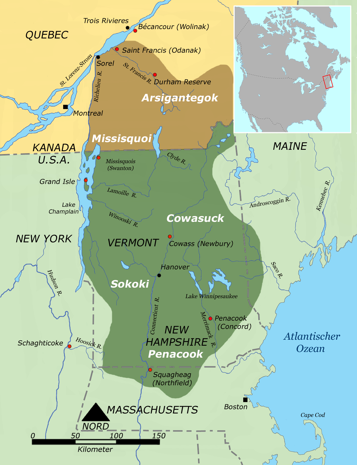
The Abenaki ( Abenaki: ''Wαpánahki'') are Indigenous people of the Northeastern Woodlands of Canada and the United States. They are an Algonquian-speaking people and part of the Wabanaki Confederacy. The Eastern Abenaki language was predominantly spoken in Maine, while the Western Abenaki language was spoken in Quebec, Vermont, and New Hampshire. While Abenaki peoples have shared cultural traits, they did not historically have a centralized government. They came together as a post-contact community after their original tribes were decimated by colonization, disease, and warfare. Names The word ''Abenaki'' and its syncope, ''Abnaki,'' are both derived from ''Wabanaki'', or ''Wôbanakiak,'' meaning "People of the Dawn Land" in the Abenaki language. While the two terms are often confused, the Abenaki are one of several tribes in the Wabanaki Confederacy. Alternate spellings include: ''Abnaki'', ''Abinaki'', ''Alnôbak'', ''Abanakee'', ''Abanaki'', ''Abanaqui'', ''Abana ... [...More Info...] [...Related Items...] OR: [Wikipedia] [Google] [Baidu] |
New England Cottontail
The New England cottontail (''Sylvilagus transitionalis''), also known as the gray rabbit, brush rabbit, wood hare, wood rabbit, or cooney, is a species of cottontail rabbit that appears in fragmented populations across New England and the state of New York, specifically from southern Maine to southern New York. This species bears a close resemblance to the eastern cottontail (''Sylvilagus floridanus''), which has been introduced in much of the New England cottontail home range. The eastern cottontail is now more common in it. In 2006, it was estimated that the current area of occupancy in its historic range is - some 86% less than the occupied range in 1960. Because of this decrease in this species' numbers and habitat, the New England cottontail is a candidate for protection under the Endangered Species Act. Cottontail hunting has been restricted in some areas where the eastern and New England cottontail species coexist in order to protect the remaining New England cottontail ... [...More Info...] [...Related Items...] OR: [Wikipedia] [Google] [Baidu] |
Blanding's Turtle
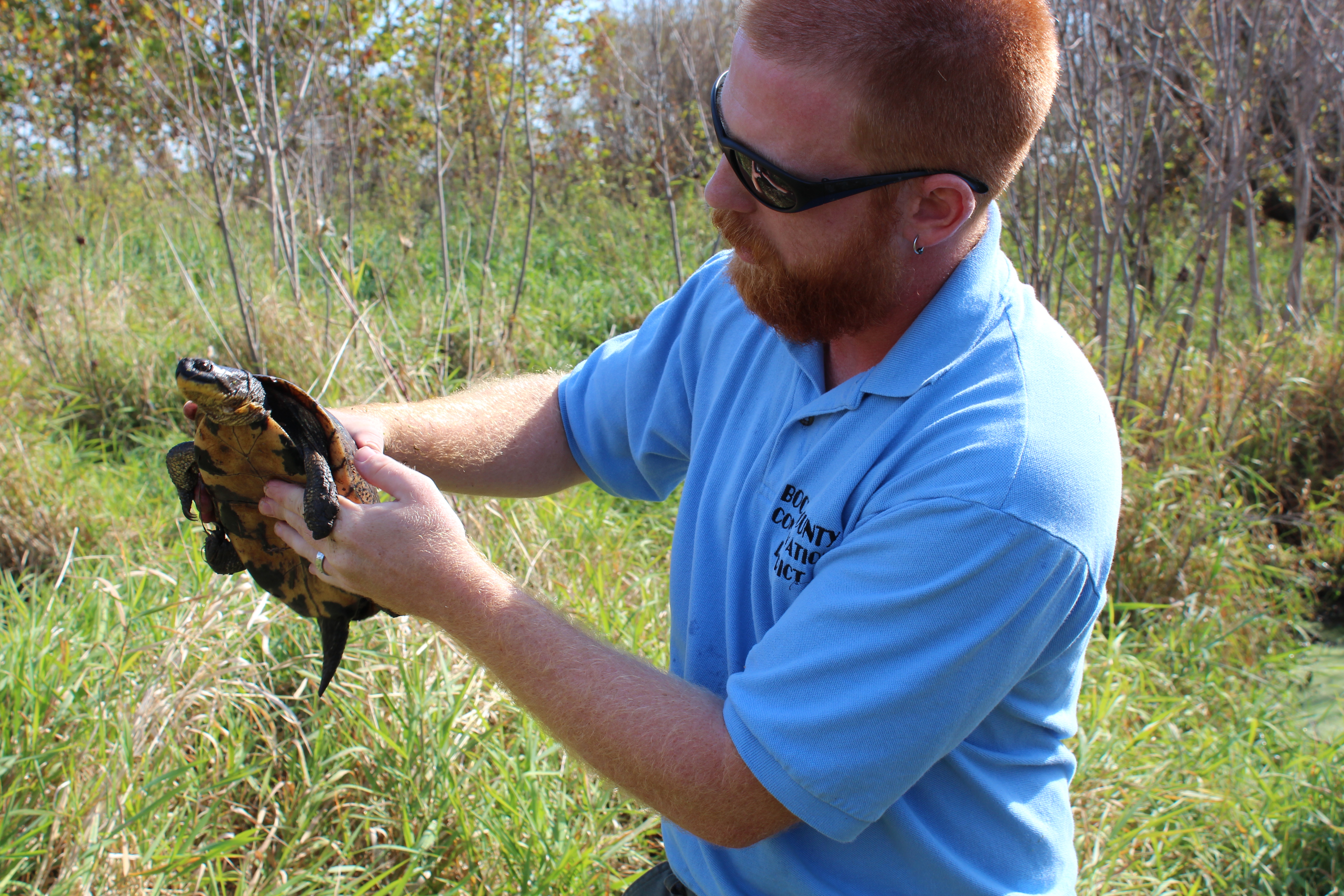
Blanding's turtle (''Emydoidea blandingii)'' is a species of semi-aquatic turtle of the Family (biology), family Emydidae. This species is native to central and eastern parts of Canada and the United States. It is considered to be an endangered species throughout much of its range. Blanding's turtle is of interest in longevity research, as it shows few or no senescent, common signs of aging and is physically active and capable of reproduction into eight or nine decades of life. Taxonomy There are differences of opinion as to the genus for this species; both ''Emys'' and ''Emydoidea'' occur in published sources in 2009, 2010, and 2011. Etymology Both the Specific name (zoology), specific name, ''blandingii'', and the common name, Blanding's turtle, are in honor of Americans, American Natural history, naturalist Dr. species:William Blanding, William Blanding (1773–1857). Description Blanding's turtle is a medium-sized turtle with an average straight carapace length of approximat ... [...More Info...] [...Related Items...] OR: [Wikipedia] [Google] [Baidu] |
Lamprey River
The Lamprey River is a river in southeastern New Hampshire, the United States. It rises in Meadow Lake in Northwood, and flows south, then generally east through Raymond, Epping, Lee, Durham and finally Newmarket. Here, it meets Great Bay, a tidal inlet of the Atlantic Ocean, to which it is connected by a tidal estuary, the Piscataqua River. The river from the Bunker Pond Dam in Epping to the confluence with the Piscassic River is part of the designated National Wild and Scenic River System. History Segments of the river are rich in history. Saw- and gristmills which operated by water power were common along the river. The Wiswall Falls Mills Site in Durham is on the National Register of Historic Places. Originally a sawmill, the site was used subsequently to make knives, nuts and bolts, pitchforks, carriages, matches and wallpaper. Sites such as Wadleigh Falls show the remnants of old mills and the rich river culture that used to be. Located in Lee, the falls is the ... [...More Info...] [...Related Items...] OR: [Wikipedia] [Google] [Baidu] |
New Hampshire Route 101
New Hampshire Route 101 (NH 101) is a state-maintained highway in southern New Hampshire extending from Keene to Hampton Beach. It is the major east–west highway in the southern portion of the state. Most of its eastern portion is a major freeway linking the greater Manchester area to the Seacoast Region. At in length, NH 101 nearly spans the entire width of southern New Hampshire. The western terminus of NH 101 is in Keene at the junction of NH 9, NH 10, and NH 12. The eastern terminus is in Hampton Beach at the junction with Ocean Boulevard ( NH 1A). Between Exeter and Hampton, NH 101 is known as the Exeter–Hampton Expressway. There are two current and three former auxiliary routes for NH 101. The current routes are NH 101A, which connects Milford and Nashua, and NH 101E, which parallels the main route in Hampton. Route description Western segment (Keene to Bedford) The western terminus of NH 101 is in Keene at the main intersection of NH 9, NH 10, and NH 12 a ... [...More Info...] [...Related Items...] OR: [Wikipedia] [Google] [Baidu] |
Phillips Exeter Academy
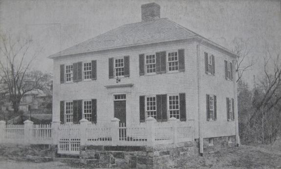
Phillips Exeter Academy (often called Exeter or PEA) is an Independent school, independent, co-educational, college-preparatory school in Exeter, New Hampshire. Established in 1781, it is America's sixth-oldest boarding school and educates an estimated 1,100 boarding and day students in grades 9 to 12, as well as postgraduate year, postgraduate students. Exeter is one of the nation's wealthiest boarding schools, with a financial endowment of $1.6 billion as of June 2024, and houses the Phillips Exeter Academy Library, world's largest high school library. The academy admits students on a Need-blind admission, need-blind basis and offers free tuition to students with family incomes under $125,000. Its List of Phillips Exeter Academy people, list of notable alumni includes U.S. president Franklin Pierce, U.S. senator Daniel Webster, Facebook founder Mark Zuckerberg, and three Nobel Prize recipients. History Origins Phillips Exeter Academy was established in 1781 by John Philli ... [...More Info...] [...Related Items...] OR: [Wikipedia] [Google] [Baidu] |
New Hampshire Route 27
New Hampshire Route 27 (abbreviated NH 27) is a long east–west highway in southeastern New Hampshire. The western terminus of NH 27 is in Hooksett at U.S. Route 3 and New Hampshire Route 28 north of Manchester. The eastern terminus is in Hampton Beach at New Hampshire Route 1A, which runs along the New Hampshire coastline adjacent to the Atlantic Ocean. NH 27 is a local highway which parallels the New Hampshire Route 101 expressway for its entire length. NH 27 serves the centers of many of the communities which NH 101 bypasses. Route description Route 27 starts at an intersection with U.S. Route 3 (Hooksett Road) and New Hampshire Route 28 in southern Hooksett. It proceeds east 1/4 mile and crosses New Hampshire 28 Bypass (Londonderry Turnpike), then continues northeast through Hooksett into Candia. Route 27 intersects New Hampshire Route 43 at Candia Four Corners, then continues east and meets NH 107 in the northwest part of Raymond. Turning southeast, the highways ru ... [...More Info...] [...Related Items...] OR: [Wikipedia] [Google] [Baidu] |
Works Progress Administration
The Works Progress Administration (WPA; from 1935 to 1939, then known as the Work Projects Administration from 1939 to 1943) was an American New Deal agency that employed millions of jobseekers (mostly men who were not formally educated) to carry out public works projects, including the construction of public buildings and roads. It was set up on May 6, 1935, by presidential order, as a key part of the Second New Deal. The WPA's first appropriation in 1935 was $4.9 billion (about $15 per person in the U.S., around 6.7 percent of the 1935 GDP). Headed by Harry Hopkins, the WPA supplied paid jobs to the unemployed during the Great Depression in the United States, while building up the public infrastructure of the US, such as parks, schools, and roads. Most of the jobs were in construction, building more than of streets and over 10,000 bridges, in addition to many airports and much housing. In 1942, the WPA played a key role in both building and staffing Internment of Japanes ... [...More Info...] [...Related Items...] OR: [Wikipedia] [Google] [Baidu] |
Atlantic Ocean
The Atlantic Ocean is the second largest of the world's five borders of the oceans, oceanic divisions, with an area of about . It covers approximately 17% of Earth#Surface, Earth's surface and about 24% of its water surface area. During the Age of Discovery, it was known for separating the New World of the Americas (North America and South America) from the Old World of Afro-Eurasia (Africa, Asia, and Europe). Through its separation of Afro-Eurasia from the Americas, the Atlantic Ocean has played a central role in the development of human society, globalization, and the histories of many nations. While the Norse colonization of North America, Norse were the first known humans to cross the Atlantic, it was the expedition of Christopher Columbus in 1492 that proved to be the most consequential. Columbus's expedition ushered in an Age of Discovery, age of exploration and colonization of the Americas by European powers, most notably Portuguese Empire, Portugal, Spanish Empire, Sp ... [...More Info...] [...Related Items...] OR: [Wikipedia] [Google] [Baidu] |
Piscataqua River
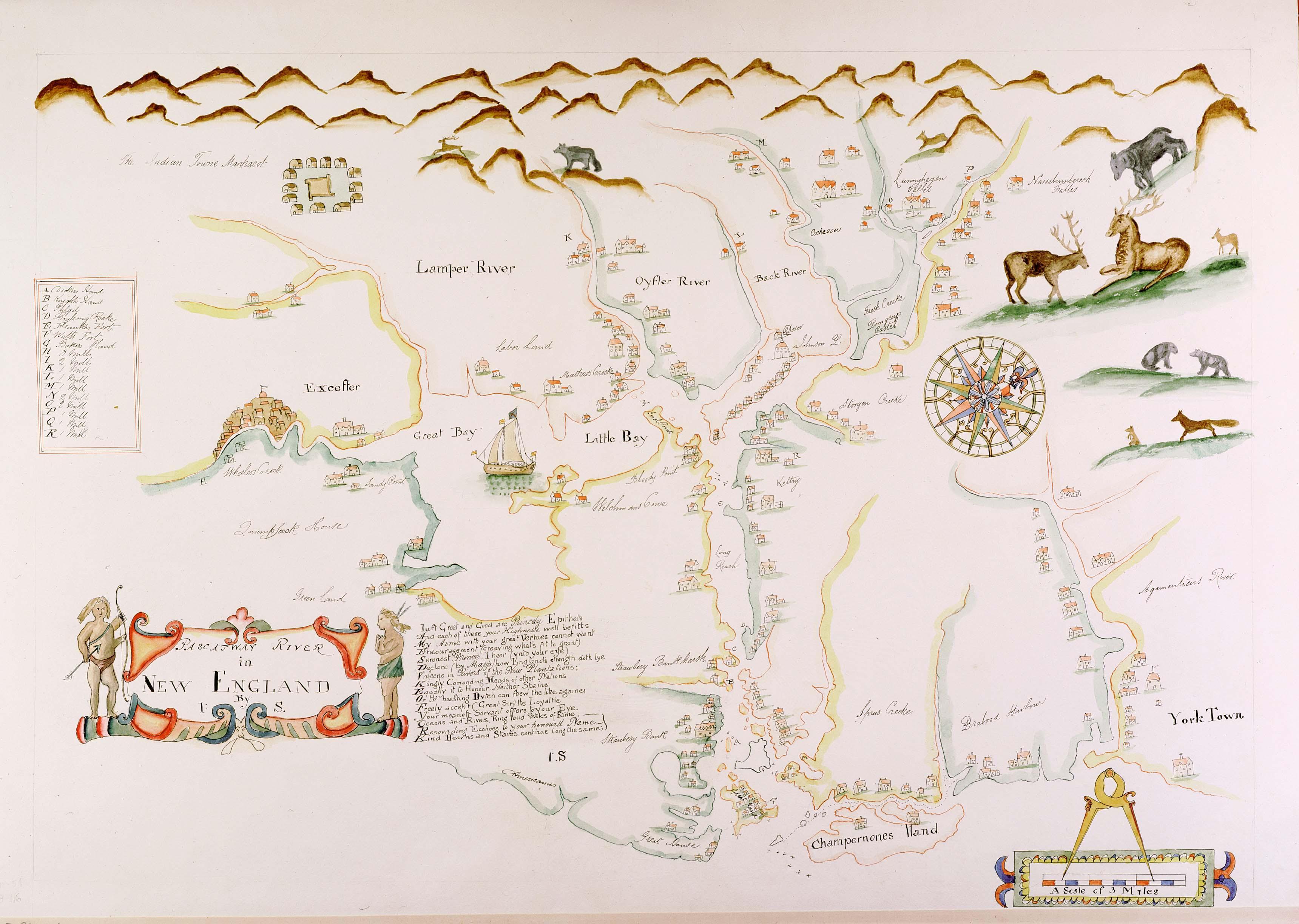
The Piscataqua River (Abenaki language, Abenaki: ''Pskehtekwis'') is a tidal river forming the boundary of the U.S. states of New Hampshire and Maine from its origin at the confluence of the Salmon Falls River and Cochecho River to the Atlantic Ocean. The drainage basin of the river is approximately , including the subwatersheds of the Great Works River and the five rivers flowing into Great Bay (New Hampshire), Great Bay: the Bellamy River, Bellamy, Oyster River (New Hampshire), Oyster, Lamprey River, Lamprey, Squamscott River, Squamscott, and Winnicut River, Winnicut. The river runs southeastward, with New Hampshire to the south and west and Maine to the north and east, and empties into the Gulf of Maine east of Portsmouth, New Hampshire. The last before the sea are known as Portsmouth Harbor and have a tidal current of around . Beyond the tidal currents, the river has a flood current speed of 12 knots, making it the fastest river on the eastern seaboard of the United State ... [...More Info...] [...Related Items...] OR: [Wikipedia] [Google] [Baidu] |


