|
South-Link Highway
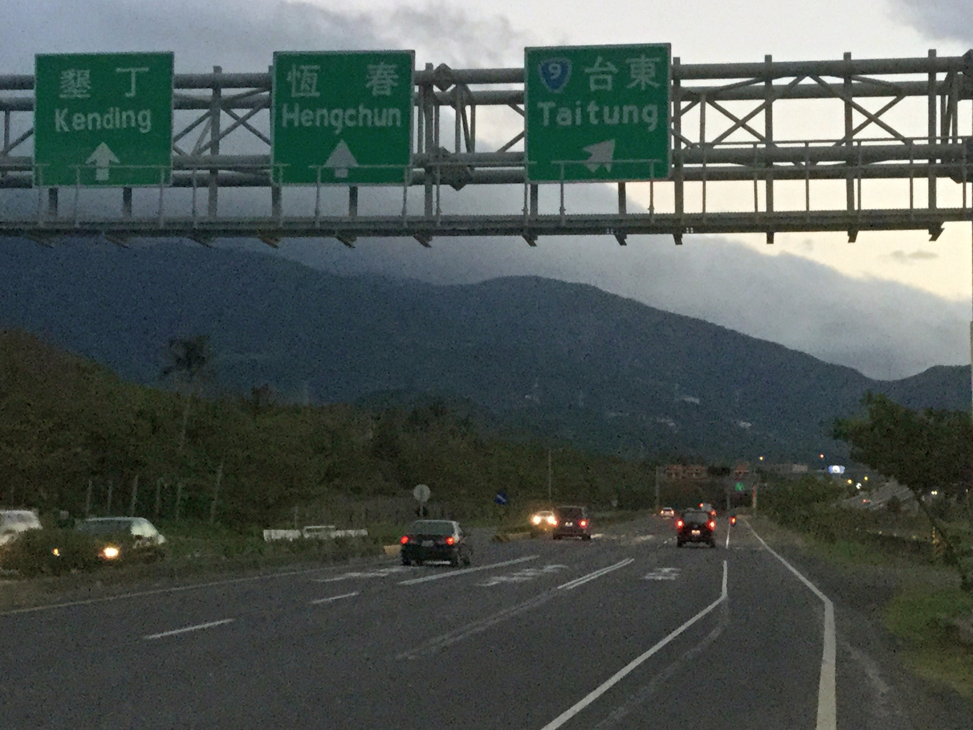
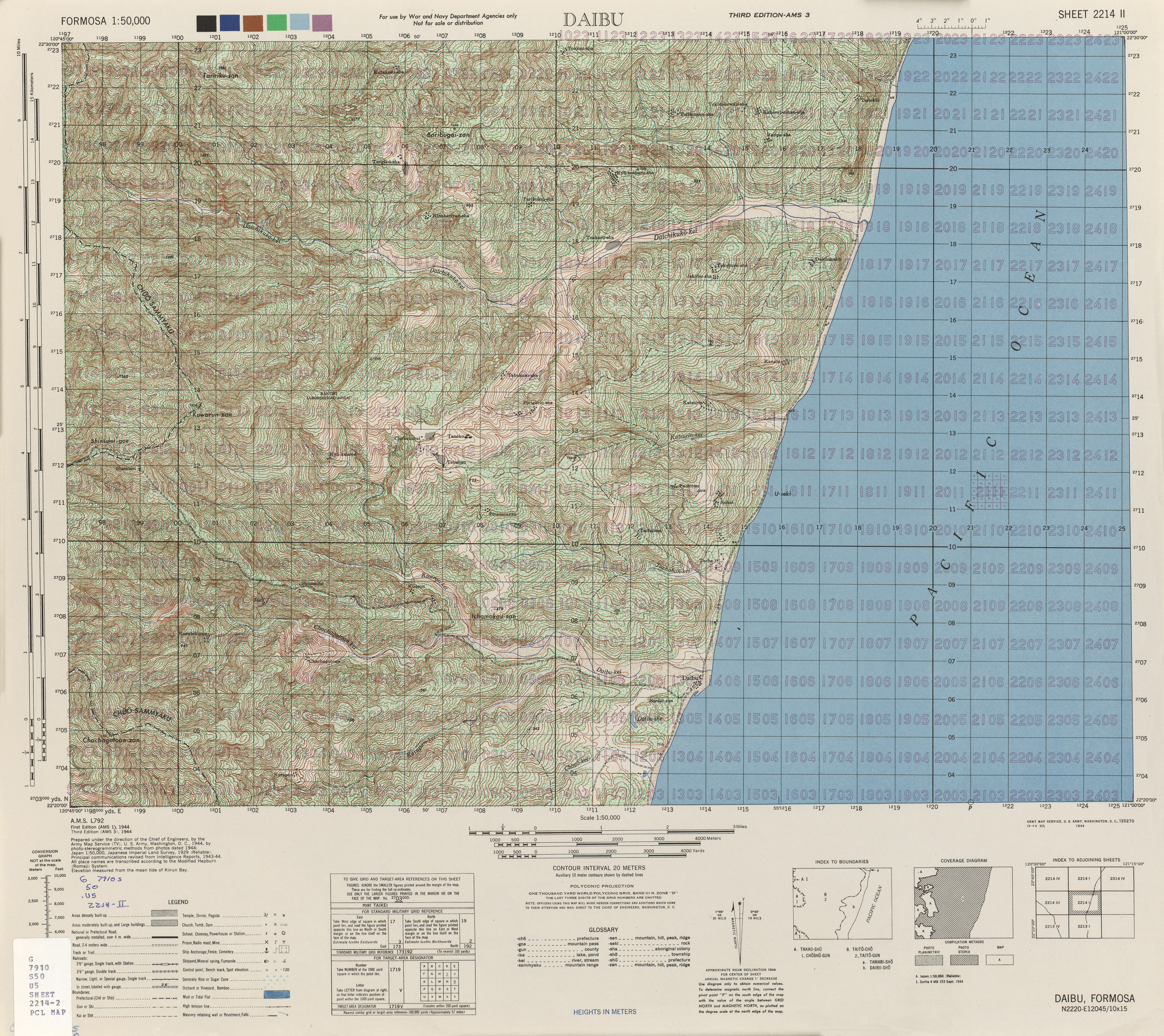
The South Link Highway is a section of Provincial Highway No. 9 from Taitung City to Fenggang, Pingtung County in Taiwan. The section of the highway from Taitung to Ansuo is coastal road, the rest passes through the Central Mountain Range through Shouka until reaching Fenggang at the end. History It was built by the Japanese government between 1933 and 1939. Route The length of the highway is about 90 km. This highway goes from Taitung City, and runs through Taimali, Dawu, Daren, and Shizi, and ends in Fenggang, Fangshan Township, Pingtung. Bridges * Jinlun Bridge The Jinlun Bridge () is a bridge in Taimali Township, Taitung County, Taiwan. It is part of the South-Link Highway. History The bridge was constructed as an improvement plan for Provincial Highway 9. It was opened for traffic on 15 October 20 ... References Highways in Taiwan {{Taiwan-road-stub ... [...More Info...] [...Related Items...] OR: [Wikipedia] [Google] [Baidu] |
Shouka (mountain Pass)
Shouka (, alternatively 壽卡, el. 460 m), formerly known as , is a mountain pass located in southern Taiwan, transversing the Central Mountain Range. Administratively, Shouka is at the border of Shizi, Pingtung and Daren, Taitung. Shouka is a major intersection in road travel in Taiwan, bringing together traffic from Kaohsiung, Taitung City, and Kenting. It is the highest point of the South-Link Highway and the intersection of Provincial Highway 9 and County Highway 199. The point is also a popular destination for road cyclists. The character "峠" is a ''kokuji'', a Japanese character that does not appear in Chinese, which is why "卡" is occasionally used in its place. History The South-Link Highway was originally built by during Japan's rule over Taiwan. Construction of the highway ran between 1933 and 1939 and became an important link between Taiwan's east coast with the rest of the island. The highest point of this highway was named "Kotobuki Pass" at its completion. ... [...More Info...] [...Related Items...] OR: [Wikipedia] [Google] [Baidu] |
Fangshan, Pingtung
Fangshan Township () is a coastal rural township in Pingtung County, Taiwan. Geography *Population: 5,749 (December 2014) *Area: Administrative divisions The township comprises the four villages of Fangshan, Fenggang, Jialu and Shanyu. Economy The township is famous for its Aiwen mangoes, which are exported to Asian countries. Infrastructure Submarine communication cables Fangshan is one of the two cable landing points of Taiwan island (the other one is Toucheng). Four submarine communication cables, including C2C and SEA-ME-WE 3, connect here. Tourist attractions * Fangshan Post Office Transportation The township is served by Neishi Station and Jialu Station of the Taiwan Railways South-Link Line. Notable natives * Tsai Ing-wen Tsai Ing-wen (; born 31 August 1956) is a Taiwanese politician serving as president of the Republic of China (Taiwan) since 2016. A member of the Democratic Progressive Party (DPP), Tsai is the first female president of Taiwan. Sh ... [...More Info...] [...Related Items...] OR: [Wikipedia] [Google] [Baidu] |
Shizi, Pingtung
Shizi Township is a mountain indigenous township in Pingtung County, Taiwan. It is the largest township of the county. The main population is the Paiwan people of the Taiwanese aborigines. Names The original Paiwan name for the area was Tjakuvukuvulj (Tjakuvukuvuɬ; historically rendered as ''Chaobo Obol'' or in ). Han Chinese settlers noted a rock outcropping in the shape of a lion's head () and called the village ''Sai-a-thau-sia'' (). Under Kuomintang rule, the name was changed to the current ''Shizi'', though in Taiwanese Hokkien the name ''Sai-a-thau'' is still normally used in spoken contexts. Geography The terrain of Shizi is mountainous, as the district is located near Taiwan's Central Mountain Range. Administrative divisions The township comprises eight villages: * Caopu () (Paiwan: ''Supaw'') * Danlu () (Paiwan: ''Tjakuljakuljai'') * Fenglin ()(Paiwan: ''Kaidi/Naimalipa'') * Nanshi () (Paiwan: ''Nansiku/Tjuladu'') * Neishi () (Paiwan: ''Kacedas'') * Neiwen () (P ... [...More Info...] [...Related Items...] OR: [Wikipedia] [Google] [Baidu] |
Daren, Taitung
Daren Township () is a mountain indigenous township in Taitung County, Taiwan. The main population is the Paiwan people of the Taiwanese aborigines. History In 2012, Daren, along with Wuqiu Township in Kinmen County (Quemoy), was proposed by the Ministry of Economic Affairs as the candidate of the new disposal site of nuclear waste after the Lanyu Storage Site in Orchid Island, Taitung County Taitung County (; Mandarin pinyin: ''Táidōng Xiàn''; Hokkien POJ: ''Tâi-tang-koān''; Hakka PFS: ''Thòi-tûng-yen''; Paiwan: ''Valangaw'';lit:Eastern part of Taiwan) is the third largest county in Taiwan, located primarily on the island' .... This proposal however received heavy objection from the local Wuqiu residents. Geography * Area: 306.4454 km2 * Population: 3,721 people Administrative divisions The township comprises six villages: Anshuo, Nantan, Senyong, Sinhua, Taiban and Tuban. Tourist attractions * Dawu Keteleeria Nature Preservation Area * Jinshueiying Na ... [...More Info...] [...Related Items...] OR: [Wikipedia] [Google] [Baidu] |
Dawu, Taitung
Dawu Township () is a rural township in Taitung County, Taiwan. The majority inhabitants of the township are the indigenous Paiwan people. Administrative divisions The township comprises five villages: Dajhu, Daniao, Dawu, Nanhsing and Shangwu. The indigenous names for these communities are and . Climate Dawu has a tropical monsoon climate. The township is known for its extreme heat due to Foehn wind effects during the daytime especially during the summer months. On 25 July 2020, Dawu recorded a temperature of , which is the highest temperature to have ever been recorded in Taiwan. Tourist attractions * Aboriginal Specialization Area * Dajhu Recreation Area * Daniao Recreation Area * Daniao Seaside Original Forest * Daniao Village Rukou Park * Dawu Beach Park * Dawu Fishing Harbor * Dawu Recreation Coast Fish Market * Duoliang Station * Ji-asiou Recreation Area * Jinlonghu Scenic Area * Shanjhuku Recreation Farm * Wangyou Pavilion * Yuanshan Recreation Ar ... [...More Info...] [...Related Items...] OR: [Wikipedia] [Google] [Baidu] |
Taimali
Taimali Township () is a rural township in Taitung County, Taiwan. It has a population of 10,763 in 96.6523 km2 area. Taimali Township is located on the Pacific coast. The indigenous Amis and Paiwan peoples make up one-third of the population. History Tjavualji was established 1,000 years ago by the Qian YaoKao, also called the Da Ma, who were ancestors of the Paiwan people. Qing era records show the placename written variously (), etc. According to Paiwan legend it had been called "the village of sunrise" (Jabauli or Tjavualji in Paiwan language) because there the sun rises from the eastern sea. In the early 1900s ( under Japanese rule), other aborigines such as the Amis and Paiwan peoples were moved to the village. In 1920, the village was officially called , which is essentially the name used up to now. During the 1940s (also under Japanese rule), some residents from Miaoli, Nantou, Changhua, Yunlin, Chiayi, Tainan, Kaohsiung, and Pingtung also settled in the area. Due ... [...More Info...] [...Related Items...] OR: [Wikipedia] [Google] [Baidu] |
Taiwan Under Japanese Rule
The island of Taiwan, together with the Penghu Islands, became a dependency of Japan in 1895, when the Qing dynasty ceded Fujian-Taiwan Province in the Treaty of Shimonoseki after the Japanese victory in the First Sino-Japanese War. The short-lived Republic of Formosa resistance movement was suppressed by Japanese troops and quickly defeated in the Capitulation of Tainan, ending organized resistance to Japanese occupation and inaugurating five decades of Japanese rule over Taiwan. Its administrative capital was in Taihoku (Taipei) led by the Governor-General of Taiwan. Taiwan was Japan's first colony and can be viewed as the first step in implementing their " Southern Expansion Doctrine" of the late 19th century. Japanese intentions were to turn Taiwan into a showpiece "model colony" with much effort made to improve the island's economy, public works, industry, cultural Japanization, and to support the necessities of Japanese military aggression in the Asia-Pacific ... [...More Info...] [...Related Items...] OR: [Wikipedia] [Google] [Baidu] |
Central Mountain Range
The Central Mountain Range is the principal mountain range on the island of Taiwan. It runs from the north of the island to the south. Due to this separation, connecting between the west and east is not very convenient. The tallest peak of the range is Xiuguluan Mountain, . Names "Central Range" or "Central Mountain Range" is a calque of the range's Chinese name, the ''Zhōngyāng Shānmài'' or ''Shānmò''. It is also sometimes simply called the Zhongyang or in English. During the Qing Dynasty, the range was known as the , from the Wade-Giles romanization of the Chinese name ''Dàshān'', meaning "Big Mountains". Geography In a broad sense, Central Mountain Range includes its conjoint ranges such as Xueshan Range and Yushan Range; thus the tallest peak of Central Mountain Range in this sense is Yushan (Jade Mountain/Mount Morrison), , and the second tallest peak is Xueshan (Snow Mountain), . Ecology The Central Range lies within the Taiwan subtropical evergreen fo ... [...More Info...] [...Related Items...] OR: [Wikipedia] [Google] [Baidu] |
Taiwan
Taiwan, officially the Republic of China (ROC), is a country in East Asia, at the junction of the East and South China Seas in the northwestern Pacific Ocean, with the People's Republic of China (PRC) to the northwest, Japan to the northeast, and the Philippines to the south. The territories controlled by the ROC consist of 168 islands, with a combined area of . The main island of Taiwan, also known as ''Formosa'', has an area of , with mountain ranges dominating the eastern two-thirds and plains in the western third, where its highly urbanised population is concentrated. The capital, Taipei, forms along with New Taipei City and Keelung the largest metropolitan area of Taiwan. Other major cities include Taoyuan, Taichung, Tainan, and Kaohsiung. With around 23.9 million inhabitants, Taiwan is among the most densely populated countries in the world. Taiwan has been settled for at least 25,000 years. Ancestors of Taiwanese indigenous peoples settled the island a ... [...More Info...] [...Related Items...] OR: [Wikipedia] [Google] [Baidu] |


