|
Shihezi Headquarters Farm
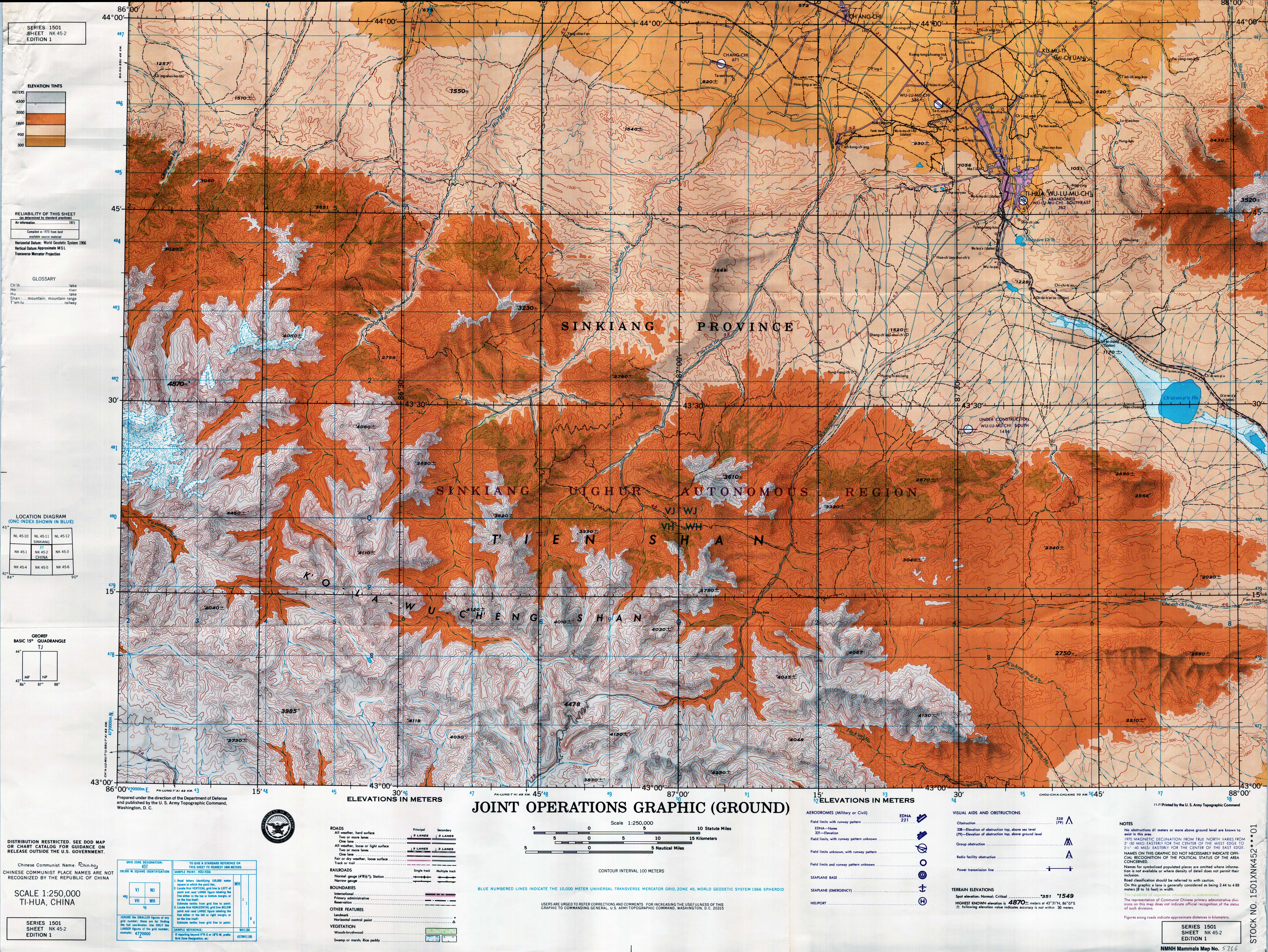
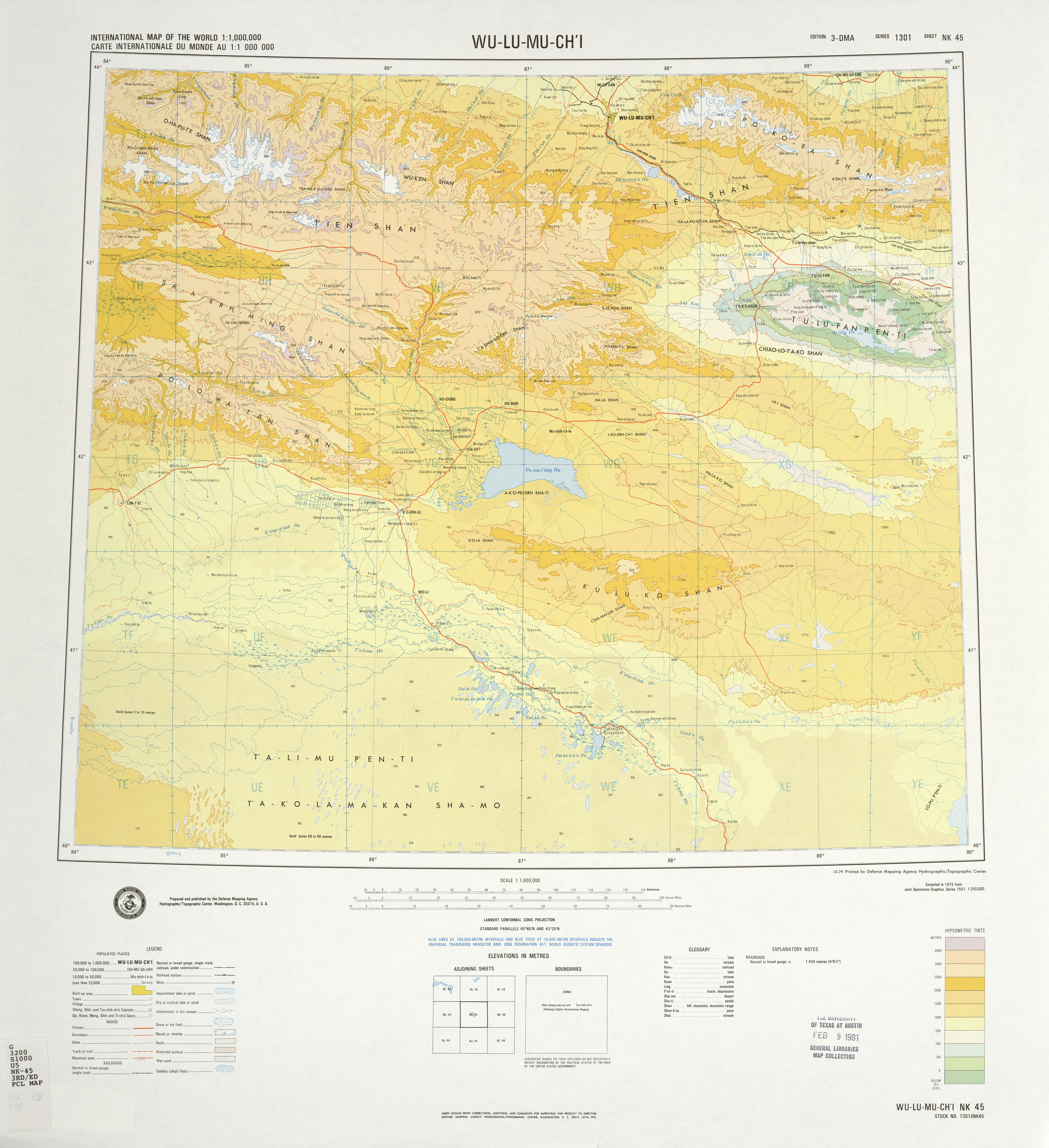
The Shihezi Headquarters Farm () is an economic and paramilitary formed unit at regiment-level in Xinjiang Production and Construction Corps (XPCC), that is part of the 8th Division of the XPCC (). The farm is headquartered in ''Beiqun Town'' () of Shihezi City, Xinjiang Uygur Autonomous Region, China. It is composed of 23 companies and 11 residential communities. As of 2018, its population was about 8,5000. The Shihezi Headquarters Farm is co-located with ''Beiquan Town Government''. With the approval of the government of the autonomous region and the Ministry of Civil Affairs in 1999, the ''Beiquan Town Government was'' formally established, the town was implemented a special management system with Shihezi Headquarters Farm for co-location work and named as Beiquan Town of Shihezi Headquarters Farm (), it is also the first administrative town directly managed by the Corps (XPCC). The total area of Shihezi Headquarters Farm is 475.76 square kilometers (including 195.2 squar ... [...More Info...] [...Related Items...] OR: [Wikipedia] [Google] [Baidu] |
Paramilitary
A paramilitary is a military that is not a part of a country's official or legitimate armed forces. The Oxford English Dictionary traces the use of the term "paramilitary" as far back as 1934. Overview Though a paramilitary is, by definition, not a military, it is usually equivalent to a light infantry or special forces in terms of strength, firepower, and organizational structure. Paramilitaries use combat-capable kit/equipment (such as Internal security vehicle, internal security/SWAT vehicles), or even actual military equipment (such as Long gun, long guns and Armoured personnel carrier, armored personnel carriers; usually military surplus resources), skills (such as battlefield medicine and bomb disposal), and tactics (such as urban warfare and close-quarters combat) that are compatible with their purpose, often combining them with skills from other relevant fields such as law enforcement, coast guard, or search and rescue. A paramilitary may fall under the command of a ... [...More Info...] [...Related Items...] OR: [Wikipedia] [Google] [Baidu] |
People's Liberation Army
The People's Liberation Army (PLA) is the military of the Chinese Communist Party (CCP) and the People's Republic of China (PRC). It consists of four Military branch, services—People's Liberation Army Ground Force, Ground Force, People's Liberation Army Navy, Navy, People's Liberation Army Air Force, Air Force, and People's Liberation Army Rocket Force, Rocket Force—and four arms—People's Liberation Army Aerospace Force, Aerospace Force, People's Liberation Army Cyberspace Force, Cyberspace Force, People's Liberation Army Information Support Force, Information Support Force, and People's Liberation Army Joint Logistics Support Force, Joint Logistics Support Force. It is led by the Central Military Commission (China), Central Military Commission (CMC) with its Chairman of the Central Military Commission (China), chairman as Supreme Military Command of the People's Republic of China, commander-in-chief. The PLA can trace its origins during the Republic of China (1912– ... [...More Info...] [...Related Items...] OR: [Wikipedia] [Google] [Baidu] |
List Of Township-level Divisions Of Xinjiang
This is a list of township-level divisions (formal fourth-level administrative divisions including towns, townships, subdistricts and county districts) of the Xinjiang Uyghur Autonomous Region, People's Republic of China. Ürümqi Dabancheng District Midong District Saybagh District Shuimogou District Tianshan District Toutunhe District Xinshi District Ürümqi County * Anningqu Aksu Prefecture Aksu City Subdistrict (街道) * Langan Subdistrict (栏杆街道), Yinbaza Subdistrict (英巴扎街道), Hongqiao Subdistrict (红桥街道), Xincheng Subdistrict (新城街道), Nancheng Subdistrict (南城街道) Town (镇) * Kaletale (喀勒塔勒镇), Ayikule (阿依库勒镇) Township (乡) * Yiganqi Township (依干其乡), Baimetugeman Township (拜什吐格曼乡), Tuopuluke Township (托普鲁克乡), Kumubaxi Township (库木巴希乡), Tuokayi Township (托喀依乡) Onsu / Wensu County Towns (بازىرى / 镇): * Wensu Town (Onsu; ئون� ... [...More Info...] [...Related Items...] OR: [Wikipedia] [Google] [Baidu] |
China National Highway 312
China National Highway 312 (312国道), also referred to as Route 312, is a key east-west route beginning in Shanghai and ending at Khorgas, Xinjiang in the Ili River valley, on the border with Kazakhstan. In total it spans , passing through Jiangsu, Anhui, Henan, Shaanxi, Gansu before ending in Xinjiang. Besides Shanghai, cities of note on the route include Suzhou, Wuxi, Nanjing, Hefei, Xinyang, Nanyang, Xi'an, Lanzhou, Jiayuguan and Ürümqi. The road was the subject of Rob Gifford's 2007 book '' China Road'', in which he describes traveling the entire length of Route 312 from the East China Sea to Central Asia. The G40 Shanghai–Xi'an Expressway has replaced National Highway 312 as the main route between those two cities. Route and distance Accidents On October 10 2019, a bridge of G312 crossing Xigang Road in Wuxi was collapsed by several overloaded trucks, killing 3 people and injuring 2 others. See also * China National Highways * U.S. Route 66 Reference ... [...More Info...] [...Related Items...] OR: [Wikipedia] [Google] [Baidu] |
Ürümqi Diwopu International Airport
Ürümqi, , is the capital of the Xinjiang, Xinjiang Uyghur Autonomous Region in Northwestern China. With a census population of 4 million in 2020, Ürümqi is the second-largest city in China's northwestern interior after Xi'an, also the second-largest in Central Asia in terms of population, right after Kabul, Afghanistan. Ürümqi has seen significant economic development since the 1990s and currently serves as a List of transport topics#Nodes, regional transport node and a cultural, political and commercial center. Etymology The name Ürümqi comes from the Mongolic languages, Mongolic Oirat language and means "beautiful pasture" (, ). It was originally the name of a small town founded by the Mongolic peoples, Mongolic, Oirat-speaking Dzungar people, Dzungars. The Qing dynasty took Ürümqi by force in 1755, during Dzungar–Qing Wars, its conquest of the Dzungar Khanate. Qing forces expanded the town into a walled city from 1763 to 1767, and upon completing the expan ... [...More Info...] [...Related Items...] OR: [Wikipedia] [Google] [Baidu] |
Wusu
UsuThe official spelling according to , (Beijing, '' SinoMaps Press'' 1997); as the official romanized name and transliterated from Mongolian, also known as Wusu, is a county-level city with more than 100,000 residents in Xinjiang, China. It is a part of Tacheng Prefecture of Ili Kazakh Autonomous Prefecture. Oil production is a major part of the economy while the county is an oasis in the Dzungarian Basin. Wusu lies between the major cities of Bole and Shihezi in Northern Xinjiang and west of Ürümqi Ürümqi, , is the capital of the Xinjiang, Xinjiang Uyghur Autonomous Region in Northwestern China. With a census population of 4 million in 2020, Ürümqi is the second-largest city in China's northwestern interior after Xi'an, also the ... and Kuitun, south of Karamay. Transport Wusu is served by China National Highway 312, the Northern Xinjiang and the Second Ürümqi-Jinghe Railways. Administrative divisions Wusu is divided into 5 subdistricts, 10 ... [...More Info...] [...Related Items...] OR: [Wikipedia] [Google] [Baidu] |
Karamay
Karamay (also spelled Karamai) is a prefecture-level city in the north of the Xinjiang Uyghur Autonomous Region, People's Republic of China. It is surrounded on all sides by Tacheng Prefecture. The name of the city comes from the Uyghur language and means "black oil", referring to the oil fields near the city. Karamay was the site of one of the worst disasters in modern Chinese history, the 1994 Karamay fire, when 324 people, including 288 school children, lost their lives in a cinema fire on 8 December 1994. History Subdivisions Karamay City has jurisdiction over four districts ( zh, s=区, p=qū, labels=no). They are not contiguous as Dushanzi District is located south of the Lanxin Railway and forms an exclave, separated from the rest of Karamay City by Kuytun City. Together with Kuytun City, Karamay City forms an enclave surrounded on all sides by Tacheng Prefecture. Geography Karamay is located in the northwest of the Dzungarian basin, with an average elevati ... [...More Info...] [...Related Items...] OR: [Wikipedia] [Google] [Baidu] |
Ürümqi
Ürümqi, , is the capital of the Xinjiang, Xinjiang Uyghur Autonomous Region in Northwestern China. With a census population of 4 million in 2020, Ürümqi is the second-largest city in China's northwestern interior after Xi'an, also the second-largest in Central Asia in terms of population, right after Kabul, Afghanistan. Ürümqi has seen significant economic development since the 1990s and currently serves as a List of transport topics#Nodes, regional transport node and a cultural, political and commercial center. Etymology The name Ürümqi comes from the Mongolic languages, Mongolic Oirat language and means "beautiful pasture" (, ). It was originally the name of a small town founded by the Mongolic peoples, Mongolic, Oirat-speaking Dzungar people, Dzungars. The Qing dynasty took Ürümqi by force in 1755, during Dzungar–Qing Wars, its conquest of the Dzungar Khanate. Qing forces expanded the town into a walled city from 1763 to 1767, and upon completing the expan ... [...More Info...] [...Related Items...] OR: [Wikipedia] [Google] [Baidu] |
Manasi River
The Manasi River (, also called Manas) is in the south of Dzungarian Basin, Xinjiang, China. Historically, the Manas River crossed a large section of the Gurbantünggüt Desert, terminating in Lake Manas (); its length then was about long. However, due to the water diversion for irrigation and other needs, the Manas River's water has not reached the eponymous lake since the 1960s, and the lake has gone dry.Weiming Cheng, Chenghu Zhou, Jianxin LiResearch on evolution of Manas Lakes in Xinjiang over last 50 years (2005). Numerous reservoirs are constructed on the Manas River and connected streams in the Shihezi City-Manas County Manas County is a county in the Xinjiang, Xinjiang Uyghur Autonomous Region under the administration of the Changji Hui Autonomous Prefecture. It covers an area of and census it had a population of 170,000. The county seat is the old town of Ma ... area, including the Jiahezi Reservoir () with the dam at . The reservoirs and canals form an extensive ... [...More Info...] [...Related Items...] OR: [Wikipedia] [Google] [Baidu] |
Dzungaria
Dzungaria (; from the Mongolian words , meaning 'left hand'), also known as Northern Xinjiang or Beijiang, is a geographical subregion in Northwest China that corresponds to the northern half of Xinjiang. Bound by the Altai Mountains to the north and the Tian Shan mountain range to the south, Dzungaria covers approximately , and borders Kazakhstan to the west and Mongolia to the east. In contexts prior to the mid-18th century Dzungar genocide, the term "Dzungaria" could cover a wider area, coterminous with the Oirat-led Dzungar Khanate. Although Dzungaria is geographically, historically, and ethnically distinct from the Tarim Basin or Southern Xinjiang (Nanjiang), the Manchu-led Qing dynasty integrated both areas into one province, Xinjiang. Dzungaria is Xinjiang's center of heavy industry, generates most of the region's GDP, and houses its political capital Ürümqi ( Oirat for 'beautiful pasture'). As such, Dzungaria continues to attract intraprovincial and interprovinci ... [...More Info...] [...Related Items...] OR: [Wikipedia] [Google] [Baidu] |
Tian Shan
The Tian Shan, also known as the Tengri Tagh or Tengir-Too, meaning the "Mountains of God/Heaven", is a large system of mountain ranges in Central Asia. The highest peak is Jengish Chokusu at high and located in Kyrgyzstan. Its lowest point is at the Turpan Depression, which is below sea level. The Tian Shan is sacred in Tengrism. Its second-highest peak is known as Khan Tengri, which can be translated as "Lord of the Spirits". At the 2013 Conference on World Heritage, the eastern portion of Tian Shan in western China's Xinjiang Region was listed as a World Heritage Site. The western portion in Kyrgyzstan, Kazakhstan, and Uzbekistan was then listed in 2016. Geography Tian Shan with the ancient Silk Road The Tian Shan range is located north and west of the Taklamakan Desert and directly north of the Tarim Basin. It straddles the border regions of Kazakhstan, Kyrgyzstan, Uzbekistan and Xinjiang in Northwest China. To the south, it connects with the Pamir Mountains ... [...More Info...] [...Related Items...] OR: [Wikipedia] [Google] [Baidu] |
9th Corps (People's Republic Of China)
The 9th Corps () was a military formation of the Chinese People's Liberation Army from the 1940s to the 1950s. The 9th Corps was activated in September 1949 from defecting Republic of China Army 42nd Reorganization Division. The Corps was composed of 25th, 26th and 27th Divisions. From mid 1949 to 1950, the divisions were located north of Wusu, southwest of Urumqi, and north of Kuqa and east of Korla, respectively.Xinjiang: China's Muslim Borderland By S. Frederick Starr, 128. In April 1952, the headquarters of the 9th Corps was merged with the headquarters of the 22nd Army (Tao Zhiyue's former Kuomintang command). In November 1952, the corps was inactivated. In May 1953, 25th, 26th and 27th divisions from the corps were reorganized as 7th, 8th and 9th agriculture construction divisions of the Xinjiang Production and Construction Corps The Xinjiang Production and Construction Corps (新疆生产建设兵团; abbreviated as 新疆兵团, or XPCC in English), also kn ... [...More Info...] [...Related Items...] OR: [Wikipedia] [Google] [Baidu] |


