|
Sheffield Glen
Sheffield Glen is a neighbourhood in Alta Vista Ward in southeast Ottawa, Ontario, Canada. It is bounded on the west by Russell Road, on the south by Walkley Road and on the north and east by Lancaster Road. The neighbourhood is more commonly referred to as Southvale by Ottawans, but appears as Sheffield Glen on maps. Southvale Crescent is the name of the main street which runs through the neighbourhood and is home to a majority of residents. The neighbourhood is home to many apartment buildings and townhouses. Its population according to the Canada 2011 Census was 2877.Population can be calculated by combining Dissemination area35060924 [...More Info...] [...Related Items...] OR: [Wikipedia] [Google] [Baidu] |
Alta Vista Ward
Alta Vista Ward (Ward 18) is a city ward in the city of Ottawa, Ontario, Canada represented on Ottawa City Council. Alta Vista Ward was created prior to the 1966 election when Gloucester Ward was split in half due to population growth in the Alta Vista area. Until the 1972 elections, the ward was represented by two councillors (then called aldermen). Prior to the 1980 election, the Ward was split in half, with the western half remaining as Alta Vista ward and the eastern half became Canterbury Ward. They were reunited prior to the 1994 Election and was known as Alta Vista-Canterbury Ward. During this time, on regional council it was known as just Alta Vista Ward. It was renamed to Alta Vista in 2000. The ward is located in Ottawa's southeast end, and covers the neighbourhoods of Eastway Gardens, Riverview, Alta Vista, Heron Gate and Sheffield Glen. The Ward is often advertised by candidates as "Alta Vista-Canterbury-Riverview", as there was a plan to name it that in 1997. ... [...More Info...] [...Related Items...] OR: [Wikipedia] [Google] [Baidu] |
Ottawa, Ontario
Ottawa (, ; Canadian French: ) is the capital city of Canada. It is located at the confluence of the Ottawa River and the Rideau River in the southern portion of the province of Ontario. Ottawa borders Gatineau, Quebec, and forms the core of the Ottawa–Gatineau census metropolitan area (CMA) and the National Capital Region (NCR). Ottawa had a city population of 1,017,449 and a metropolitan population of 1,488,307, making it the fourth-largest city and fourth-largest metropolitan area in Canada. Ottawa is the political centre of Canada and headquarters to the federal government. The city houses numerous foreign embassies, key buildings, organizations, and institutions of Canada's government, including the Parliament of Canada, the Supreme Court, the residence of Canada's viceroy, and Office of the Prime Minister. Founded in 1826 as Bytown, and incorporated as Ottawa in 1855, its original boundaries were expanded through numerous annexations and were ultimately ... [...More Info...] [...Related Items...] OR: [Wikipedia] [Google] [Baidu] |
Canada
Canada is a country in North America. Its ten provinces and three territories extend from the Atlantic Ocean to the Pacific Ocean and northward into the Arctic Ocean, covering over , making it the world's second-largest country by total area. Its southern and western border with the United States, stretching , is the world's longest binational land border. Canada's capital is Ottawa, and its three largest metropolitan areas are Toronto, Montreal, and Vancouver. Indigenous peoples have continuously inhabited what is now Canada for thousands of years. Beginning in the 16th century, British and French expeditions explored and later settled along the Atlantic coast. As a consequence of various armed conflicts, France ceded nearly all of its colonies in North America in 1763. In 1867, with the union of three British North American colonies through Confederation, Canada was formed as a federal dominion of four provinces. This began an accretion of provinces and ... [...More Info...] [...Related Items...] OR: [Wikipedia] [Google] [Baidu] |
Russell Road (Ontario)
Russell Road is an arterial road in Eastern Ontario, Canada. It begins in Ottawa in the Riverview neighbourhood and runs eastward through the rural communities of Ramsayville, Carlsbad Springs and Bearbrook in Ottawa and through the Municipality of Clarence-Rockland, connecting the communities of Cheney and Bourget, ending at Boundary Road on the eastern border of Clarence Rockland. In Ottawa it is officially Ottawa Road #26, and in Clarence-Rockland as United Counties of Prescott and Russell County Road #2. History The road was originally built in the 1830s from parts of an indigenous trail that led to Montreal. In the 19th century, it was also known as the "Ottawa and Russell macadamized road". and was owned by the Ottawa and Russell Macadamized Road Company. It would later be owned by the Ottawa, Montreal & Russell Road Company. The Carleton County 1879 Atlas shows the road running from the village of Janeville (now Vanier), southward following the east bank of the Rideau ... [...More Info...] [...Related Items...] OR: [Wikipedia] [Google] [Baidu] |
Walkley Road
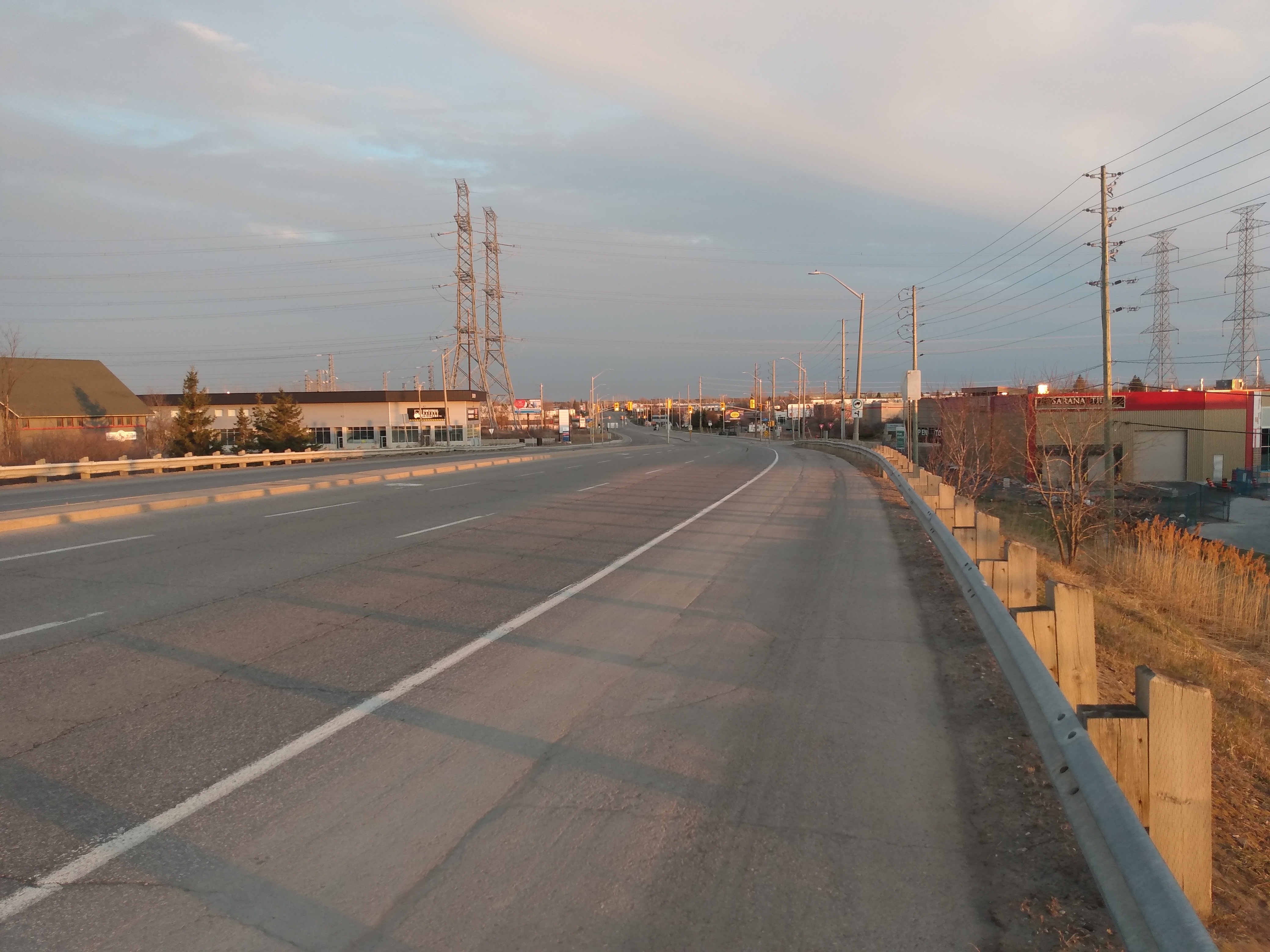
Walkley Road (List of numbered roads in Ottawa, Ottawa Road #74) is a major road in Ottawa, Ontario, Canada. It runs from Riverside Drive (Ottawa), Riverside Drive to Ramseyville Road (formerly Baseline Road (Ottawa), Baseline Road). It is mostly a four-lane divided road which runs through both residential and industrial areas of the southern part of urban Ottawa. See also * List of roads in Ottawa External links Ottawa 2020 Transportation Master Plan Roads in Ottawa {{Ottawa-stub ... [...More Info...] [...Related Items...] OR: [Wikipedia] [Google] [Baidu] |
Canada 2016 Census
The 2016 Canadian census was an enumeration of Canadian residents, which counted a population of 35,151,728, a change from its 2011 population of 33,476,688. The census, conducted by Statistics Canada, was Canada's seventh quinquennial census. The official census day was May 10, 2016. Census web access codes began arriving in the mail on May 2, 2016. The 2016 census marked the reinstatement of the mandatory long-form census, which had been dropped in favour of the voluntary National Household Survey for the 2011 census. With a response rate of 98.4%, this census is said to be the best one ever recorded since the 1666 census of New France. This census was succeeded by Canada's 2021 census. Planning Consultation with census data users, clients, stakeholders and other interested parties closed in November 2012. Qualitative content testing, which involved soliciting feedback regarding the questionnaire and tests responses to its questions, was scheduled for the fall of 2013, w ... [...More Info...] [...Related Items...] OR: [Wikipedia] [Google] [Baidu] |
Canadian Museum Of Science And Technology
The Canada Science and Technology Museum (abbreviated as CSTM; french: Musée des sciences et de la technologie du Canada) is a national museum of science and technology in Ottawa, Ontario, Canada. The museum has a mandate to preserve and promote the country's scientific and technological heritage. The museum is housed in a building. The museum is operated by Ingenium, a Crown corporation that also operates two other national museums of Canada. The museum originated as the science and technology branch of the defunct National Museum of Canada. The branch opened its own building in 1967, and subsequently became its own institution in 1968, named the National Museum of Science and Technology. The museum adopted its current name in 2000. The museum's building underwent significant renovations from 2014 to 2017, which saw most of the original structure demolished and replaced. The museum's collection contains over 20,000 artifact lots with 60,000 individual objects, some of which are ... [...More Info...] [...Related Items...] OR: [Wikipedia] [Google] [Baidu] |
Hawthorne Meadows
Hawthorne Meadows is a neighbourhood in Alta Vista Ward in southeast Ottawa, Ontario, Canada. It is triangular in shape; it is bounded on the west by St. Laurent Boulevard, on the northeast by Russell Road and on the south by Walkley Road. According to the Canada 2016 Census, the population of this area was 3,577. History The neighbourhood exists at the site of the Hawthorne Post office and Orange Hall which was located at the corner of present day Walkley and Russell Roads. The neighbourhood was mostly built in the 1960s by Minto Construction. Demographics The neighbourhood corresponds to Census Tract 5050010.00 (which also consists of the St. Laurent Square apartments, which are not in the neighbourhood). According to the 2016 Census, 47% of the population were Anglophones and 20% were Francophones. Other major languages include Arabic (8%), Somali (4%), Tagalog (3%), Spanish (2%), Creoles (2%), Italian (1%), Swahili (1%) and Urdu (1%). According to the Canada 2016 Census ... [...More Info...] [...Related Items...] OR: [Wikipedia] [Google] [Baidu] |


