|
Sandanski–Petrich Valley
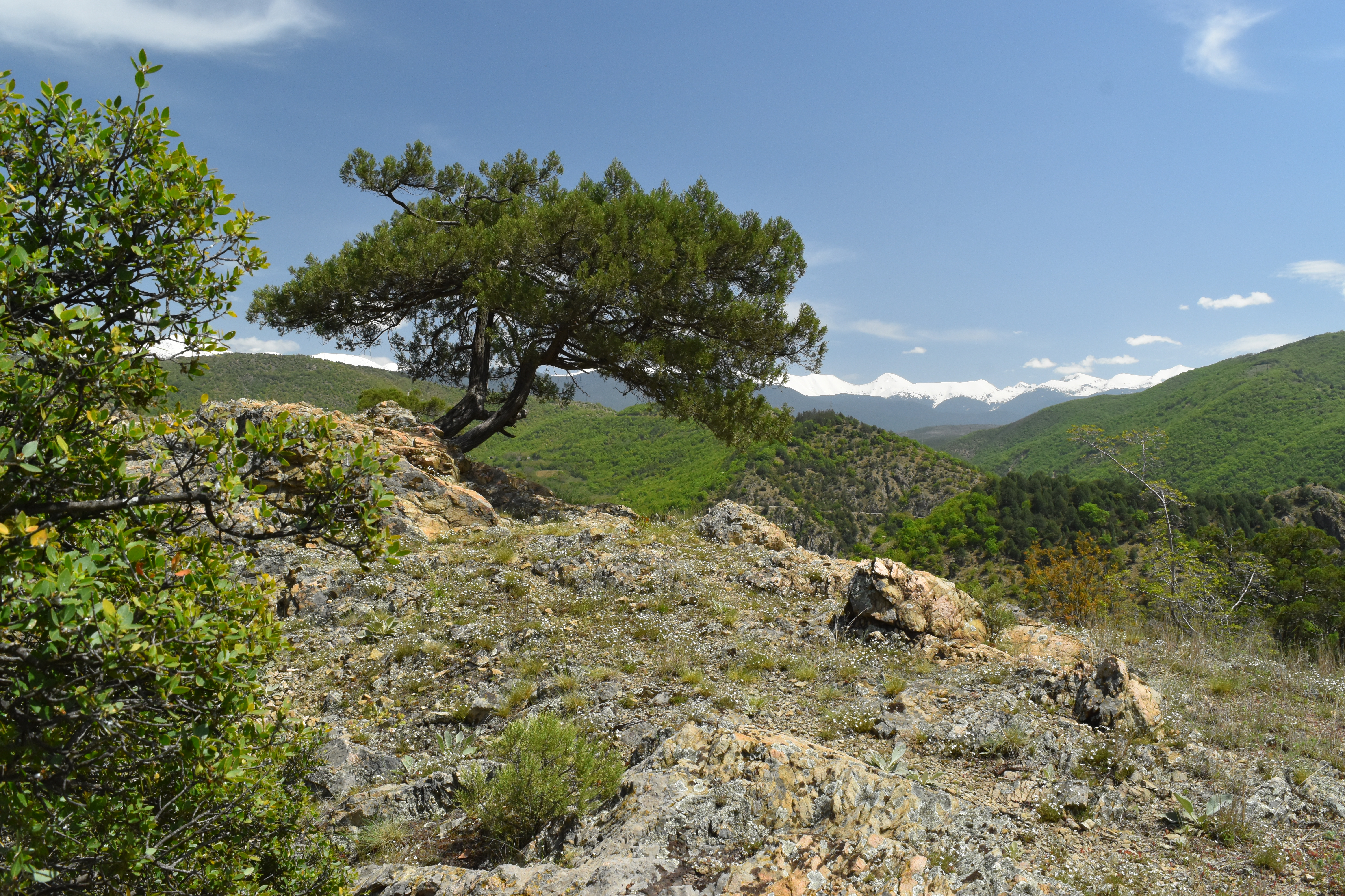
Sandanski–Petrich Valley ( bg, Санданско-Петричка котловина, Sandansko-Petrichka kotlovina) is situated in southwestern Bulgaria along the river Struma and its right tributary Strumeshnitsa, with a very small part of the territory extending to Greece. The valley is enclosed by several mountain ranges, three of them reaching heights of over 2,000 m, and is open to the Strumitsa Valley to the west and the Serres Valley to the south. Due to the proximity to the Aegean Sea, the climate is continental Mediterranean, making Sandanski–Petrich Valley one of the warmest regions of Bulgaria. Administratively, it falls within Blagoevgrad Province, where it occupies its southwestern-most parts in is divided in four municipalities. It is named after the two most populous cities in the area, Sandanski and Petrich. The mild climate, numerous mineral springs and the abundance of natural and cultural landmarks within the valley and in its proximity favour agric ... [...More Info...] [...Related Items...] OR: [Wikipedia] [Google] [Baidu] |
Belasica
Belasica (Macedonian and Bulgarian: , also translit. ''Belasitsa'' or ''Belasitza'', Ottoman Turkish: بلش Turkish: ''Beleş''), Belles ( el, Μπέλλες, ''Bélles'') or Kerkini (, ''Kerkíni'';), is a mountain range in the region of Macedonia in Southeastern Europe, shared by northeastern Greece (about 45%), southeastern North Macedonia (35%) and southwestern Bulgaria (20%). Geography The mountain range is fault-block mountain about long and wide and is situated just northeast of Dojran Lake. The highest point is Radomir (Kalabaka) at 2,031 m, with elevation otherwise ranging between 300 and 1900 m above sea level. The borders of all three countries meet at Tumba Peak. The climate in the area shows strong Mediterranean influence. The area of Belasica became a euroregion in 2003. Two football teams are named after the mountain range, PFC Belasitsa from the nearby Bulgarian town of Petrich and FC Belasica from Strumica in North Macedonia. History Since ancien ... [...More Info...] [...Related Items...] OR: [Wikipedia] [Google] [Baidu] |
Kresna Gorge
Kresna Gorge ( bg, Кресненско дефиле) is a steep valley in south-western Bulgaria, stretching about 18 km. The gorge has been formed by the Struma River, which flows from the Vitosha mountains. Kresna gorge has a rich biodiversity, which has come under pressure from the Struma motorway construction project, a new leg of the Trans European Corridor No. 4. In the south, the gorge bisects the Tisata nature reserve. Kresna Gorge was the place of the Battle of Kresna Gorge between Bulgaria and Greece during the 1913 Second Balkan War. The Greek army was threatened by encirclement in the valley, but due to the Romanian army advancing against the undefended capital Sofia, Bulgaria had to agree to an armistice and the resulting peace treaty in Bucharest which was unfavorable to Bulgaria's territorial aspirations. Terrain and Climate Kresna Gorge is situated near the villages of Palat, Drakata, and Krupnik while surrounded by the Pirin and Maleshevska Mountains. The gor ... [...More Info...] [...Related Items...] OR: [Wikipedia] [Google] [Baidu] |
Pirinska Bistritsa
The Pirinska Bistritsa ( bg, Пиринска Бистрица) is a river in south-western Bulgaria, a left tributary of the Struma. The river is 53 km long; the last 7 km before its confluence with the Struma forms the border between Bulgaria and Greece. Pirinska Bistritsa drains the south-western sections of the Pirin mountain range and the northern sections of the Slavyanka mountain range. The river springs from the southern shore of the Argirovo glacial lake in situated in the Demirkapia cirque in Northern Pirin at an altitude of 2,365 m. It flows in southern direction in a deep valley. Near Pirin refuge it turns to the southeast and enters a densely forested area, where it again flows southwards. At the village of Pirin the river takes a sharp turn to the southwest and enters a sparsely forested valley with eroded slopes. At the village of Katuntsi it enters the Sandanski–Petrich Valley, where the river bed widens. At half a kilometer south of the village o ... [...More Info...] [...Related Items...] OR: [Wikipedia] [Google] [Baidu] |
Melnishka Reka
The Melnishka reka ( bg, Мелнишка река) is a river in south-western Bulgaria, a left tributary of the Struma. The river is 30 km long and drains part of the south-western sections of the Pirin mountain range. The river takes at an altitude of 2,409 m, at about 300 m from the summit of Kelyo (2,484 m). It flows in southeastern direction through most of its course. In its upper stretches Melnishka reka flows through a densely forested valley. Downstream of the village of Doleni, the river enters en eroded valley, where along with its tributary the Sugarevska reka, it runs along the Melnik Earth Pyramids. Near the village of Zornitsa the river enters the Sandanski–Petrich Valley, at the village of Kromidovo it turns westwards and then southwards at the village of Novo Konomladi. It flows into the Struma at an altitude of 85 m at 1.8 km west of the village of Marikostinovo. Its drainage basin covers a territory of 97 km2 or 0.56% of ... [...More Info...] [...Related Items...] OR: [Wikipedia] [Google] [Baidu] |
Sandanska Bistritsa
The Sandanska Bistritsa ( bg, Санданска Бистрица) is a river in south-western Bulgaria, a left tributary of the Struma. The river is 33 km long and drains the south-western sections of the Pirin mountain range. The Sandanska Bistritsa takes its source from the south-eastern corner of the Tevnoto Lake in Northern Pirin at an altitude of 2,512 m. It flows in southern direction through another four lakes of the Malokamenishki Lakes group and then turns westwards. After the confluence with the first significant right tributary, the Bashliytsa, the turns to the south-west and flows in a deep sparsely forested valley. In the upper course of the river is located the Popinolashki waterfall, one of Pirin's largest. Near the town of Sandanski the river enters the Sandanski–Petrich Valley forming a large mucous cone. It flows into the Struma at an altitude of 104 m near the Sandanski industrial zone. Its drainage basin covers a territory of 139 km2 o ... [...More Info...] [...Related Items...] OR: [Wikipedia] [Google] [Baidu] |
Vlahina Reka
Vlahina () or Vlaina (), meaning "Vlach Mountain" is a mountain range on the border of southwestern Bulgaria and eastern North Macedonia. The highest peak is Ogreyak (also known as Kadiytsa) at 1,924 m. Nearby towns include Simitli to the northeast in Bulgaria and Pehčevo Pehčevo ( mk, Пехчево, is a small town in the eastern part of North Macedonia. It is the seat of Pehčevo Municipality. Pehčevo is known for its winter tourism. History In the late 19th and early 20th century, Pehčevo was part of the ... to the southwest in North Macedonia. Mountain ranges of Bulgaria Mountain ranges of North Macedonia Landforms of Blagoevgrad Province Bulgaria–North Macedonia border International mountains of Europe Pehčevo Municipality Rhodope mountain range {{Pehčevo-geo-stub ... [...More Info...] [...Related Items...] OR: [Wikipedia] [Google] [Baidu] |
Fluorite
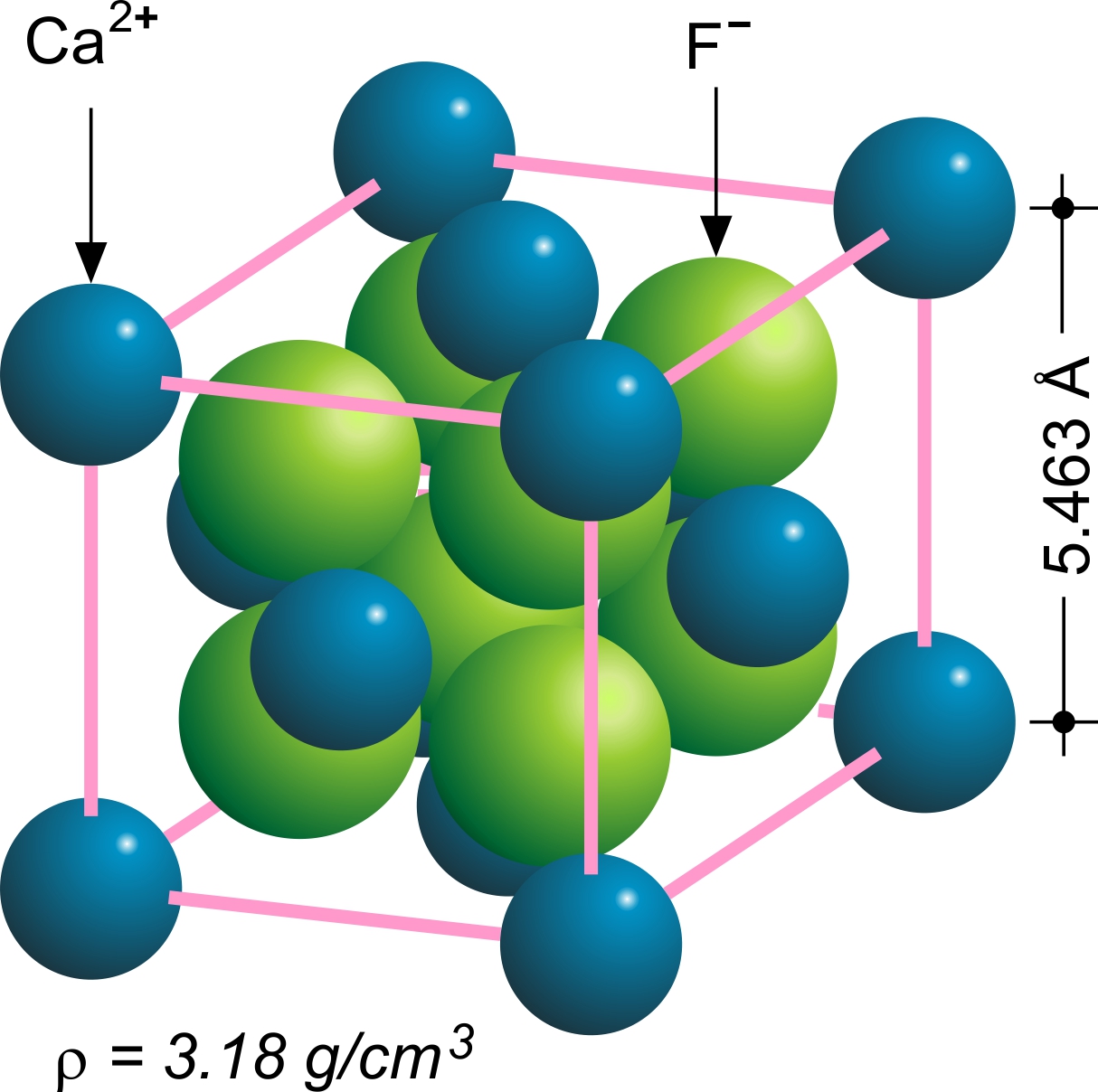
Fluorite (also called fluorspar) is the mineral form of calcium fluoride, CaF2. It belongs to the halide minerals. It crystallizes in isometric cubic habit, although octahedral and more complex isometric forms are not uncommon. The Mohs scale of mineral hardness, based on scratch hardness comparison, defines value 4 as fluorite. Pure fluorite is colourless and transparent, both in visible and ultraviolet light, but impurities usually make it a colorful mineral and the stone has ornamental and lapidary uses. Industrially, fluorite is used as a flux for smelting, and in the production of certain glasses and enamels. The purest grades of fluorite are a source of fluoride for hydrofluoric acid manufacture, which is the intermediate source of most fluorine-containing fine chemicals. Optically clear transparent fluorite lenses have low dispersion, so lenses made from it exhibit less chromatic aberration, making them valuable in microscopes and telescopes. Fluorite optics ar ... [...More Info...] [...Related Items...] OR: [Wikipedia] [Google] [Baidu] |
Quaternary
The Quaternary ( ) is the current and most recent of the three period (geology), periods of the Cenozoic era (geology), Era in the geologic time scale of the International Commission on Stratigraphy (ICS). It follows the Neogene Period and spans from 2.58 million years ago to the present. The Quaternary Period is divided into two epochs: the Pleistocene (2.58 million years ago to 11.7 thousand years ago) and the Holocene (11.7 thousand years ago to today, although a third epoch, the Anthropocene, has been proposed but is not yet officially recognised by the ICS). The Quaternary Period is typically defined by the cyclic growth and decay of continental ice sheets related to the Milankovitch cycles and the associated climate and environmental changes that they caused. Research history In 1759 Giovanni Arduino (geologist), Giovanni Arduino proposed that the geological strata of northern Italy could be divided into four successive formations or "orders" ( it, quattro ord ... [...More Info...] [...Related Items...] OR: [Wikipedia] [Google] [Baidu] |
Pliocene
The Pliocene ( ; also Pleiocene) is the epoch in the geologic time scale that extends from 5.333 million to 2.58See the 2014 version of the ICS geologic time scale million years ago. It is the second and most recent epoch of the Period in the Cenozoic Era. The Pliocene follows the Miocene Epoch and is followed by the Pleistocene Epoch. Prior to the 2009 revision of the geologic time scale, which placed the fou ... [...More Info...] [...Related Items...] OR: [Wikipedia] [Google] [Baidu] |
Tertiary
Tertiary ( ) is a widely used but obsolete term for the geologic period from 66 million to 2.6 million years ago. The period began with the demise of the non- avian dinosaurs in the Cretaceous–Paleogene extinction event, at the start of the Cenozoic Era, and extended to the beginning of the Quaternary glaciation at the end of the Pliocene Epoch. The time span covered by the Tertiary has no exact equivalent in the current geologic time system, but it is essentially the merged Paleogene and Neogene periods, which are informally called the Early Tertiary and the Late Tertiary, respectively. The Tertiary established the Antarctic as an icy island continent. Historical use of the term The term Tertiary was first used by Giovanni Arduino during the mid-18th century. He classified geologic time into primitive (or primary), secondary, and tertiary periods based on observations of geology in Northern Italy. Later a fourth period, the Quaternary, was applied. In the early ... [...More Info...] [...Related Items...] OR: [Wikipedia] [Google] [Baidu] |
Kozhuh (volcano)
Rupite ( bg, Рупите, ) is a village which includes a small mountainous protected area in the southeastern part of Blagoevgrad Province, Bulgaria, 10-12 kilometres northeast of Petrich, inside Petrich Municipality, on the right bank of the Struma River. It is best known as the place where the Bulgarian medium Baba Vanga lived and was buried. The area is in fact the crater of an extinct volcano, its appearance being shaped by the volcanic hill of Kozhuh, the thermal springs and Pchelina Hill. The village has 1,124 inhabitants. Rupite is a protected area, which is situated at a distance of about 10 km from Petrich and 2 km from the village of Rupite, at the eastern foot of the extinct volcano Kozhuh Mountain (281 meters altitude). The hill was built by volcanic rocks. Its name comes from the fact that it looks like a mantle (kozhuh in Bulgarian). In 1962 a part of the locality of Kozhuh – 0.4 hectares – was declared a natural landmark. The protected area of Rupite is famous ... [...More Info...] [...Related Items...] OR: [Wikipedia] [Google] [Baidu] |
Pogled Kum Prez Gr Petrich Kum Gr Sandanski
Pogled may refer to: In Montenegro: * Pogled (mountain), a mountain peak in Kosovo, Serbia, and Montenegro In Serbia: * Pogled, Arilje, a settlement in the Municipality of Arilje In Slovenia: * Pogled, Moravče, a settlement in the Municipality of Moravče * Pogled, Apače, a settlement in the Municipality of Apače {{geodis ... [...More Info...] [...Related Items...] OR: [Wikipedia] [Google] [Baidu] |


