|
Rise Park, Nottingham
Rise Park is a suburb of Nottingham four miles north of the City Centre and three miles north-east of junction 26 of the M1 motorway. It comprises approximately 1500 homes, primarily privately owned houses and bungalows, and a small number of low rise, three-storey flats. Construction of the estate began in the early 1960s, starting at the bottom of the hill to the west and gradually spreading upwards and eastwards to be completed in the early 1970s. It was built on the former site of Rise Farm (known as Bulwellrise Farm until around 1900), the southern boundary of which ran along the edge of what is now Rise Park Road, Langbank Avenue and Bracadale Road. The farmhouse had stood on what would now be the south-east corner of Haverill Crescent. On the western boundary ran a railway line, closed in the mid-1960s and now a tree-lined footpath. To the north is Bestwood Country Park and to the east is another housing estate built in the late 1970s on the site of Home Farm. To the ... [...More Info...] [...Related Items...] OR: [Wikipedia] [Google] [Baidu] |
Nottingham North (UK Parliament Constituency)
Nottingham North is a constituency represented in the House of Commons of the UK Parliament since 2017 by Alex Norris of the Labour and Co-operative party. Boundaries 1955–1974: The County Borough of Nottingham wards of Byron, Mapperley, Portland, and St Albans, and the Urban District of Hucknall. 1974–1983: The County Borough of Nottingham wards of Byron, Forest, Mapperley, Portland, Radford, and St Albans. 1983–2010: The City of Nottingham wards of Aspley, Beechdale, Bestwood Park, Bilborough, Bulwell East, Bulwell West, Byron, Portland, and Strelley. 2010–present: The City of Nottingham wards of Aspley, Basford, Bestwood, Bilborough, Bulwell, and Bulwell Forest. Constituency profile The constituency consists mostly of residential areas, a majority of neighbourhoods of which were council housing. Of these a slight majority, rather than being social housing, is now private under the Right to Buy, such as Bulwell. Overall, its census Super Output Areas have the ... [...More Info...] [...Related Items...] OR: [Wikipedia] [Google] [Baidu] |
City Of Nottingham
Nottingham ( , locally ) is a city and unitary authority area in Nottinghamshire, East Midlands, England. It is located north-west of London, south-east of Sheffield and north-east of Birmingham. Nottingham has links to the legend of Robin Hood and to the lace-making, bicycle and tobacco industries. The city is also the county town of Nottinghamshire and the settlement was granted its city charter in 1897, as part of Queen Victoria's Diamond Jubilee celebrations. Nottingham is a tourist destination; in 2018, the city received the second-highest number of overnight visitors in the Midlands and the highest number in the East Midlands. In 2020, Nottingham had an estimated population of 330,000. The wider conurbation, which includes many of the city's suburbs, has a population of 768,638. It is the largest urban area in the East Midlands and the second-largest in the Midlands. Its Functional Urban Area, the largest in the East Midlands, has a population of 919,484. The populatio ... [...More Info...] [...Related Items...] OR: [Wikipedia] [Google] [Baidu] |
Nottinghamshire
Nottinghamshire (; abbreviated Notts.) is a landlocked county in the East Midlands region of England, bordering South Yorkshire to the north-west, Lincolnshire to the east, Leicestershire to the south, and Derbyshire to the west. The traditional county town is Nottingham, though the county council is based at County Hall in West Bridgford in the borough of Rushcliffe, at a site facing Nottingham over the River Trent. The districts of Nottinghamshire are Ashfield, Bassetlaw, Broxtowe, Gedling, Mansfield, Newark and Sherwood, and Rushcliffe. The City of Nottingham was administratively part of Nottinghamshire between 1974 and 1998, but is now a unitary authority, remaining part of Nottinghamshire for ceremonial purposes. The county saw a minor change in its coverage as Finningley was moved from the county into South Yorkshire and is part of the City of Doncaster. This is also where the now-closed Doncaster Sheffield Airport is located (formerly Robin Hood Airport). ... [...More Info...] [...Related Items...] OR: [Wikipedia] [Google] [Baidu] |
Nottingham
Nottingham ( , locally ) is a city and unitary authority area in Nottinghamshire, East Midlands, England. It is located north-west of London, south-east of Sheffield and north-east of Birmingham. Nottingham has links to the legend of Robin Hood and to the lace-making, bicycle and tobacco industries. The city is also the county town of Nottinghamshire and the settlement was granted its city charter in 1897, as part of Queen Victoria's Diamond Jubilee celebrations. Nottingham is a tourist destination; in 2018, the city received the second-highest number of overnight visitors in the Midlands and the highest number in the East Midlands. In 2020, Nottingham had an estimated population of 330,000. The wider conurbation, which includes many of the city's suburbs, has a population of 768,638. It is the largest urban area in the East Midlands and the second-largest in the Midlands. Its Functional Urban Area, the largest in the East Midlands, has a population of 919,484. The popula ... [...More Info...] [...Related Items...] OR: [Wikipedia] [Google] [Baidu] |
Nottingham City Centre
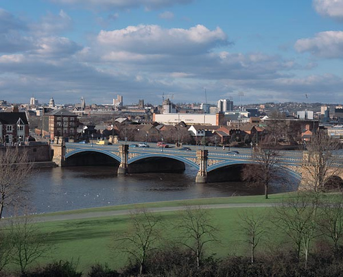
Nottingham city centre is the cultural, commercial, financial and historical heart of Nottingham, England. Nottingham's city centre represents the central area of the Greater Nottingham conurbation. The centre of the city is usually defined as the Old Market Square, one of the largest surviving town squares in the United Kingdom. Covering about 12,000 square metres, it is within the boundaries of the centuries-old Great Market Place, which covered about 22,000 square metres. A major redevelopment of the Old Market Square was completed in March 2007. Many of the main shopping streets abut the square, which is dominated by Nottingham's city hall. The building's landmark dome can be seen for miles around. Much of the ground floor of the building houses the Exchange Arcade, a boutique shopping centre. A Bohemian quarter of the city known as Hockley has gained popularity in recent years, situated close to the Lace Market area. The northwestern end of the city centre is hom ... [...More Info...] [...Related Items...] OR: [Wikipedia] [Google] [Baidu] |
Arnold, Nottinghamshire
Arnold () is a market town and unparished area in the Borough of Gedling in the ceremonial county of Nottinghamshire in the East Midlands of England. It is situated to the north-east of Nottingham's city boundary. Arnold has the largest town centre in the Borough of Gedling and the most important town centre in the northeastern part of the conurbation of Greater Nottingham. Gedling Borough Council is headquartered in Arnold. Since 1968 Arnold has had a market, and the town used to have numerous factories associated with the hosiery industry. Nottinghamshire Police have been headquartered in Arnold since 1979. At the time of the 2011 United Kingdom census, Arnold had a population of 37,768. Areas within Arnold include Daybrook, Woodthorpe, Redhill, Warren Hill, Killisick and Dorket Head. Toponymy Arnold was referred to as "Ernehale" in Domesday Book of 1086. This name meant 'place frequented by eagles' or 'the valley of eagles'. ''A History of Arnold'' (1913) by Rev ... [...More Info...] [...Related Items...] OR: [Wikipedia] [Google] [Baidu] |
Bulwell
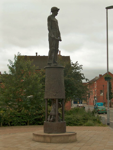
Bulwell is a market town in the City of Nottingham, in Nottinghamshire, England. It is south-west of Hucknall and to the north-west of Nottingham. The United Kingdom Census 2011 recorded the population of Bulwell at 29,771 which amounted to over 10 per cent of Nottingham city's population. The 2011 census gave a population of 16,157 for the Bulwell ward of Nottingham City Council. There is an adjacent ward, Bulwell Forest, which includes Highbury Vale, Rise Park and the west of Top Valley), its population at the same census being 13,614. History Early settlers The earliest documented settlements in Bulwell appeared around 800 AD, and were most likely built around the same time as the first local bridge across the River Leen. The river was significantly narrower, shallower and slower-moving in Bulwell than in other potential locations along its length, and the threat of highwaymen was a danger on existing cross-country routes; thus a toll bridge was constructed at Bulwell, ... [...More Info...] [...Related Items...] OR: [Wikipedia] [Google] [Baidu] |
Hucknall
Hucknall, formerly Hucknall Torkard, is a market town in the Ashfield district of Nottinghamshire, England. It lies 7 miles north of Nottingham, 7 miles south-east of Kirkby-in-Ashfield, 9 miles from Mansfield and 10 miles south of Sutton-in-Ashfield. It is the second largest town in the Ashfield district after Sutton-in-Ashfield. Hucknall is north-west of Nottingham, on the west bank of the Leen Valley, on land which rises from the Trent Valley in the south and extends northwards to Kirkby-in-Ashfield. The Whyburn or Town Brook flows through the town centre. Farleys Brook marks its southern boundary. Due to the mass amount of housing and industrial estates along the southside of the town. Hucknall is contiguous with the wider City of Nottingham with the suburbs of Bulwell and Bestwood Village both to the south and southeast. The town's highest point is Long Hill, at above sea level, with views over the city and Trent Valley, which descends to 22–24 metres (72– ... [...More Info...] [...Related Items...] OR: [Wikipedia] [Google] [Baidu] |


