|
Ranikot Fort
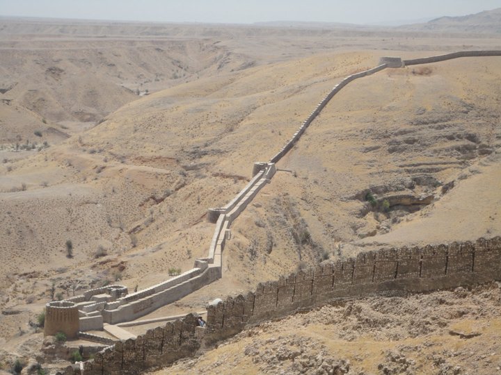
Ranikot Fort ( sd, راڻي ڪوٽ) (also known as Rannikot) is a historical Talpur fort near Sann, Jamshoro District, Sindh. in Pakistan .Ranikot Fort is also known as The Great Wall of Sindh and is believed to be the world's largest fort, with a circumference of approximately . The fort's ramparts have been compared to the Great Wall of China. The site was nominated in 1993 by the Pakistan National Commission for UNESCO world heritage status, and has since been on the tentative list of UNESCO World Heritage Sites. The fort is listed as a historical site under the Antiquities Act, 1975 and its subsequent amendments, and is provided protection. Location Ranikot Fort is to the north of Hyderabad on the indus highway (N55). There is also an easy access of about an hour's journey from Karachi to Sann on the Indus Highway. A diversion road, starting a little distance away from Sann, the nearest town, leads to the fort along a rugged road and reaches the eastern gate of the fort ... [...More Info...] [...Related Items...] OR: [Wikipedia] [Google] [Baidu] |
Jamshoro District
Jamshoro District ( sd, ضلعو ڄام شورو, ur, ), is a district of Sindh province, Pakistan. Jamshoro city is the capital while Kotri is the largest city of the Jamshoro District. The district borders Dadu district to the north. To the east, the Indus separates it from Nawab Shah, Matyari and Hyderabad districts. Thatta district lies to the south, and Karachi district to the south west. To the west, the Kheerthar Range separates it from the Sindh and Lasbela district of Baluchistan. Jamshoro District was split from Dadu District in 14th December 2004 It is situated on the west bank of River Indus. Geography The total geographical area of the district is 11,260 square kilometres. It is about 220 kilometers from north to south and about 100 kilometres wide from east to west. A 2 to 6 kilometres wide belt of the west bank of River Indus is cultivated and irrigated and the remaining land of the district is either hilly or cultivated. Agriculture is the main source of i ... [...More Info...] [...Related Items...] OR: [Wikipedia] [Google] [Baidu] |

