|
Route Nationale 19
The Route nationale 19 (N19) is a trunk road ( nationale) in north east France. The road forms part of European route E54. Reclassification The RN19 has been subsequently downgraded in several sections to the RD319 and RD619. Route Paris - Provins - Troyes - Chaumont - Langres - Vesoul - Belfort - Switzerland Paris to Troyes (0 to 148 km) The road starts as the Quai d'Ivry on the south bank of the river Seine south east of the City centre. The road crosses the river just downstream from the river Marne on the Pont d'Ivry. in a predominantly industrial area. The road then has a junction with the N6 (Paris to Lyon road at the Carrefour de la Résistance. The road then heads through the suburb of Maisons Alfort. After it crosses the A86 autoroute the road passes east of Créteil as the Avenue de Paris. The road passes south east through Bonneuil-sur-Marne and the Foret de Gros Bois. The road crosses the N104 (Paris outer ring road) and enters an area famous for its chee ... [...More Info...] [...Related Items...] OR: [Wikipedia] [Google] [Baidu] |
Route Nationale (France)
A ''route nationale'', or simply ''nationale'', is a class of trunk road in France. They are important roads of national significance which cross broad portions of the French territory, in contrast to departmental or communal roads which serve more limited local areas. Their use is free, except when crossing certain structures subject to a toll. They are open to all vehicles, except on certain sections having motorway ('' autoroute'') or express road (''voie express'') status, both of these categories being reserved for motorized vehicles only. France at one time had some 30,500 km of ''routes nationales'' and publicly owned motorways, but this figure has decreased with the transfer of the responsibility for many routes to the '' départements'' so that by 2010 the total length of motorways and other national roads was around 21,100 km. By way of comparison, ''routes départementales'' in the same year covered a total distance of 378,000 km. The layout of the ma ... [...More Info...] [...Related Items...] OR: [Wikipedia] [Google] [Baidu] |
Calais
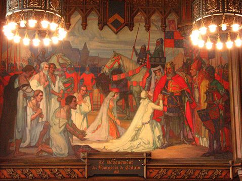
Calais ( , , traditionally , ) is a French port city in the Pas-de-Calais department, of which it is a subprefecture. Calais is the largest city in Pas-de-Calais. The population of the city proper is 67,544; that of the urban area is 144,625 (2020). and it is reflected in the city's name in the local Picard language, ''Calés''. Other archaic names for the city are Portuguese ''Calêsio'' and German ''Kalen''. ''Kales'', the city's historic name in Dutch and West Flemish (once spoken in the area) was retained until more recently in the name for the Strait of Dover, ''Nauw van Kales'', and is still used in Dutch sources wishing to emphasise former linguistic ties to the area. Though the modern French spelling of ''Calais'' gradually supplanted other variants in English, the pronunciation () persisted and survives in other towns named for the European city including Calais, Maine, and Calais, Vermont, in the United States. In " De Gustibus" (1855), Robert Browning r ... [...More Info...] [...Related Items...] OR: [Wikipedia] [Google] [Baidu] |
Besançon
Besançon (, ; , ; archaic ; ) is the capital of the Departments of France, department of Doubs in the region of Bourgogne-Franche-Comté. The city is located in Eastern France, close to the Jura Mountains and the border with Switzerland. Capital of the historic and cultural region of Franche-Comté, Besançon is home to the Bourgogne-Franche-Comté regional council headquarters, and is an important administrative centre in the region. It is also the seat of one of the fifteen French ecclesiastical provinces and one of the two 1st Armored Division (France), divisions of the French Army. In 2022 the city had a population of 120,057, in a metropolitan area of 284,474, the second in the region in terms of population. Established in a meander of the river Doubs (river), Doubs, the city was already important during the Gallo-Roman era under the name of ''Vesontio'', capital of the Sequani. Its geography and specific history turned it into a military stronghold, a garrison city, a p ... [...More Info...] [...Related Items...] OR: [Wikipedia] [Google] [Baidu] |
Saône
The Saône ( , ; ; ) is a river in eastern France (modern Regions of France, region of Bourgogne-Franche-Comté). It is a right tributary of the Rhône, rising at Vioménil in the Vosges (department), Vosges Departments of France, department and joining the Rhône in Lyon, at the southern end of the Presqu'île. Terminology The name derives from that of the Celtic mythology, Gallic river goddess Souconna (mythology), Souconna, which has also been connected with a local Celts, Celtic tribe, the Sequani, Sequanes. Monk, Monastic copyists progressively transformed ''Souconna'' to ''Saoconna'', which ultimately gave rise to . The other recorded ancient names for the river were and . The name ''Arar'' later gave rise to specific regional terms in historiography, created to designate various northern parts of History of Burgundy, historical Burgundy in relation to the river Saône. Depending on the point of view of a particular author, northern Burgundian lands were thus designated ... [...More Info...] [...Related Items...] OR: [Wikipedia] [Google] [Baidu] |
Alps
The Alps () are some of the highest and most extensive mountain ranges in Europe, stretching approximately across eight Alpine countries (from west to east): Monaco, France, Switzerland, Italy, Liechtenstein, Germany, Austria and Slovenia. The Alpine arch extends from Nice on the western Mediterranean Sea, Mediterranean to Trieste on the Adriatic Sea, Adriatic and Vienna at the beginning of the Pannonian Basin. The mountains were formed over tens of millions of years as the African and Eurasian tectonic plates collided. Extreme shortening caused by the event resulted in marine sedimentary rocks rising by thrust fault, thrusting and Fold (geology), folding into high mountain peaks such as Mont Blanc and the Matterhorn. Mont Blanc spans the French–Italian border, and at is the highest mountain in the Alps. The Alpine region area contains 82 peaks higher than List of Alpine four-thousanders, . The altitude and size of the range affect the climate in Europe; in the mountain ... [...More Info...] [...Related Items...] OR: [Wikipedia] [Google] [Baidu] |
Franche-Comté
Franche-Comté (, ; ; Frainc-Comtou dialect, Frainc-Comtou: ''Fraintche-Comtè''; ; also ; ; all ) is a cultural and Provinces of France, historical region of eastern France. It is composed of the modern departments of France, departments of Doubs (department), Doubs, Jura (department), Jura, Haute-Saône and the Territoire de Belfort. In 2021, its population was 1,179,601. From 1956 to 2015, the Franche-Comté was a Regions of France, French administrative region. Since 1 January 2016, it has been part of the new region Bourgogne-Franche-Comté. The region is named after the ' (Free County of Burgundy), definitively separated from the region of Burgundy proper in the fifteenth century. In 2016, these two-halves of the historic Kingdom of Burgundy were reunited, as the region of Bourgogne-Franche-Comté. It is also the 6th biggest region in France. The name "Franche-Comté" is feminine because the word "comté" in the past was generally feminine, although today it is masculine. ... [...More Info...] [...Related Items...] OR: [Wikipedia] [Google] [Baidu] |
A31 Autoroute
The A31 autoroute, also known as ''l'Autoroute de Lorraine-Bourgogne'', is a French motorway. The road runs from the Franco-Luxembourg border to Beaune where it joins the A6. The northern part of the autoroute is free, as far as the town of Toul, but is a toll road south of there. The autoroute serves the cities of Metz, Nancy, and Dijon and is heavily used in the holiday season as it is a convenient route for those travelling from Belgium, the Netherlands, Luxembourg, and Germany to the south of France France, officially the French Republic, is a country located primarily in Western Europe. Overseas France, Its overseas regions and territories include French Guiana in South America, Saint Pierre and Miquelon in the Atlantic Ocean#North Atlan .... Junctions Future There is a proposal to create a new autoroute, the A32, to relieve congestion on the A31 but the scheme is currently stalled owing to vigorous opposition. External linksA31 autoroute in Saratlas {{Authori ... [...More Info...] [...Related Items...] OR: [Wikipedia] [Google] [Baidu] |
Charles De Gaulle
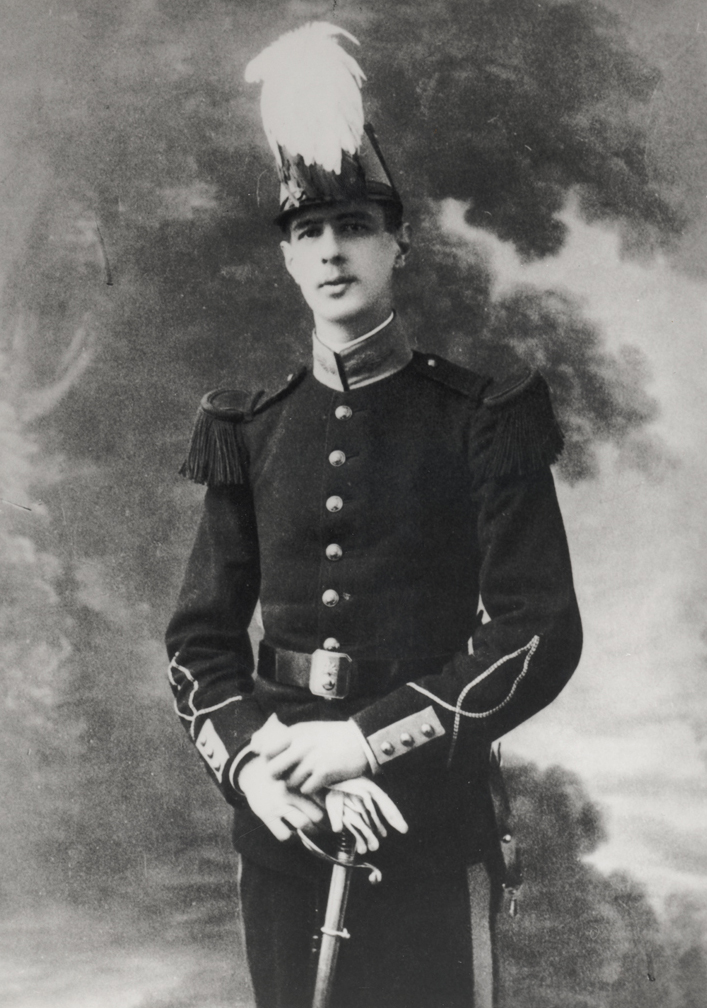
Charles André Joseph Marie de Gaulle (22 November 18909 November 1970) was a French general and statesman who led the Free France, Free French Forces against Nazi Germany in World War II and chaired the Provisional Government of the French Republic from 1944 to 1946 to restore democracy in France. In 1958, amid the May 1958 crisis in France, Algiers putsch, he came out of retirement when appointed Prime Minister of France, Prime Minister by President René Coty. He rewrote the Constitution of France and founded the French Fifth Republic, Fifth Republic after approval by 1958 French constitutional referendum, referendum. He was elected President of France later that year, a position he held until his resignation in 1969. Born in Lille, he was a decorated officer of World War I, wounded several times and taken prisoner of war (POW) by the Germans. During the interwar period, he advocated mobile armoured divisions. During the German invasion of May 1940, he led an armoured divisi ... [...More Info...] [...Related Items...] OR: [Wikipedia] [Google] [Baidu] |
Bar-sur-Aube
Bar-sur-Aube (, literally ''Bar on Aube (river), Aube'') is a Communes of France, commune and a Subprefectures in France, sub-prefecture in the Aube Departments of France, department in the Grand Est region of France. Surrounded by hills and Champagne vineyards, the city is traversed by the river Aube, from which it derives its name. The inhabitants of the commune are known as ''Baralbins'' or ''Baralbines'' and ''Barsuraubois'' or ''Barsurauboises''. The commune has been awarded three flowers by the ''National Council of Towns and Villages in Bloom'' in the ''Competition of cities and villages in Bloom''. Geography Bar-sur-Aube is located some 30 km west by north-west of Chaumont, Haute-Marne, Chaumont and 25 km south-east of Brienne-le-Château. Access to the commune is by the D619 road from Ailleville in the north-west which passes through the centre of the commune and the town before continuing east to Lignol-le-Château. The D396 branches off the D619 south-ea ... [...More Info...] [...Related Items...] OR: [Wikipedia] [Google] [Baidu] |
Aube (river)
The Aube () is a river in France, a right tributary of the Seine. It is long. The river gives its name to the Aube department. Its source is in the Haute-Marne department, on the plateau of Langres, near the town of Auberive. It flows through the departments of Haute-Marne, Côte-d'Or, Aube, and Marne. It flows into the river Seine near Marcilly-sur-Seine. Cities along the river include Bar-sur-Aube and Arcis-sur-Aube. Main tributaries * Aubette * Aujon * Landon * Voire * Ravet * Meldançon * Puits * Huitrelle * Herbissonne * Barbuise * Salon * Superbe Departments and towns crossed * Haute-Marne: Auberive * Côte-d'Or: Montigny-sur-Aube * Aube: Bar-sur-Aube, Brienne-le-Château, Ramerupt, Arcis-sur-Aube * Marne: Anglure See also * The Albian Age in the Cretaceous Period of geological time is named for the River Aube (after the Latin name for the river, Alba) * Rivers of France This is a list of rivers that are at least partially in France. The ri ... [...More Info...] [...Related Items...] OR: [Wikipedia] [Google] [Baidu] |
Dijon
Dijon (, ; ; in Burgundian language (Oïl), Burgundian: ''Digion'') is a city in and the Prefectures in France, prefecture of the Côte-d'Or Departments of France, department and of the Bourgogne-Franche-Comté Regions of France, region in eastern France. the Communes of France, commune had a population of 156,920. The earliest archaeological finds within the city limits of Dijon date to the Neolithic Period (geology), period. Dijon later became a Roman Empire, Roman settlement named ''Divio'', located on the road between Lyon and Paris. The province was home to the Duke of Burgundy, Dukes of Burgundy from the early 11th until the late 15th centuries, and Dijon became a place of tremendous wealth and power, one of the great European centres of art, learning, and science. The city has retained varied architectural styles from many of the main periods of the past millennium, including Capetian, Gothic architecture, Gothic, and Renaissance architecture, Renaissance. Many still-i ... [...More Info...] [...Related Items...] OR: [Wikipedia] [Google] [Baidu] |


