|
Queenstown, New Zealand
Queenstown ( mi, Tāhuna) is a resort town in Otago in the south-west of New Zealand's South Island. It has an urban population of The town is built around an inlet called Queenstown Bay on Lake Wakatipu, a long, thin, Z-shaped lake formed by glacial processes, and has views of nearby mountains such as The Remarkables, Cecil Peak, Walter Peak and just above the town, Ben Lomond and Queenstown Hill. The Queenstown-Lakes District has a land area of not counting its inland lakes Hāwea, Wakatipu, and Wānaka. The region has an estimated resident population of Neighbouring towns include Arrowtown, Glenorchy, Kingston, Wānaka, Alexandra, and Cromwell. The nearest cities are Dunedin and Invercargill. Queenstown is known for its commerce-oriented tourism, especially adventure and ski tourism. History Māori settlement and presence The area was discovered and first settled by Māori. Kāi Tahu say that the lake was dug by the Waitaha ancestor, Rākaihautū, with ... [...More Info...] [...Related Items...] OR: [Wikipedia] [Google] [Baidu] |
Resort Town
A resort town, often called a resort city or resort destination, is an urban area where tourism or vacationing is the primary component of the local culture and economy. A typical resort town has one or more actual resorts in the surrounding area. Sometimes the term ''resort town'' is used simply for a locale popular among tourists. One task force in British Columbia used the definition of an incorporated or unincorporated contiguous area where the ratio of transient rooms, measured in bed units, is greater than 60% of the permanent population. Generally, tourism is the main export in a resort town economy, with most residents of the area working in the tourism or resort industry. Shops and luxury boutiques selling locally themed souvenirs, motels, and unique restaurants often proliferate the downtown areas of a resort town. In the case of the United States, resort towns were created around the late 1800s and early 1900s with the development of early town-making.Crewe, Ka ... [...More Info...] [...Related Items...] OR: [Wikipedia] [Google] [Baidu] |
Inlet
An inlet is a (usually long and narrow) indentation of a shoreline, such as a small arm, bay, sound, fjord, lagoon or marsh, that leads to an enclosed larger body of water such as a lake, estuary, gulf or marginal sea. Overview In marine geography, the term "inlet" usually refers to either the actual channel between an enclosed bay and the open ocean and is often called an "entrance", or a significant recession in the shore of a sea, lake or large river. A certain kind of inlet created by past glaciation is a fjord, typically but not always in mountainous coastlines and also in montane lakes. Multi-arm complexes of large inlets or fjords may be called sounds, e.g., Puget Sound, Howe Sound, Karmsund (''sund'' is Scandinavian for "sound"). Some fjord-type inlets are called canals, e.g., Portland Canal, Lynn Canal, Hood Canal, and some are channels, e.g., Dean Channel and Douglas Channel Douglas Channel is one of the principal inlets of the British C ... [...More Info...] [...Related Items...] OR: [Wikipedia] [Google] [Baidu] |
Cromwell, New Zealand
Cromwell (Māori: ''Tīrau'') is a town in Central Otago in the Otago region of New Zealand. Geography Cromwell is between (linking to Wānaka, north, and Queenstown via the Kawarau Gorge, west) and State Highway 8 leading to the Lindis Pass, northeast, and Alexandra, 33 km south. The road to Alexandra winds through the Cromwell Gorge. A point near Cromwell lies 119 kilometres from the sea, the farthest from the sea anywhere in New Zealand. A prominent feature surrounding much of the town is the man-made Lake Dunstan. Nearby settlements are at Bannockburn, Lowburn, Tarras, and Ripponvale. Cromwell has a strategic location between the Lindis and the Haast passes, and acts as a hub between the towns of Wānaka, Queenstown and Alexandra. Cromwell is also the home of the Cromwell Chafer Beetle ''(Prodontria lewisi)''. The 45th parallel south runs just north of the township. Cromwell lay at the confluence of the Clutha River and the Kawarau River, which was ... [...More Info...] [...Related Items...] OR: [Wikipedia] [Google] [Baidu] |
Alexandra, New Zealand
Alexandra (Māori: ''Manuherikia'' or ''Areketanara'') is a town in the Central Otago district of the South Island of New Zealand. It is on the banks of the Clutha River (at the confluence of the Manuherikia River), on State Highway 8, by road from Dunedin and south of Cromwell. The nearest towns to Alexandra via state highway 8 are Clyde seven kilometers to the northwest and Roxburgh forty kilometers to the south. State highway 85 also connects Alexandra to Omakau, Lauder, Oturehua, Ranfurly and on to Palmerston on the East Otago coast. The town of Alexandra is home to people as of History The town was founded during the Central Otago goldrush in the 1860s, and was named after Alexandra of Denmark by John Aitken Connell who surveyed the town. In a two-month period in 1862, two gold miners called Horatio Hartley and Christopher Reilly collected 34 kilograms of gold from the Cromwell Gorge, Hartley and Reilly travelled together to New Zealand after meeting in the Calif ... [...More Info...] [...Related Items...] OR: [Wikipedia] [Google] [Baidu] |
Wānaka
Wānaka () is a popular ski and summer resort town in the Otago region of the South Island of New Zealand. At the southern end of Lake Wānaka, it is at the start of the Clutha River/Mata-Au and is the gateway to Mount Aspiring National Park. Wānaka is primarily a resort town with both summer and winter seasons. Its economy is based on the many outdoor opportunities this offers. Historically, Māori visited the Wānaka area to hunt and fish in summer, or on their way to seek ''pounamu'' (greenstone) on the West Coast. Ngāi Tahu abandoned their seasonal camps after a raid by a North Island war party in 1836. The current town was founded as Pembroke during the gold rush of the 19th century, and renamed to Wanaka in 1940. Along with the rest of the Queenstown-Lakes District, Wānaka is growing rapidly, with the population increasing by 50% between 2005 and 2015. Names ''Wānaka'' is the South Island dialect pronunciation of , which means 'sacred knowledge or a place of learn ... [...More Info...] [...Related Items...] OR: [Wikipedia] [Google] [Baidu] |
Kingston, New Zealand
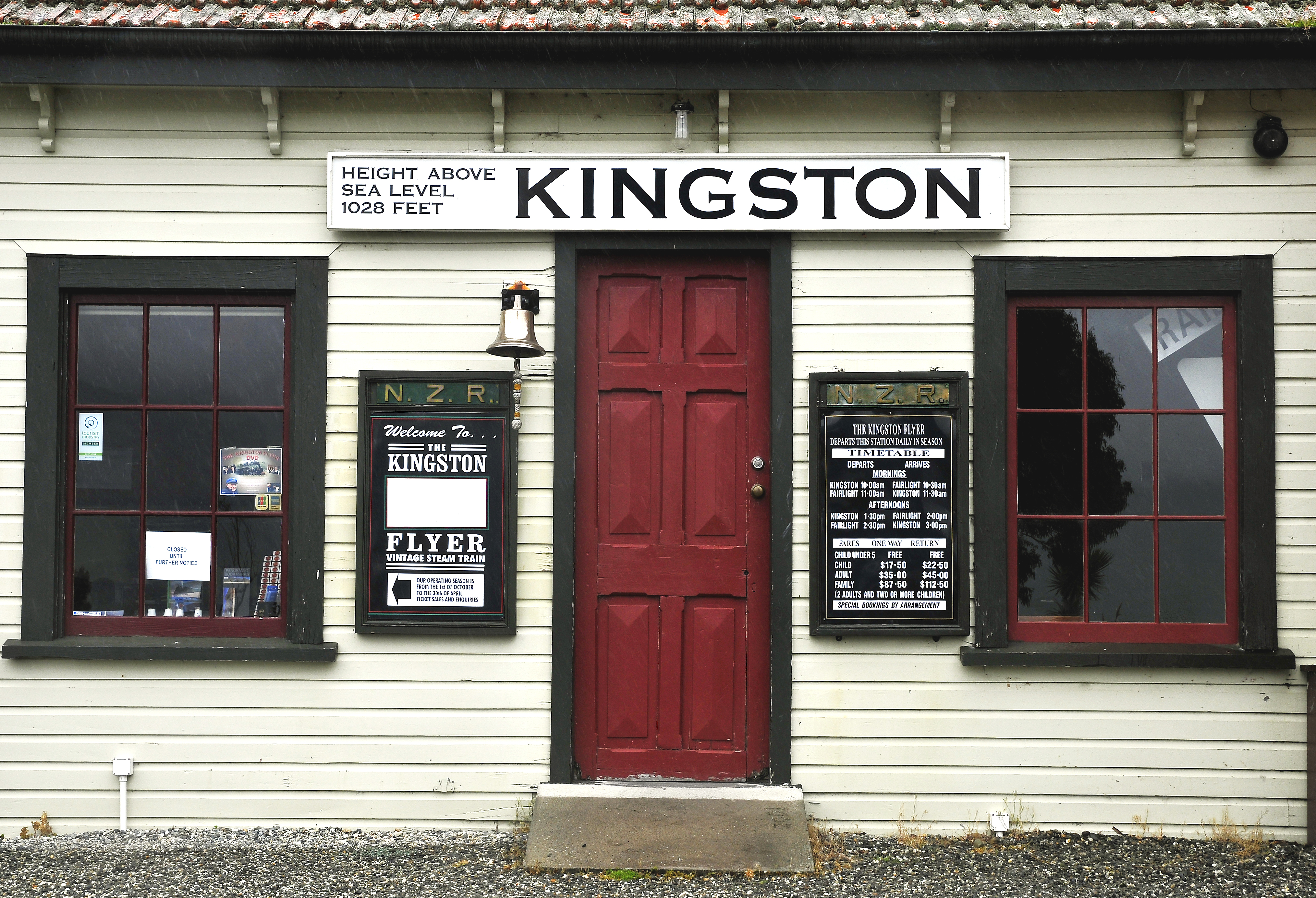
Kingston is a small town at the southernmost end of Lake Wakatipu, just north of the border of Otago and Southland, in New Zealand's South Island. It is 47 kilometres south of Queenstown by a road, "The Devil's Staircase", which winds between the lake to the west and The Remarkables mountains to the east. It is 70 kilometres north of Lumsden, and close to the headwaters of the Mataura River. History Kingston was originally named 'St Johns' after police commissioner St. John Branigan. Demographics Kingston is described by Statistics New Zealand as a rural settlement. It covers . It is part of the much larger Kingston statistical area. Kingston settlement had a population of 306 at the 2018 New Zealand census, an increase of 108 people (54.5%) since the 2013 census, and an increase of 159 people (108.2%) since the 2006 census. There were 135 households. There were 156 males and 150 females, giving a sex ratio of 1.04 males per female. The median age was 37.5 years (com ... [...More Info...] [...Related Items...] OR: [Wikipedia] [Google] [Baidu] |
Glenorchy, New Zealand
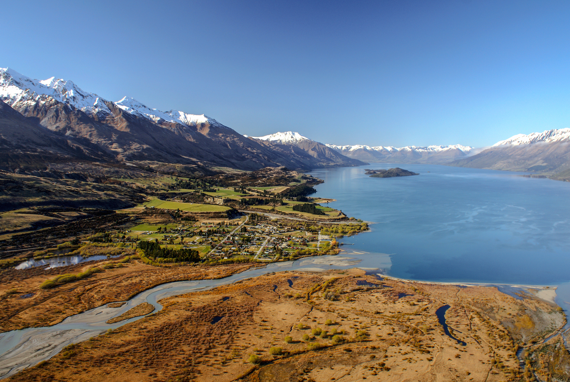
Glenorchy is a small settlement at the northern end of Lake Wakatipu in the South Island region of Otago, New Zealand. It is approximately by road or boat from Queenstown, the nearest large town. There are two pubs, a café and a range of small shops in the town catering mainly to tourists but also to the small resident population. There is also a small airstrip which caters to small planes. The locality of Paradise is nearby. The Dart River / Te Awa Whakatipu and Rees River flow into the head of Lake Wakatipu next to Glenorchy. Naming Glenorchy was named after Glen Orchy, a valley in Argyll, Scotland. Demographics Glenorchy is described by Statistics New Zealand as a rural settlement. It covers . It is part of the much larger Glenorchy statistical area. Glenorchy settlement had a population of 318 at the 2018 New Zealand census, an increase of 57 people (21.8%) since the 2013 census, and an increase of 126 people (65.6%) since the 2006 census. There were 129 househ ... [...More Info...] [...Related Items...] OR: [Wikipedia] [Google] [Baidu] |
Arrowtown
Arrowtown (Māori: ''Haehaenui'') is a historic gold mining town in the Otago region of the South Island of New Zealand. Arrowtown is located on the banks of the Arrow River approximately 7.5 km from State Highway 6. Arrowtown is located 19.5 kilometres to the east of Queenstown. As well as the route via State Highway 6 between Arrowtown and Queenstown, there is also road access directly to Queenstown via the Shotover Gorge and a third route via the picturesque Lake Hayes. There are many well preserved buildings that were used by the European and Chinese immigrants who settled during the town's gold mining era. History Gold was found in the Arrow River in 1862, and a township of 1,000 miners soon sprang up. It was initially named Fox's, based on William Fox's claim to have been first to find gold there, but was soon renamed Arrowtown. Chinese settlers, who first arrived in the 1870s in Arrowtown were forced to live in huts on the banks of Bush Creek. At the high poin ... [...More Info...] [...Related Items...] OR: [Wikipedia] [Google] [Baidu] |
Lake Wānaka
Lake Wānaka is New Zealand's fourth-largest lake and the seat of the town of Wānaka in the Otago region. The lake is 278 meters above sea level, covers , and is more than deep. "Wānaka" is the South Island dialect pronunciation of , which means "the lore of the tohunga or priest" or a place of learning. Geography Geography Lake Wānaka lies at the heart of the Otago Lakes in the lower South Island of New Zealand. The township of Wānaka, which sits in a glacier-carved basin on the shores of the lake, is the gateway to Mt Aspiring National Park. Lake Hāwea is a 15-minute drive away, en route to the frontier town of Makarora, the last stop before the West Coast Glacier region. To the south is the historic Cardrona Valley, a popular scenic alpine route to neighbouring Queenstown. Geology Lake Wānaka lies in a u-shaped valley formed by glacial erosion during the last ice age more than 10,000 years ago. It is fed by the Mātukituki and Makarora Rivers, and is the sou ... [...More Info...] [...Related Items...] OR: [Wikipedia] [Google] [Baidu] |
Lake Hāwea
Lake Hāwea is New Zealand's ninth largest lake. The lake is in the Otago Region at an altitude of 348 metres. It covers 141 km² and reaches 392 metres deep. Lake Hāwea is named after a Māori tribe who preceded the Waitaha people in the area. Lake Hāwea stretches 35 kilometres from north to south. It lies in a glacial valley formed during the last ice age, and is fed by the Hunter River. Nearby Lake Wānaka lies in a parallel glacial valley eight kilometres to the west. At their closest point, a rocky ridge called The Neck, the lakes are only 1000 metres apart. Lake Hāwea is dammed to the south by an ancient terminal moraine created some 10,000 years ago. In 1958 the lake was artificially raised 20 metres to store more water for increased hydroelectric power generation at the Roxburgh Dam. The only flat land around the lake is at its southern end, surrounding its outflow into the Hāwea River, a short tributary of the Clutha / Matau-au, which it joins near ... [...More Info...] [...Related Items...] OR: [Wikipedia] [Google] [Baidu] |
Queenstown Hill
Queenstown Hill, also known by its Māori name of Te Tapu-nui (mountain of intense sacredness), is a small mountain near Queenstown, New Zealand in the South Island. The lower levels of the hill contain housing especially near Queenstown, Frankton Road and Marina Heights. Midway up the hill is a large forest of mainly douglas fir and larch, while the top is largely clear and the ground cover is that of tussock and native vegetation. Queenstown Hill is also home to a farm consisting of 1800 sheep which is owned and operated by the Middletons who purchased the lease in 1963 and freeholded the land in 1978. The Queenstown Hill Time Walk is part of the land owned by the Middletons. Queenstown Hill Time Walk The Time Walk is a walk on the Queenstown Hill that was created to mark the Millennium in the year 2000. The entrance to the trail is on Belfast Terrace. At the start of the walk is a wrought iron gate which shows symbols of the local area. There are many panels along the wa ... [...More Info...] [...Related Items...] OR: [Wikipedia] [Google] [Baidu] |
Walter Peak, New Zealand
Walter Peak is a mountain located near Queenstown, New Zealand. It has a height of . It is regularly visited by the TSS Earnslaw steamship, which takes passengers to the base of the mountain to visit the Walter Peak High Country Farm. The Colonel's homestead, close to the steamships destination, is also popular and serves lunch and dinner. See also *List of mountains of New Zealand by height The following are lists of mountains in New Zealand ordered by height. Names, heights, topographic prominence and isolation, and coordinates were extracted from the official Land Information New Zealand (LINZ) Topo50 topographic maps at thin ... References External linksTSS Earnslaw and Walter Peak High Country Farm Mountains of Otago Queenstown-Lakes District Southern Alps {{Otago-geo-stub ... [...More Info...] [...Related Items...] OR: [Wikipedia] [Google] [Baidu] |
.jpg)


