|
Primorsko
Primorsko ( ) is a town and seaside resort in southeastern Bulgaria, the capital of the municipality of the same name, and part of Burgas Province. A well-known resort on the Bulgarian Black Sea Coast, it is located 52 km south of Burgas and has a beach strip of about 1 km2. The average temperature is 29 °C in July, often reaching 30-33 °C and making Primorsko a favourable place for tourism. Seawater temperature in July and August is 27-28 °C. Primorsko enjoys more than 2,300 sunshine hours a year, mostly in summertime. The rivers Ropotamo and Dyavolska reka run close to the town. The Ropotamo nature reserve and Snake Island reserve are also nearby.Dimitrov D. P., G. Georgiev. 2024. Engineering Geological and Hydrotechnical conditions of Primorsko Fishing Port, SE Bulgaria. Engineering Geology and Hydrogeology, 38, 37–51. doibr>10.52321/igh.38.1.37/ref> History Remains of stone anchors from the second half of the 2nd millennium and the 1st millenn ... [...More Info...] [...Related Items...] OR: [Wikipedia] [Google] [Baidu] |
Primorsko Municipality
Primorsko Municipality ( Bulgarian: Община Приморско, ''Obshtina Primorsko'') is a municipality in Burgas Province, Bulgaria. It includes the towns of Primorsko Primorsko ( ) is a town and seaside resort in southeastern Bulgaria, the capital of the municipality of the same name, and part of Burgas Province. A well-known resort on the Bulgarian Black Sea Coast, it is located 52 km south of Burgas and ... and Kiten, as well as a number of villages. Demographics Religion According to the latest Bulgarian census of 2011, the religious composition, among those who answered the optional question on religious identification, was the following: References External links * Municipalities in Burgas Province {{Burgas-geo-stub ... [...More Info...] [...Related Items...] OR: [Wikipedia] [Google] [Baidu] |
Burgas Province
Burgas (, formerly the Burgas okrug) is a province in southeastern Bulgaria on the southern Bulgarian Black Sea Coast. The province is named after its administrative and industrial centre, the city of Burgas, the fourth biggest town in the country. It is the largest province by area, with a territory of Bulgarian Provinces area and population 1999 — National Center for Regional Development — page 90-91 that is divided into 13 municipalities. It has a total population, as of December 2009, of 422,319 inhabitants. ... [...More Info...] [...Related Items...] OR: [Wikipedia] [Google] [Baidu] |
Kiten, Burgas Province
Kiten ( ) is a seaside resort town on the Bulgarian Black Sea Coast, part of Burgas Province. It is situated on the small Urdoviza peninsula, near the mouth of the Kiten River, and has two beaches: Atliman and Urdoviza. Until the Balkan Wars in 1912–1913, there was only an unmanned pier used to export wood and charcoal on the site. Kiten was founded in 1931 by 30 families of Bulgarian refugees from Eastern Thrace who resettled there from the newly founded refugee village of Fazanovo. However, the area has roots from antiquity, as amphoras from the 6th century BCE were found on the south beach (Urdoviza). Kiten was declared a national resort in 1962, and since 1981 it had been administratively a quarter of nearby Primorsko. On 17 June 2005, the former village was proclaimed a separate town in order to more effectively cope with the growing number of tourists, primarily from Bulgaria, Romania, Czech Republic, Slovakia, Poland, Serbia, Russia and Germany. Geography The town of Ki ... [...More Info...] [...Related Items...] OR: [Wikipedia] [Google] [Baidu] |
Dyavolska Reka
The Dyavolska reka (, "devil's river") is a 37 km long river in Burgas Province, southeastern Bulgaria. The river originates under the name Dudenska reka from a spring at an altitude of 440 m, southeast of the summit of Chukara (466 m) in the Bosna Ridge of the Strandzha mountain range. It flows in northeastern direction though a forested valley until the village of Yasna polyana. Downstream of the village it turns east and forms a wide swampy valley until its mouth in a dike-protected riverbed. It flows into the Black Sea at the town of Primorsko. The marshy area at is mouth is known as Dyavolsko blato (, "devil's swamp"), covered by common reed ("Phragmites australis"). The swamp is fed by a freshwater spring, has an area of 2.7 km2 and depth up to 3 m. Its drainage basin covers a territory of 133 km2 and borders the drainage basins of the Ropotamo to the north and west, the Veleka to the southwest, and the Karaagach to the south and southeast, ... [...More Info...] [...Related Items...] OR: [Wikipedia] [Google] [Baidu] |
Bulgarian Black Sea Coast
The Bulgarian Black Sea Coast (), also known as the Bulgarian Riviera, covers the entire eastern bound of Bulgaria stretching from the Romanian Black Sea resorts in the north to European Turkey in the south, along 378 km of coastline. White and golden sandy beaches occupy approximately 130 km of the 378 km long coast. The region is an important center of tourism during the summer season (May–October), drawing millions of foreign and local tourists alike and constituting one of the country's most popular tourist destinations. Prior to 1989 the Bulgarian Black Sea coast was internationally known as the ''Red Riviera''. Since the fall of the Iron Curtain, however, its nickname has been changed to the ''Bulgarian Riviera''. The Bulgarian Black Sea Coast has a humid subtropical climate (Köppen climate classification ''Cfa''), with considerable maritime and continental influences. The area's average air temperature in the summer is about 28 °C ... [...More Info...] [...Related Items...] OR: [Wikipedia] [Google] [Baidu] |
Ropotamo
The Ropotamo ( , from the Ancient Greek language, Ancient Greek word Ροπόταμος ''ropotamos'' meaning "border river") is a river in south-eastern Bulgaria. It takes its source from the Bosna (ridge), Bosna Ridge in the Strandzha Mountains, running for 48.5 km to empty into the Black Sea near Cape Saint Demetrius between Dyuni and Primorsko. The river is most often noted for its 30 m-wide mouth that is home to an abundance of flora species, over 100 of which endangered in the country. The lower section of the river is a List of protected areas of Bulgaria, protected area since 1940 and forms part of the Ropotamo Reserve. The lower Ropotamo is a popular tourist attraction because of the Nymphaeaceae, water lilies and the rock formations above the river, on some of which white-tailed eagles nest. Ropotamo Glacier on Livingston Island in the South Shetland Islands, Antarctica is named after Ropotamo River. Geography Under the name Tserovska River, the Ropotamo ori ... [...More Info...] [...Related Items...] OR: [Wikipedia] [Google] [Baidu] |
Municipalities Of Bulgaria
The 28 Provinces of Bulgaria, provinces of Bulgaria are divided into 265 municipalities (община, ''obshtina''). Municipalities typically comprise multiple towns, villages and settlements and are governed by a mayor who is elected by popular majority vote for a four-year term, and a municipal council which is elected using proportional representation for a four-year term. The creation of new municipalities requires that they must be created in a territory with a population of at least 6,000 and created around a designated settlement. They must also be named after the settlement that serves as the territory's administrative center, among other criteria. The council of a municipality is further permitted to create administrative subdivisions: mayoralties (''kmetstvo''), settlements (''naseleno myasto''), and wards or quarters (''rayon''). Mayoralties are overseen by elected mayors and typically comprises one or more villages or towns; they must contain a population of at leas ... [...More Info...] [...Related Items...] OR: [Wikipedia] [Google] [Baidu] |
Seaside Resort
A seaside resort is a city, resort town, town, village, or hotel that serves as a Resort, vacation resort and is located on a coast. Sometimes the concept includes an aspect of an official accreditation based on the satisfaction of certain requirements such as in the German ''Seebad''. Where a beach is the primary focus for tourists, it may be called a beach resort. History Seaside resorts have existed since antiquity. In Ancient Rome, Roman times, the town of Baiae by the Tyrrhenian Sea in Italy was a resort for those who were sufficiently prosperous. Barcola by the Adriatic Sea in northern Italy with its Roman luxury villas is considered a special example of ancient leisure culture by the sea. Mersea Island in Essex, England was a seaside holiday destination for wealthy ancient Romans living in Colchester. The development of the beach as a popular leisure resort from the mid-19th century was the first manifestation of what is now the global tourist industry. The first seasi ... [...More Info...] [...Related Items...] OR: [Wikipedia] [Google] [Baidu] |
Strandzha
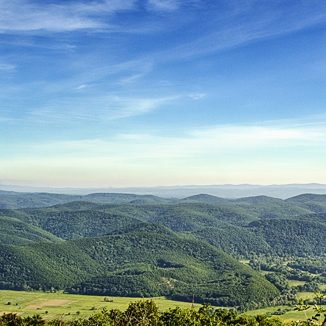
Strandzha (, also transliterated as ''Strandja'', ; , or ) is a mountain massif in southeastern Bulgaria and East Thrace, the European part of Turkey. It is in the southeastern part of the Balkans between the plains of Thrace to the west, the lowlands near Burgas to the north, and the Black Sea to the east. Its highest peak is Mahya Dağı (, ''Mahiada'') () in Turkey, while the highest point on Bulgarian territory is Golyamo Gradishte () (). The total area is approximately . Geography and climate The climate of the area is considerably influenced by the Black Sea and is predominantly humid continental in the mountains and humid subtropical at the coast. Major rivers in the area are the Veleka ( long) and the border river Rezovska ( long). Strandzha Nature Park Strandzha Nature Park, established in 1995 in the Bulgarian part of the massif, is the largest protected area in Bulgaria. In size it is , or about 1% of Bulgaria's total territory. The İğneada Floodplain Fo ... [...More Info...] [...Related Items...] OR: [Wikipedia] [Google] [Baidu] |
Constantinople
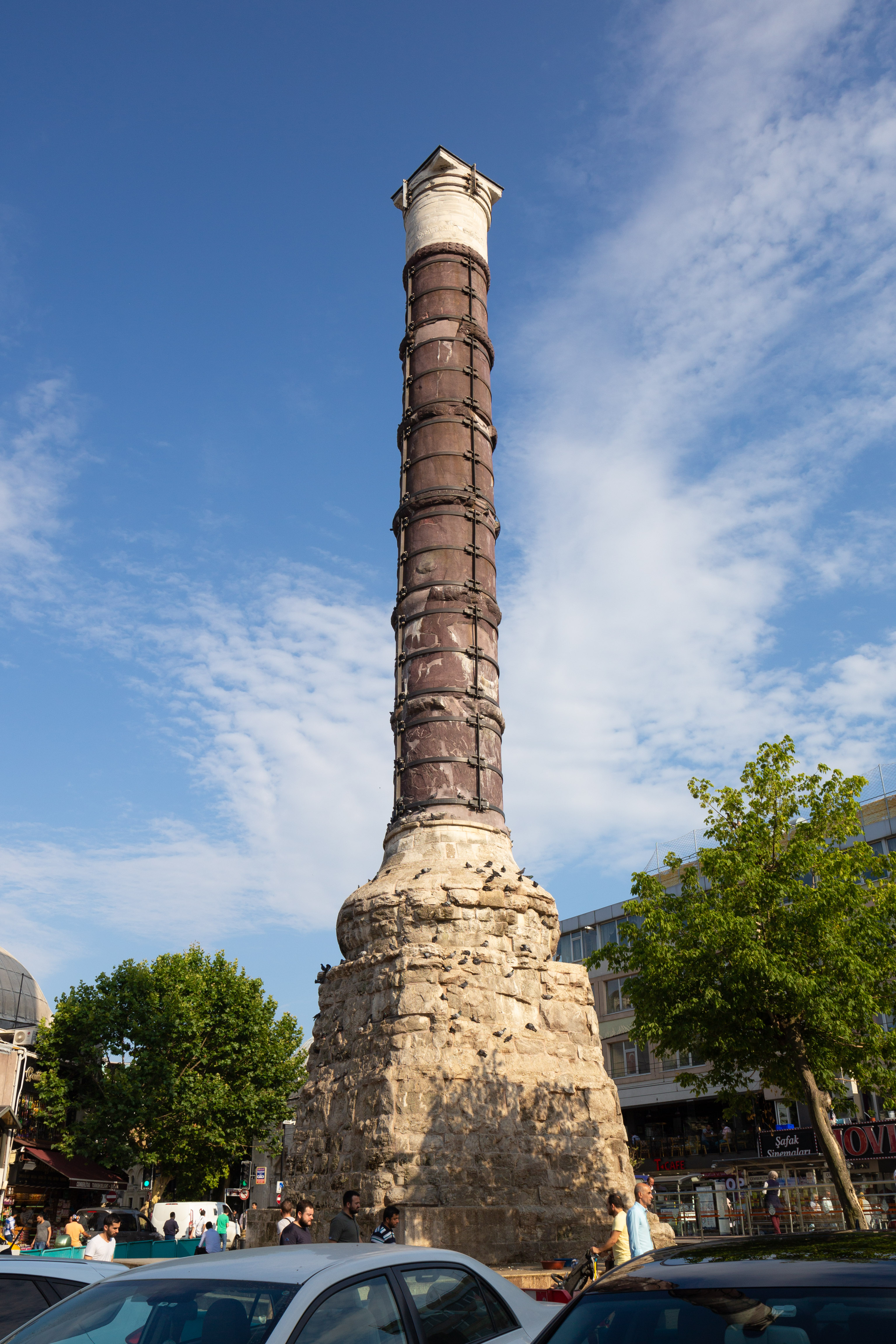
Constantinople (#Names of Constantinople, see other names) was a historical city located on the Bosporus that served as the capital of the Roman Empire, Roman, Byzantine Empire, Byzantine, Latin Empire, Latin, and Ottoman Empire, Ottoman empires between its consecration in 330 until 1930, when it was renamed to Istanbul. Initially as New Rome, Constantinople was founded in 324 during the reign of Constantine the Great on the site of the existing settlement of Byzantium, and shortly thereafter in 330 became the capital of the Roman Empire. Following the collapse of the Western Roman Empire in the late 5th century, Constantinople remained the capital of the Eastern Roman Empire (also known as the Byzantine Empire; 330–1204 and 1261–1453), the Latin Empire (1204–1261), and the Ottoman Empire (1453–1922). Following the Turkish War of Independence, the Turkish capital then moved to Ankara. Although the city had been known as Istanbul since 1453, it was officially renamed as Is ... [...More Info...] [...Related Items...] OR: [Wikipedia] [Google] [Baidu] |
Zabernovo
Zabernovo () is a village in Malko Tarnovo Municipality, in Burgas Province, in southeastern Bulgaria. Accessed May 5, 2010 It is situated in . Paroria, a forest known for being the 14th-century monastic site of the , is located just to the west of Zabernovo. Honours [...More Info...] [...Related Items...] OR: [Wikipedia] [Google] [Baidu] |


