|
Piarere
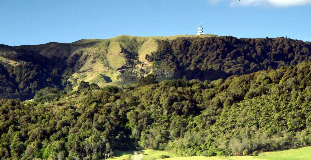
Piarere is a locality in the Waikato region of New Zealand's North Island. It is situated on State Highway 29 close to its junction with State Highway 1, close to the shore of Lake Karapiro. The nearest towns are Tīrau, six kilometres to the southeast, Matamata, 10 kilometres to the northeast, and Cambridge, 10 kilometres to the northwest. The meaning of the settlement's name is uncertain, as ''piarere'' may be translated from Māori in numerous ways, but it is possibly a personal name. The Hinuera Gap, a geological feature stretching northeast of Piarere, was in prehistoric times the path of the Waikato River, which had its outlet in the Firth of Thames. The river's course was altered to its current outflow by the massive eruption of Lake Taupo 25,000 years ago. Demographics Piarere locality covers . It is part of the larger Tīrau statistical area. Piarere had a population of 423 in the 2023 New Zealand census, an increase of 27 people (6.8%) since the 2018 census, and ... [...More Info...] [...Related Items...] OR: [Wikipedia] [Google] [Baidu] |
Waikato River
The Waikato River is the longest river in New Zealand, running for through the North Island. It rises on the eastern slopes of Mount Ruapehu, joining the Tongariro River system and flowing through Lake Taupō, New Zealand's largest lake. It then drains Taupō at the lake's northeastern edge, creates the Huka Falls, and flows northwest through the Waikato Plains. It empties into the Tasman Sea south of Auckland, at Port Waikato. It gives its name to the Waikato region that surrounds the Waikato Plains. The present course of the river was largely formed about 17,000 years ago. Contributing factors were climate warming, forest being reestablished in the river headwaters and the deepening, rather than widening, of the existing river channel. The channel was gradually eroded as far up river as Piarere, leaving the old Hinuera channel through the Hinuera Gap high and dry. The remains of the old course are seen clearly at Hinuera, where the cliffs mark the ancient river edges. The Wai ... [...More Info...] [...Related Items...] OR: [Wikipedia] [Google] [Baidu] |
New Zealand State Highway 29
State Highway 29 (SH 29) is a New Zealand state highway that travels over the Kaimai Ranges linking the Bay of Plenty and Waikato regions. For most of its length, SH 29 is a two-lane single carriageway with occasional passing lanes and slow vehicle bays. 5 km of it near its eastern terminus is part of the Takitimu Drive Toll Road. Route SH 29 begins at SH 2 at a grade separated intersection at which only westbound SH 2 traffic can enter and eastbound traffic can exit. Immediately after it commences, SH 29 becomes the Takitimu Drive (Pyes Pa – Mount Maunganui Expressway) Toll Road. Before the eastern terminus was shifted to this route it was better known as 'Route K'. At the end of this tolled section, SH 29 reaches a roundabout intersecting the former eastern section (now SH 29A) and . SH 29 turns west through the village of Tauriko. From here SH 29 roughly follows the Wairoa River as it climbs the Kaimai Ranges. About a quarter of the way up the Kaimai's, SH 29 ... [...More Info...] [...Related Items...] OR: [Wikipedia] [Google] [Baidu] |
State Highway 1 (New Zealand)
State Highway 1 (SH 1) is the longest and most significant road in the New Zealand road network, running the length of both main islands. It appears on road maps as SH 1 and on road signs as a white number 1 on a red shield, but it has the official designations SH 1N in the North Island, SH 1S in the South Island. SH 1 is long, in the North Island and in the South Island. Since 2010 new roads have reduced the length from . For the majority of its length it is a two-lane single carriageway, with at-grade intersections and property accesses, in both rural and urban areas. These sections have some passing lanes. Around of SH 1 is of motorway or expressway standard : in the North Island and in the South Island. Route North Island (SH 1N) SH 1 starts at Cape Reinga, at the northwestern tip of the Aupōuri Peninsula, and since April 2010 has been sealed (mainly with either chipseal or asphalt) for its entire length. From Waitiki Landing south of Cape Reinga, SH 1 t ... [...More Info...] [...Related Items...] OR: [Wikipedia] [Google] [Baidu] |
South Waikato District
South Waikato District is a Territorial authorities of New Zealand, local government district in the Waikato, Waikato Region of the North Island of New Zealand. It is located between the cities of Hamilton, New Zealand, Hamilton to the north, Rotorua to the east, Taupō to the south and Ruapehu District to the west. The seat of the South Waikato District Council is at Tokoroa, the biggest town. The other main towns are Putāruru, Tīrau and Arapuni. Populated places South Waikato District consists of the following towns, localities, settlements and communities: * Putaruru Ward: ** ''Arahiwi West'' ** Arapuni ** ''Hodderville, New Zealand, Hodderville'' ** Lichfield, New Zealand, Lichfield ** Ngatira ** ''North Putāruru'' ** ''Pinedale, New Zealand, Pinedale'' ** ''Puketurua'' ** Putāruru ** Waotu * Tirau Ward: ** Okoroire ** ''Piarere'' ** Tapapa ** Tīrau ** ''Waiomou'' * Tokoroa Ward: ** Kinleith ** ''North Tokoroa'' ** ''Te Whetu'' ** Tokoroa ** ''Ātiamuri, Upper Ātia ... [...More Info...] [...Related Items...] OR: [Wikipedia] [Google] [Baidu] |
Hinuera Gap
Hinuera is a settlement in the Waikato Region of New Zealand's North Island. It is located along State Highway 29, approximately halfway between the cities of Hamilton and Tauranga. It also contains the Hinuera cliffs along State Highway 29. Hinuera had a butter factory from 1922 to 1987. Electric street lights were introduced in 1923. Demographics Hinuera settlement and its surrounds cover . The SA1 area is part of the larger Hinuera statistical area. Hinuera had a population of 162 in the 2023 New Zealand census, unchanged since the 2018 census, and an increase of 9 people (5.9%) since the 2013 census. There were 84 males and 75 females in 66 dwellings. 1.9% of people identified as LGBTIQ+. The median age was 34.8 years (compared with 38.1 years nationally). There were 36 people (22.2%) aged under 15 years, 27 (16.7%) aged 15 to 29, 69 (42.6%) aged 30 to 64, and 27 (16.7%) aged 65 or older. People could identify as more than one ethnicity. The results were 88.9% E ... [...More Info...] [...Related Items...] OR: [Wikipedia] [Google] [Baidu] |
LGBTQ
LGBTQ people are individuals who are lesbian, Gay men, gay, bisexual, transgender, queer, or questioning (sexuality and gender), questioning. Many variants of the initialism are used; LGBTQIA+ people incorporates intersex, Asexuality, asexual, Aromanticism, aromantic, agender, and other individuals. The group is generally conceived as broadly encompassing all individuals who are part of a Sexual and gender minorities, sexual or gender minority, including all Sexual orientation, sexual orientations, romantic orientations, gender identities, and sex characteristics that are Non-heterosexual, not heterosexual, heteroromantic, cisgender, or endosex, respectively. Scope and terminology A broad array of sexual and gender minority identities are usually included in who is considered LGBTQ. The term ''gender, sexual, and romantic minorities'' is sometimes used as an alternative umbrella term for this group. Groups that make up the larger group of LGBTQ people include: * People with a ... [...More Info...] [...Related Items...] OR: [Wikipedia] [Google] [Baidu] |
2013 New Zealand Census
The 2013 New Zealand census was the thirty-third national census. "The National Census Day" used for the census was on Tuesday, 5 March 2013. The population of New Zealand was counted as 4,242,048 – an increase of 214,101 or 5.3% over the 2006 census. The 2013 census forms were the same as those developed for the 2011 census which was cancelled due to the February 2011 major earthquake in Christchurch. There were no new topics or questions. New Zealand's next census was conducted in March 2018. Collection methods The results from the post-enumeration survey showed that the 2013 census recorded 97.6 percent of the residents in New Zealand on census night. However, the overall response rate was 92.9 percent, with a non-response rate of 7.1 percent made up of the net undercount and people who were counted in the census but had not received a form. Results Population and dwellings Population counts for New Zealand regions. Note: All figures are for the census usually resid ... [...More Info...] [...Related Items...] OR: [Wikipedia] [Google] [Baidu] |
2018 New Zealand Census
The 2018 New Zealand census, which took place on Tuesday 6 March 2018, was the thirty-fourth national census in New Zealand. The population of New Zealand was counted as 4,699,755 – an increase of 457,707 (10.79%) over the 2013 census. Results from the 2018 census were released to the public on 23 September 2019, from the Statistics New Zealand website. The most recent New Zealand census was held in March 2023. History Background The ''Census Act 1877'' required censuses to be held every fifth year and is well embedded in legislation and government systems. Since 1881, censuses have been held every five years, with the exceptions of those in 1931 and 1941 and the one in 2011 which was cancelled due to the February 2011 earthquake in Christchurch, which displaced many Canterbury residents from their homes only a few weeks before census day. It was rescheduled for March 2013, so the 2013 census is the previous census completed before this one. Issues and controversies In Ju ... [...More Info...] [...Related Items...] OR: [Wikipedia] [Google] [Baidu] |
2023 New Zealand Census
The 2023 New Zealand census, which took place on 7 March 2023, was the thirty-fifth national census in New Zealand. It implemented measures that aimed to increase the Census' effectiveness in response to the issues faced with the 2018 census, including supporting Māori to complete the census. It also included new questions on topics such as gender, sexual identity, and disabilities/health conditions. The first Census data was published on 29 May 2024, in a range of data products and services. Conducting the census The 2023 census can be completed online or on paper forms. Forms with an access code were mailed out to householders from 20 February, but paper forms could be requested online or by telephone. The telephone number had operators speaking English, te reo Māori, Samoan, Tongan, Korean, Mandarin, Cantonese, Hindi, and Punjabi. New Zealand Sign Language was available through NZ Relay. One dwelling form was required for each household, and one individual form was requi ... [...More Info...] [...Related Items...] OR: [Wikipedia] [Google] [Baidu] |
Oruanui Eruption
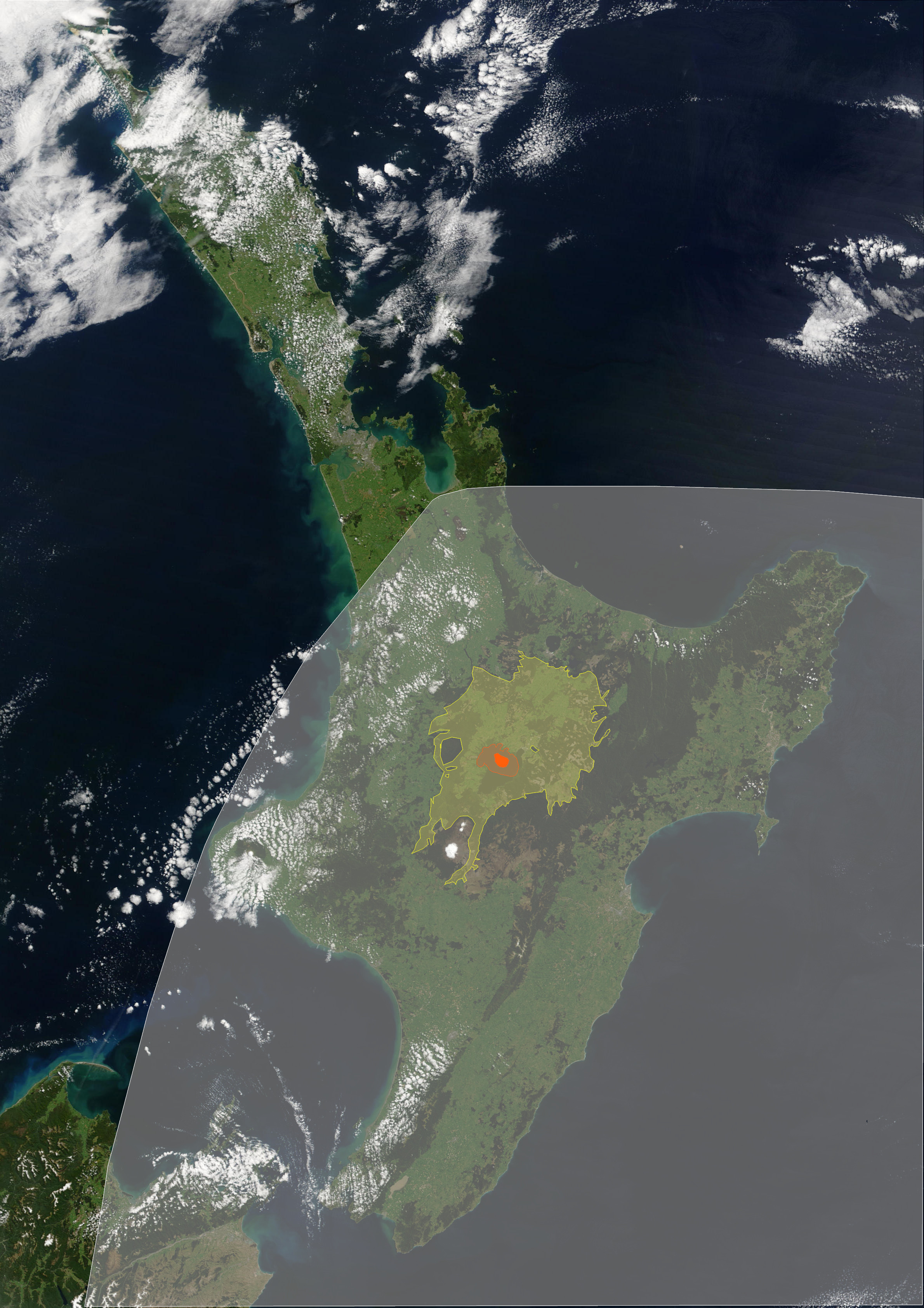
The Oruanui eruption (also known as the Kawakawa eruption or Kawakawa/Oruanui event) of Taupō Volcano in New Zealand around 25,700 years before present was the world's most recent supereruption, and its largest phreatomagmatic eruption characterised to date. Geography At the time of the eruption, the sea level was much lower than at present, and for over 100,000 years the Taupō Volcano had been mainly under Lake Huka, a larger lake than the present Lake Taupō. Lake Huka was destroyed in the eruption, and other features of the local geography were changed significantly as outlined below. Eruption With a Volcanic Explosivity Index of 8, it is one of the largest eruptions ever to occur in New Zealand and the most recent supereruption. It occurred years BP in the Late Pleistocene. It generated approximately of pyroclastic fall deposits, of pyroclastic density current (PDC) deposits (mostly ignimbrite), and of primary intracaldera material, equivalent to of rhyolitic m ... [...More Info...] [...Related Items...] OR: [Wikipedia] [Google] [Baidu] |
Firth Of Thames
The Firth of Thames () is a large bay located in the north of the North Island of New Zealand. It is the firth of the rivers Waihou and Piako, the former of which was formerly named the Thames River, and the town of Thames lies on its southeastern coast. Its Maori name is ''Tikapa''. In traditional legend, the firth and the greater Hauraki Gulf are protected by a taniwha named Ureia, who takes the form of a whale. The firth lies at the southern end of the Hauraki Gulf, southeast of the city of Auckland. It occupies a rift valley or graben between the Coromandel Peninsula and Hunua Ranges, which continues into the Hauraki Plains to the south. Conservation The Firth of Thames is an important site for waders or shorebirds, and is listed as a wetland of international importance under the Ramsar Convention. The Miranda Shorebird Centre, operated by the Miranda Naturalists' Trust, is located on the Seabird Coast, on the western shore of the bay at Miranda. However, the f ... [...More Info...] [...Related Items...] OR: [Wikipedia] [Google] [Baidu] |
Māori Language
Māori (; endonym: 'the Māori language', commonly shortened to ) is an Eastern Polynesian languages, Eastern Polynesian language and the language of the Māori people, the indigenous population of mainland New Zealand. The southernmost member of the Austronesian language family, it is related to Cook Islands Māori, Tuamotuan language, Tuamotuan, and Tahitian language, Tahitian. The Māori Language Act 1987 gave the language recognition as one of New Zealand's official languages. There are regional dialects of the Māori language. Prior to contact with Europeans, Māori lacked a written language or script. Written Māori now uses the Latin script, which was adopted and the spelling standardised by Northern Māori in collaboration with English Protestant clergy in the 19th century. In the second half of the 19th century, European children in rural areas spoke Māori with Māori children. It was common for prominent parents of these children, such as government officials, to us ... [...More Info...] [...Related Items...] OR: [Wikipedia] [Google] [Baidu] |


