|
Patayamatebele
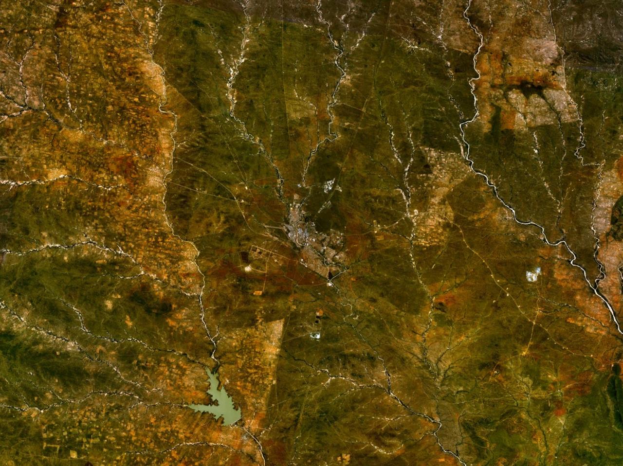
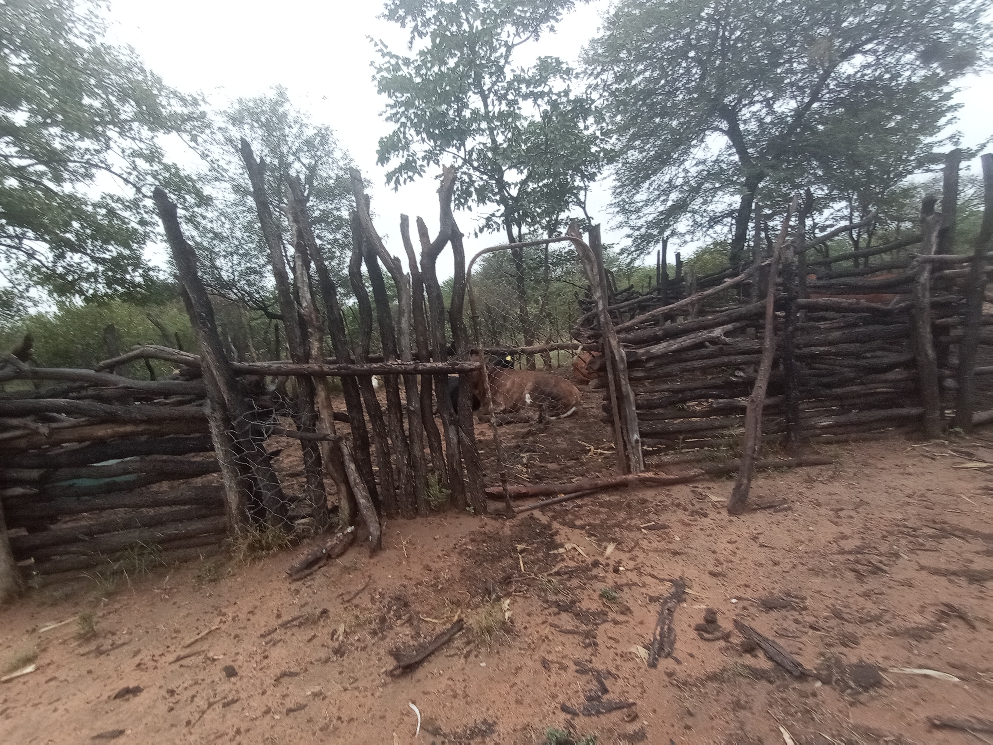
Patayamatebele is a village in the North East District of Botswana near to the Dikgatlhong Dam. Location Patayamatebele is a small village of about 500 people, southeast of Francistown. The people belong to various groups such as the Bangwato, Basarwa, Bakhurutshe, Bakalaka and Babirwa. Patayamatebele lies between the Shashe and Tati rivers. The village was officially gazetted in 2007. It can be reached by road from Tonota via Ditladi. It has been proposed that Patayamatebele, and the villages of Shashe Bridge and Ditladi, which today are in the Tati West constituency, should be transferred to the Tati East constituency. The reason for transferring Patayamatebele is its proximity to Matopi. The village is serviced by Tonota Agricultural District. Economy The main economic activities in Patayamatebele are farming and gathering wild berries. The cattle in the area were destroyed due to foot-and-mouth disease in the 2002/2003 period. In September 2012, Peter Siele, the Mini ... [...More Info...] [...Related Items...] OR: [Wikipedia] [Google] [Baidu] |
North-East District (Botswana)
The North-East District is one of the administrative districts of Botswana. Its capital is Francistown. In 2011, North-East had a population of 60,264 people. The district is predominantly occupied by Kalanga-speaking people, the BaKalanga. The district is administered by a district administration and district council, which are responsible for local administration. In the north and east, North-East borders the Matabeleland South Province of Zimbabwe, and the border in the east is predominantly along the Ramokgwebana River. In the south and west, the district borders the Central District along the Shashe River. Geography Most parts of Botswana have tableland slopes sliding from east to west. It is predominantly savannah, with tall grasses, bushes, and trees. The region has an average elevation of around above sea level. The annual precipitation is around , most of which is received during the summer season from November to May. There are conflicts between agricultural expansi ... [...More Info...] [...Related Items...] OR: [Wikipedia] [Google] [Baidu] |
Chokwe, Botswana
Tshokwe (or Chokwe) is a village in Central District of Botswana. The village is located south-east of Francistown, near the border with Zimbabwe, and it has a primary school. The population was 897 according to the 2001 census. Tshokwe is north of the village of Tobane, to which it is connected by a footpath. The village is extremely poor, and was afflicted by an outbreak of foot-and-mouth disease, which caused the cattle to be destroyed. Although the government has provided power lines and water pipes for connection to homesteads, most of the people cannot afford the connections. The government has been attempting to assist through affirmative action, where residents of remote communities are given preference in government hiring programs. The village is southeast of the Dikgatlhong Dam, which was constructed between 2008. Before work started on the dam, the government arranged for counselling services on AIDS both to construction workers and to residents of Chokwe as well as ... [...More Info...] [...Related Items...] OR: [Wikipedia] [Google] [Baidu] |
Dikgatlhong Dam
The Dikgatlhong Dam is a dam near the village of Robelela on the Shashe River in Botswana, completed in December 2011. When full it will hold . The next largest dam in Botswana, the Gaborone Dam, has capacity of . Purpose The dam is located on the Shashe River three kilometers below the confluence with the Tati River, about northeast of the town of Selebi Phikwe. It is upstream of the Botswana - Zimbabwe border. The project should increase the secure supply of water for Gaborone, Francistown, and towns and villages along the north–south route for the foreseeable future. It will eventually deliver another per second of raw water delivery to the north–south carrier pipeline. Water will also be fed to the Palapye coalfields and to the proposed 1,200 MW power station at Mmamabula. Project costs for the dam were around P1,134 million (US$300 million). The pipeline would cost another P1,127 million. The reservoir may also attract tourists drawn by wildlife, water sports ... [...More Info...] [...Related Items...] OR: [Wikipedia] [Google] [Baidu] |
Matsiloje
Matsiloje is a village in the North East District of Botswana on the west bank of the Ramokgwebana River, which forms the border with Zimbabwe. A tarmac road connects the village to Francistown, to the east. The village has a junior secondary school. The village lies beside the Matsiloje hills, which are quarried for limestone used in manufacturing cement and soapstone products. The exploratory Muphanephane gold mine is in the Matsiloje area. In 2002 there was an outbreak of foot-and-mouth disease in the Matsiloje and Matshelagabedi areas, with another outbreak in the Matopi and Tseteng areas towards the end of the year. 12,000 cattle were killed in Matsiloje/Matshelagabedi and 4000 cattle in Matopi/Tseteng. The government compensated farmers with cash and animals, and instituted a relief work program. The village is affected by illegal immigrants from Zimbabwe, and resulting crime. Before construction of the Dikgatlhong Dam began to the south of Matsiloje in 2008, the gover ... [...More Info...] [...Related Items...] OR: [Wikipedia] [Google] [Baidu] |
Matopi
Matopi is a village in the North East District of Botswana near to the Dikgatlhong Dam. Location The village is serviced by Tonota Agricultural District. Economy Towards the end of 2002 there was an outbreak of Foot and Mouth Disease in the Matopi and Tseteng areas, apparently due to infected cattle straying from Zimbabwe, leading to the killing of 4000 cattle. The government compensated farmers in cash and with animals and introduced a relief program. The village has a health post. It does not have telephone service. Before construction of the Dikgatlhong Dam began, in 2008 the government arranged for counselling services on AIDS to residents of the Mmadinare, Robelela, Matopi, Matsiloje, Chokwe and Patayamatebele Patayamatebele is a village in the North East District of Botswana near to the Dikgatlhong Dam. Location Patayamatebele is a small village of about 500 people, southeast of Francistown. The people belong to various groups such as the Bangwato, ... villages ... [...More Info...] [...Related Items...] OR: [Wikipedia] [Google] [Baidu] |
Tonota
selebi phikwe Tonota is a village located in the Central District of Botswana. The people in Tonota are said to be Bakhurutshe who fought against some other tribes they found there and after winning the war, they owned the land and they became 'Ba bina kgama le phofu'. The name Tonota is said to be spelled THONOTHA (pronounced DONOTHA) in natural Sekhurutshe but was changed to Tonota due to the influence of the Tswana Languages. The village is located 27 kilometers south of the City of Francistown along the A1 (Francistown-Gaborone) road. It lies along the Southwest bank of Shashe River, which happens to the border between the Central and North East Districts, so Tonota is considered to be in the Central District. Tonota is a large territory divided into small segments, namely: Tonota Village in the South, Semotswane, Mandunyane, and Shashe Bridge to the north. Thchief of the Tonota village is Kgosi Bokamoso Radipitsewho took over the chieftainship from his father, Ramosinyi Radipi ... [...More Info...] [...Related Items...] OR: [Wikipedia] [Google] [Baidu] |
Robelela
Robelela is a village in Central District of Botswana. It is located south-east of Francistown, close to the border with Zimbabwe. The population was 471 in 2001 census. Robelela in the Bobirwa Sub-District, is the village closest to the Dikgatlhong Dam, completed in 2012. This will be the biggest dam in Botswana with a carrying capacity of 400 million cubic meters. A pipeline to Selebi-Phikwe is planned to carry the water to the North-South Carrier Pipeline, which will take the water south from Selebi-Phikwe to Gaborone Gaborone ( , , ) is the Capital city, capital and largest city of Botswana with a population of 246,325 based on the 2022 census, about 10% of the total population of Botswana. Its agglomeration is home to 421,907 inhabitants at the 2011 cen .... The influx of construction workers for the three major components of the project, which includes a new tarred road, and the relocation of affected settlements has started to increase the population of Robelela, ... [...More Info...] [...Related Items...] OR: [Wikipedia] [Google] [Baidu] |
Mmadinare
Mmadinare is a village that is located in the Central District of Botswana, 15 kilometers from Selibe Phikwe. The village is slowly growing into a town, with a population estimate of about 13 000 (estimates from the 2004 census) people of different tribes including Bangwato, Batalaote, Babirwa, and others. Mmadinare is located in the center of hills; like other villages in Southern Africa it was started during wars and hills were used as a form of protection from enemies, as they were able to see them from a distance. Geography Motloutse River passes on the northern part of the village called, which supplies the Letsibogo Dam with water, on its way to Shashe River down further east. The river is partly depleted as a result of sand mining by the copper mine in Selibe Phikwe, which gets sand from the river to wash their copper ores. The area also has a high potential for tourism and wildlife resources, as there are many animals in the surrounding areas especially elephants which ... [...More Info...] [...Related Items...] OR: [Wikipedia] [Google] [Baidu] |
Foot-and-mouth Disease
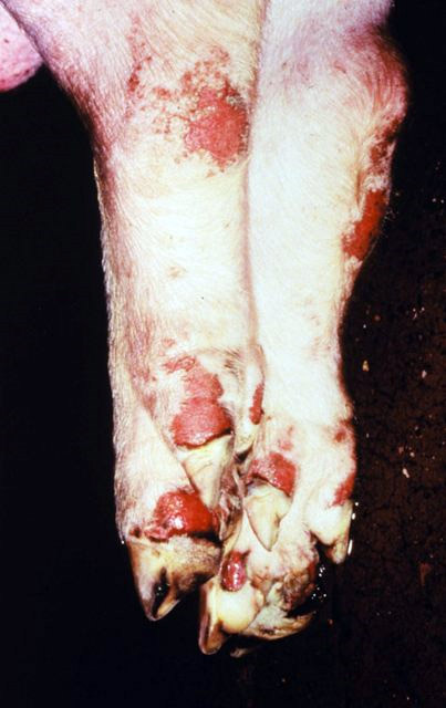
Foot-and-mouth disease (FMD) or hoof-and-mouth disease (HMD) is an infectious disease, infectious and sometimes fatal virus (biology), viral disease that affects cloven-hoofed animals, including domestic and wild Bovidae, bovids. The virus causes a high fever lasting two to six days, followed by vesicle (dermatology), blisters inside the mouth and near the hoof that may rupture and cause lameness. FMD has very severe implications for animal farming, since it is highly infectious and can be spread by infected animals comparatively easily through contact with contaminated farming equipment, vehicles, clothing, and feed, and by domestic and wild predators. Its containment demands considerable efforts in vaccine, vaccination, strict monitoring, trade restrictions, quarantines, and the culling of both infected and healthy (uninfected) animals. Susceptible animals include cattle, domestic water buffalo, water buffalo, domestic sheep, sheep, goats, pigs, antelope, deer, and bison. It has ... [...More Info...] [...Related Items...] OR: [Wikipedia] [Google] [Baidu] |
Shashe Bridge
The Shashe River (or Shashi River) is a major left-bank tributary of the Limpopo River in Zimbabwe. It rises northwest of Francistown, Botswana and flows into the Limpopo River where Botswana, Zimbabwe and South Africa meet. The confluence is at the site of the . Hydrology The Shashe River is a highly river, with flow generally restricted to a few days of the year. The river contributes 12.2% of the mean annual |
Tati River
The Tati River is a river in northeast Botswana, a tributary of the Shashe River, which in turn is a tributary of the Limpopo River. The river flows through Francistown, where it is joined by the Ntshe (or Inchwe) River from the left. History About 1865 a hunter came across traces of old gold diggings near the Tati. He invited Karl Mauch to accompany him on his next trip, and in 1866 Mauch announced that he had found the Tati goldfields extending about which started the first gold rush in Southern Africa the following year. In 1869 the Englishman Daniel Francis came to hunt for gold on the river, before heading south to the Kimberley Kimberly or Kimberley may refer to: Places and historical events Australia * Kimberley (Western Australia) ** Roman Catholic Diocese of Kimberley * Kimberley Warm Springs, Tasmania * Kimberley, Tasmania a small town * County of Kimberley, a ... diamond fields in 1870. The gold was hard to extract, and the gold rush died down. Francis retu ... [...More Info...] [...Related Items...] OR: [Wikipedia] [Google] [Baidu] |


