|
Owlpen Manor
Owlpen Manor is a Tudor Grade I listed manor house of the Mander family, situated in the village of Owlpen in the Stroud district in Gloucestershire, England. There is an associated estate set in a valley within the Cotswold Area of Outstanding Natural Beauty. The manor house is about one mile east of Uley, and three miles east of Dursley. History The manor house is of medieval origins, incorporating fabric dated by dendrochronology to c. 1270. It was largely built and rebuilt in the Tudor period by the Daunt family between 1464 and 1616. Since then it has not seen significant development, except for some improvements early in the 18th century, when the east wing of the house, together with the gardens, church and Grist Mill, were reordered by Thomas Daunt IV between 1719 and 1726. Medieval period Owlpen (pronounced locally "Ole-pen") derives its name, it is thought, from the Saxon thegn, Olla, who first set up his ''pen'', or enclosure, by the springs that rise under the f ... [...More Info...] [...Related Items...] OR: [Wikipedia] [Google] [Baidu] |
Owlpen
Owlpen is a small village and civil parish in the Stroud district of Gloucestershire, England, set in a valley in the Cotswold hills. It is about east of Uley, and east of Dursley. The Owlpen valley is set around the settlement like an amphitheatre of wooded hills open to the west. The landscape falls within the Cotswold Area of Outstanding Natural Beauty, so designated in 1966. The population of the parish in mid-2010 was 29 (est.), the smallest in Gloucestershire. A key feature of the village is a Tudor manor house, Owlpen Manor, of the Mander family. The main economic activities in the village are agriculture, forestry and tourism. Name Owlpen (pronounced locally "Ole-pen") derives its name, it is thought, from the Saxon thegn, Olla, who first set up his ''pen'', or enclosure, by the springs that rise under the foundations of the manor, about the 9th century. Archaeology There are several signs of early settlement in the area. Round barrows and standing stones are w ... [...More Info...] [...Related Items...] OR: [Wikipedia] [Google] [Baidu] |
Abbey
An abbey is a type of monastery used by members of a religious order under the governance of an abbot or abbess. Abbeys provide a complex of buildings and land for religious activities, work, and housing of Christian monks and nuns. The concept of the abbey has developed over many centuries from the early monastic ways of religious men and women where they would live isolated from the lay community about them. Religious life in an abbey may be monastic. An abbey may be the home of an enclosed religious order or may be open to visitors. The layout of the church and associated buildings of an abbey often follows a set plan determined by the founding religious order. Abbeys are often self-sufficient while using any abundance of produce or skill to provide care to the poor and needy, refuge to the persecuted, or education to the young. Some abbeys offer accommodation to people who are seeking spiritual retreat. There are many famous abbeys across the Mediterranean Basin and Eu ... [...More Info...] [...Related Items...] OR: [Wikipedia] [Google] [Baidu] |
County Kerry
County Kerry ( gle, Contae Chiarraí) is a county in Ireland. It is located in the South-West Region and forms part of the province of Munster. It is named after the Ciarraige who lived in part of the present county. The population of the county was 155,258 at the 2022 census, A popular tourist destination, Kerry's geography is defined by the MacGillycuddy's Reeks mountains, the Dingle, Iveragh and Beara peninsulas, and the Blasket and Skellig islands. It is bordered by County Limerick to the north-east and Cork County to the south and south-east. Geography and subdivisions Kerry is the fifth-largest of Ireland's 32 traditional counties by area and the 16th-largest by population. It is the second-largest of Munster's six counties by area, and the fourth-largest by population. Uniquely, it is bordered by only two other counties: County Limerick to the east and County Cork to the south-east. The county town is Tralee although the Catholic diocesan seat is Killarn ... [...More Info...] [...Related Items...] OR: [Wikipedia] [Google] [Baidu] |
Chief Justice Of The Common Pleas
The chief justice of the Common Pleas was the head of the Court of Common Pleas, also known as the Common Bench or Common Place, which was the second-highest common law court in the English legal system until 1875, when it, along with the other two common law courts and the equity and probate courts, became part of the High Court of Justice. As such, the chief justice of the Common Pleas was one of the highest judicial officials in England, behind only the Lord High Chancellor and the Lord Chief Justice of England, who headed the Queen's Bench (King's when the monarch was male). History Initially, the position of Chief Justice of the Common Pleas was not an appointment; of the justices serving in the court, one would become more respected than his peers, and was therefore considered the "chief" justice. The position was formalised in 1272, with the raising of Sir Gilbert of Preston to Chief Justice, and from then on, it was a formally-appointed role, similar to the position ... [...More Info...] [...Related Items...] OR: [Wikipedia] [Google] [Baidu] |
Edward Coke
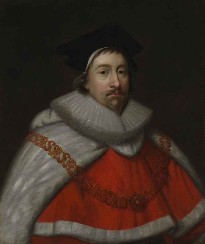
Edward is an English given name. It is derived from the Anglo-Saxon name ''Ēadweard'', composed of the elements '' ēad'' "wealth, fortune; prosperous" and '' weard'' "guardian, protector”. History The name Edward was very popular in Anglo-Saxon England, but the rule of the Norman and Plantagenet dynasties had effectively ended its use amongst the upper classes. The popularity of the name was revived when Henry III named his firstborn son, the future Edward I, as part of his efforts to promote a cult around Edward the Confessor, for whom Henry had a deep admiration. Variant forms The name has been adopted in the Iberian peninsula since the 15th century, due to Edward, King of Portugal, whose mother was English. The Spanish/Portuguese forms of the name are Eduardo and Duarte. Other variant forms include French Édouard, Italian Edoardo and Odoardo, German, Dutch, Czech and Romanian Eduard and Scandinavian Edvard. Short forms include Ed, Eddy, Eddie, Ted, Teddy and Ned. ... [...More Info...] [...Related Items...] OR: [Wikipedia] [Google] [Baidu] |
John Bridgeman (judge)
Sir John Bridgeman, SL (1568/69 – 5 February 1638) was a barrister of the Inner Temple, serjeant-at-law and local magnate in the West of England during the early 17th century. Early career Bridgeman came from a minor gentry family settled at Littledean, Gloucestershire. He matriculated from Magdalen College, Oxford in June 1582, and after some years at Clifford's Inn, was admitted to the Inner Temple in June 1591. Sometime during this period, he married Frances Daunt. When her brother Giles died in 1596, he became embroiled in a dispute with her uncle Thomas Daunt over the manor of Owlpen. He lost the case when he was accused of forging deeds before Sir Edward Coke, the Attorney General. They had at least two children: *George Bridgeman *Anne Bridgeman, married John Winford Bridgeman was called to the bar in 1600. Most of his work was in the Court of Common Pleas, a report of whose proceedings between 1613 and 1621 he compiled. In 1613, he purchased the manor of Nympsfield ... [...More Info...] [...Related Items...] OR: [Wikipedia] [Google] [Baidu] |
County Cork
County Cork ( ga, Contae Chorcaí) is the largest and the southernmost county of Ireland, named after the city of Cork, the state's second-largest city. It is in the province of Munster and the Southern Region. Its largest market towns are Mallow, Macroom, Midleton, and Skibbereen. the county had a population of 581,231, making it the third- most populous county in Ireland. Cork County Council is the local authority for the county, while Cork City Council governs the city of Cork and its environs. Notable Corkonians include Michael Collins, Jack Lynch, Roy Keane, Sonia O'Sullivan and Cillian Murphy. Cork borders four other counties: Kerry to the west, Limerick to the north, Tipperary to the north-east and Waterford to the east. The county contains a section of the Golden Vale pastureland that stretches from Kanturk in the north to Allihies in the south. The south-west region, including West Cork, is one of Ireland's main tourist destinations, known for its rugg ... [...More Info...] [...Related Items...] OR: [Wikipedia] [Google] [Baidu] |
Kinsale
Kinsale ( ; ) is a historic port and fishing town in County Cork, Ireland. Located approximately south of Cork City on the southeast coast near the Old Head of Kinsale, it sits at the mouth of the River Bandon, and has a population of 5,281 (as of the 2016 census) which increases in the summer when tourism peaks. Kinsale is a holiday destination for both Irish and overseas tourists. The town is known for its restaurants, including the Michelin-starred Bastion restaurant, and holds a number of annual gourmet food festivals. As a historically strategic port town, Kinsale's notable buildings include Desmond Castle (associated with the Earls of Desmond and also known as the French Prison) of , the 17th-century pentagonal bastion fort of James Fort on Castlepark peninsula, and Charles Fort, a partly restored star fort of 1677 in nearby Summercove. Other historic buildings include the Church of St Multose (Church of Ireland) of 1190, St John the Baptist (Catholic) of 1839, and t ... [...More Info...] [...Related Items...] OR: [Wikipedia] [Google] [Baidu] |
Carrigaline
Carrigaline () is a town and civil parish in County Cork, Ireland, situated on the River Owenabue. Located about south of Cork city, and with a population of 15,770 people, it is one of the largest commuter towns of the city. The R611 regional road passes through the town, and it is just off the N28 national primary route to Ringaskiddy. Carrigaline grew rapidly in the late 20th century, from a village of a few hundred people into a thriving commuter town although some locals still refer to it as "the village". The town is one of the key gateways to west Cork, especially for those who arrive by ferry from France. Carrigaline is within the Cork South-Central Dáil constituency. Economy Carrigaline Pottery, situated in Main Street, closed in 1979, but was subsequently re-opened and run as a co-operative for many years after that. Despite its small size, the village also had a small cinema, owned and run by the Cogan family. Neither the pottery nor the cinema exist today. The ... [...More Info...] [...Related Items...] OR: [Wikipedia] [Google] [Baidu] |
Munster
Munster ( gle, an Mhumhain or ) is one of the provinces of Ireland, in the south of Ireland. In early Ireland, the Kingdom of Munster was one of the kingdoms of Gaelic Ireland ruled by a "king of over-kings" ( ga, rí ruirech). Following the Norman invasion of Ireland, the ancient kingdoms were shired into counties for administrative and judicial purposes. In later centuries, local government legislation has seen further sub-division of the historic counties. Munster has no official function for local government purposes. For the purposes of the ISO, the province is listed as one of the provincial sub-divisions of the State ( ISO 3166-2:IE) and coded as "IE-M". Geographically, Munster covers a total area of and has a population of 1,364,098, with the most populated city being Cork. Other significant urban centres in the province include Limerick and Waterford. History In the early centuries AD, Munster was the domain of the Iverni peoples and the Clanna Dedad famil ... [...More Info...] [...Related Items...] OR: [Wikipedia] [Google] [Baidu] |
Plantations Of Ireland
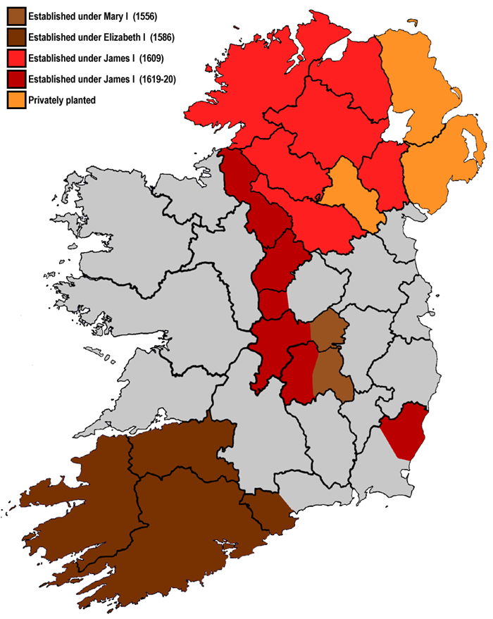
Plantations in 16th- and 17th-century Ireland involved the confiscation of Irish-owned land by the English Crown and the colonisation of this land with settlers from Great Britain. The Crown saw the plantations as a means of controlling, anglicising and 'civilising' Gaelic Ireland. The main plantations took place from the 1550s to the 1620s, the biggest of which was the plantation of Ulster. The plantations led to the founding of many towns, massive demographic, cultural and economic changes, changes in land ownership and the landscape, and also to centuries of ethnic and sectarian conflict. They took place before and during the earliest English colonisation of the Americas, and a group known as the West Country Men were involved in both Irish and American colonization. There had been small-scale immigration from Britain since the 12th century, after the Anglo-Norman invasion. By the 15th century, direct English control had shrunk to an area called the Pale. In the 154 ... [...More Info...] [...Related Items...] OR: [Wikipedia] [Google] [Baidu] |
Wotton-under-Edge
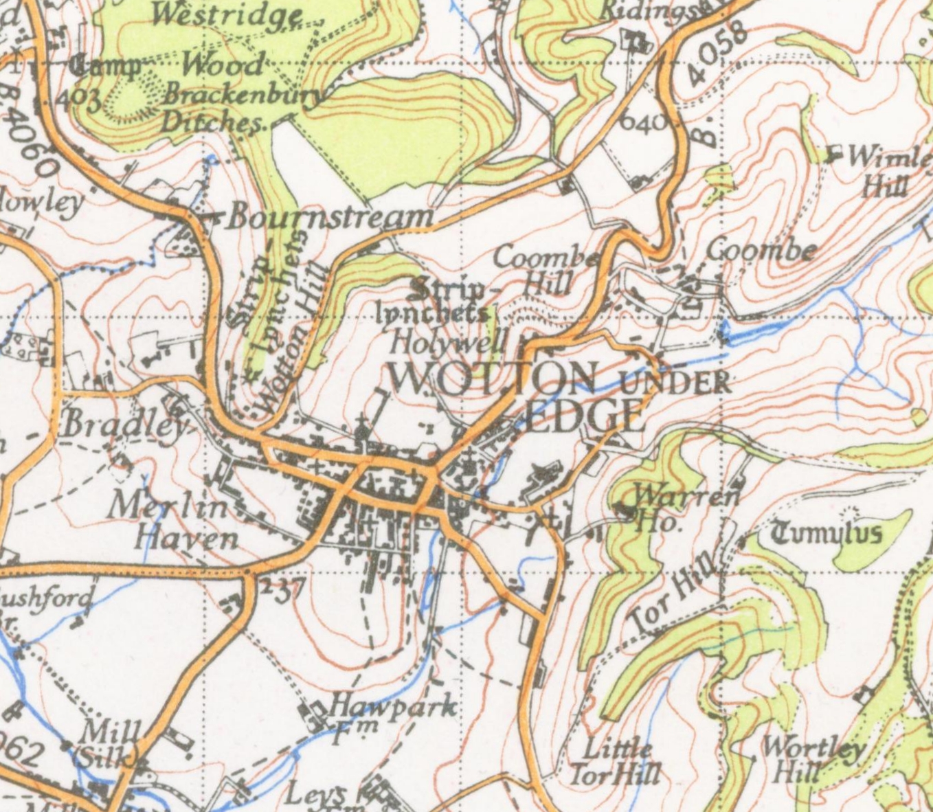
Wotton-under-Edge is a market town within the Stroud district of Gloucestershire, England. Located near the southern fringe of the Cotswolds, the Cotswold Way long-distance footpath passes through the town. Standing on the B4058, Wotton is about from the M5 motorway. The nearest railway station is Cam and Dursley, away by road, on the Bristol to Birmingham line. History The first record of the town is in an Anglo-Saxon Royal Charter of King Edmund I, who in AD 940 leased four hides of land in ''Wudetun'' to Eadric. The name ''Wudetun'' means the enclosure, homestead or village (''tun'') in or near the wood (''wude''). The "Edge" refers to the limestone escarpment of the Cotswold Edge which includes the hills of Wotton Hill and Tor Hill that flank the town. In the 1086 Domesday Book listing, Wotton was in the hundred of Dudstone. Kingswood Abbey was founded in 1139, but all that remains is a 16th-century Cistercian gatehouse. Nearby historical buildings include th ... [...More Info...] [...Related Items...] OR: [Wikipedia] [Google] [Baidu] |


_2.jpg)


