|
North Pennine Ring
The North Pennine Ring is a canal ring which crosses the Pennines between Manchester, Leeds and Castleford. It follows parts of five canals, and shares much of its route with the Outer Pennine Ring, which uses a different route for the southern crossing of the Pennines. History The concept of a canal ring was created in 1965, as part of a campaign by the Inland Waterways Association to prevent the complete closure of the Rochdale Canal. Initially the canal was described as part of the "Cheshire Canal Ring", which was soon shortened to the "Cheshire Ring". It described a series of interconnecting canals which could be navigated, usually in a week or two, without having to cover any section twice, and has subsequently been applied to several other such routes. The North Pennine Ring is a recent addition, as it was only with the restoration of the Rochdale Canal in 2002 that the ring became a possibility. The term was coined by enthusiasts as an adjunct to the South Pennine R ... [...More Info...] [...Related Items...] OR: [Wikipedia] [Google] [Baidu] |
Canal Ring
A canal ring is the name given to a series of canals that make a complete loop. Etymology There have been canals which formed a ring for more than 200 years, but the term was unknown before the 1960s, when the Inland Waterways Association coined Cheshire Ring as part of its campaign to save the Ashton Canal and Peak Forest Canal from closure. Working boatmen were concerned with getting from A to B as fast as possible, or for the lowest toll, rather than in visiting more of the system, and what are now known as rings were simply alternative routes to them, but circular routes allow leisure boaters to see twice as much of the system as is possible with an "out and back" cruise. Hire companies are keen to promote their proximity to popular cruising rings. Since the Cheshire Ring was born, more rings (and variants of them) have been named. The best-known are those that can be completed in one or two weeks, although some three-week rings (such as the Outer Pennine Ring) have been ... [...More Info...] [...Related Items...] OR: [Wikipedia] [Google] [Baidu] |
Manchester Ship Canal
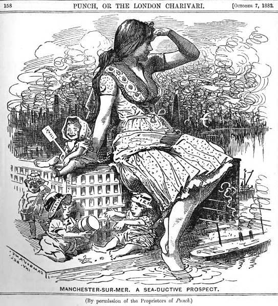
The Manchester Ship Canal is a inland waterway in the North West of England linking Manchester to the Irish Sea. Starting at the Mersey Estuary at Eastham, near Ellesmere Port, Cheshire, it generally follows the original routes of the rivers Mersey and Irwell through the historic counties of Cheshire and Lancashire. Several sets of locks lift vessels about to the canal's terminus in Manchester. Landmarks along its route include the Barton Swing Aqueduct, the world's only swing aqueduct, and Trafford Park, the world's first planned industrial estate and still the largest in Europe. The rivers Mersey and Irwell were first made navigable in the early 18th century. Goods were also transported on the Runcorn extension of the Bridgewater Canal (from 1776) and the Liverpool and Manchester Railway (from 1830), but by the late 19th century the Mersey and Irwell Navigation had fallen into disrepair and was often unusable. In addition, Manchester's business community viewed t ... [...More Info...] [...Related Items...] OR: [Wikipedia] [Google] [Baidu] |
Sydney Harbour Bridge
The Sydney Harbour Bridge is a steel through arch bridge in Sydney, spanning Port Jackson, Sydney Harbour from the Sydney central business district, central business district (CBD) to the North Shore (Sydney), North Shore. The view of the bridge, the harbour, and the nearby Sydney Opera House is widely regarded as an iconic image of Sydney, and of Australia itself. Nicknamed "The Coathanger" because of its arch-based design, the bridge carries rail, vehicular, bicycle and pedestrian traffic. Under the direction of John Bradfield (engineer), John Bradfield of the NSW Public Works, New South Wales Department of Public Works, the bridge was designed and built by British firm Dorman Long of Middlesbrough, and opened in 1932. The bridge's general design, which Bradfield tasked the NSW Department of Public Works with producing, was a rough copy of the Hell Gate Bridge in New York City. This general design document, however, did not form any part of the request for tender, which remain ... [...More Info...] [...Related Items...] OR: [Wikipedia] [Google] [Baidu] |
Stanley Ferry Aqueduct
Stanley Ferry Aqueduct was built between 1836 and 1839 to take the Aire and Calder Navigation over the River Calder in West Yorkshire, England. It is one of the earliest through arch bridges in the world and is considered to be the longest span aqueduct executed in cast iron. Designed by George Leather Sr. and built by H. McIntosh, the aqueduct has a span of , a width of and a depth of . It is still in use today, though an additional wider concrete aqueduct was constructed alongside in 1981 and the bridge was then renovated. Stanley Ferry is also the place where the Tom Pudding tub boats were loaded with coal from local collieries between 1863 and 1985 and transported down to Goole in long trains by canal. The site is one of three historic fords crossing the River Calder near Wakefield. Because the water was deepened for navigation a ferry became necessary, but was replaced by the first bridge in 1879. Like many through arch bridges, the design of the bridge is often confused ... [...More Info...] [...Related Items...] OR: [Wikipedia] [Google] [Baidu] |
Wakefield
Wakefield is a cathedral city in West Yorkshire, England located on the River Calder. The city had a population of 99,251 in the 2011 census.https://www.nomisweb.co.uk/census/2011/ks101ew Census 2011 table KS101EW Usual resident population, West Yorkshire – Wakefield BUASD, code E35000474 The city is the administrative centre of the wider City of Wakefield metropolitan district, which had a population of , the most populous district in England. It is part of the West Yorkshire Built-up Area and the Yorkshire and The Humber region. In 1888, it was one of the last group of towns to gain city status due to having a cathedral. The city has a town hall and county hall, as the former administrative centre of the city's county borough and metropolitan borough as well as county town to both the West Riding of Yorkshire and West Yorkshire, respectively. The Battle of Wakefield took place in the Wars of the Roses, and the city was a Royalist stronghold in the Civil W ... [...More Info...] [...Related Items...] OR: [Wikipedia] [Google] [Baidu] |
Tom Pudding
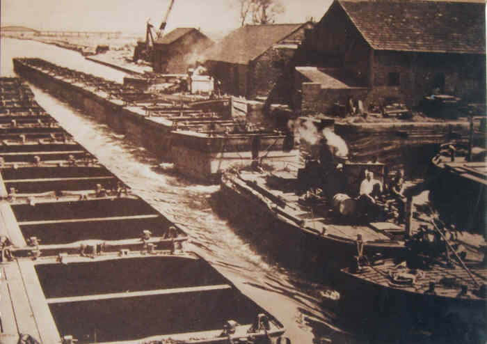
Tom Pudding was the name given to the tub boats on the Aire and Calder Navigation, introduced in 1863 and used until 1985, which were a very efficient means of transferring and transporting coal from the open cast collieries of the South Yorkshire Coalfield near Stanley Ferry to the port of Goole, competing with rail. The name derives from their resemblance to a string of black puddings or perhaps Yorkshire puddings and the first name of the original constructor. Background The use of trains of boats to move bulk products has a long history. In the 1760s, the Third Duke of Bridgwater developed the Navigable Levels at Worsley, which were a series of underground navigable tunnels serving coal workings. They were linked to the Bridgwater Canal, and two sizes of boats were used both underground and on the canal. 'M' boats were and carried 10 tons of coal, while 'T' boats were and carried 7 tons. They were pointed at both ends, as they could not be turned below ground, and were ma ... [...More Info...] [...Related Items...] OR: [Wikipedia] [Google] [Baidu] |
River Aire
The River Aire is a major river in Yorkshire, England, in length. The ''Handbook for Leeds and Airedale'' (1890) notes that the distance from Malham to Howden is direct, but the river's meanderings extend that to . Between Malham Tarn and Airmyn, the river drops . Part of the river below Leeds is canalised, and is known as the Aire and Calder Navigation. Course The Aire starts at Malham Tarn and becomes a subterranean stream at 'Water Sinks' about one mile (1.6 km) before the top of Malham Cove, it then flows underground to Aire Head, just below Malham, in North Yorkshire, and then flows through Gargrave and Skipton. After Cononley, the river enters West Yorkshire where it passes through the former industrial areas of Keighley, Bingley, Saltaire and Shipley. It then passes through Leeds and on to Swillington and Woodlesford. At Castleford is the confluence of the Aire and Calder; just downstream of the confluence was the ford where the ancient British road, ... [...More Info...] [...Related Items...] OR: [Wikipedia] [Google] [Baidu] |
Blackburn
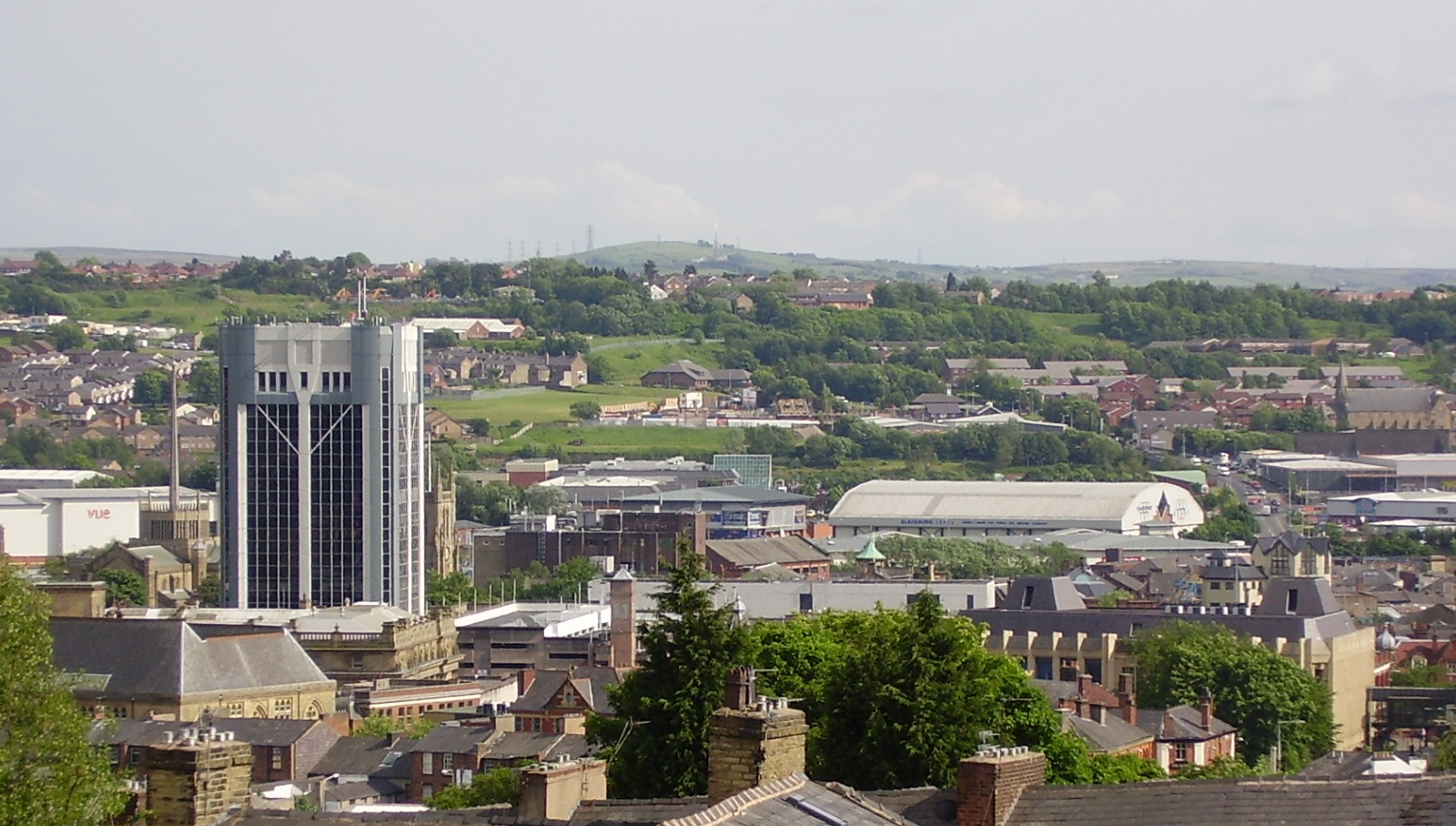
Blackburn () is an industrial town and the administrative centre of the Blackburn with Darwen borough in Lancashire, England. The town is north of the West Pennine Moors on the southern edge of the Ribble Valley, east of Preston and north-northwest of Manchester. Blackburn is the core centre of the wider unitary authority area along with the town of Darwen. It is one of the largest districts in Lancashire, with commuter links to neighbouring cities of Manchester, Salford, Preston, Lancaster, Liverpool, Bradford and Leeds. At the 2011 census, Blackburn had a population of 117,963, whilst the wider borough of Blackburn with Darwen had a population of 150,030. Blackburn had a population of 117,963 in 2011, with 30.8% being people of ethnic backgrounds other than white British. A former mill town, textiles have been produced in Blackburn since the middle of the 13th century, when wool was woven in people's houses in the domestic system. Flemish weavers who settled in t ... [...More Info...] [...Related Items...] OR: [Wikipedia] [Google] [Baidu] |
Lancaster Canal
The Lancaster Canal is a canal in North West England, originally planned to run from Westhoughton in Lancashire to Kendal in south Cumbria ( historically in Westmorland). The section around the crossing of the River Ribble was never completed, and much of the southern end leased to the Leeds and Liverpool Canal, of which it is now generally considered part. Of the canal north of Preston, only the section from Preston to Tewitfield near Carnforth in Lancashire is currently open to navigation for , with the canal north of Tewitfield having been severed in three places by the construction of the M6 motorway, and by the A590 road near Kendal. The southern part, from Johnson's Hillock to Aspull, remains navigable as part of the Leeds and Liverpool Canal. The planned continuation to Westhoughton was never built. History Initial ideas for what would become the Lancaster Canal were formulated as a result of the high price of coal in the city of Lancaster and the surrounding area ... [...More Info...] [...Related Items...] OR: [Wikipedia] [Google] [Baidu] |
Wigan
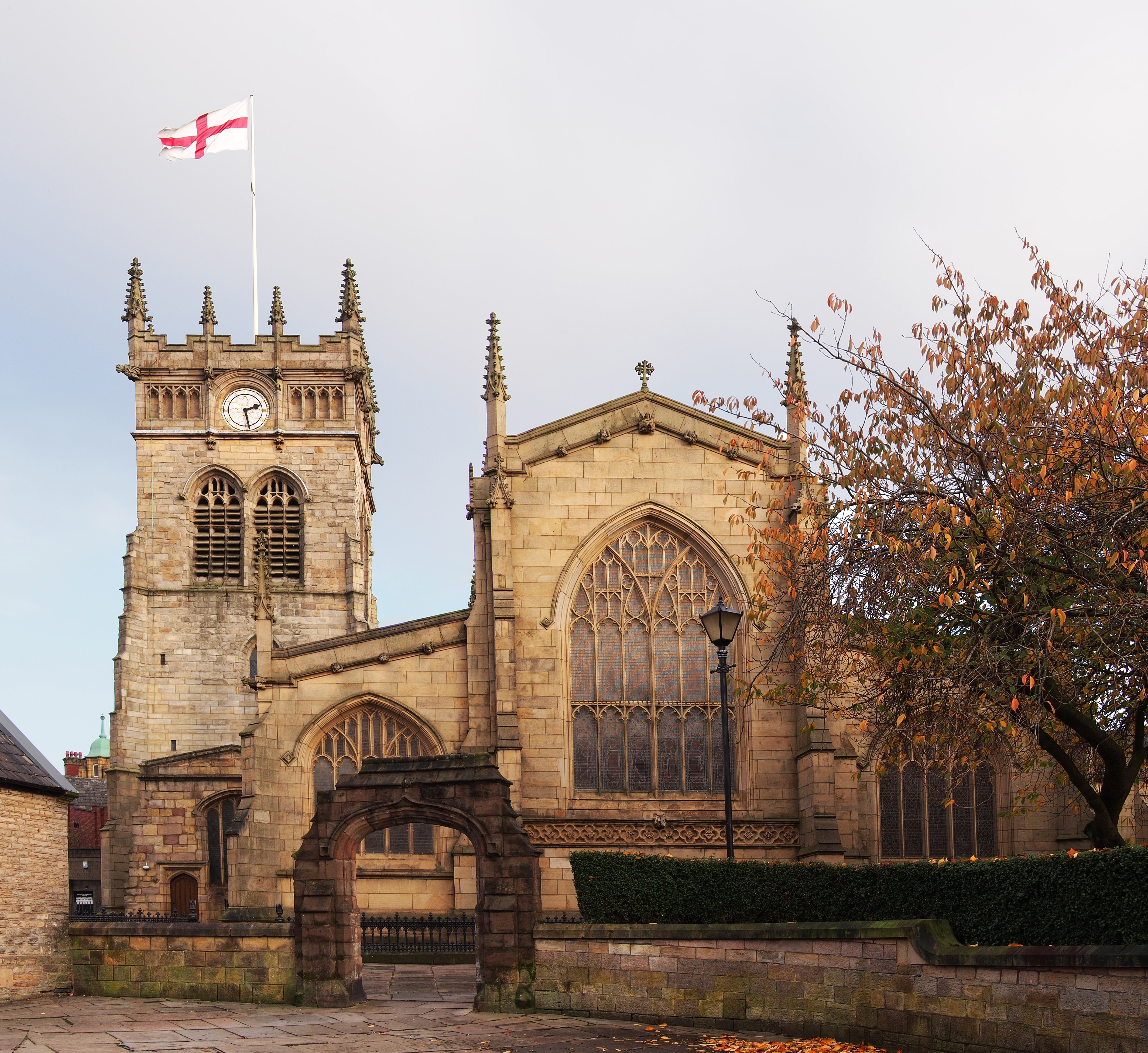
Wigan ( ) is a large town in Greater Manchester, England, on the River Douglas. The town is midway between the two cities of Manchester, to the south-east, and Liverpool, to the south-west. Bolton lies to the north-east and Warrington to the south. It is the largest settlement in the Metropolitan Borough of Wigan and is its administrative centre. The town has a population of 107,732 and the wider borough of 330,713. Wigan was formerly within the historic county of Lancashire. Wigan was in the territory of the Brigantes, an ancient Celtic tribe that ruled much of what is now northern England. The Brigantes were subjugated in the Roman conquest of Britain and the Roman settlement of ''Coccium'' was established where Wigan lies. Wigan was incorporated as a borough in 1246, following the issue of a charter by King Henry III of England. At the end of the Middle Ages, it was one of four boroughs in Lancashire established by Royal charter. The Industrial Revolution saw ... [...More Info...] [...Related Items...] OR: [Wikipedia] [Google] [Baidu] |
Subsidence
Subsidence is a general term for downward vertical movement of the Earth's surface, which can be caused by both natural processes and human activities. Subsidence involves little or no horizontal movement, which distinguishes it from slope movement. Processes that lead to subsidence include dissolution of underlying carbonate rock by groundwater; gradual compaction of sediments; withdrawal of fluid lava from beneath a solidified crust of rock; mining; pumping of subsurface fluids, such as groundwater or petroleum; or warping of the Earth's crust by tectonic forces. Subsidence resulting from tectonic deformation of the crust is known as tectonic subsidence and can create accommodation for sediments to accumulate and eventually lithify into sedimentary rock. Ground subsidence is of global concern to geologists, geotechnical engineers, surveyors, engineers, urban planners, landowners, and the public in general.National Research Council, 1991. ''Mitigating losses from land ... [...More Info...] [...Related Items...] OR: [Wikipedia] [Google] [Baidu] |

.jpg)


