|
Nortada
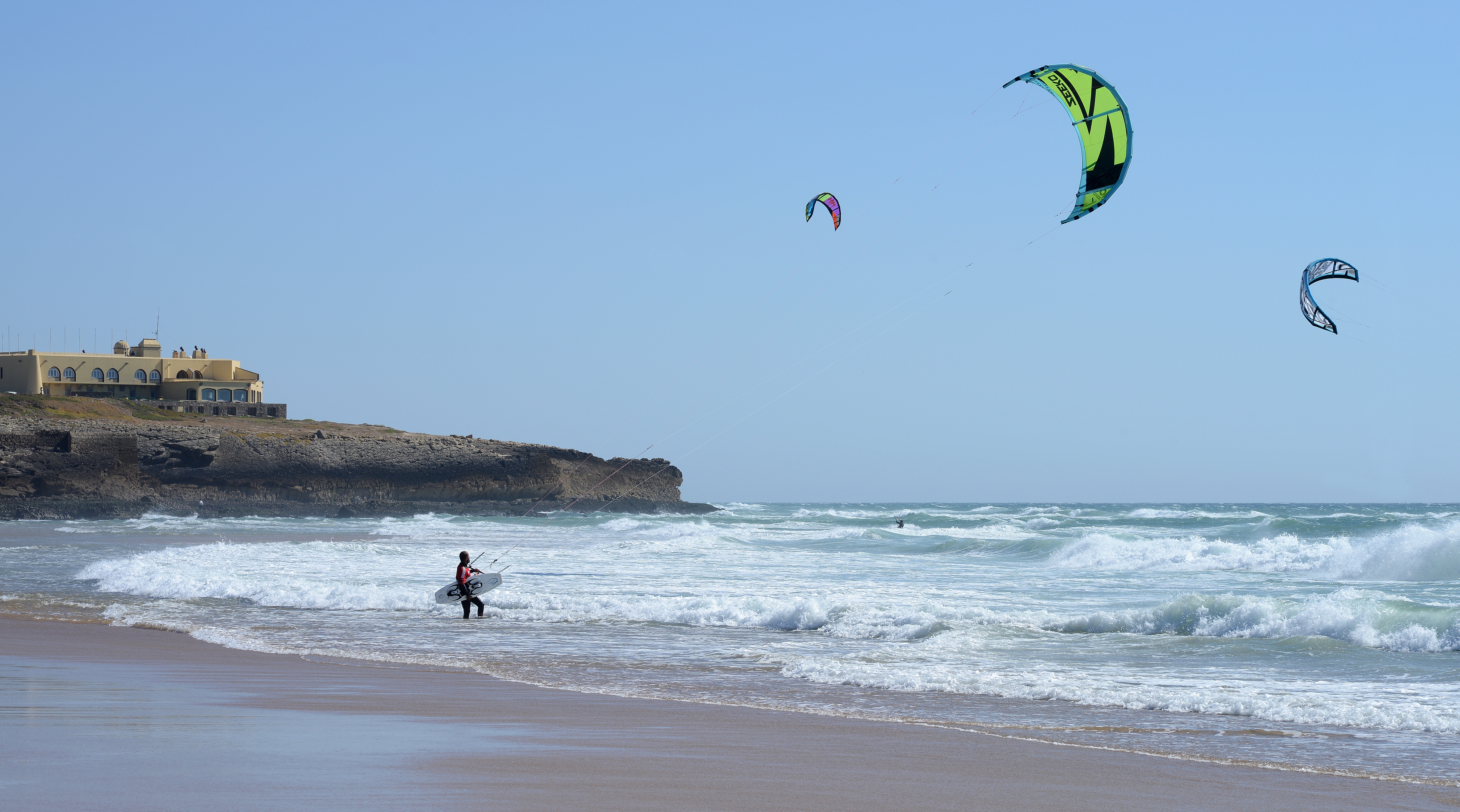
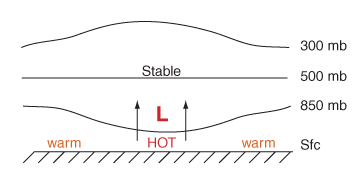
The Nortada ("north wind") is a summer wind along the west coast of the Iberian Peninsula from northerly directions, which occurs mainly between June to September. The main wind direction is north-northeast. The wind is created primarily by a thermal low over the Iberian Peninsula and an Azores High above the Atlantic. The months with the highest frequency of heat lows thus coincide with the months of the most frequent occurrence of the Nortada. The wind is strengthened locally by thermal but also orographic influences, as, for instance, by mountain ranges. The wind often leads in the coastal area to coastal upwelling of cool water, which, in turn often leads to a strengthening of the wind. A popular windsurfing and kitesurfing spot, where such a local amplification occurs, is for example the Praia do Guincho near Lisbon Lisbon (; pt, Lisboa ) is the capital and largest city of Portugal, with an estimated population of 544,851 within its administrative limits in an area of 10 ... [...More Info...] [...Related Items...] OR: [Wikipedia] [Google] [Baidu] |
Iberian Peninsula
The Iberian Peninsula (), ** * Aragonese and Occitan: ''Peninsula Iberica'' ** ** * french: Péninsule Ibérique * mwl, Península Eibérica * eu, Iberiar penintsula also known as Iberia, is a peninsula in southwestern Europe, defining the westernmost edge of Eurasia. It is principally divided between Spain and Portugal, comprising most of their territory, as well as a small area of Southern France, Andorra, and Gibraltar. With an area of approximately , and a population of roughly 53 million, it is the second largest European peninsula by area, after the Scandinavian Peninsula. Name Greek name The word ''Iberia'' is a noun adapted from the Latin word "Hiberia" originating in the Ancient Greek word Ἰβηρία ('), used by Greek geographers under the rule of the Roman Empire to refer to what is known today in English as the Iberian Peninsula. At that time, the name did not describe a single geographical entity or a distinct population; the same name was ... [...More Info...] [...Related Items...] OR: [Wikipedia] [Google] [Baidu] |
Thermal Low
Thermal lows, or heat lows, are non-frontal low-pressure areas that occur over the continents in the subtropics during the warm season, as the result of intense heating when compared to their surrounding environments.Glossary of Meteorology (2009)Thermal Low. American Meteorological Society. Retrieved on 2009-03-02. Thermal lows occur near the Sonoran Desert, on the Mexican plateau, in California's Central Valley (California), Great Central Valley, in the Sahara, over north-west Argentina in South America, over the Kimberley (Western Australia), Kimberley region of north-west Australia, over the Iberian peninsula, and over the Tibetan plateau. On land, intense, rapid solar heating of the earth's surface causes the heating of the lowest layers of the atmosphere, via re-radiated energy in the infrared spectrum. The hotter air is less dense than surrounding cooler air and rises, leading to the formation of a low pressure area. Elevated areas can enhance the strength of the thermal ... [...More Info...] [...Related Items...] OR: [Wikipedia] [Google] [Baidu] |
Azores High
The Azores High also known as North Atlantic (Subtropical) High/Anticyclone or the Bermuda-Azores High, is a large subtropical semi-permanent centre of high atmospheric pressure typically found south of the Azores in the Atlantic Ocean, at the Horse latitudes. It forms one pole of the North Atlantic oscillation, the other being the Icelandic Low. The system influences the weather and climatic patterns of vast areas of North Africa and Southern Europe, and to a lesser extent, eastern North America. The aridity of the Sahara Desert and the summer drought of the Mediterranean Basin is due to the large-scale subsidence and sinking motion of air in the system. In its summer position, the high is centered near Bermuda, and creates a southwest flow of warm tropical air toward the East Coast of the United States. In summer, the Azores-Bermuda High is strongest. The central pressure hovers around 1024 mbar (hPa). This high-pressure block exhibits anticyclonic behaviour, circulating ... [...More Info...] [...Related Items...] OR: [Wikipedia] [Google] [Baidu] |
Orography
Orography is the study of the topographic relief of mountains, and can more broadly include hills, and any part of a region's elevated terrain. Orography (also known as ''oreography'', ''orology'' or ''oreology'') falls within the broader discipline of geomorphology. The term orography comes from the Greek: , hill, , to write. Uses Mountain ranges and elevated land masses have a major impact on global climate. For instance, the elevated areas of East Africa substantially determine the strength of the Indian monsoon.Srinivasan, J., Nanjundiah, Ravi S. and Chakraborty, Arindam (2005Impact of Orography on the Simulation of Monsoon Climate in a General Circulation Model''Indian Institute of Science'' In scientific models, such as general circulation models, orography defines the lower boundary of the model over land. When a river's tributaries or settlements by the river are listed in 'orographic sequence', they are in order from the highest (nearest the source of the river) to th ... [...More Info...] [...Related Items...] OR: [Wikipedia] [Google] [Baidu] |
Upwelling
Upwelling is an oceanographic phenomenon that involves wind-driven motion of dense, cooler, and usually nutrient-rich water from deep water towards the ocean surface. It replaces the warmer and usually nutrient-depleted surface water. The nutrient-rich upwelled water stimulates the growth and reproduction of primary producers such as phytoplankton. The biomass of phytoplankton and the presence of cool water in those regions allow upwelling zones to be identified by cool sea surface temperatures (SST) and high concentrations of chlorophyll-a. The increased availability of nutrients in upwelling regions results in high levels of primary production and thus fishery production. Approximately 25% of the total global marine fish catches come from five upwellings, which occupy only 5% of the total ocean area.Jennings, S., Kaiser, M.J., Reynolds, J.D. (2001) "Marine Fisheries Ecology." Oxford: Blackwell Science Ltd. Upwellings that are driven by coastal currents or diverging ope ... [...More Info...] [...Related Items...] OR: [Wikipedia] [Google] [Baidu] |
Windsurfing
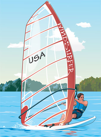
Windsurfing is a wind propelled water sport that is a combination of sailing and surfing. It is also referred to as "sailboarding" and "boardsailing", and emerged in the late 1960s from the aerospace and surf culture of California. Windsurfing gained a popular following across Europe and North America by the late 1970s and had achieved significant global popularity by the 1980s. Windsurfing became an olympic sport in 1984. Newer variants include windfoiling, kiteboarding and wingfoiling. Hydrofoil fins under the board allow the boards to safely lift out of the water and fly silently and smoothly above the surface even in lighter winds. Windsurfing is a recreational, family friendly sport, most popular at flat water locations around the world that offer safety and accessibility for beginner and intermediate participants. Technique and equipment have evolved over the years Major competitive disciplines include slalom, wave and freestyle. Increasingly, "foiling" is replacing trad ... [...More Info...] [...Related Items...] OR: [Wikipedia] [Google] [Baidu] |
Kitesurfing
Kiteboarding or kitesurfing is a sport that involves using wind power with a large power kite to pull a rider across a water, land, or snow surface. It combines aspects of paragliding, surfing, windsurfing, skateboarding, snowboarding, and wakeboarding. Kiteboarding is among the less expensive and the more convenient sailing sports. After some concepts emerged in the late 1970s and early 1980s and some designs were successfully tested, the sport received a wider audience in the late 1990s and became mainstream at the turn of the century. It has freestyle, wave-riding, and racing competitions. The sport held the speed sailing record, reaching before being eclipsed by the Vestas Sailrocket. Worldwide, there are 1.5 million kitesurfers, while the industry sells around 100,000 to 150,000 kites per year. Most power kites are leading edge inflatable kites or foil kites attached by about of flying lines to a control bar and a harness. The kitesurfer rides on either a bidir ... [...More Info...] [...Related Items...] OR: [Wikipedia] [Google] [Baidu] |
Praia Do Guincho
Praia do Guincho (English: Guincho Beach) is an Atlantic beach located on Portugal's Estoril coast, 5 km from the town of Cascais, and is located in the municipality of Cascais, more precisely in the parishes of Cascais and Alcabideche, in the District of Lisbon. Guincho is situated close to several small villages, including Areia, Charneca, Figueira do Guincho and Biscaia. The beach, which has a shoreline of approximately 800 metres, has preferred surfing conditions and is popular for surfing, windsurfing, and kitesurfing. Strong northern winds are predominant during summer time (June–August) as well as smaller north-west swells, making this beach ideal for windsurfing and kitesurfing. During winter (especially December), the predominant winds are from the east, and swells increase in size, making it a perfect spot for surfing, with multiple beach-breaks providing powerful lefts and rights. There are also several surfcamps and surfschools in the area that provide accommod ... [...More Info...] [...Related Items...] OR: [Wikipedia] [Google] [Baidu] |
Lisbon
Lisbon (; pt, Lisboa ) is the capital and largest city of Portugal, with an estimated population of 544,851 within its administrative limits in an area of 100.05 km2. Lisbon's urban area extends beyond the city's administrative limits with a population of around 2.7 million people, being the 11th-most populous urban area in the European Union.Demographia: World Urban Areas - demographia.com, 06.2021 About 3 million people live in the Lisbon metropolitan area, making it the third largest metropolitan area in the , after |
Sagres (Vila Do Bispo)
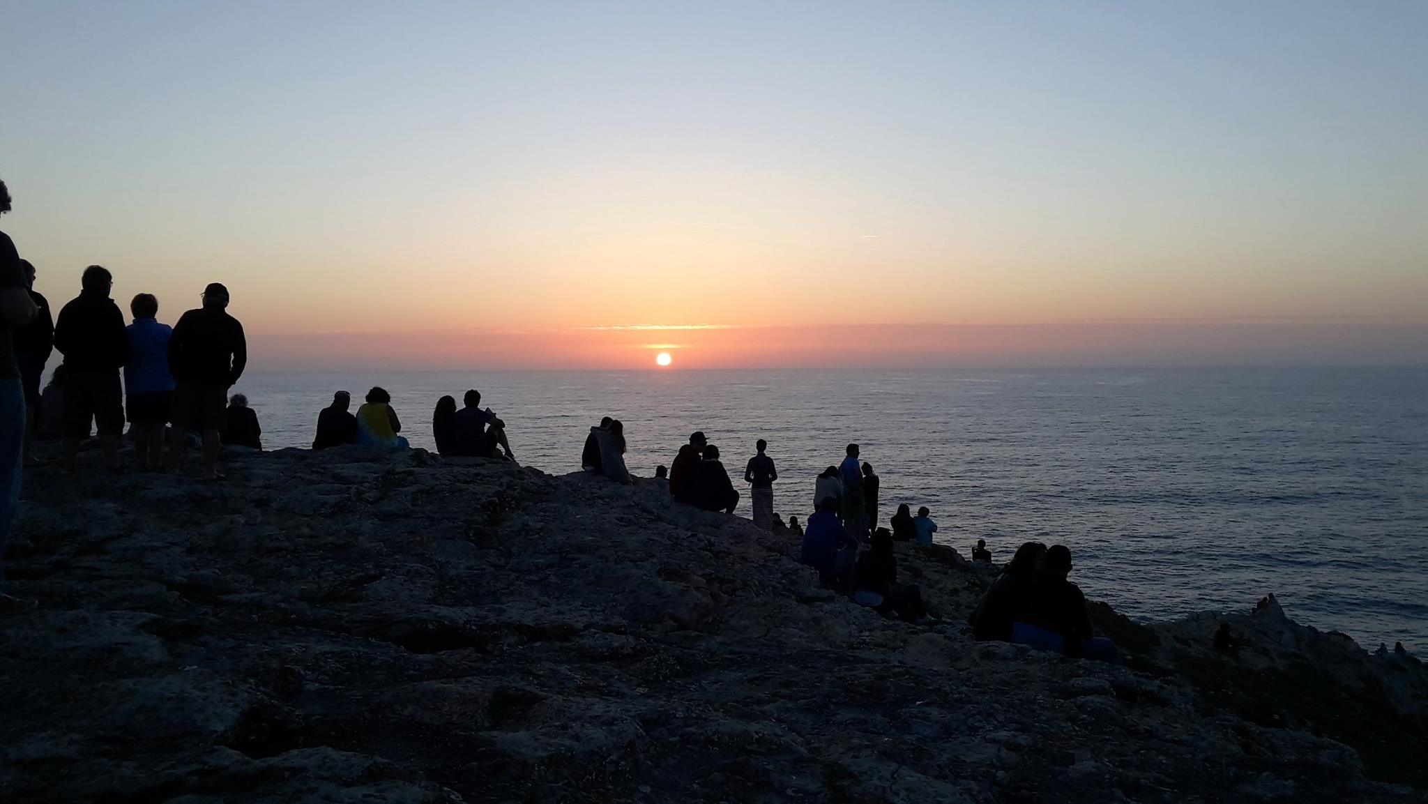
Sagres is a civil parish in the municipality of Vila do Bispo, in the southern Algarve of Portugal. It has 1,894 inhabitants (2021) in an area of . It is historically connected to the early Portuguese Age of Discovery. Sagres is near the Western end of the world's longest estimated straight-line path over land, at 11,241 km, ending near Jinjiang in the People's Republic of China. History The name Sagres derives from ''Sagrado'' (''holy'') owing to the important local religious practices and rituals that occurred during the pre-history of the nation.Câmara Municipal de Vila do Bispo (2012), p.1 From here some of the Mediterranean peoples (including the Phoenicians, Greeks, Carthaginians and Romans), venerated their divinities and which some believed, owing to the absence of a human settlement, was the gathering place for their gods. Christinas (Mozarabs) that lived in this zone, during the Muslim occupation, erected the Church of Corvo, where the mortal remains of the s ... [...More Info...] [...Related Items...] OR: [Wikipedia] [Google] [Baidu] |


