|
Newchapel, Surrey
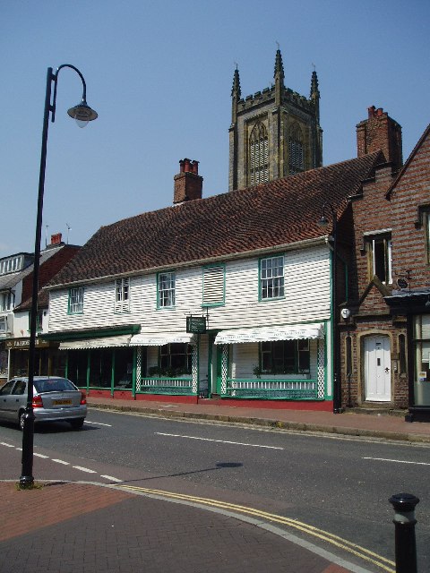
Newchapel is a large hamlet in Surrey, England. It lies on the A22 between Godstone and East Grinstead. It is the location of the London England Temple of the Church of Jesus Christ of Latter-day Saints (LDS Church). The temple, only open to followers of that religious group, has a visitors' centre where their beliefs are explained; visitors can also stroll in the grounds. The closest villages are Lingfield, Felbridge __NOTOC__ Felbridge is a village and civil parish in the Tandridge district of Surrey with a playing field within its focal area, narrowly in West Sussex. Felbridge village forms a contiguous settlement with East Grinstead and had 829 homes ..., Copthorne and Blindley Heath. References External links {{authority control Villages in Surrey Tandridge ... [...More Info...] [...Related Items...] OR: [Wikipedia] [Google] [Baidu] |
Horne, Surrey
__NOTOC__ Horne is a rural village and civil parish in the District of Tandridge in Surrey, England. The parish includes the hamlet of Newchapel, where the British Wildlife Centre is situated. Eastern fields forming a narrow part of the parish are split by the A22 road, a main road to East Grinstead. The civil parish covers and is centred east of Horley, west of Lingfield, SSW of Oxted, and south-east of Kingston upon Thames. At the 2011 Census the civil parish included the population of Newchapel. History A British ( Celtic) gold coin has been found in Horne, but is more probably a mark of transit than of settlement. Otherwise there are no prehistoric remains, such as are usually found in other Wealden parishes. Horne must have owed such importance as it had later to the iron industry. The parish lay within the Anglo-Saxon Tandridge hundred, where the wealthy and powerful would meet periodically at a level below that of the shire to decide on strategic matters ... [...More Info...] [...Related Items...] OR: [Wikipedia] [Google] [Baidu] |
Tandridge District
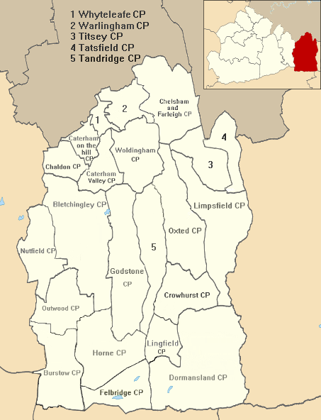
Tandridge is a local government district in east Surrey, England. Its council is based in Oxted, although the largest settlement is Caterham; other notable settlements include Warlingham, Godstone and Lingfield. In mid-2019, the district had an estimated population of 88,129. Tandridge borders the Borough of Reigate and Banstead to the west, the London Borough of Croydon to the north, the London Borough of Bromley to the north-east, the Sevenoaks District of Kent to the east, the Wealden District of East Sussex to the south-east, the Mid Sussex District of West Sussex to the south and the Borough of Crawley, also in West Sussex, to the south-west. The district contains parts of the North Downs Area of Outstanding Natural Beauty and the Weald. It also contains several woodlands and some open heathland. Elevations above sea level range from at Botley Hill, in the North Downs near Oxted, to near Edenbridge. History It is named after a hillside village and slope on the south slo ... [...More Info...] [...Related Items...] OR: [Wikipedia] [Google] [Baidu] |
Surrey
Surrey () is a ceremonial county, ceremonial and non-metropolitan county, non-metropolitan counties of England, county in South East England, bordering Greater London to the south west. Surrey has a large rural area, and several significant urban areas, urban areas which form part of the Greater London Built-up Area. With a population of approximately 1.2 million people, Surrey is the 12th-most populous county in England. The most populated town in Surrey is Woking, followed by Guildford. The county is divided into eleven districts with borough status. Between 1893 and 2020, Surrey County Council was headquartered at County Hall, Kingston upon Thames, County Hall, Kingston-upon-Thames (now part of Greater London) but is now based at Woodhatch Place, Reigate. In the 20th century several alterations were made to Surrey's borders, with territory ceded to Greater London upon its creation and some gained from the abolition of Middlesex. Surrey is bordered by Greater London to ... [...More Info...] [...Related Items...] OR: [Wikipedia] [Google] [Baidu] |
East Surrey (UK Parliament Constituency)
East Surrey is a constituency represented in the House of Commons of the UK Parliament since 2019 by Claire Coutinho, a Conservative. The seat covers an affluent area in the English county of Surrey. Since its creation in 1918, East Surrey has elected a Conservative MP on an absolute majority (over 50% of the vote) at every general election, and is therefore regarded as a Conservative safe seat. Its greatest share of the vote for any opposition candidate was 33.75% in February 1974. Boundaries 1832–1868: The Hundreds of Brixton, Kingston, Reigate, Tandridge and Wallington. 1868–1885: The Hundred of Tandridge, and so much of the Hundred of Wallington as included and lay to the east of the parishes of Croydon and Sanderstead, and so much of the Hundred of Brixton as included and lay to the east of the parishes of Streatham, Clapham and Lambeth. ''For period to 1918 see completely new single-member Wimbledon and Reigate seats, also termed N.E. and S.E. Divisions of Surrey.'' ... [...More Info...] [...Related Items...] OR: [Wikipedia] [Google] [Baidu] |
Hamlet (place)
A hamlet is a human settlement that is smaller than a town or village. Its size relative to a parish can depend on the administration and region. A hamlet may be considered to be a smaller settlement or subdivision or satellite entity to a larger settlement. The word and concept of a hamlet has roots in the Anglo-Norman settlement of England, where the old French ' came to apply to small human settlements. Etymology The word comes from Anglo-Norman ', corresponding to Old French ', the diminutive of Old French ' meaning a little village. This, in turn, is a diminutive of Old French ', possibly borrowed from (West Germanic) Franconian languages. Compare with modern French ', Dutch ', Frisian ', German ', Old English ' and Modern English ''home''. By country Afghanistan In Afghanistan, the counterpart of the hamlet is the qala ( Dari: قلعه, Pashto: کلي) meaning "fort" or "hamlet". The Afghan ''qala'' is a fortified group of houses, generally with its own co ... [...More Info...] [...Related Items...] OR: [Wikipedia] [Google] [Baidu] |
A22 Road
A, or a, is the first letter and the first vowel of the Latin alphabet, used in the modern English alphabet, the alphabets of other western European languages and others worldwide. Its name in English is ''a'' (pronounced ), plural ''aes''. It is similar in shape to the Ancient Greek letter alpha, from which it derives. The uppercase version consists of the two slanting sides of a triangle, crossed in the middle by a horizontal bar. The lowercase version can be written in two forms: the double-storey a and single-storey ɑ. The latter is commonly used in handwriting and fonts based on it, especially fonts intended to be read by children, and is also found in italic type. In English grammar, " a", and its variant " an", are indefinite articles. History The earliest certain ancestor of "A" is aleph (also written 'aleph), the first letter of the Phoenician alphabet, which consisted entirely of consonants (for that reason, it is also called an abjad to distinguish it fr ... [...More Info...] [...Related Items...] OR: [Wikipedia] [Google] [Baidu] |
Godstone
Godstone is a village and civil parish in Surrey, England, east of Reigate at the junction of the A22 and A25 roads, near the M25 motorway and the North Downs. Godstone railway station is separated from it by agricultural land. Blindley Heath Site of Special Scientific Interest, the Greensand Way and the North Downs Way all pass through areas of Godstone. Oxted east is the administrative centre of its local government, Tandridge District. Westerham, Kent, is east. The county town of Guildford is due west and London is north. Etymology The earliest known appearance of the name is ''Godeston'' from AD 1248. It was subsequently known as ''Godestone, Godiston, Codeston, Codestone, Coddestone, Coddeston'' and ''Goddeston.'' The name took its current form in AD 1548. The root itself is uncertain but the same as the towns of Godalming and Godmanchester, suggesting it may be derived from the ethnonym of the Goths who settled Sub-Roman Britain. It appears the t ... [...More Info...] [...Related Items...] OR: [Wikipedia] [Google] [Baidu] |
East Grinstead
East Grinstead is a town in West Sussex, England, near the East Sussex, Surrey, and Kent borders, south of London, northeast of Brighton, and northeast of the county town of Chichester. Situated in the extreme northeast of the county, the civil parish has an area of . The population at the 2011 Census was 26,383. Nearby towns include Crawley and Horley to the west, Tunbridge Wells to the east and Redhill and Reigate to the northwest. The town is contiguous with the village of Felbridge to the northwest. Until 1974 East Grinstead was in East Sussex, before joining together with Haywards Heath and Burgess Hill as the Mid-Sussex district of West Sussex. The town is on the Greenwich Meridian. It has many historic buildings, and the Weald and Ashdown Forest lie to the south-east. Places of interest The High Street contains one of the longest continuous runs of 14th-century timber-framed buildings in England. Other notable buildings in the town include Sackville College, the ... [...More Info...] [...Related Items...] OR: [Wikipedia] [Google] [Baidu] |
London England Temple
The London England Temple (formerly the London Temple) is the 12th operating temple of the Church of Jesus Christ of Latter-day Saints (LDS Church) and is located in Newchapel, Surrey, England. Despite its name, it is not located within London or Greater London. The temple serves church members in south Wales, the Channel Islands, southern parts of England, the Limerick District of Ireland, and Jordan. History The site of the original 34,000 square foot building, located 25 miles south of London, was selected in 1952 by David O. McKay and Stayner Richards.Prescott, Marianne Holman"Why the Angel Moroni statue stopped traffic and other interesting facts about the London temple on its 60th anniversary" ''Church News'', 9 August 2019. Retrieved on 17 March 2020. Building of the temple began on 27 August 1955, and the temple was dedicated on 7 September 1958. Over 76,000 people toured the building during the public open house before it was dedicated. It was the first LDS temple ... [...More Info...] [...Related Items...] OR: [Wikipedia] [Google] [Baidu] |
The Church Of Jesus Christ Of Latter-day Saints
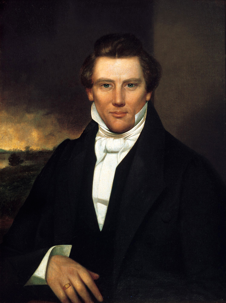
The Church of Jesus Christ of Latter-day Saints, informally known as the LDS Church or Mormon Church, is a nontrinitarian Christian church that considers itself to be the restoration of the original church founded by Jesus Christ. The church is headquartered in the United States in Salt Lake City, Utah, and has established congregations and built temples worldwide. According to the church, it has over 16.8 million members and 54,539 full-time volunteer missionaries. The church is the fourth-largest Christian denomination in the United States, with over 6.7 million US members . It is the largest denomination in the Latter Day Saint movement founded by Joseph Smith during the early 19th-century period of religious revival known as the Second Great Awakening. Church theology includes the Christian doctrine of salvation only through Jesus Christ,"For salvation cometh to none such except it be through repentance and faith on the Lord Jesus Christ." Book of Mormon ... [...More Info...] [...Related Items...] OR: [Wikipedia] [Google] [Baidu] |
Lingfield, Surrey
Lingfield is a village and civil parish in the Tandridge district of Surrey, England, approximately south of London. Several buildings date from the Tudor period and the timber-frame medieval church is Grade I listed. The stone cage or old gaol, constructed in 1773, was last used in 1882 to hold a poacher. Lingfield Park Racecourse is to the south of the village. In addition to turf racing on the flat and over jumps, there is also an all-weather course. History The village lay within the Anglo-Saxon administrative division of Tandridge hundred. Lingfield was not listed in the Domesday Book of 1086, but is shown on the map as ''Leangafeld'', its spelling in 871AD. The southern part of the parish is in the old iron district. A forge and a furnace 'about Copthorne and Lingfield' were owned by Lady Gage in 1574, and Clarke's pond and Cook's pond may have been heads for water power to work hammers. Henry Malden wrote in 1911 that Lingfield is mostly: On the creation of Sur ... [...More Info...] [...Related Items...] OR: [Wikipedia] [Google] [Baidu] |
Felbridge
__NOTOC__ Felbridge is a village and civil parish in the Tandridge district of Surrey with a playing field within its focal area, narrowly in West Sussex. Felbridge village forms a contiguous settlement with East Grinstead and had 829 homes and households at the time of the 2011 census. Domewood is part of Felbridge civil parish, which was created in 1953. History Early history Until shortly after 1911, the area was part of the parish of Horne. No reference appears to a separate settlement being here in the Domesday Book of 1086. Post Reformation James son of Edward Evelyn succeeded to the manors of Hedgecourt (and smaller carucate of Covelingeley) in the parish of Horne and the estate of Felbridge in 1751. Julia Evelyn Medley, his granddaughter by his first wife, who had married Charles Jenkinson, 3rd Earl of Liverpool held this estate, after James's Evelyn wife's death, as late as 1841. By 1911, whereabouts it lost much of its land, amid the economic change and social ... [...More Info...] [...Related Items...] OR: [Wikipedia] [Google] [Baidu] |


.jpg)
