|
New York State Route 155
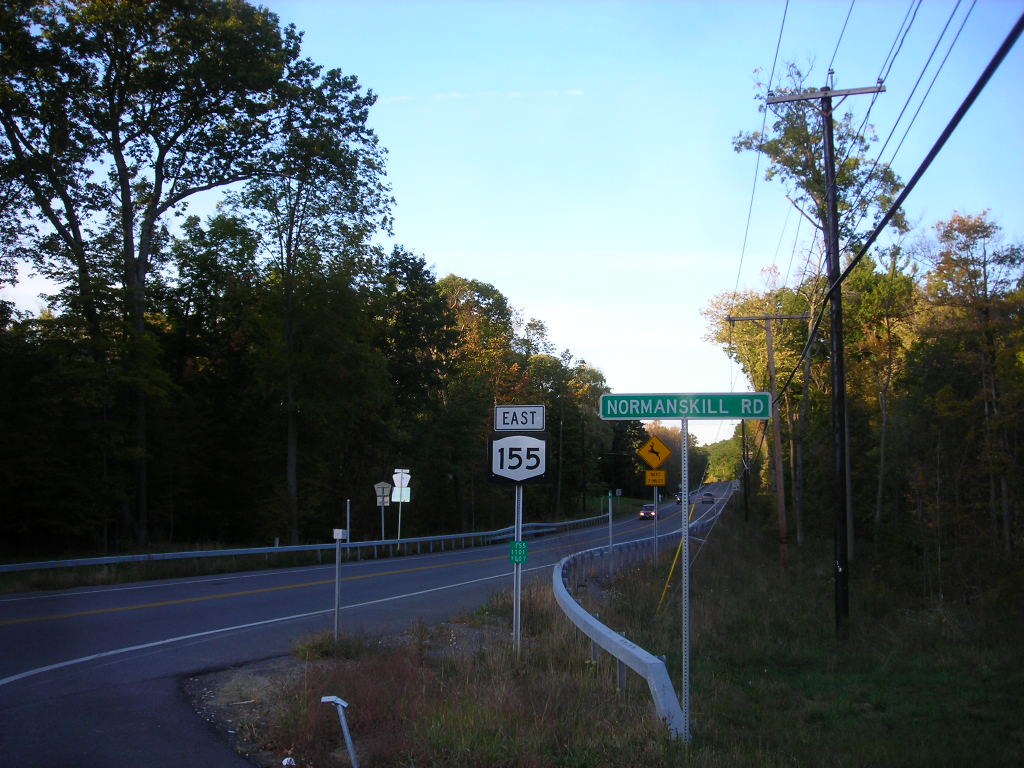
New York State Route 155 (NY 155) is a state highway located entirely within Albany County in the Capital District of New York. The western terminus of the route is at NY 85A in Voorheesville. The eastern terminus is at NY 32 in Watervliet. NY 155 mainly serves as a connection to the Albany International Airport from the major roads it connects to. Route description NY 155 begins at a roundabout with NY 85A (Maple Road) on the eastern edge of Voorheesville in the town of New Scotland. NY 155 proceeds northeast along State Farm Road, crossing under the former railroad bed of the Albany and Susquehanna Railroad into a junction with County Route 306 (CR 306 or Voorheesville Avenue / Normanskill Road). The two lane road continues on, winding northwest through New Scotland before entering the town of Guilderland. The route passes east of the Albany Country Club before crossing the Normans Kill creek and passing a housing de ... [...More Info...] [...Related Items...] OR: [Wikipedia] [Google] [Baidu] |
New York State Department Of Transportation
The New York State Department of Transportation (NYSDOT) is the department of the Government of New York (state), New York state government responsible for the development and operation of highways, Rail transport, railroads, mass transit systems, ports, waterways and aviation facilities in the U.S. state of New York (state), New York. This transportation network includes: * A state and local highway system, encompassing over 110,000 miles (177,000 km) of highway and 17,000 bridges. * A 5,000 mile (8,000 km) rail network, carrying over 42 million short tons (38 million metric tons) of equipment, raw materials, manufactured goods and produce each year. * Over 130 public transit operators, serving over 5.2 million passengers each day. * Twelve major public and private ports, handling more than 110 million short tons (100 million metric tons) of freight annually. * 456 public and private aviation facilities, through which more than 31 million people travel each year. It ow ... [...More Info...] [...Related Items...] OR: [Wikipedia] [Google] [Baidu] |
Normans Kill
The Normans Kill is a U.S. Geological Survey. National Hydrography Dataset high-resolution flowline dataThe National Map accessed October 3, 2011 creek in New York's Capital District located in Schenectady and Albany counties. It flows southeasterly from its source in the town of Duanesburg near Delanson to its mouth at the Hudson River in the town of Bethlehem. In the town of Guilderland, the stream is dammed to create the Watervliet Reservoir, a drinking water source for the city of Watervliet and the Town of Guilderland. A one megawatt hydrolectric plant at the dam provides power to pump water to the filtration plant. The Normans Kill has a drainage area of over , and includes portions of Schoharie County along with the counties in which the Normans Kill itself flows through. The Normans Kill has been used historically as a source of water power during colonial times, during which many mills sprung up along its banks. Prior to the Industrial Revolution, blocks of ice wer ... [...More Info...] [...Related Items...] OR: [Wikipedia] [Google] [Baidu] |
