|
National Cycle Route 61
National Cycle Route 61 is part of the National Cycle Network managed by the charity Sustrans. It runs for 34 miles from Maidenhead (Berkshire) to Hoddesdon (Hertfordshire) via Uxbridge, Watford, St Albans, Hatfield, Welwyn Garden City and Hertford in the United Kingdom. Route Maidenhead to Uxbridge Maidenhead , Windsor, Berkshire, Windsor , Uxbridge National Cycle Route 61 starts from a junction with National Cycle Route 4 on the southern outskirts of Maidenhead. It follows the Jubilee River (a River Thames flood relief channel, passing north of Windsor not far from Eton College. Just north of Eton, the route then leaves the river to cross Ditton Park and then turns north through Langley. The route then follows country lanes and a section of unsurfaced bridleway before joining National Cycle Route 6 on the towpath of the Grand Union Canal at Cowley, London, Cowley in Uxbridge, not far from Brunel University. Uxbridge to St Albans Uxbridge , Rickmansworth , Watford , St Alb ... [...More Info...] [...Related Items...] OR: [Wikipedia] [Google] [Baidu] |
National Cycle Network
The National Cycle Network (NCN) is the national cycling route network of the United Kingdom, which was established to encourage cycling and walking throughout Britain, as well as for the purposes of bicycle touring. It was created by the charity Sustrans who were aided by a £42.5 million National Lottery grant. However Sustrans themselves only own around 2% of the paths on the network, these rest being made of existing public highways and rights of way, and permissive paths negotiated by Sustrans with private landowners, which Sustrans have then labelled as part of their network. In 2017, the Network was used for over 786 million cycling and walking trips, made by 4.4 million people. In 2020, around a quarter the NCN was scrapped on safety grounds, leaving of signed routes. These are made up of of traffic-free paths with the remaining on-road. It uses shared use paths, disused railways, minor roads, canal towpaths and traffic-calmed routes in towns and cit ... [...More Info...] [...Related Items...] OR: [Wikipedia] [Google] [Baidu] |
Ebury Way
The Ebury Way is a rail trail in Hertfordshire between Watford and Rickmansworth. The route crosses the Grand Union Canal and three rivers; the River Colne, the River Chess and the River Gade. Passing lakes and fields in Rickmansworth, the path is shared by walkers and cyclists. Its origin as the Watford and Rickmansworth Railway means that it is wide and largely flat. It forms part of National Cycle Route 61 which runs between Windsor to the southwest and Ware to the northeast. The Watford section of the Ebury Way up to its crossing of the Colne also forms part of NCR 6 so this section is jointly routed 6/61. See also *National Cycle Network *Segregated cycle facilities *List of rail trails This is a list of rail trails around the world longer than 0.1 miles (160 metres). Rail trails are former railway lines that have been converted to paths designed for pedestrian, bicycle, skating, equestrian, and/or light motorized traffic. Mos ... * Sustainable transport Externa ... [...More Info...] [...Related Items...] OR: [Wikipedia] [Google] [Baidu] |
Rye House, Hertfordshire
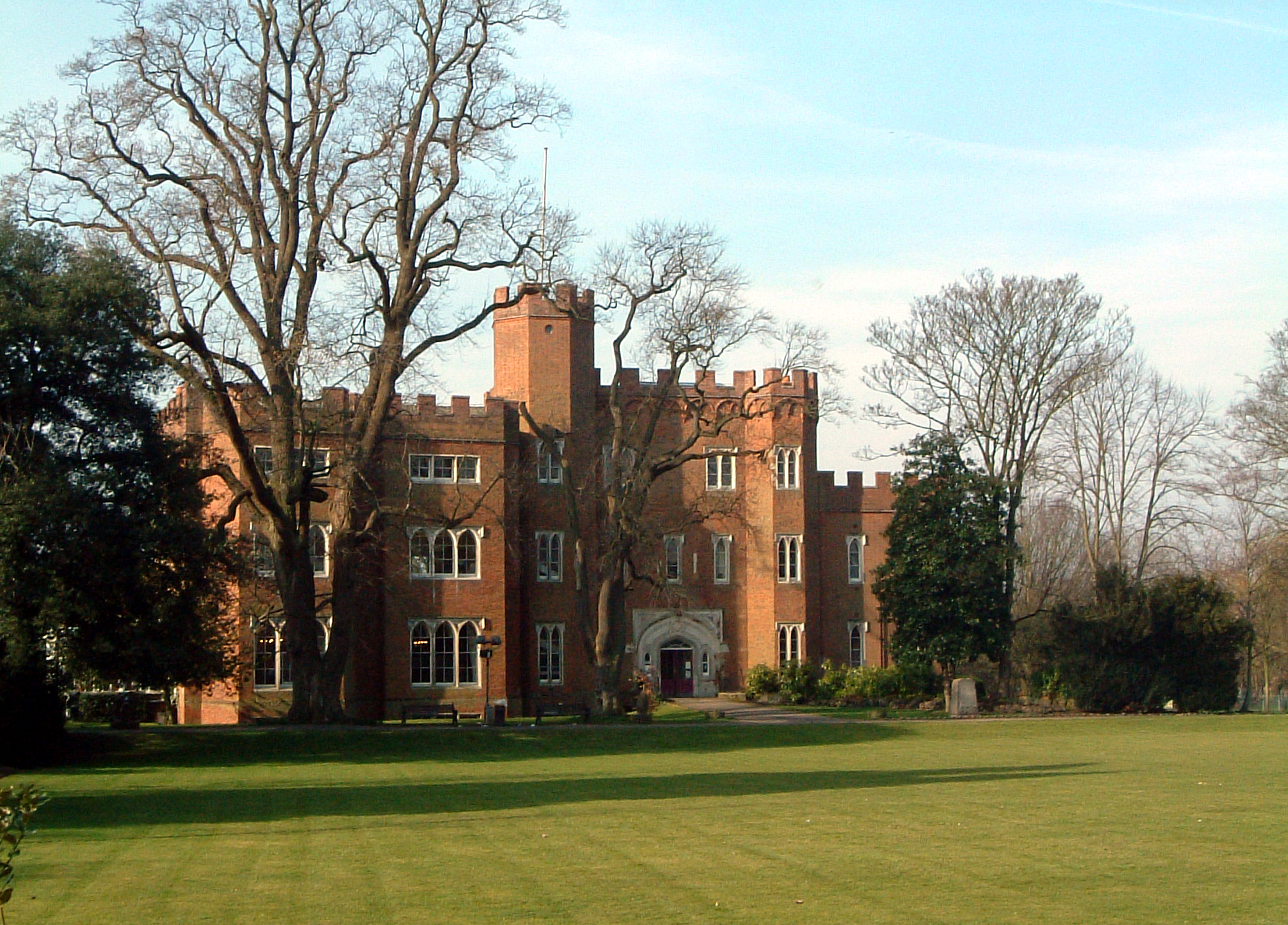
Rye House in Hoddesdon, Hertfordshire is a former fortified manor house, located in what is now the Lee Valley Regional Park. The gatehouse is the only surviving part of the structure and is a Grade I listed building. The house gave its name to the Rye House Plot, an assassination attempt of 1683 that was a violent consequence of the Exclusion Crisis in British politics at the end of the 1670s. History The ownership of Rye House was very stable over four centuries; but the fabric gradually ran down, and the buildings diminished. Foundation Andres Pedersen, a Danish soldier who took part in the Hundred Years' War, was denizenised in England in 1433, becoming Sir Andrew Ogard. In 1443 he was allowed to impark part of the manor of Rye, the area then called the Isle of Rye, in the parish of Stanstead Abbots, and was given licence to crenellate what became Rye House. Over 50 types of moulded brick were used in its construction. Early Modern period In 1517 William Parr was livi ... [...More Info...] [...Related Items...] OR: [Wikipedia] [Google] [Baidu] |
Ware, Hertfordshire
Ware is a town in Hertfordshire, England close to the county town of Hertford. It is also a civil parish in East Hertfordshire district. Location The town lies on the north–south A10 road which is partly shared with the east–west A414 (for Hertford to the west and Harlow to the east). There is a large viaduct over the River Lea at Kings Meads. The £3.6m two-mile bypass opened on 17 January 1979. At the north end of the bypass is the Wodson Park Sports and Leisure Centre and Hanbury Manor, a hotel and country club. The former route of the A10 through the town is now the A1170. The railway station is on the Hertford East Branch Line and operated by Greater Anglia and is on a short single track section of the otherwise double track line. History Archaeology has shown that Ware has been occupied since at least the Mesolithic period (which ended about 4000 BC). The Romans had a sizeable settlement here and foundations of several buildings, including a temple, and two cemeteri ... [...More Info...] [...Related Items...] OR: [Wikipedia] [Google] [Baidu] |
Hertford
Hertford ( ) is the county town of Hertfordshire, England, and is also a civil parish in the East Hertfordshire district of the county. The parish had a population of 26,783 at the 2011 census. The town grew around a ford on the River Lea, near its confluences with the rivers Mimram, Beane, and Rib. The Lea is navigable from the Thames up to Hertford. Fortified settlements were established on each side of the ford at Hertford in 913AD. The county of Hertfordshire was established at a similar time, being named after and administered from Hertford. Hertford Castle was built shortly after the Norman Conquest in 1066 and remained a royal residence until the early seventeenth century. Hertfordshire County Council and East Hertfordshire District Council both have their main offices in the town and are major local employers, as is McMullen's Brewery, which has been based in the town since 1827. The town is also popular with commuters, being only north of central London and conn ... [...More Info...] [...Related Items...] OR: [Wikipedia] [Google] [Baidu] |
Welwyn Garden City
Welwyn Garden City ( ) is a town in Hertfordshire, England, north of London. It was the second garden city in England (founded 1920) and one of the first new towns (designated 1948). It is unique in being both a garden city and a new town and exemplifies the physical, social and cultural planning ideals of the periods in which it was built. History Welwyn Garden City was founded by Sir Ebenezer Howard in 1920 following his previous experiment in Letchworth Garden City. Howard had called for the creation of planned towns that were to combine the benefits of the city and the countryside and to avoid the disadvantages of both. It was designed to be 'The Perfect Town'. The Garden Cities and Town Planning Association had defined a garden city as "a town designed for healthy living and industry of a size that makes possible a full measure of social life but not larger, surrounded by a rural belt; the whole of the land being in public ownership, or held in trust for the community ... [...More Info...] [...Related Items...] OR: [Wikipedia] [Google] [Baidu] |
Hatfield, Hertfordshire
Hatfield is a town and civil parish in Hertfordshire, England, in the borough of Welwyn Hatfield. It had a population of 29,616 in 2001, and 39,201 at the 2011 Census. The settlement is of Saxon origin. Hatfield House, home of the Marquess of Salisbury, forms the nucleus of the old town. From the 1930s when de Havilland opened a factory until the 1990s when British Aerospace closed it, aircraft design and manufacture employed more people there than any other industry. Hatfield was one of the post-war New Towns built around London and has much modernist architecture from the period. The University of Hertfordshire is based there. Hatfield lies north of London beside the A1(M) motorway and has direct trains to London King's Cross railway station, Finsbury Park and Moorgate. There has been a strong increase in commuters who work in London moving into the area. In 2022, TV property expert Phil Spencer named Hatfield as the second best place to live for regular commuters to ... [...More Info...] [...Related Items...] OR: [Wikipedia] [Google] [Baidu] |
Verulamium
Verulamium was a town in Roman Britain. It was sited southwest of the modern city of St Albans in Hertfordshire, England. A large portion of the Roman city remains unexcavated, being now park and agricultural land, though much has been built upon. The ancient Watling Street passed through the city. Much of the site and its environs is now a scheduled monument. History Before the Romans established their settlement, there was already a tribal centre in the area which belonged to the Catuvellauni. This settlement is usually called Verlamion. The etymology is uncertain but the name has been reconstructed as *''Uerulāmion'', which would have a meaning like "he tribe or settlementof the broad hand" (''Uerulāmos'') in Brittonic.Isaac, Graham R. "Place-Names in Ptolemy's Geography: An Electronic Data Base with Etymological Analysis of the Celtic Name-elements". Aberystwyth : CMCS Publications, 2004. Computer file : CD-ROM. In this pre-Roman form, it was among the first places in B ... [...More Info...] [...Related Items...] OR: [Wikipedia] [Google] [Baidu] |
St Albans Abbey Station
St Albans Abbey railway station in St Albans, Hertfordshire, England is about south of the city centre in the St Stephen's area. It is the terminus of the Abbey Line from Watford Junction, operated by London Northwestern Railway. It is one of two stations in St Albans, the other being the much larger and busier St Albans City. The unstaffed station consists of a single open-air platform and a car park. Improvement works were carried out in 2008. It was the second UK railway station to receive a Harrington Hump to improve accessibility. History St Albans Abbey was the first railway station in St Albans, built by the London and North Western Railway in 1858. It was, as it is now, a terminus; the company's plans to extend northwards to Luton and Dunstable never materialised. Although the Midland Railway opened their station (St Albans City) in 1868, it was not until 1924 that "Abbey" was added to the station's title to avoid confusion – by this stage, both stations ... [...More Info...] [...Related Items...] OR: [Wikipedia] [Google] [Baidu] |
Abbey Flyer
The Abbey Line, also called the St Albans Abbey branch line, is a railway line from Watford Junction to St Albans Abbey. The route passes through town and countryside in the county of Hertfordshire, just outside the boundaries of the Oyster Card and London fare zones. Its northern terminus in St Albans Abbey is located in the south of the city, around away from the larger St Albans City railway station on the Midland Main Line. The Abbey line is a semi-rural line and, due to its single-track operation, service frequencies are limited. The service is sometimes referred to locally as ''the Abbey Flyer''. History The line was opened by the London and North Western Railway (LNWR) on 5 May 1858 and was the first railway to reach St Albans. Originally there were two intermediate stations: * * In 1910 a station at Callowland opened, now . In 1924 the terminus at St Albans became to distinguish it from the Midland Railway main line station at , which opened in 1868. ... [...More Info...] [...Related Items...] OR: [Wikipedia] [Google] [Baidu] |
M10 Motorway (Great Britain)
The M10 was a motorway in Hertfordshire, England, running for approximately 3 miles (4.5 km) from the M1 motorway at junction 7 near Hemel Hempstead to the A414 North Orbital Road at Park Street Roundabout, just south of St Albans. Opened in 1959, it was reclassified as part of the A414 in 2009. History The M10 opened on 2 November 1959 along with the M1 and M45, and was designed and constructed by Tarmac Construction as part of the St Albans bypass (along with the M1 between junctions 5 and 10). At the time, the M1's southern terminus was at junction 5 at Berrygrove, with the main route from there to the A1 in London being via the A41 Watford Bypass. Since the capacity of the A roads was much less than that of the motorway, a distributing spur was required to split up the traffic and reduce congestion at Berrygrove. The M10 was thus built to distribute southbound traffic on the M1 onto the A5 (now A5183) and, as an alternative, via the North Orbital Road and the ... [...More Info...] [...Related Items...] OR: [Wikipedia] [Google] [Baidu] |


