|
Nansenflua
Nansenflua is an undersea rock in the northern part of Rekvedbukta off the southeastern coast of Jan Mayen in the Arctic Ocean. The shoal is named after the ship HNoMS ''Fridtjof Nansen'', which sank after striking the previously uncharted rock in November 1940. Nansenflua is the only obstruction in Rekvedbukta. The name ''Nansenflua'' was introduced in charts published by the Norwegian Polar Institute in 1955, and is included as a recognized name in Anders K. Orvin's 1960 paper ''The place-names of Jan Mayen''. It follows a convention based on two then in force Orders in Council, dated 28 April 1933 and 31 May 1957, of using the Nynorsk grammatical form. The suffix "-a" in the feminine definite form was chosen, as no local dialect existed on Jan Mayen. The last part of the name, "flu(a)", means "rock awash", or "sunken rock". The geographical location is given by Orvin as , with an exactitude of 1'. The rock, located two meters under the surface, has a small top area and vertic ... [...More Info...] [...Related Items...] OR: [Wikipedia] [Google] [Baidu] |
Eggøya
Eggøya ("Egg Island") is a peninsula of Jan Mayen island of the Arctic Ocean. It is located on the southern side, in the central part of the island, east of Sørlaguna, and defines the northeastern extension of the bay Rekvedbukta. To the west of the peninsula is the bay Eggøybukta, and to the east is the bay Jamesonbukta. The highest peak at the peninsula has a height of 217 m.a.s.l. Eggøya consists of the northern part of an old volcanic crater, and small hydrothermal vents are still present. The outer part of the peninsula forms the semicircular bay of Kraterbukta, facing south-southeast with steep slopes. To the south of the peninsula is a small islet, Eggøykalven. Name history The name "Eggøya" indicates that the peninsula used to be an island. The oldest reference given by Orvin is Joan Blaeu's '' Atlas Major sive Cosmographia Blaviana'' from 1662, with the nl, Eyer Eylandt of vogel klippen. In the 1801 publication ''Histoire des peches, des decouvertes et des etab ... [...More Info...] [...Related Items...] OR: [Wikipedia] [Google] [Baidu] |
HNoMS Fridtjof Nansen (1930)
''Fridtjof Nansen'' was the first ship in the Norwegian armed forces to be built specially to perform coast guard and fishery protection duties in the Arctic. She saw service in the Second World War with the Royal Norwegian Navy until she ran aground on an unmarked shallow at Jan Mayen in November 1940. Construction ''Fridtjof Nansen'' was constructed with yard number 118 at the Royal Norwegian Naval Yard at Karljohansvern in Horten. She was launched on 5 November 1930, and command was assumed on 29 May 1931 by Commander Ole A. Blom. 1933 sinking On 21 December 1933 ''Fridtjof Nansen'' departed the port of Hammerfest on her way to her patrol areas in eastern Finnmark. While passing through Vestervågen in Måsøy she ran aground and sank the next night. She was raised the next year and taken to Horten for repairs. War service Norwegian Campaign At the outbreak of war in Norway with the German invasion on 9 April 1940, ''Fridtjof Nansen'' was posted to the Finnmark detachme ... [...More Info...] [...Related Items...] OR: [Wikipedia] [Google] [Baidu] |
Jan Mayen
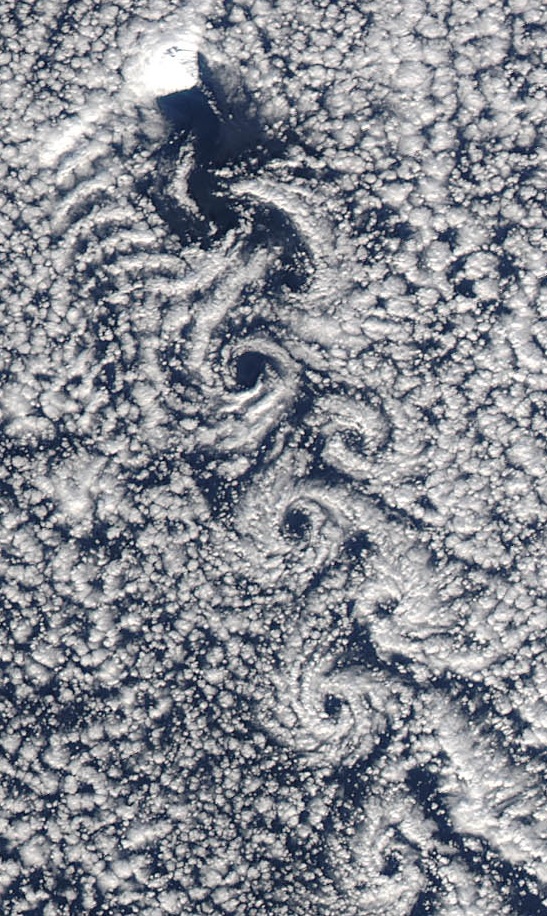
Jan Mayen () is a Norwegian volcanic island in the Arctic Ocean with no permanent population. It is long (southwest-northeast) and in area, partly covered by glaciers (an area of around the Beerenberg volcano). It has two parts: larger northeast Nord-Jan and smaller Sør-Jan, linked by a wide isthmus. It lies northeast of Iceland (495 km 05 miNE of Kolbeinsey), east of central Greenland, and west of the North Cape, Norway. The island is mountainous, the highest summit being the Beerenberg volcano in the north. The isthmus is the location of the two largest lakes of the island, Sørlaguna (South Lagoon) and Nordlaguna (North Lagoon). A third lake is called Ullerenglaguna (Ullereng Lagoon). Jan Mayen was formed by the Jan Mayen hotspot and is defined by geologists as a separate continent. Although administered separately, in the ISO 3166-1 standard, Jan Mayen and Svalbard are collectively designated as ''Svalbard and Jan Mayen'', with the two-letter country code " ... [...More Info...] [...Related Items...] OR: [Wikipedia] [Google] [Baidu] |
Rekvedbukta (Jan Mayen)
Rekvedbukta (English: ''Driftwood Bay'') is an open bay on the central southern coast of the island of Jan Mayen, about eight nautical miles long. Geography The bay extends from the point Kapp Traill to the south and northeastwards to the peninsula of Eggøya. It has a length of about eight nautical miles. The only inhabited site on Jan Mayen, Olonkinbyen, is located at the plain Trollsletta at the southern part of the bay. South of the settlement is the harbour Båtvika. The aerodrome Jan Mayensfield is located northeast of Olonkinbyen, along Rekvedbukta. Further northeast is the shallow elongated lake Sørlaguna, which can extend up to eight kilometers in the spring, separated from the bay by the sandy bar Lagunevollen. Eggøybukta at the northeastern part of the bay is a suitable harbour under favourable weather conditions. The bay contains the islet of Losbåten and the shoal Losbåtrevet to the southwest. In the northeastern part of the bay is the shoal Nansenflua, named ... [...More Info...] [...Related Items...] OR: [Wikipedia] [Google] [Baidu] |
Iceland In World War II
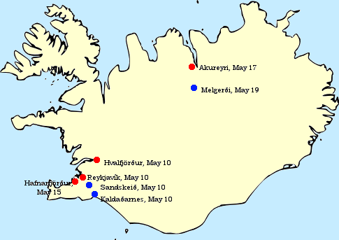
At the beginning of World War II, Iceland was a sovereign kingdom in personal union with Denmark, with King Christian X as head of state. Iceland officially remained neutral throughout World War II. However, the British invaded Iceland on 10 May 1940. On 7 July 1941, the defence of Iceland was transferred from Britain to the United States, which was still a neutral country until five months later. On 17 June 1944, Iceland dissolved its union with Denmark and the Danish monarchy and declared itself a republic, which remains to this day. Background The British government was alarmed by Germany's growing interest in Iceland over the course of the 1930s. The Third Reich's overtures began with friendly competition between German and Icelandic football teams. When war began, Denmark and Iceland declared neutrality and limited visits to the island by military vessels and aircraft of the belligerents. Neutrality During the German occupation of Denmark, contact between the countries ... [...More Info...] [...Related Items...] OR: [Wikipedia] [Google] [Baidu] |
HNoMS Honningsvåg
HNoMS ''Honningsvåg'' was a naval trawler that served throughout the Second World War as a patrol boat in the Royal Norwegian Navy. She was launched at the North Sea harbour of Wesermünde in Hanover, Germany in February 1940 as the fishing trawler ''Malangen'' and was captured by Norwegian militiamen at the North Norwegian port of Honningsvåg during her maiden fishing journey to the Barents Sea. Having taken part in the defence of Norway in 1940 she spent the rest of the war years patrolling the ocean off Iceland. She was decommissioned in 1946, sold to a civilian fishing company in 1947 and scrapped in 1973. German career ''Malangen'' was launched in February 1940 with the designation PG 550 for the trawler company Norddeutsche Hochseefischerei AG. At this early point in the war the Kriegsmarine had not yet begun requisitioning all new trawlers and ''Malangen'' was used as an ordinary fishing vessel. Maiden voyage and capture On 27 March 1940 the ''Malangen'' departed Wese ... [...More Info...] [...Related Items...] OR: [Wikipedia] [Google] [Baidu] |
Royal Norwegian Navy
The Royal Norwegian Navy ( no, Sjøforsvaret, , Sea defence) is the branch of the Norwegian Armed Forces responsible for naval operations of Norway. , the Royal Norwegian Navy consists of approximately 3,700 personnel (9,450 in mobilized state, 32,000 when fully mobilized) and 70 vessels, including 4 heavy frigates, 6 submarines, 14 patrol boats, 4 minesweepers, 4 minehunters, 1 mine detection vessel, 4 support vessels and 2 training vessels. It also includes the Coast Guard. This navy has a history dating back to 955. From 1509 to 1814, it formed part of the navy of Denmark-Norway, also referred to as the "Common Fleet". Since 1814, the Royal Norwegian Navy has again existed as a separate navy. In Norwegian, all its naval vessels since 1946 bear ship prefix "KNM", Kongelig Norske Marine (which accurately translates to Royal Norwegian Navy/Naval vessel). In English, they are permitted still to be ascribed prefix "HNoMS", meaning "His/Her Norwegian Majesty's Ship" ("HNMS" c ... [...More Info...] [...Related Items...] OR: [Wikipedia] [Google] [Baidu] |
NFCC
The PFF National Challenge Cup is an annual semi-professional knockout football competition in men's domestic Pakistani football within the Pakistan football league system. It is organized by and named after the Pakistan Football Federation. Khan Research Laboratories have won the most titles (six). WAPDA are the current champions, winning the 2020 edition courtesy of a 1-0 win against SSGC F.C. in the final. Background Although it is an annual competition, it has not been held on a few occasions. The competition was not held from (1980–83, 1986, 1988–89, 1995, 1997, 2004, 2006–07, 2017, 2021–22). The tournament has seen various name changes throughout its establishment. Names Finals ;Wins by club Results by team Since its establishment, the National Challenge Cup has been won by 15 different teams. Teams shown in ''italics'' are no longer in existence. Giant killings The possibility of unlikely victories in the earlier rounds of the competition, where lo ... [...More Info...] [...Related Items...] OR: [Wikipedia] [Google] [Baidu] |
Eggøykalven
Eggøykalven ("Egg Island Calf") is an islet south of the peninsula of Eggøya at the southern part of Jan Mayen Jan Mayen () is a Norwegian volcanic island in the Arctic Ocean with no permanent population. It is long (southwest-northeast) and in area, partly covered by glaciers (an area of around the Beerenberg volcano). It has two parts: larger .... It is located just about 80 meters west of the point of Eggøyodden, and southeast of the bay Eggøybukta. The islet was earlier much higher, but has been significantly worn down by the ocean. References Landforms of Jan Mayen Islands of Norway {{JanMayen-geo-stub ... [...More Info...] [...Related Items...] OR: [Wikipedia] [Google] [Baidu] |
Nynorsk
Nynorsk () () is one of the two written standards of the Norwegian language, the other being Bokmål. From 12 May 1885, it became the state-sanctioned version of Ivar Aasen's standard Norwegian language ( no, Landsmål) parallel to the Dano-Norwegian written language (''Riksmål''). Nynorsk became the name in 1929, and it is after a series of reforms still a variation which is closer to , whereas Bokmål is closer to ''Riksmål'' and Danish. Between 10 and 15 percent of Norwegians (Primarily in the west around the city of Bergen,) have Nynorsk as their official language form, estimated by the number of students attending ''videregående skole'' (secondary education). Nynorsk is also taught as a mandatory subject in both high school and elementary school for all Norwegians who do not have it as their own language form. History Danish was the written language of Norway until 1814, and Danish with Norwegian intonation and pronunciation was on occasion spoken in the cities (see ... [...More Info...] [...Related Items...] OR: [Wikipedia] [Google] [Baidu] |


