|
Nové Zámky
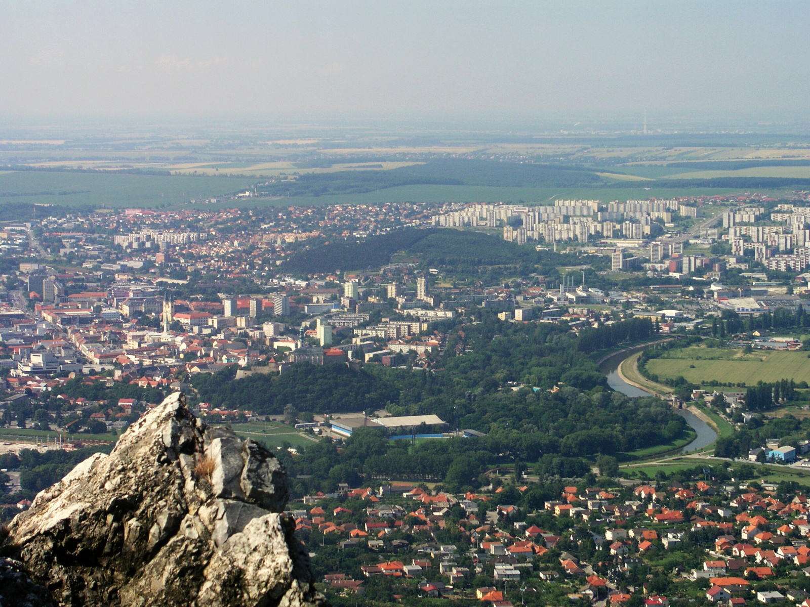
Nové Zámky (; hu, Érsekújvár; german: Neuhäus ; la, Novum Castrum; tr, Uyvar) is a town in Nové Zámky District in the Nitra Region of southwestern Slovakia. Geography The town is located on the Danubian Lowland, on the Nitra River, at an altitude of 119 metres. It is located around 100 km from Bratislava and around 25 km from the Hungarian border. It is a road and railway hub of southern Slovakia. The town lies in the temperate zone and has a continental climate. Annual average temperature reaches around , with the warmest month being July with an average of and the coldest January with . Average annual precipitation is 556 mm. History The town has a distinguished history. From the second half of the 10th century until 1918, it was part of the Kingdom of Hungary. A fortress was built as a defence against the Ottoman Turks, on the site of an older settlement in the years 1573–81. Between 1589 and 1663, the settlement was the seat of the Capt ... [...More Info...] [...Related Items...] OR: [Wikipedia] [Google] [Baidu] |
List Of Sovereign States
The following is a list providing an overview of sovereign states around the world with information on their status and recognition of their sovereignty. The 206 listed states can be divided into three categories based on membership within the United Nations System: 193 member states of the United Nations, UN member states, 2 United Nations General Assembly observers#Present non-member observers, UN General Assembly non-member observer states, and 11 other states. The ''sovereignty dispute'' column indicates states having undisputed sovereignty (188 states, of which there are 187 UN member states and 1 UN General Assembly non-member observer state), states having disputed sovereignty (16 states, of which there are 6 UN member states, 1 UN General Assembly non-member observer state, and 9 de facto states), and states having a political status of the Cook Islands and Niue, special political status (2 states, both in associated state, free association with New Zealand). Compi ... [...More Info...] [...Related Items...] OR: [Wikipedia] [Google] [Baidu] |
Šahy
Šahy ( hu, Ipolyság, rarely german: Eipelschlag) is a town in southern Slovakia, The town has an ethnic Hungarian majority and its population is 7,238 people (2018), with an average age of 42.5. Geography It is located at the eastern reaches of the Danubian Lowland on the river Ipeľ at the Hungarian border, on the E77 road from Budapest to Kraków. Besides the main settlement, it also has two "boroughs" of Preseľany nad Ipľom ( west of centre, annexed 1980) and Tešmák ( east of centre, annexed 1986). From 1980 to 1996 it also had now independent village of Hrkovce. History The first written mention is from 1237 in a document of King Béla IV under name ''Saag'', when Martin Hont-Pázmány founded a Premonstratensian monastery there. It got character of a small town in the 14th century. It was part of Ottoman Empire between 1541–1595 and 1605–1685 and was known as "Şefradi". It was also sanjak centre in Uyvar eyalet between 1663 and 1685. Before break-up of Austria ... [...More Info...] [...Related Items...] OR: [Wikipedia] [Google] [Baidu] |
Pukanec
Pukanec (german: Bugganz / ''Puk(k)an(t)z'', hu, Bakabánya; tr, Bukabak) is a village and municipality (historical town) in the Levice District in the Nitra Region of southern Slovakia. Etymology The name is probably derived from a personal name Baka, Bak, Bukan/Pukan or potentially from Slovak ''buk'' (beech). History In the past, it was one of the nine free royal mining towns, where silver and other precious ore was mined. In historical records Pukanec was first mentioned in 1075 under the name ''villa Baka'', a location in the region of today's Pukanec and Devičany. This note describes the borders of ownership of land given by the Hungarian King to the Monastery in Hronský Beňadik Hronský Beňadik. Outside these borders there was a land of miners. And in this document there is only one "villa Baka" mentioned, which means that there was only one Baka - with Slovak inhabitants. Afterwards in later notes from the 11th and 12th centuries AD Nemeth and Toth Baka are ment ... [...More Info...] [...Related Items...] OR: [Wikipedia] [Google] [Baidu] |
Hlohovec
Hlohovec (german: Freistad(l) an der Waag, Hungarian ''Galgóc''), is a town in southwestern Slovakia, with a population of 21,508. Name The name comes from ''*Glogovec'', the Old Slavic name for a place densely overgrown by hawthorn. The Hungarian form ''Galgóc'' was adopted before a phonological change ''g'' > ''h'' in Slovak.Martin Štefánik - Ján Lukačka et al. 2010, Lexikón stredovekých miest na Slovensku, Historický ústav SAV, Bratislava, pp. 164, . http://forumhistoriae.sk/-/lexikon-stredovekych-miest-na-slovensku History The first written evidence of its existence is from 1113, when a town with the name ''Galgocz'' was mentioned in the so-called Second Zobor Document. In 1362 Hlohovec obtained town privileges. Ottoman troops captured city and annexed it to the sanjak of Uyvar as the Holok eyalet in 1663. Austrian troops retook it in 1664. Landmarks The dominant building is a Renaissance- Baroque castle built in 1720. The castle is built on the place o ... [...More Info...] [...Related Items...] OR: [Wikipedia] [Google] [Baidu] |
Levice
Levice (; hu, Léva, Hungarian pronunciation: ; german: Lewenz, literally lionesses) is a town in western Slovakia. The town lies on the left bank of the lower Hron river. The Old Slavic name of the town was ''Leva'', which means "the Left One". The town is located in the north-eastern corner of the Danubian Lowland (''Podunajská nížina''), east of Bratislava, south-east of Nitra, south-west of Banská Štiavnica, south-west of Zvolen and from the border with Hungary. It is the capital of the Levice District, which is the largest district in Slovakia at . The town's heraldic animal is lion (in Slovak ''lev''), and the town's colours are green and yellow. History Levice is first mentioned as Leua, one of the villages belonging to the parish of St. Martin's Church in Bratka ( hu, Baratka) in 1156. It was part of the comitatus Tekov (''Bars''). First attacked by the Turks in 1544, the town was set on fire while the castle was left unharmed. Between 1581 and 1589, the ... [...More Info...] [...Related Items...] OR: [Wikipedia] [Google] [Baidu] |
Nitra
Nitra (; also known by other #Etymology, alternative names) is a city in western Slovakia, situated at the foot of Zobor Mountain in the valley of the river Nitra (river), Nitra. It is located 95 km east of Bratislava. With a population of about 78,353, it is the fifth largest city in Slovakia. Nitra is also one of the oldest cities in Slovakia; it was the political center of the Principality of Nitra. Today, it is a seat of a ''Regions of Slovakia, kraj'' (Nitra Region), and an ''Districts of Slovakia, okres'' (Nitra District). Etymology The first mention of Nitra dates back to the 9th century. The name of the city is derived from the Nitra river. The name is Indo-European languages, Indo-European, but the question of its History of Proto-Slavic#Pre-Slavic, pre-Slavic or Slavic people, Slavic origin has not been satisfactorily answered. Nitra might be derived from the old Indo-European root ''neit-'', ''nit-'' meaning "to cut" or "to burn" using a derivation element ''-r-'' (see ... [...More Info...] [...Related Items...] OR: [Wikipedia] [Google] [Baidu] |
Sanjak
Sanjaks (liwāʾ) (plural form: alwiyāʾ) * Armenian: նահանգ (''nahang''; meaning "province") * Bulgarian: окръг (''okrǔg''; meaning "county", "province", or "region") * el, Διοίκησις (''dioikēsis'', meaning "province") or επαρχία (''eparchia'', meaning " eparchy") * lad, sancak , group=note (; ota, ; Modern Turkish: ''Sancak'', ) were administrative divisions of the Ottoman Empire. ''Sanjak'', and the variant spellings ''sandjak'', ''sanjaq'' and ''sinjaq'', are English or French transliterations of the Turkish word ''sancak'', meaning "district", " banner" or "flag". Sanjaks were also called by the Arabic word for ''banner'' or ''flag'': '' liwa (Liwā or Liwā’)''. Ottoman provinces ( eyalets, later vilayets) were divided into sanjaks (also called ''livas'') governed by sanjakbeys (also called '' Mutesarriff'') and were further subdivided into '' timars'' (fiefs held by '' timariots''), kadiluks (the area of responsibility of a jud ... [...More Info...] [...Related Items...] OR: [Wikipedia] [Google] [Baidu] |
Star Fortress
A bastion fort or ''trace italienne'' (a phrase derived from non-standard French, literally meaning ''Italian outline'') is a fortification in a style that evolved during the early modern period of gunpowder when the cannon came to dominate the battlefield. It was first seen in the mid-fifteenth century in Italy. Some types, especially when combined with ravelins and other outworks, resembled the related star fort of the same era. The design of the fort is normally a polygon with bastions at the corners of the walls. These outcroppings eliminated protected blind spots, called "dead zones", and allowed fire along the curtain from positions protected from direct fire. Many bastion forts also feature cavaliers, which are raised secondary structures based entirely inside the primary structure. Origins Their predecessors, medieval fortresses, were usually placed on high hills. From there, arrows were shot at the enemies. The enemies' hope was to either ram the gate or c ... [...More Info...] [...Related Items...] OR: [Wikipedia] [Google] [Baidu] |
Captaincies Of The Kingdom Of Hungary
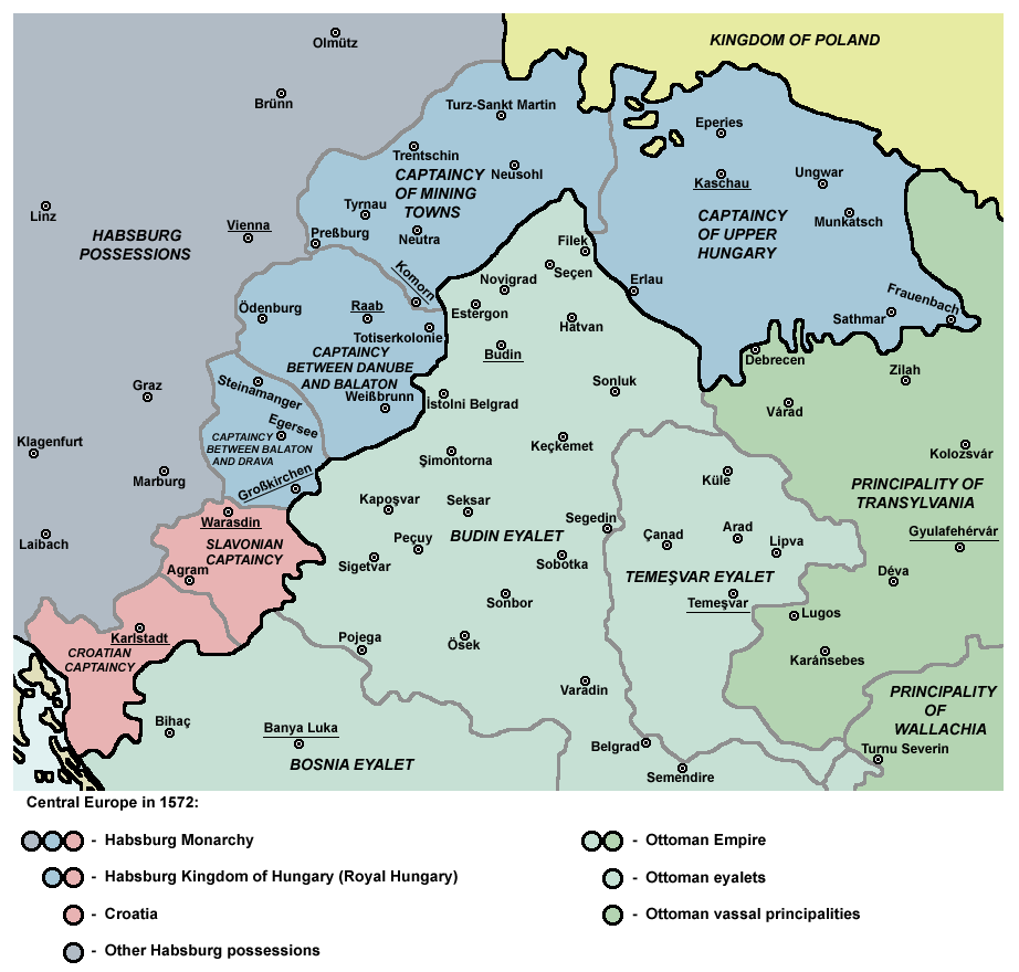
The Captaincies of the Kingdom of Hungary ( hu, Magyar királyi főkapitányságok) were administrative divisions, military districts in the 16th and 17th centuries. The Ottoman Empire meant a constant threat to the kingdom, therefore the Habsburg Hungarian kings needed to establish a well-working military administration. The captaincy (''főkapitányság'') was administered by the Royal Captain-general of the Captaincy. In 1542, the Hungarian kingdom, primarily for military and administrative purposes, was divided into two captaincies, Captaincy of Cisdanubia (mostly Upper Hungary) and Captaincy of Transdanubia (the remaining territories). Captaincy of Győr was founded in 1556. In 1563 Captaincy of Lower Hungary was established (today approx. the present-day regions of western and central Slovakia). By 1566, Kanizsa at southwestern Transdanubia also evolved into a new captaincy.Pálffy 1999, p. 92. Irrespective of the military districts, there were coexistent superior (''nemesi' ... [...More Info...] [...Related Items...] OR: [Wikipedia] [Google] [Baidu] |


.jpg)


