|
Northeast China Plain
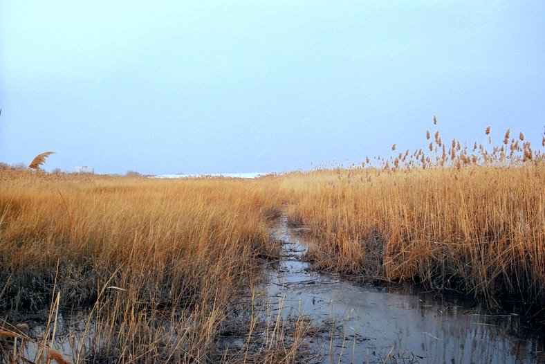
The Northeast China Plain (), also known as Songliao Plain, Manchurian Plain or Northeast Plain, is located in Northeast China. It lies between the Greater and Lesser Khingan and Changbai mountains, ending at the coast at Liaodong Bay in the Bohai Sea. Covering 350,000 km2, it is China's largest plain, with an elevation of lower than 200 meters, and less than 100 meters to the southwest. The Songhua, Nen, and Liao rivers run through the plain. The Northeast Plain includes Songnen Plain in the north, Liaohe Plain in the south, and Sanjiang Plain in the northeast. The Songnen plain was formed by the Songhua and alluvial soils from the Nen. The Liaohe plain, located in the hilly areas near Changchun, was created by the separation of watersheds of the Songhua and Liaohe, which are collectively known as the Liaohe plain. The Sanjiang plain, at the confluence of the Sungari, Amur, and Ussuri rivers,Encyclopedia Britannica''Northeast Plain'' Retrieved 12-5-2019. was origi ... [...More Info...] [...Related Items...] OR: [Wikipedia] [Google] [Baidu] |
Amur River
The Amur River () or Heilong River ( zh, s=黑龙江) is a perennial river in Northeast Asia, forming the natural border between the Russian Far East and Northeast China (historically the Outer and Inner Manchuria). The Amur ''proper'' is long, and has a drainage basin of .Амур (река в Азии) If including its main stem , the Argun, the Am ... [...More Info...] [...Related Items...] OR: [Wikipedia] [Google] [Baidu] |
Manchuria
Manchuria is a historical region in northeast Asia encompassing the entirety of present-day northeast China and parts of the modern-day Russian Far East south of the Uda (Khabarovsk Krai), Uda River and the Tukuringra-Dzhagdy Ranges. The exact geographical extent varies depending on the definition: in the narrow sense, the area constituted by three Chinese provinces of Heilongjiang, Jilin, and Liaoning as well as the eastern Inner Mongolian prefectures of China, prefectures of Hulunbuir, Hinggan League, Hinggan, Tongliao, and Chifeng; in a broader sense, historical Manchuria includes those regions plus the Amur river basin, parts of which were ceded to the Russian Empire by the Manchu-led Qing dynasty during the Amur Annexation of 1858–1860. The parts of Manchuria ceded to Russia are collectively known as Outer Manchuria or Russian Manchuria, which include present-day Amur Oblast, Primorsky Krai, the Jewish Autonomous Oblast, the southern part of Khabarovsk Krai, and the easter ... [...More Info...] [...Related Items...] OR: [Wikipedia] [Google] [Baidu] |
Geography Of Northeast China
Geography (from Ancient Greek ; combining 'Earth' and 'write', literally 'Earth writing') is the study of the lands, features, inhabitants, and phenomena of Earth. Geography is an all-encompassing discipline that seeks an understanding of Earth and world, its human and natural complexities—not merely where objects are, but also how they have changed and come to be. While geography is specific to Earth, many concepts can be applied more broadly to other Astronomical object, celestial bodies in the field of planetary science. Geography has been called "a bridge between natural science and social science disciplines." Origins of many of the concepts in geography can be traced to Greek Eratosthenes of Cyrene, who may have coined the term "geographia" (). The first recorded use of the word Geography (Ptolemy), γεωγραφία was as the title of a book by Greek scholar Claudius Ptolemy (100 – 170 AD). This work created the so-called "Ptolemaic tradition" of geography, w ... [...More Info...] [...Related Items...] OR: [Wikipedia] [Google] [Baidu] |
Plains Of China
In geography, a plain, commonly known as flatland, is a flat expanse of land that generally does not change much in elevation, and is primarily treeless. Plains occur as lowlands along valleys or at the base of mountains, as coastal plains, and as plateaus or uplands. Plains are one of the major landforms on earth, being present on all continents and covering more than one-third of the world's land area. Plains in many areas are important for agriculture. There are various types of plains and biomes on them. Description A plain or flatland is a flat expanse of land with a layer of grass that generally does not change much in elevation, and is primarily treeless. Plains occur as lowlands along valleys or at the base of mountains, as coastal plains, and as plateaus or uplands. Plains are one of the major landforms on earth, where they are present on all continents, and cover more than one-third of the world's land area. In a valley, a plain is enclosed on two sides, but in ot ... [...More Info...] [...Related Items...] OR: [Wikipedia] [Google] [Baidu] |
Marsh
In ecology, a marsh is a wetland that is dominated by herbaceous plants rather than by woody plants.Keddy, P.A. 2010. Wetland Ecology: Principles and Conservation (2nd edition). Cambridge University Press, Cambridge, UK. 497 p More in general, the word can be used for any low-lying and seasonally waterlogged terrain. In Europe and in agricultural literature low-lying meadows that require draining and embanked polderlands are also referred to as marshes or marshland. Marshes can often be found at the edges of lakes and streams, where they form a transition between the aquatic and terrestrial ecosystems. They are often dominated by grasses, rushes or reeds. If woody plants are present they tend to be low-growing shrubs, and the marsh is sometimes called a carr. This form of vegetation is what differentiates marshes from other types of wetland such as swamps, which are dominated by trees, and mires, which are wetlands that have accumulated deposits of acidic peat. Marshes ... [...More Info...] [...Related Items...] OR: [Wikipedia] [Google] [Baidu] |
Wetland
A wetland is a distinct semi-aquatic ecosystem whose groundcovers are flooded or saturated in water, either permanently, for years or decades, or only seasonally. Flooding results in oxygen-poor ( anoxic) processes taking place, especially in the soils. Wetlands form a transitional zone between waterbodies and dry lands, and are different from other terrestrial or aquatic ecosystems due to their vegetation's roots having adapted to oxygen-poor waterlogged soils. They are considered among the most biologically diverse of all ecosystems, serving as habitats to a wide range of aquatic and semi-aquatic plants and animals, with often improved water quality due to plant removal of excess nutrients such as nitrates and phosphorus. Wetlands exist on every continent, except Antarctica. The water in wetlands is either freshwater, brackish or saltwater. The main types of wetland are defined based on the dominant plants and the source of the water. For example, ''marshes'' ar ... [...More Info...] [...Related Items...] OR: [Wikipedia] [Google] [Baidu] |
Chernozem
Chernozem ( ),; also called black soil, regur soil or black cotton soil, is a black-colored soil containing a high percentage of humus (4% to 16%) and high percentages of phosphorus and ammonia compounds. Chernozem is very fertile soil and can produce high agricultural yields with its high moisture-storage capacity. Chernozems are a Reference Soil Group of the World Reference Base for Soil Resources (WRB). Distribution The name comes from the Russian terms for black (чёрный ''čjornyj'') and soil, earth or land (земля ''zemlja''). Studies of the steppe soils of the Poltava region in the Russian Empire in 1883, conducted by geologist Vasily Dokuchaev, showed that the peasants called all soils by color, so the scientist began to use such names. Chernozem was black in color due to the large amount of organic matter. Dokuchaev was the first to describe the chernozem of the European part of the Russian Empire, and discovered its fertility. It is distinct from t ... [...More Info...] [...Related Items...] OR: [Wikipedia] [Google] [Baidu] |
Guangxu Emperor
The Guangxu Emperor (14 August 1871 – 14 November 1908), also known by his temple name Emperor Dezong of Qing, personal name Zaitian, was the tenth Emperor of China, emperor of the Qing dynasty, and the ninth Qing emperor to rule over China proper, from 1875 to 1908. His succession was endorsed by dowager empresses Empress Dowager Ci'an, Ci'an and Empress Dowager Cixi, Cixi for political reasons after Emperor Tongzhi died without an heir. Cixi held political power for much of Guangxu's reign as regent, except for the period between his assumption of ruling powers in 1889 and the Hundred Days' Reform in 1898. The Qing Empire's prestige and sovereignty continued to erode during Guangxu's reign with defeats in the Sino-French War, the First Sino-Japanese War, and the Boxer Rebellion. Guangxu engaged intellectuals like Kang Youwei and Liang Qichao to develop the Hundred Days' Reform program of 1898 to reverse the decline. Among the goals was removing Cixi from power. The program ... [...More Info...] [...Related Items...] OR: [Wikipedia] [Google] [Baidu] |
Chuang Guandong
''Chuang Guandong'' (; IPA: ; literally "Crashing into Guandong" with ''Guandong'' being an older name for Manchuria) is descriptive of the rush of Han people into Manchuria, mainly from the Shandong Peninsula and Zhili, during the hundred-year period beginning in the last half of the 19th century. During the first two centuries of the Manchu-led Qing dynasty, this part of China, the traditional homeland of the ruling Manchus, was, with few exceptions, closed to settlement by Han civilians, with only certain Manchu bannermen, Mongol bannermen, and Han bannermen allowed in. As a result of the ''Chuang Guandong'', the Han Chinese now form the overwhelming majority of the population of Manchuria/Northeast China. Historical background Manchuria, also called Guandong (literally, "east of the pass" referring to Shanhai Pass at the east end of the Great Wall of China) or Guanwai (), used to be a land of sparse population, inhabited mainly by the Tungusic peoples. In 1668 during the re ... [...More Info...] [...Related Items...] OR: [Wikipedia] [Google] [Baidu] |
Han Chinese
The Han Chinese, alternatively the Han people, are an East Asian people, East Asian ethnic group native to Greater China. With a global population of over 1.4 billion, the Han Chinese are the list of contemporary ethnic groups, world's largest ethnic group, making up about 17.5% of the world population. The Han Chinese represent 91.11% of the population in China and 97% of the population in Taiwan. Han Chinese are also a significant Overseas Chinese, diasporic group in Southeast Asian countries such as Thailand, Malaysia, and Indonesia. In Singapore, people of Han Chinese or Chinese descent make up around 75% of the country's population. The Han Chinese have exerted a primary formative influence in the development and growth of Chinese civilization. Originating from Zhongyuan, the Han Chinese trace their ancestry to the Huaxia people, a confederation of agricultural tribes that lived along the middle and lower reaches of the Yellow River in the north central plains of Chin ... [...More Info...] [...Related Items...] OR: [Wikipedia] [Google] [Baidu] |
Jurchen People
Jurchen (, ; , ) is a term used to collectively describe a number of East Asian people, East Asian Tungusic languages, Tungusic-speaking people. They lived in northeastern China, also known as Manchuria, before the 18th century. The Jurchens were renamed Manchu people, Manchus in 1635 by Hong Taiji. Different Jurchen groups lived as hunter-gatherers, pastoralist semi-nomads, or sedentary agriculturists. Generally lacking a central authority, and having little communication with each other, many Jurchen groups fell under the influence of neighbouring dynasties, their chiefs paying tribute and holding nominal posts as effectively hereditary commanders of border guards. Han Chinese, Han officials of the Ming dynasty (1368–1644) classified them into three groups, reflecting relative proximity to the Ming: #Jianzhou Jurchens, Jianzhou (Chinese: 建州) Jurchens, some of whom were mixed with Chinese populations, lived in the proximity of the Mudan River, Mudan river, the Changbai Mo ... [...More Info...] [...Related Items...] OR: [Wikipedia] [Google] [Baidu] |


