|
Nicolas Baudin
Nicolas Thomas Baudin (; 17 February 175416 September 1803) was a French explorer, cartographer, naturalist and hydrographer, most notable for his explorations in Australia and the southern Pacific. He carried a few corms of Gros Michel banana from Southeast Asia, depositing them at a botanical garden on the Caribbean island of Martinique. Biography Early career Born a commoner in Saint-Martin-de-Ré on the Île de Ré on 17 February 1754, Nicolas Baudin joined the merchant navy as an apprentice () at the age of 15; he was then "of average height with brown hair". He then joined the French East India Company at the age of 20 on ''Flamand''. He returned from India on ''L'Étoile'' and arrived at Lorient. At the beginning of 1778, he was to set sail from Nantes on ''Lion'' as second lieutenant. It was a ship equipped by his uncle, Jean Peltier Dudoyer, at the request of the Americans, which would become a privateer and be renamed ''Deane''. At first the Minister for the N ... [...More Info...] [...Related Items...] OR: [Wikipedia] [Google] [Baidu] |
Saint-Martin-de-Ré
Saint-Martin-de-Ré (, "St Martin of Île de Ré, Ré"; Saintongeais dialect, Saintongeais: ''Sént-Martin-de-Ré'', before 1962: ''Saint-Martin'') is a Communes of France, commune in the western French Departments of France, department of Charente-Maritime.Commune de Saint-Martin-de-Ré (17369) INSEE It is one of the ten communes located on the Île de Ré. The fortifications in Saint-Martin-de-Ré, drawn up by Vauban between 1681 and 1685, were inscribed on the UNESCO World Heritage List in 2008 for their testimony to Vauban's work and its influence on military strategy and architecture over the subsequent 200 years. History Fortifications [...More Info...] [...Related Items...] OR: [Wikipedia] [Google] [Baidu] |
Lorient
Lorient (; ) is a town (''Communes of France, commune'') and Port, seaport in the Morbihan Departments of France, department of Brittany (administrative region), Brittany in western France. History Prehistory and classical antiquity Beginning around 3000 BC, settlements in the area of Lorient are attested by the presence of Megalith, megalithic architecture. Ruins of Roman roads (linking Vannes to Quimper and Port-Louis, Morbihan, Port-Louis to Carhaix) confirm Gallo-Roman presence. Founding In 1664, Jean-Baptiste Colbert founded the Louis XIV's East India Company, French East Indies Company. In June 1666, an Ordonnance, ordinance of Louis XIV of France, Louis XIV granted lands of Port-Louis, Morbihan, Port-Louis to the company, along with Faouédic on the other side of the roadstead. One of its directors, Denis Langlois, bought lands at the confluence of the Scorff and the Blavet rivers, and built slipways. At first, it only served as a subsidiary of Port-Louis, where o ... [...More Info...] [...Related Items...] OR: [Wikipedia] [Google] [Baidu] |
Benjamin Franklin
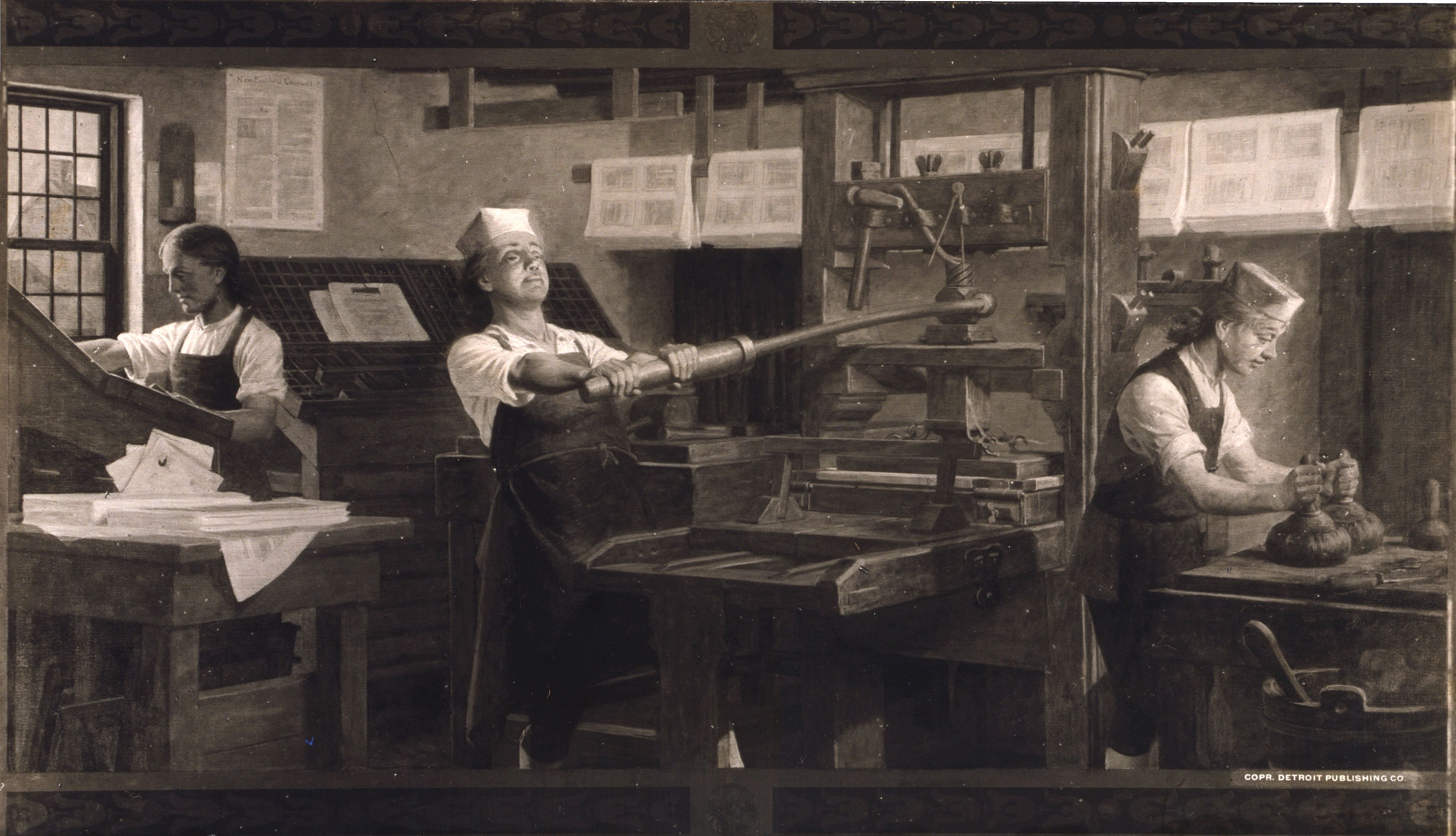
Benjamin Franklin (April 17, 1790) was an American polymath: a writer, scientist, inventor, statesman, diplomat, printer, publisher and Political philosophy, political philosopher.#britannica, Encyclopædia Britannica, Wood, 2021 Among the most influential intellectuals of his time, Franklin was one of the Founding Fathers of the United States; a Committee of Five, drafter and signer of the United States Declaration of Independence, Declaration of Independence; and the first United States Postmaster General, postmaster general. Born in the Province of Massachusetts Bay, Franklin became a successful Early American publishers and printers, newspaper editor and printer in Philadelphia, the leading city in the colonies, publishing ''The Pennsylvania Gazette'' at age 23. He became wealthy publishing this and ''Poor Richard's Almanack'', which he wrote under the pseudonym "Richard Saunders". After 1767, he was associated with the ''Pennsylvania Chronicle'', a newspaper known for it ... [...More Info...] [...Related Items...] OR: [Wikipedia] [Google] [Baidu] |
Action Of 12 December 1782
The action of 12 December 1782 was a naval engagement fought off the coast of Spain near Ferrol, in which the British 40-gun fifth rate HMS ''Mediator'' successfully attacked a convoy of five armed ships. ''Mediator'' succeeded in capturing one American privateer, the ''Alexander'', and then captured the French ex-ship of the line ''La Ménagère''. The convoy was part of Pierre-Augustin de Beaumarchais' supply chain to the American colonists. Background The Frenchman Pierre Beaumarchais founded a commercial enterprise, Roderigue Hortalez and Co., supported by France and Spain. The French and Spanish supplied the American rebels with weapons, munitions, clothes, and provisions that would never be paid for. Beaumarchais contracted for the transport of the supplies in convoys. Even so, the Royal Navy captured many of the transport vessels. Beaumarchais assembled one convoy in December 1782. He met his captains in Bordeaux and then supervised the loading of his vessels. The plan w ... [...More Info...] [...Related Items...] OR: [Wikipedia] [Google] [Baidu] |
Cape Of Good Hope
The Cape of Good Hope ( ) is a rocky headland on the Atlantic Ocean, Atlantic coast of the Cape Peninsula in South Africa. A List of common misconceptions#Geography, common misconception is that the Cape of Good Hope is the southern tip of Africa, based on the misbelief that the Cape was the dividing point between the Atlantic Ocean, Atlantic and Indian Ocean, Indian oceans. In fact, the southernmost point of Africa is Cape Agulhas about to the east-southeast. The currents of the two oceans meet at the point where the warm-water Agulhas current meets the cold-water Benguela current and turns back on itself. That oceanic meeting point fluctuates between Cape Agulhas and Cape Point (about east of the Cape of Good Hope). When following the western side of the African coastline from the equator, however, the Cape of Good Hope marks the point where a ship begins to travel more eastward than southward. Thus, the first modern rounding of the cape in 1487 by Portuguese discoveries, ... [...More Info...] [...Related Items...] OR: [Wikipedia] [Google] [Baidu] |
Dutch Cape Colony
The Cape of Good Hope () was a Dutch United East India Company (VOC) supplystation in Southern Africa, centered on the Cape of Good Hope, from where it derived its name. The original supply station and the successive states that the area was incorporated into occupied much of modern South Africa. Between 1652 and 1691, it was a Commandment, and between 1691 and 1795, a Governorate of the VOC. Jan van Riebeeck established the supply station as a re-supply and layover port for vessels of the VOC trading with Asia. The Cape came under VOC rule from 1652 to 1795 and from 1803 to 1806 as Dutch Cape Colony was ruled by the Batavian Republic. Much to the dismay of the shareholders of the VOC, who focused primarily on making profits from the Asian trade, the colony rapidly expanded into a settler colony in the years after its founding. As the only permanent settlement of the Dutch United East India Company serving as a trading post, it proved an ideal retirement place for employee ... [...More Info...] [...Related Items...] OR: [Wikipedia] [Google] [Baidu] |
Cape Cod
Cape Cod is a peninsula extending into the Atlantic Ocean from the southeastern corner of Massachusetts, in the northeastern United States. Its historic, maritime character and ample beaches attract heavy tourism during the summer months. The name Cape Cod, coined in 1602 by Bartholomew Gosnold, is the ninth-oldest English place-name in the U.S. As defined by the Cape Cod Commission's enabling legislation, Cape Cod is coextensive with Barnstable County, Massachusetts. It extends from Provincetown, Massachusetts, Provincetown in the northeast to Woods Hole, Massachusetts, Woods Hole in the southwest, and is bordered by Plymouth, Massachusetts, Plymouth to the northwest. The Cape is divided into fifteen New England town, towns, several of which are in turn made up of multiple named villages. Cape Cod forms the southern boundary of the Gulf of Maine, which extends north-eastward to Nova Scotia. Since 1914, most of Cape Cod has been separated from the mainland by the Cape Cod Cana ... [...More Info...] [...Related Items...] OR: [Wikipedia] [Google] [Baidu] |
Acadia
Acadia (; ) was a colony of New France in northeastern North America which included parts of what are now the The Maritimes, Maritime provinces, the Gaspé Peninsula and Maine to the Kennebec River. The population of Acadia included the various indigenous First Nations in Canada, First Nations that comprised the Wabanaki Confederacy, the Acadian people and other French people, French settlers. The first capital of Acadia was established in 1605 as Port-Royal (Acadia), Port-Royal. Soon after, English forces of Captain Argall, an English ship's captain employed by the Virginia Company of London attacked and burned down the Port-Royal National Historic Site, fortified habitation in 1613. A new centre for Port-Royal was established nearby, and it remained the longest-serving capital of French Acadia until the British Siege of Port Royal (1710), siege of Port Royal in 1710. There were six colonial wars in a 74-year period in which British interests tried to capture Acadia, starting ... [...More Info...] [...Related Items...] OR: [Wikipedia] [Google] [Baidu] |
Halifax, Nova Scotia
Halifax is the capital and most populous municipality of the Provinces and territories of Canada, Canadian province of Nova Scotia, and the most populous municipality in Atlantic Canada. As of 2024, it is estimated that the population of the Halifax Census Metropolitan Area, CMA was 530,167, with 348,634 people in its urban area. The regional municipality consists of four former municipalities that were Amalgamation (politics), amalgamated in 1996: History of Halifax (former city), Halifax, Dartmouth, Nova Scotia, Dartmouth, Bedford, Nova Scotia, Bedford, and Halifax County, Nova Scotia, Halifax County. Halifax is an economic centre of Atlantic Canada, home to a concentration of government offices and private companies. Major employers include the Canadian Armed Forces, Department of National Defence, Dalhousie University, Nova Scotia Health Authority, Saint Mary's University (Halifax), Saint Mary's University, the Halifax Shipyard, various levels of government, and the Port of ... [...More Info...] [...Related Items...] OR: [Wikipedia] [Google] [Baidu] |
Liverpool, Nova Scotia
Liverpool is a Canadian community and former town located along the Atlantic Ocean of the Province of Nova Scotia's South Shore (Nova Scotia), South Shore. It is situated within the Region of Queens Municipality, which is the local governmental unit that comprises all of Queens County, Nova Scotia. History Liverpool's harbour was an ancient seasonal camp of Nova Scotia's native Mi'kmaq people, Mi'kmaq and was known as Ogomkigeak meaning "dry sandy place" and Ogukegeok, meaning "place of departure". Samuel de Champlain originally named the harbour Port Rossignol, in honour of Captain Rossignol, an early 17th-century founder of New France in North America who used the harbour for trading. Later Nicolas Denys, a pioneering 17th-century French explorer and trader of Nova Scotia, was granted land here by the leader of Acadia, Isaac de Razilly (c. 1632). Following the Expulsion of the Acadians (1755) during the French and Indian War (the North American theatre of the Seven Years' ... [...More Info...] [...Related Items...] OR: [Wikipedia] [Google] [Baidu] |
Saint-Domingue
Saint-Domingue () was a French colonization of the Americas, French colony in the western portion of the Caribbean island of Hispaniola, in the area of modern-day Haiti, from 1659 to 1803. The name derives from the Spanish main city on the island, Santo Domingo, which came to refer specifically to the Spanish-held Captaincy General of Santo Domingo, now the Dominican Republic. The borders between the two were fluid and changed over time until they were finally solidified in the Dominican War of Independence in 1844. The French had established themselves on the western portion of the islands of Hispaniola and Tortuga (Haiti), Tortuga thanks to the Devastations of Osorio. In the Treaty of Ryswick of 1697, Spain formally recognized French control of Tortuga Island and the western third of the island of Hispaniola. In 1791, slaves and some Saint-Domingue Creoles, Creoles took part in a Haitian Vodou, Vodou ceremony at Bois Caïman and planned the Haitian Revolution. The slave rebe ... [...More Info...] [...Related Items...] OR: [Wikipedia] [Google] [Baidu] |


