|
Neutrality Patrol
On September 3, 1939, the British and French declarations of war on Germany initiated the Battle of the Atlantic. The United States Navy Chief of Naval Operations (CNO) established a combined air and ship patrol of the United States Atlantic coast, including the Caribbean, on 4 September, President Franklin D. Roosevelt declared the United States' neutrality on 5 September, and declared the naval patrol a Neutrality Patrol.Cressman, p. 2 Roosevelt's initiation of the Neutrality Patrol, which in fact also escorted British ships, as well as orders to U.S. Navy destroyers first to actively report U-boats, then "shoot on sight", meant American neutrality was honored more in the breach than observance. Background Upon declaration of war, the United Kingdom, France, and Germany attempted to restrict their adversaries' ability to import raw materials and manufactured goods. The belligerent navies were deployed to intercept ships capable of carrying such imports. Ships evading enemy nava ... [...More Info...] [...Related Items...] OR: [Wikipedia] [Google] [Baidu] |
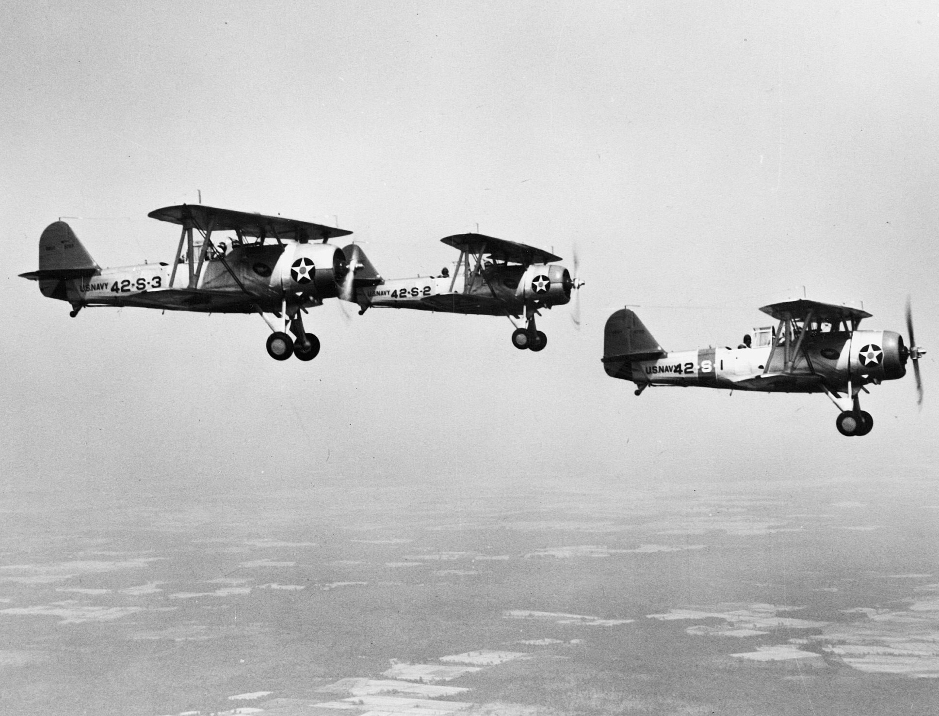
Vought SBU-1 VS-42 1940 NAN3-90
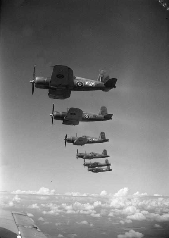
Vought was the name of several related American aerospace firms. These have included, in the past, Lewis and Vought Corporation, Chance Vought, Vought-Sikorsky, LTV Aerospace (part of Ling-Temco-Vought), Vought Aircraft Companies, and Vought Aircraft Industries. The first incarnation of Vought was established by Chance M. Vought and Birdseye Lewis in 1917. In 1928, it was acquired by United Aircraft and Transport Corporation, which a few years later became United Aircraft Corporation; this was the first of many reorganizations and buyouts. During the 1920s and 1930s, Vought Aircraft and Chance Vought specialized in carrier-based aircraft for the United States Navy, by far its biggest customer. Chance Vought produced thousands of planes during World War II, including the F4U Corsair. Vought became independent again in 1954, and was purchased by Ling-Temco-Vought (LTV) in 1961. The company designed and produced a variety of planes and missiles throughout the Cold War. Vought was ... [...More Info...] [...Related Items...] OR: [Wikipedia] [Google] [Baidu] |
World War I
World War I (28 July 1914 11 November 1918), often abbreviated as WWI, was List of wars and anthropogenic disasters by death toll, one of the deadliest global conflicts in history. Belligerents included much of Europe, the Russian Empire, the United States, and the Ottoman Empire, with fighting occurring throughout Europe, the Middle East, Africa, the Pacific Ocean, Pacific, and parts of Asia. An estimated 9 million soldiers were killed in combat, plus another 23 million wounded, while 5 million civilians died as a result of military action, hunger, and disease. Millions more died in Genocides in history (World War I through World War II), genocides within the Ottoman Empire and in the Spanish flu, 1918 influenza pandemic, which was exacerbated by the movement of combatants during the war. Prior to 1914, the European great powers were divided between the Triple Entente (comprising French Third Republic, France, Russia, and British Empire, Britain) and the Triple A ... [...More Info...] [...Related Items...] OR: [Wikipedia] [Google] [Baidu] |
Gibraltar
) , anthem = " God Save the King" , song = " Gibraltar Anthem" , image_map = Gibraltar location in Europe.svg , map_alt = Location of Gibraltar in Europe , map_caption = United Kingdom shown in pale green , mapsize = , image_map2 = Gibraltar map-en-edit2.svg , map_alt2 = Map of Gibraltar , map_caption2 = Map of Gibraltar , mapsize2 = , subdivision_type = Sovereign state , subdivision_name = , established_title = British capture , established_date = 4 August 1704 , established_title2 = , established_date2 = 11 April 1713 , established_title3 = National Day , established_date3 = 10 September 1967 , established_title4 = Accession to EEC , established_date4 = 1 January 1973 , established_title5 = Withdrawal from the EU , established_date5 = 31 January 2020 , official_languages = English , languages_type = Spoken languages , languages = , capital = Westside, Gibraltar (de facto) , coordinates = , largest_settlement_type = largest district , larg ... [...More Info...] [...Related Items...] OR: [Wikipedia] [Google] [Baidu] |
Labrador
, nickname = "The Big Land" , etymology = , subdivision_type = Country , subdivision_name = Canada , subdivision_type1 = Province , subdivision_name1 = Newfoundland and Labrador , subdivision_type2 = , subdivision_name2 = , subdivision_type3 = , subdivision_name3 = , subdivision_type4 = , subdivision_name4 = , image_map = File:Labrador-Region.PNG , map_caption = Labrador (red) within Canada , pushpin_map = , pushpin_relief = , pushpin_map_caption = , coordinates = , coordinates_footnotes = , established_title = Founded , established_date = 1763 , area_footnotes = , area_total_km2 = ... [...More Info...] [...Related Items...] OR: [Wikipedia] [Google] [Baidu] |
Newfoundland (island)
Newfoundland (, ; french: link=no, Terre-Neuve, ; ) is a large island off the east coast of the North American mainland and the most populous part of the Canadian province of Newfoundland and Labrador. It has 29 percent of the province's land area. The island is separated from the Labrador Peninsula by the Strait of Belle Isle and from Cape Breton Island by the Cabot Strait. It blocks the mouth of the Saint Lawrence River, creating the Gulf of Saint Lawrence, the world's largest estuary. Newfoundland's nearest neighbour is the French overseas collectivity of Saint Pierre and Miquelon. With an area of , Newfoundland is the world's 16th-largest island, Canada's fourth-largest island, and the largest Canadian island outside the North. The provincial capital, St. John's, is located on the southeastern coast of the island; Cape Spear, just south of the capital, is the easternmost point of North America, excluding Greenland. It is common to consider all directly neighb ... [...More Info...] [...Related Items...] OR: [Wikipedia] [Google] [Baidu] |
Panama
Panama ( , ; es, link=no, Panamá ), officially the Republic of Panama ( es, República de Panamá), is a transcontinental country spanning the southern part of North America and the northern part of South America. It is bordered by Costa Rica to the west, Colombia to the southeast, the Caribbean Sea to the north, and the Pacific Ocean to the south. Its capital and largest city is Panama City, whose metropolitan area is home to nearly half the country's million people. Panama was inhabited by indigenous tribes before Spanish colonists arrived in the 16th century. It broke away from Spain in 1821 and joined the Republic of Gran Colombia, a union of Nueva Granada, Ecuador, and Venezuela. After Gran Colombia dissolved in 1831, Panama and Nueva Granada eventually became the Republic of Colombia. With the backing of the United States, Panama seceded from Colombia in 1903, allowing the construction of the Panama Canal to be completed by the United States Army Corps of ... [...More Info...] [...Related Items...] OR: [Wikipedia] [Google] [Baidu] |
Panama Conference (1939)
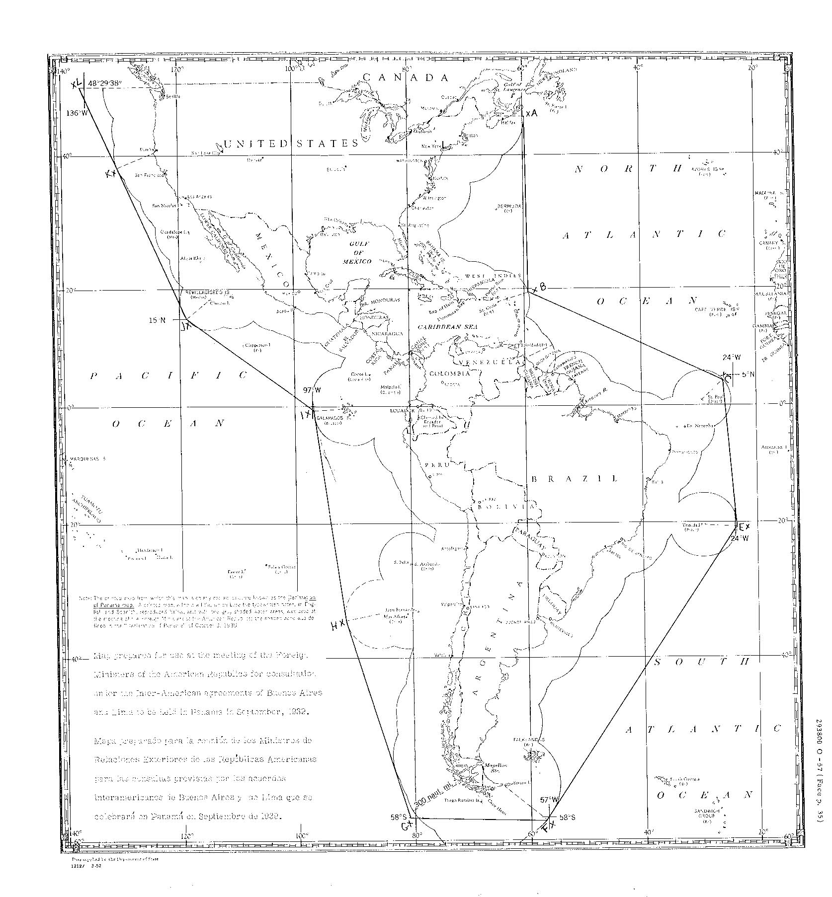
The Panama Conference was a meeting by the Ministers of Foreign Affairs of the United States, Panama, Mexico, Ecuador, Cuba, Costa Rica, Peru, Paraguay, Uruguay, Honduras, Chile, Colombia, Venezuela, Argentina, Guatemala, Nicaragua, Dominican Republic, Brazil, Bolivia, Haiti and El Salvador in Panama City at the Republic of Panama on September 23, 1939, shortly after the beginning of World War II in Europe. Background US President Franklin D. Roosevelt had sought to aid Latin America by the non-interventionist Good Neighbor policy, but he soon became aware of the possibility of nations in the region turning to fascism, and he began efforts aimed at uniting the region against its influence. He called conferences, notably the 1936 Inter-American Conference for the Maintenance of Peace and 1938 Peru Conference. Despite opposition by Chile and Argentina, the Lima Declaration was unofficially agreed upon at Peru and stipulated that any country in the Americas co ... [...More Info...] [...Related Items...] OR: [Wikipedia] [Google] [Baidu] |
Windward Islands
french: Îles du Vent , image_name = , image_caption = ''Political'' Windward Islands. Clockwise: Dominica, Martinique, Saint Lucia, Saint Vincent and the Grenadines, and Grenada. , image_alt = , locator_map = , location = Caribbean Sea North Atlantic Ocean , coordinates = , area_km2 = 3232.5 , total_islands = 90+ , major_islands = Carriacou Dominica GrenadaMartinique Petite MartiniqueSaint Lucia Saint Vincent , highest_mount = Morne Diablotins, Dominica , elevation_m = 1,447 , country = Dominica , country_largest_city = Roseau , country1 = Grenada , country1_largest_city = St. George's , country2 = Martinique , country2_largest_city = Fort-de-France , country3 = Saint Lucia , country3_largest_city = Castries , country4 = Saint Vincent and the Grenadines , country4_largest_city = Kingstown , density_km2 = 227 , population = 854,000 , ethnic_groups = The Windward Islands are the southern, generally larger islands of the Lesser Antilles. Part of the West Indies, ... [...More Info...] [...Related Items...] OR: [Wikipedia] [Google] [Baidu] |
Leeward Islands
french: Îles-Sous-le-Vent , image_name = , image_caption = ''Political'' Leeward Islands. Clockwise: Antigua and Barbuda, Guadeloupe, Saint kitts and Nevis. , image_alt = , locator_map = , location = Caribbean Sea North Atlantic Ocean , coordinates = , area_km2 = , total_islands = 30+ , major_islands = Antigua and BarbudaGuadeloupeMontserrat Saint Kitts and NevisSaint Martin Virgin Islands , highest_mount = La Grande Soufrière, Guadeloupe , elevation_m = 1,467 , country = Antigua and Barbuda , country_largest_city = Saint John's, Antigua, St. John's , country1 = Guadeloupe , country1_largest_city = Les Abymes , country2 = Saint Kitts and Nevis , country2_largest_city = Basseterre , country3 = Sint Maarten , country3_largest_city = Philipsburg, Sint Maarten, Philipsburg , density_km2 = , population = +700,000 , ethnic_groups = The Leeward Islands () are a group of islands situated where the northeastern Caribbean Sea meets the western Atlantic Ocean. Starting with th ... [...More Info...] [...Related Items...] OR: [Wikipedia] [Google] [Baidu] |
Circle Of Latitude
A circle of latitude or line of latitude on Earth is an abstract east–west small circle connecting all locations around Earth (ignoring elevation) at a given latitude coordinate line. Circles of latitude are often called parallels because they are parallel to each other; that is, planes that contain any of these circles never intersect each other. A location's position along a circle of latitude is given by its longitude. Circles of latitude are unlike circles of longitude, which are all great circles with the centre of Earth in the middle, as the circles of latitude get smaller as the distance from the Equator increases. Their length can be calculated by a common sine or cosine function. The 60th parallel north or south is half as long as the Equator (disregarding Earth's minor flattening by 0.335%). On the Mercator projection or on the Gall-Peters projection, a circle of latitude is perpendicular to all meridians. On the ellipsoid or on spherical projection, all circle ... [...More Info...] [...Related Items...] OR: [Wikipedia] [Google] [Baidu] |
Boston
Boston (), officially the City of Boston, is the capital city, state capital and List of municipalities in Massachusetts, most populous city of the Commonwealth (U.S. state), Commonwealth of Massachusetts, as well as the cultural and financial center of the New England region of the United States. It is the 24th-List of United States cities by population, most populous city in the country. The city boundaries encompass an area of about and a population of 675,647 2020 U.S. Census, as of 2020. It is the seat of Suffolk County, Massachusetts, Suffolk County (although the county government was disbanded on July 1, 1999). The city is the economic and cultural anchor of a substantially larger metropolitan area known as Greater Boston, a metropolitan statistical area (MSA) home to a census-estimated 4.8 million people in 2016 and ranking as the tenth-largest MSA in the country. A broader combined statistical area (CSA), generally corresponding to the commuting area and includ ... [...More Info...] [...Related Items...] OR: [Wikipedia] [Google] [Baidu] |
Declaration Of Panama Map
Declaration may refer to: Arts, entertainment, and media Literature * ''Declaration'' (book), a self-published electronic pamphlet by Michael Hardt and Antonio Negri * ''The Declaration'' (novel), a 2008 children's novel by Gemma Malley Music * ''Declaration'' (The Alarm album) (1984) * ''Declaration'' (Bleeding Through album) (2008) * ''Declaration'' (Steven Curtis Chapman album) (2001) *''Déclaration'', a 1973 album by Georges Moustaki * ''The Declaration'', a 2008 album by Ashanti *''Declaration'', a 2020 album by Red Songs *"Declaration (This Is It)", a 2012 gospel song by Kirk Franklin *"Declaration", a song by Killswitch Engage from the album ''The End of Heartache'', 2004 *"Declaration", a song by Trivium from the album '' Ascendancy'', 2005 *"Déclaration", a classical song by Leoncavallo *"The Declaration", a 1970 song by The 5th Dimension Other arts, entertainment, and media * Declaration (poker), a formal expression of intent to take some action in the card g ... [...More Info...] [...Related Items...] OR: [Wikipedia] [Google] [Baidu] |


