|
Montenegrin Campaign
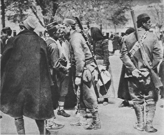
The Montenegrin campaign of World War I, in January 1916, was a part of the Serbian campaign of World War I, in which Austria-Hungary defeated and occupied the Kingdom of Montenegro, an ally of Serbia. By January 1916, the Serbian Army had been defeated by an Austrian-Hungarian, German and Bulgarian invasion. The remnants of the Serbian army had withdrawn through Montenegro and Albania, and were being evacuated by allied ships from 12 December first to Italy and later to Corfu. The Austro-Hungarian High Command, then at Teschen, decided to use the success in Serbia to knock Montenegro out of the war. The army of Montenegro that had fought alongside their Serbian allies, had now withdrawn into their own territory, but were still resisting against the Central Powers. Furthermore, the Austrian Commander-in-Chief Conrad von Hötzendorf wanted to take the Italian-held Albanian ports of Durazzo and Valona. Two Austrian army corps for this task were formed in December 1915. One ... [...More Info...] [...Related Items...] OR: [Wikipedia] [Google] [Baidu] |
Serbian Campaign
The Serbian campaign was a series of military expeditions launched in 1914 and 1915 by the Central Powers against the Kingdom of Serbia during the First World War. The first campaign began after Austria-Hungary declared war on Serbia on 28 July 1914. The campaign to "punish" Serbia was under the command of Austrian Oskar Potiorek. It ended after three unsuccessful Austro-Hungarian invasion attempts were repelled by the Serbians and their Montenegrin allies. The victory of the Serbian Army at the battle of Cer is considered the first Allied victory in World War I, while the defeat of the Austro-Hungarian Army by Serbia has been called one of the great upsets of modern military history. The second campaign was launched, under German command, almost a year later, on 6 October 1915, when Bulgarian, Austro-Hungarian, and German forces, led by Field Marshal August von Mackensen, successfully invaded Serbia from three sides, pre-empting an Allied advance from Salonica to help ... [...More Info...] [...Related Items...] OR: [Wikipedia] [Google] [Baidu] |
Vlorë
Vlorë ( , ; sq-definite, Vlora) is the third most populous city of the Republic of Albania and seat of Vlorë County and Vlorë Municipality. Located in southwestern Albania, Vlorë sprawls on the Bay of Vlorë and is surrounded by the foothills of the Ceraunian Mountains along the Albanian Adriatic and Ionian Sea Coasts. It experiences a Mediterranean climate, which is affected by the Ceraunian Mountains and the proximity to the Mediterranean Sea. Vlorë was founded as Aulon as an Ancient Greek colony on the Illyrian coast and was conquered at different periods throughout history by Romans, Byzantines, Normans, Venetians and Ottomans. Between the 18th and 19th centuries, the Albanians gathered both spiritual and intellectual strength for national consciousness, which conclusively led to the Albanian Renaissance. Vlorë played an instrumental role in Albanian Independence as an epicenter for the founders of modern Albania, who signed the Declaration of Independenc ... [...More Info...] [...Related Items...] OR: [Wikipedia] [Google] [Baidu] |
Priština
Pristina, ; sr, / (, ) is the capital and largest city of Kosovo. The city's municipal boundaries in Pristina District form the largest urban center in Kosovo. After Tirana, Pristina has the second largest population of ethnic Albanians and speakers of the Albanian language. Inhabited by humans since prehistoric times, the area of Pristina was home to several Illyrian peoples. King Bardyllis of the Dardanians brought various tribes together in the 4th century BC and established the Dardanian Kingdom.''The Cambridge Ancient History: The fourth century B.C.'' Volume 6 of The Cambridge Ancient History Iorwerth Eiddon Stephen Edwards, , , Authors: D. M. Lewis, John Boardman, Editors: D. M. Lewis, John Boardman, Second Edition, Cambr ... [...More Info...] [...Related Items...] OR: [Wikipedia] [Google] [Baidu] |
Berane
Berane ( cyrl, Беране) is one of the largest towns of northeastern Montenegro and a former administrative centre of the Ivangrad District. The town is located on the Lim river. From 1949 to 1992, it was named Ivangrad ( cyrl, Иванград) in honour to people's hero Ivan Milutinović. The town has a population of over 11,000, whereas its municipality area reaches nearly 30,000 people, making it one of the largest centres of Polimlje area. During the medieval period the land of Berane was known as Budimlja (Будимља). It was of great holistic, political and economic importance in the medieval Serbian state and its rulers. Until 1455, when Turks took the city, Budimlja was part of the wider historical region of Raška, within the Medieval Serbia. Since the first Serbian Uprising until its final liberation, fights against Turks were constant. Famous battles occurred from 1825 to 1862 when the most important Rudes battle was fought on 7 April in which the Monten ... [...More Info...] [...Related Items...] OR: [Wikipedia] [Google] [Baidu] |
Novi Pazar
Novi Pazar ( sr-cyr, Нови Пазар, lit. "New Bazaar"; ) is a city located in the Raška District of southwestern Serbia. As of the 2011 census, the urban area has 66,527 inhabitants, while the city administrative area has 100,410 inhabitants. The city is the cultural center of the Bosniaks in Serbia and the region of Sandžak. A multicultural area of Muslims and Orthodox Christians, many monuments of both religions, like the Altun-Alem Mosque and the Church of the Holy Apostles Peter and Paul, are found in the region which has a total of 30 protected monuments of culture. Name During the 14th century under the old Serbian fortress of Stari Ras, an important market-place named ''Trgovište'' started to develop. By the middle of the 15th century, in the time of the final Ottoman Empire conquest of Old Serbia, another market-place was developing some 11 km to the east. The older place became known as ''Staro Trgovište'' (Old Trgovište, tr, Eski Pazar) and the yo ... [...More Info...] [...Related Items...] OR: [Wikipedia] [Google] [Baidu] |
Battle Of Mojkovac
The Battle of Mojkovac was a World War I battle fought between 6 January and 7 January 1916 near Mojkovac, in today's Montenegro, between the armies of Austria-Hungary and the Kingdom of Montenegro. It ended with a decisive Montenegrin victory. Prelude In the winter of 1915, the Montenegrin Army had been fighting the Austro-Hungarian Army for three months in Serbia. In January 1916 they had to resist the invasion of their own territory. The Montenegrin Army was weakened by the harsh weather and lack of supplies. On 5 January 1916, they received a command to protect the retreat of the Royal Serbian Army to Corfu in Greece via Albania. Savo Lazarević was commander of Montenegrin Royal Gendarmerie which was part of Čakor Detachment during the Battle of Mojkovac. Battle The fighting culminated on 6 and 7 January 1916 (on Orthodox Christmas; also known as 'Bloody Christmas'). Led by Serdar ( Vojvoda) Janko Vukotić with Krsto Popović as second in command, the Montenegrins in ... [...More Info...] [...Related Items...] OR: [Wikipedia] [Google] [Baidu] |
Bijelo Polje
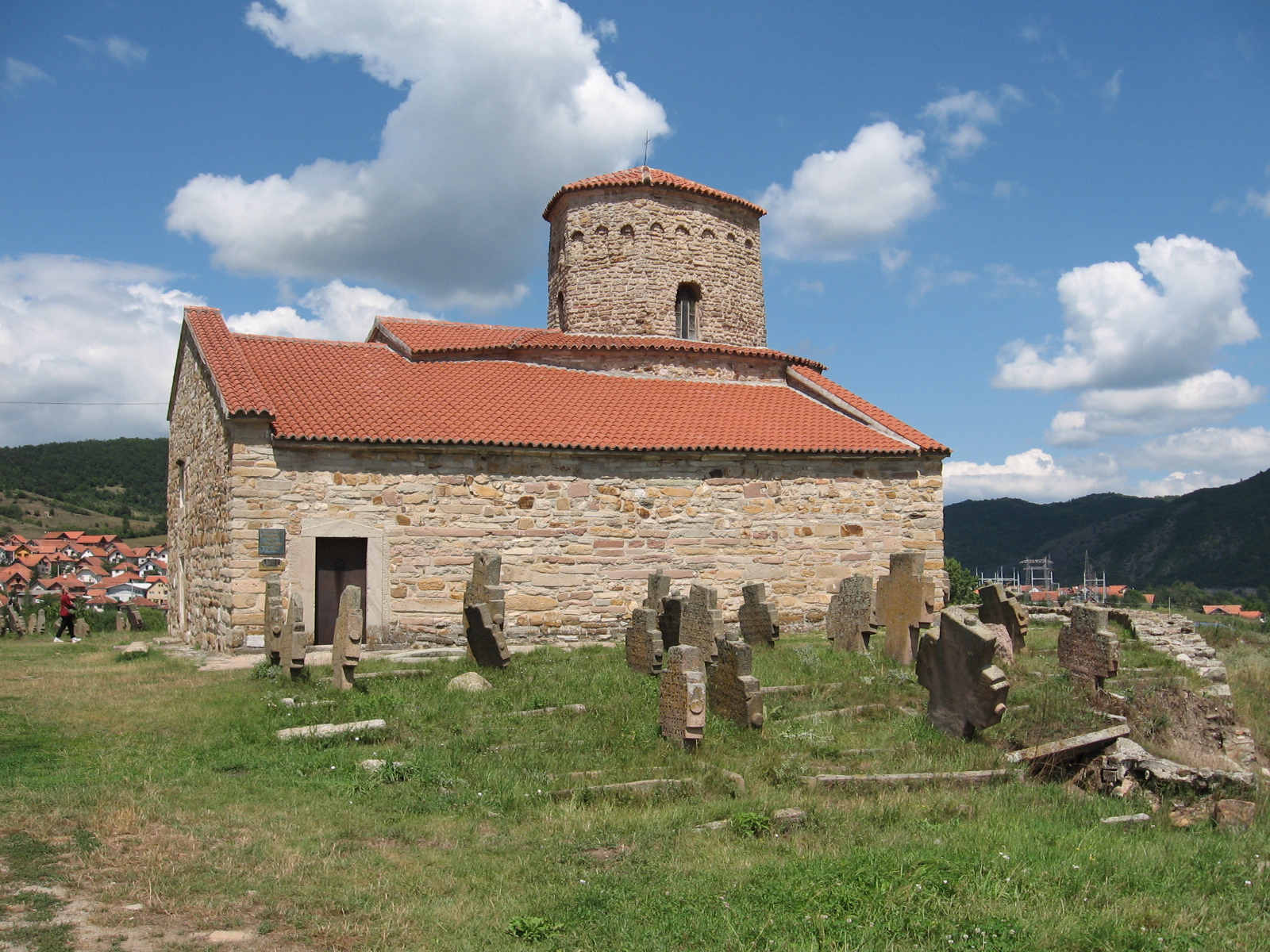
Bijelo Polje ( cnr, Бијело Поље, ) is a town in northeastern Montenegro on the Lim River. It has an urban population of 15,400 (2011 census). It is the administrative, economic, cultural and educational centre of northern Montenegro. Bijelo Polje is the center of Bijelo Polje Municipality (population of 46,051). It is the unofficial center of the north-eastern region of Montenegro. Bijelo Polje means 'white field' in Serbo-Croatian. History Bijelo Polje's Saint Peter and Paul Church is the place where the UNESCO Miroslav's Gospel of Miroslav, brother of Serbian ruler Stefan Nemanja was written. During World War II, Bijelo Pole was a prominent location for the anti-fascist resistance movement in Yugoslavia, Montenegro in particular. Population Bijelo Polje is the administrative centre of the Bijelo Polje municipality, which in 2011 had a population of 46,251. The town of Bijelo Polje itself has 15,400 citizens. Population of Bijelo Polje (town): *1981 - 11,927 *1 ... [...More Info...] [...Related Items...] OR: [Wikipedia] [Google] [Baidu] |
Pljevlja
Pljevlja ( srp, Пљевља, ) is a town and the center of Pljevlja Municipality located in the northern part of Montenegro. The town lies at an altitude of . In the Middle Ages, Pljevlja had been a crossroad of the important commercial roads and cultural streams, with important roads connecting the littoral with the Balkan interior. In 2011, the municipality of Pljevlja had a population of 30,786, while the city itself had a population of about 19,489 making it the fourth largest urban settlement in Montenegro. The municipality borders those of Žabljak, Bijelo Polje and Mojkovac in Montenegro, as well as Bosnia and Herzegovina to the west and Serbia to the northeast. With a total area of , it is the third largest municipality in Montenegro. History Prehistory and antiquity The first traces of human life in the region date between 50,000 and 40,000 BC, while reliable findings show that the Ćehotina River valley was inhabited no later than 30,000 BC. The oldest traces of ... [...More Info...] [...Related Items...] OR: [Wikipedia] [Google] [Baidu] |
Tara (river)
The Tara ( sr-cyrl, Тара) is a river in Montenegro and Bosnia and Herzegovina. It emerges from the confluence of the Opasnica and Veruša rivers in the Komovi Mountains, part of the Dinaric Alps of Montenegro. The total length is 146 km, of which 141 km are in or on the border of Montenegro,;Statistical Yearbook of Montenegro 2017, Geography Statistical Office of Montenegro it also forms the border between the two countries in several places. The Tara flows from south to north - north-west and converges with the at the Bosnia and Herzegovina and Montenegro border between the villages of Šćepan Polje (Montenegro) and Hum (Bosnia and ... [...More Info...] [...Related Items...] OR: [Wikipedia] [Google] [Baidu] |
Podgorica
Podgorica (Cyrillic: Подгорица, ; lit. 'under the hill') is the capital and largest city of Montenegro. The city was formerly known as Titograd (Cyrillic: Титоград, ) between 1946 and 1992—in the period that Montenegro formed, as the Socialist Republic of Montenegro in honour of Marshal Josip Broz Tito. The city was largely destroyed during the bombing of Podgorica in World War II and accordingly the city is now dominated by architecture from the following decades of communism. Further but less substantial damage was caused by the 1999 bombing by NATO forces. The surrounding landscape is predominantly mountainous terrain. The city is just north of the Lake Skadar and close to coastal destinations on the Adriatic Sea. Historically, it was Podgorica's position at the confluence of the Ribnica and Morača rivers and at the meeting-point of the fertile Zeta Plain and Bjelopavlići Valley that encouraged settlement. Etymology Podgorica is written in Cyrillic ... [...More Info...] [...Related Items...] OR: [Wikipedia] [Google] [Baidu] |
Lovćen
Lovćen ( cyrl, Ловћен, ) is a mountain and national park in southwestern Montenegro. It is the inspiration behind the names ''Montenegro'' and ''Crna Gora'', both of which mean "Black Mountain" and refer to the appearance of Mount Lovćen when covered in dense forests. The name ''Crna Gora'' was first mentioned in a charter issued by Stefan Milutin in 1276 and was used for several regions across medieval Serbian lands, including Skopska Crna Gora and Užička Crna Gora. Mount Lovćen rises from the borders of the Adriatic basin, closing the long and twisting bays of Boka Kotorska and making the hinterland to the coastal town of Kotor. The mountain has two imposing peaks, ''Štirovnik''; and ''Jezerski vrh''; . The mountain slopes are rocky, with numerous fissures, pits and deep depressions giving its scenery a specific look. Lovćen stands on the border between two completely different natural wholes, the sea and the mainland, and so it is under the influence of bot ... [...More Info...] [...Related Items...] OR: [Wikipedia] [Google] [Baidu] |
Kingdom Of Dalmatia
The Kingdom of Dalmatia ( hr, Kraljevina Dalmacija; german: Königreich Dalmatien; it, Regno di Dalmazia) was a crown land of the Austrian Empire (1815–1867) and the Cisleithanian half of Austria-Hungary (1867–1918). It encompassed the entirety of the region of Dalmatia, with its capital at Zadar. History The Habsburg monarchy had annexed the lands of Dalmatia after the Napoleonic War of the First Coalition: when Napoleon Bonaparte launched his Italian Campaign into the Habsburg duchies of Milan and Mantua in 1796, culminating in the Siege of Mantua, he compelled Emperor Francis II to make peace. In 1797 the Treaty of Campo Formio was signed, whereby the Habsburg emperor renounced possession of the Austrian Netherlands and officially recognized the independence of the Italian Cisalpine Republic. In turn, Napoleon ceded to him the possessions of the Republic of Venice, including the Dalmatian coast (Venetian Dalmatia) and the Bay of Kotor ( Venetian Albania). ''La Seren ... [...More Info...] [...Related Items...] OR: [Wikipedia] [Google] [Baidu] |

.jpg)


