|
Mizque
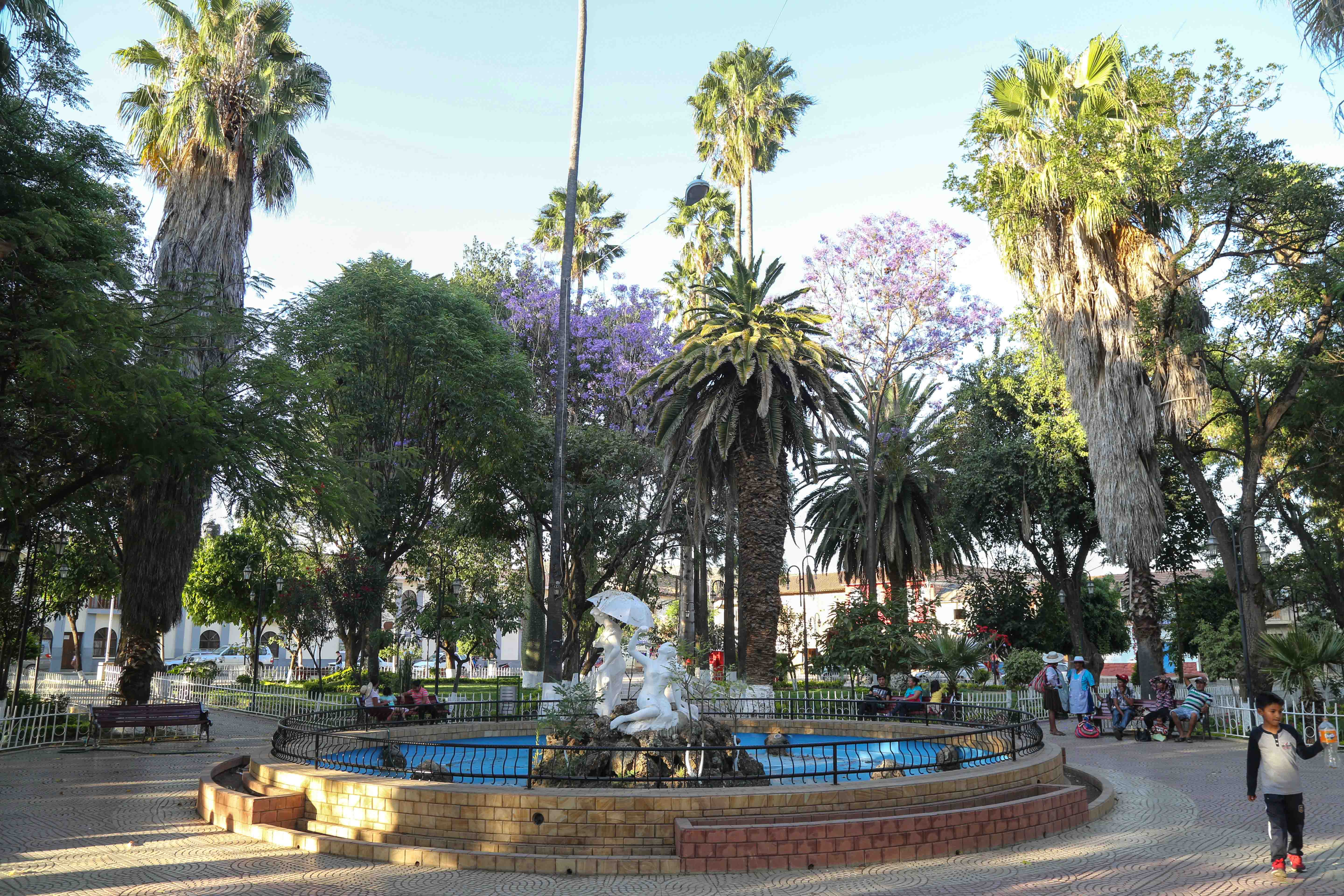
Mizque, Misk'i (from Quechua: ''misk'i'', meaning "sweet") is a town in the Cochabamba Department, Bolivia. It is the capital of the Mizque Province. Mizque is located in the valley of the Mizque River, one of the main tributaries of the Río Grande. Historically, it was located in the region of Upper Peru, and was a ''corregimiente'' dependent on Santa Cruz de la Sierra until 1783, when it became an independent town of the ''Intendencia de Cochabamba'', in the Viceroyalty of the Río de la Plata. During the Spanish American wars of independence, Mizque sent deputies to the Congress of Tucumán, which declared Argentina's independence in 1816, and to the congress that declared the independence of Bolivia in 1825. Communications Mizque is located on a well maintained highway which to the north-west leads through the Valle Alto to Cochabamba. In the other direction, as National Road 23, the route runs southwards to Aiquile and, beyond that, to Sucre. The bus connection to C ... [...More Info...] [...Related Items...] OR: [Wikipedia] [Google] [Baidu] |
Mizque Province
Mizque (from Quechua: ''misk'i'', meaning "sweet") is a province in the Cochabamba Department, Bolivia. Its capital is Mizque. The province, in 1992, had a population of 27,959 inhabitants, mostly indigenous citizens of Quechuan descent. In 2001, the population increased to 36,181 inhabitants and it was estimated at 41,062 in 2005. Geography Mizque Province is home to a great diversity of ecoregions because it contains a wide variety of topographic features with heights ranging between 2,000 and 3,600 m. The province belongs to the Julpe- Mizque basin with an area of 3,845 km2. The main rivers are: * Mizque River, 75 km * Julpe River, 60 km * Uyuchama River, 50 km * Tuqma River, 45 km * Kari Kari River, 42 km * Vicho Vicho River, 32 km Although there is a large amount of superficial and sub-superficial water within the province, the zone is suffering from drought due to the lack of irrigation systems. Some of the highest mountains of ... [...More Info...] [...Related Items...] OR: [Wikipedia] [Google] [Baidu] |
Mizque Municipality
Mizque Municipality is the first municipal section of the Mizque Province in the Cochabamba Department, Bolivia. Its seat is Mizque Mizque, Misk'i (from Quechua: ''misk'i'', meaning "sweet") is a town in the Cochabamba Department, Bolivia. It is the capital of the Mizque Province. Mizque is located in the valley of the Mizque River, one of the main tributaries of the Río Gr .... Geography Some of the highest mountains of the municipality are listed below: Subdivision Mizque Municipality is divided into six cantons. References External links Population data and map of Mizque Municipality Municipalities of the Cochabamba Department {{CochabambaBO-geo-stub ... [...More Info...] [...Related Items...] OR: [Wikipedia] [Google] [Baidu] |
Provinces Of Bolivia
A province is the second largest administrative division in Bolivia, after a department. Each department is divided into provinces. There are 112 provinces. The country's provinces are further divided into 337 municipalities which are administered by an alcalde and municipal council A municipal council is the legislative body of a municipality or local government area. Depending on the location and classification of the municipality it may be known as a city council, town council, town board, community council, rural counc .... List of provinces Beni Department Chuquisaca Department Cochabamba Department La Paz Department Oruro Department Pando Department Potosí Department Santa Cruz Department Tarija Department See also * Departments of Bolivia * Municipalities of Bolivia Sources Instituto Nacional de Estadística - Bolivia(Spanish) {{Articles on second-level administrative divisions of South American countries Su ... [...More Info...] [...Related Items...] OR: [Wikipedia] [Google] [Baidu] |
Cochabamba Department
Cochabamba ( ay, Quchapampa Jach'a Suyu, es, Departamento de Cochabamba , qu, Quchapampa Suyu), from Quechua ''qucha'' or ''qhucha'', meaning "lake", ''pampa'' meaning "plain", is one of the nine departments of Bolivia. It is known to be the " granary" of the country because of its variety of agricultural products from its geographical position. It has an area of 55,631 km2. Its population in the 2012 census was 1,758,143. Its capital is the city of Cochabamba, known as the "City of Eternal Spring" and "The Garden City" because of its spring-like temperatures all year. History The Cochabamba valley was inhabited for over a thousand years due to its fertile productive soils and climate. Archaeological evidence suggests that the initial valley inhabitants were of various ethnic indigenous groups. Tiwanaku, Tupuraya, Mojocoya, Omereque and Inca inhabited the valley at various times before the Spanish arrived. The first Spanish inhabitant of the Valley was Garci Ruiz de O ... [...More Info...] [...Related Items...] OR: [Wikipedia] [Google] [Baidu] |
Mizque River
The Mizque River (Quechua language, Quechua ''misk'i'' sweet) is a river of Bolivia in the Cochabamba Department. It is a tributary of Río Grande (Bolivia), Río Grande. See also *List of rivers of Bolivia Further reading *Rand McNally, The New International Atlas, 1993. Rivers of Cochabamba Department {{Bolivia-river-stub ... [...More Info...] [...Related Items...] OR: [Wikipedia] [Google] [Baidu] |
Congress Of Tucumán
The Congress of Tucumán was the representative assembly, initially meeting in San Miguel de Tucumán, that declared the independence of the United Provinces of South America (modern-day Argentina, Uruguay, part of Bolivia) on July 9, 1816, from the Spanish Empire. Overview Following the May Revolution of 1810, the Viceroy had been replaced by the Primera Junta. The provinces had been moving towards full independence but royalist forces from the Viceroyalty of Peru have had the upper hand in the Upper Peru and were threatening the revolution. On April 15, 1815, a revolution ended the mandate of Carlos María de Alvear and called a General Congress. Delegate deputies, each representing 15,000 inhabitants, were sent from all the provinces to the sessions that started on March 24, 1816. Nevertheless, some territories that formerly belonged to the Viceroyalty of the River Plate did not take part in the Congress: the delegates from the ''Banda Oriental'' ('Eastern Bank', today Urug ... [...More Info...] [...Related Items...] OR: [Wikipedia] [Google] [Baidu] |
Municipalities Of Bolivia
Municipalities in Bolivia are administrative divisions of the entire national territory governed by local elections. Municipalities are the third level of administrative divisions, below departments and provinces. Some of the provinces consist of only one municipality. In these cases the municipalities are identical to the provinces they belong to. History of governance Municipalities in Bolivia are each led by a mayor, an executive office. Mayors were appointed by the national government from 1878 to 1942 and from 1949 to 1987. Local elections were held under the 1942 municipal code, which was in force until 1991. The 1985 Organic Law of Municipalities restored local elections for mayor and created a legislative body, the municipal council. In 1994, the entire territory of Bolivia was merged into municipalities, where previously only urban areas were organized as municipalities. As an effect of decentralization through the 1994 Law of Popular Participation the number of municip ... [...More Info...] [...Related Items...] OR: [Wikipedia] [Google] [Baidu] |
Santa Cruz De La Sierra
Santa Cruz de la Sierra (; "Holy Cross of the Mountain Range"), commonly known as Santa Cruz, is the largest city in Bolivia and the capital of the Santa Cruz department. Situated on the Pirai River in the eastern Tropical Lowlands of Bolivia, the Santa Cruz de la Sierra Metropolitan Region is the most populous urban agglomeration in Bolivia with an estimated of 2.4 million population in 2020, it is formed by a conurbation of seven Santa Cruz municipalities: Santa Cruz de la Sierra, La Guardia, Warnes, Cotoca, El Torno, Porongo, and Montero. The city was first founded in 1561 by Spanish explorer Ñuflo de Chavez about east of its current location, and was moved several times until it was finally established on the Pirai River in the late 16th century. For much of its history, Santa Cruz was mostly a small outpost town, and even after Bolivia gained its independence in 1825 there was little attention from the authorities or the population in general to settle the region. ... [...More Info...] [...Related Items...] OR: [Wikipedia] [Google] [Baidu] |
Sucre
Sucre () is the capital of Bolivia, the capital of the Chuquisaca Department and the 6th most populated city in Bolivia. Located in the south-central part of the country, Sucre lies at an elevation of . This relatively high altitude gives the city a subtropical highland climate with cool temperatures year-round. Its pre-Columbian name was Chuquisaca; during the Spanish Empire it was called La Plata. Before the arrival of the Spanish, the city of Chuquisaca had its own autonomy with respect to the Inca Empire (the Charcas were the only people that did not pay the ransom for the Inca captive). Today, the region is of predominantly Quechua background, with some Aymara communities and influences. Today Sucre remains a city of major national importance and is an educational and government center, being the location of the Bolivian Supreme Court. Its pleasant climate and low crime rates have made the city popular amongst foreigners and Bolivians alike. Notably, Sucre contains on ... [...More Info...] [...Related Items...] OR: [Wikipedia] [Google] [Baidu] |
Aiquile
Aiquile is a town in the Cochabamba Department, Bolivia. It is the capital of the Narciso Campero Province and Aiquile Municipality. Most of its population is Quechua, and its residents are reputed to be the best charango The charango is a small Andean stringed instrument of the lute family, from the Quechua and Aymara populations in the territory of the Altiplano in post-Colonial times, after European stringed instruments were introduced by the Spanish during co ... makers in the country. External links Map of Narciso Campero Province Populated places in Cochabamba Department {{CochabambaBO-geo-stub ... [...More Info...] [...Related Items...] OR: [Wikipedia] [Google] [Baidu] |
Cochabamba
Cochabamba ( ay, Quchapampa; qu, Quchapampa) is a city and municipality in central Bolivia in a valley in the Andes mountain range. It is the capital of the Cochabamba Department and the fourth largest city in Bolivia, with a population of 630,587 according to the 2012 Bolivian census. Its name is from a compound of the Quechua words ''qucha'' "lake" and ''pampa'', "open plain." Residents of the city and the surrounding areas are commonly referred to as ''cochalas'' or, more formally, ''cochabambinos''. It is known as the "City of Eternal Spring" or "The Garden City" because of its spring-like temperatures all year round. It is also known as "La Llajta," which means "town" in Quechua. It is the largest urban center between the higher capital of La Paz and Santa Cruz de la Sierra in the tropical plains of the east. It sits south-west of the Tunari mountains, and north of the foothills of the Valle Alto. In antiquity, the area featured numerous lakes, which gave the city its na ... [...More Info...] [...Related Items...] OR: [Wikipedia] [Google] [Baidu] |
Spanish American Wars Of Independence
The Spanish American wars of independence (25 September 1808 – 29 September 1833; es, Guerras de independencia hispanoamericanas) were numerous wars in Spanish America with the aim of political independence from Spanish rule during the early 19th century. These began shortly after the start of the French invasion of Spain during the Napoleonic Wars. Thus, the strict period of military campaigns would go from the battle of Chacaltaya (1809), in present-day Bolivia, to the battle of Tampico (1829), in Mexico. In 1808, the sequestration of the Spanish royal family by Napoleon Bonaparte, the Abdications of Bayonne, gave rise to an emergence of liberalism and desire for liberties throughout the Spanish Empire. The violent conflicts started in 1809, with short-lived governing juntas established in Chuquisaca, La Paz and Quito opposing the government of the Supreme Central Junta of Seville. At the beginning of 1810, numerous new juntas appeared across the Spanish domains in ... [...More Info...] [...Related Items...] OR: [Wikipedia] [Google] [Baidu] |


.jpg)
