|
Middleton, New Zealand
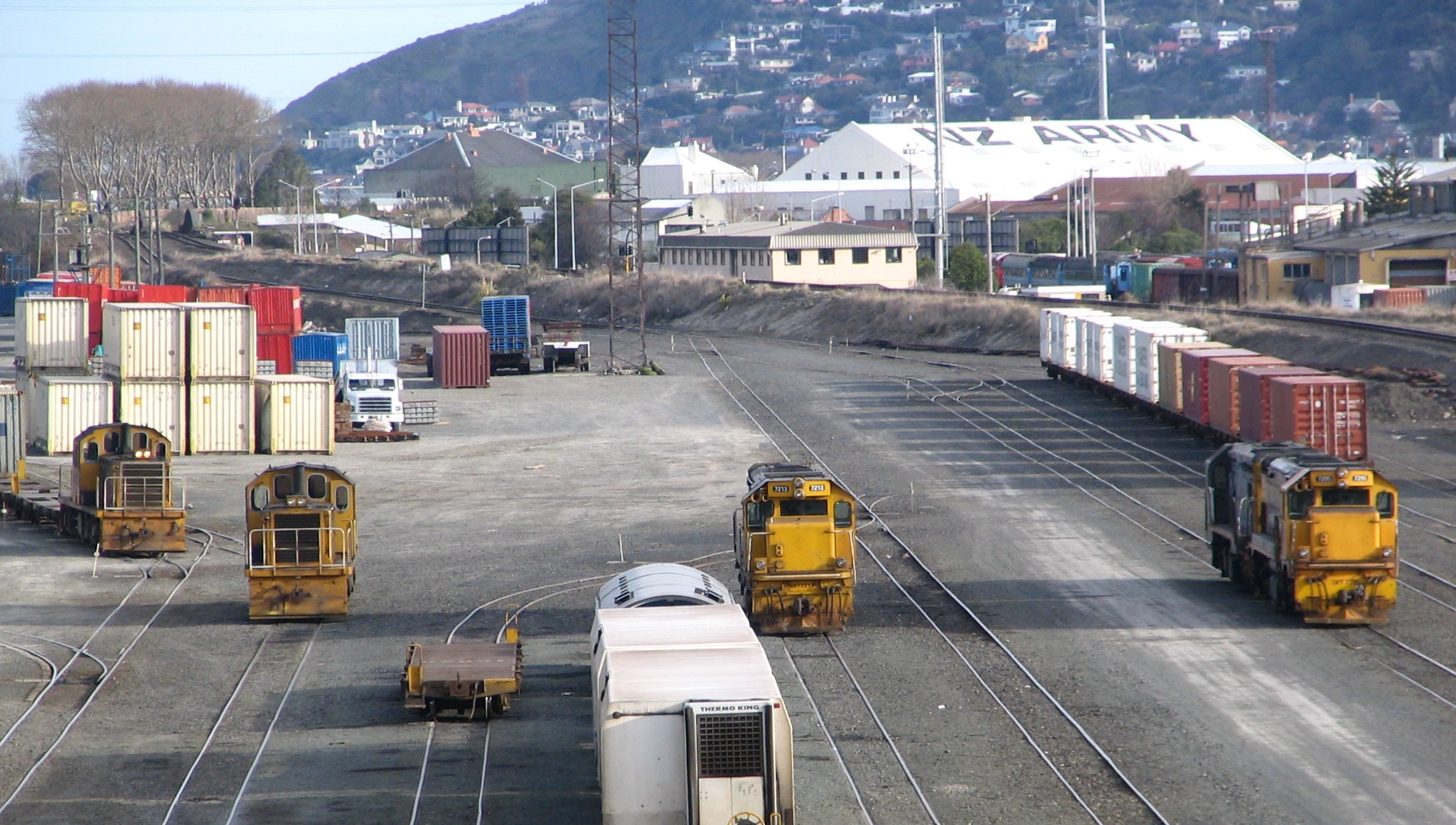
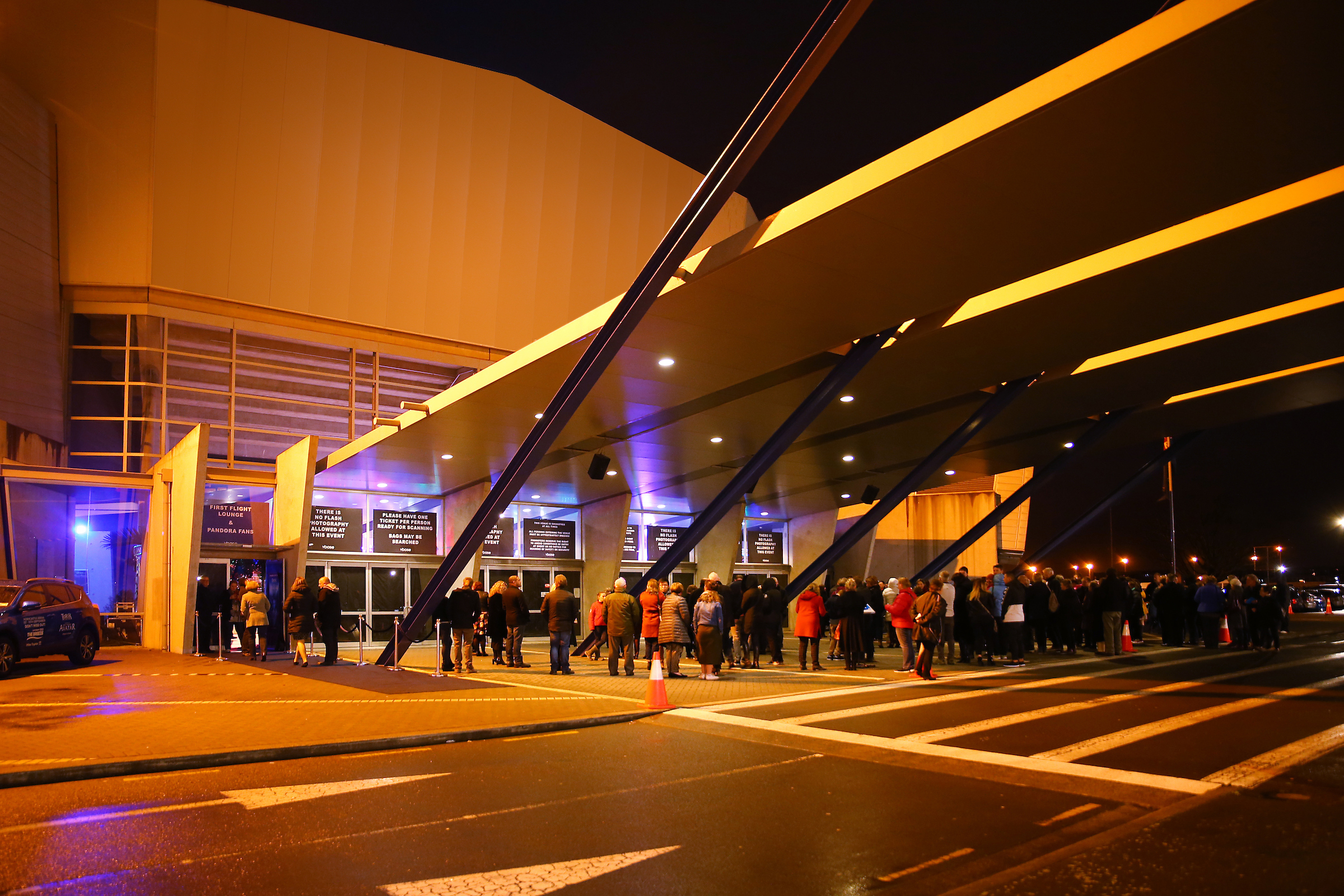
Middleton is a predominantly industrial and wholesale suburb of Christchurch, New Zealand. It is located in the west of the city, between Wigram and Addington, and immediately to the south of Upper Riccarton. Middleton's boundaries are typically defined by major roads. The western and southern boundaries are State Highways 73 and 76 respectively, with State Highway 75 continuing from the junction of the two at the southern tip of Middleton. Blenheim Road, a major Christchurch thoroughfare with multiple retail and commercial premises, forms much of the northern limit, while Matipo Street generally defines the eastern boundary, with Addington Raceway and Horncastle Arena just beyond in neighbouring Addington. The suburb is also home to a large rail yard operated by KiwiRail, connecting Christchurch to both the South Island Main Trunk Railway and the Midland Line. Demographics Middleton covers . It had an estimated population of as of with a population density of people ... [...More Info...] [...Related Items...] OR: [Wikipedia] [Google] [Baidu] |
Hillmorton, New Zealand
Hillmorton is a suburb of south-western Christchurch, New Zealand. The suburb is centred around the intersection of Lincoln Road and Hoon hay Road, two arterial routes which form part of State Highway 75 and feed into the Christchurch Southern Motorway which runs to the north of the suburb. History Hillmorton takes its name from Hill Morton Farm, the property of John Twigger, who settled in the area in 1863. Land from the subdivision of this farm was advertised for sale in a local newspaper in 1879 as being "part of Twigger's property known as Hillmorton". At the same time as Twigger settled the area, 1863 also saw the opening of the Sunnyside Hospital, Christchurch's first mental asylum. The buildings were constructed in a gothic style by architect John Campbell, and represented a shift in the approach to mental illness in the region. Where previously those with mental illnesses were held at Lyttelton Gaol, the hospital was founded on the principles of moral management, provid ... [...More Info...] [...Related Items...] OR: [Wikipedia] [Google] [Baidu] |
Christchurch
Christchurch ( ; mi, Ōtautahi) is the largest city in the South Island of New Zealand and the seat of the Canterbury Region. Christchurch lies on the South Island's east coast, just north of Banks Peninsula on Pegasus Bay. The Avon River / Ōtākaro flows through the centre of the city, with an urban park along its banks. The city's territorial authority population is people, and includes a number of smaller urban areas as well as rural areas. The population of the urban area is people. Christchurch is the second-largest city by urban area population in New Zealand, after Auckland. It is the major urban area of an emerging sub-region known informally as Greater Christchurch. Notable smaller urban areas within this sub-region include Rangiora and Kaiapoi in Waimakariri District, north of the Waimakariri River, and Rolleston and Lincoln in Selwyn District to the south. The first inhabitants migrated to the area sometime between 1000 and 1250 AD. They hunted moa, which ... [...More Info...] [...Related Items...] OR: [Wikipedia] [Google] [Baidu] |
New Zealand State Highway 75
State Highway 75 (SH 75) is a state highway in New Zealand servicing the Banks Peninsula region, connecting Christchurch on the northwestern part of the peninsula with Akaroa towards the east coast. It is wholly two lane (with the exception of some passing lanes near Hilltop), but partially functions as a major arterial corridor of Christchurch. Its highest point is at Hilltop, where it rises to about 555 m - just 8 m lower than the more mountainous Haast Pass in the Southern Alps. Route The highway currently begins at the intersection of Curletts Road and Christchurch Southern Motorway (the former SH 73, the latter SH 76) which is now a dogbone interchange. At Curletts Road, the road proceeds as a short expressway to the southeast until it reaches the intersection of Hoon Hay Road and Halswell Road. SH 75 turns right onto Halswell Road, and continues in a southwesterly direction until it just passes the settlement of Halswell. Now known as Tai Tapu Road, th ... [...More Info...] [...Related Items...] OR: [Wikipedia] [Google] [Baidu] |
2013 New Zealand Census
The 2013 New Zealand census was the thirty-third national census. "The National Census Day" used for the census was on Tuesday, 5 March 2013. The population of New Zealand was counted as 4,242,048, – an increase of 214,101 or 5.3% over the 2006 census. The 2013 census forms were the same as the forms developed for the 2011 census which was cancelled due to the February 2011 major earthquake in Christchurch. There were no new topics or questions. New Zealand's next census was conducted in March 2018. Collection methods The results from the post-enumeration survey showed that the 2013 census recorded 97.6 percent of the residents in New Zealand on census night. However, the overall response rate was 92.9 percent, with a non-response rate of 7.1 percent made up of the net undercount and people who were counted in the census but had not received a form. Results Population and dwellings Population counts for New Zealand regions. Note: All figures are for the census usually r ... [...More Info...] [...Related Items...] OR: [Wikipedia] [Google] [Baidu] |
2018 New Zealand Census
Eighteen or 18 may refer to: * 18 (number), the natural number following 17 and preceding 19 * one of the years 18 BC, AD 18, 1918, 2018 Film, television and entertainment * ''18'' (film), a 1993 Taiwanese experimental film based on the short story ''God's Dice'' * ''Eighteen'' (film), a 2005 Canadian dramatic feature film * 18 (British Board of Film Classification), a film rating in the United Kingdom, also used in Ireland by the Irish Film Classification Office * 18 (''Dragon Ball''), a character in the ''Dragon Ball'' franchise * "Eighteen", a 2006 episode of the animated television series '' 12 oz. Mouse'' Music Albums * ''18'' (Moby album), 2002 * ''18'' (Nana Kitade album), 2005 * '' 18...'', 2009 debut album by G.E.M. Songs * "18" (5 Seconds of Summer song), from their 2014 eponymous debut album * "18" (One Direction song), from their 2014 studio album ''Four'' * "18", by Anarbor from their 2013 studio album '' Burnout'' * "I'm Eighteen", by Alice Cooper commo ... [...More Info...] [...Related Items...] OR: [Wikipedia] [Google] [Baidu] |
Midland Line, New Zealand
The Midland line is a 212 km section of railway between Rolleston and Greymouth in the South Island of New Zealand. The line features five major bridges, five viaducts and 17 tunnels, the longest of which is the Otira tunnel. It is the route of the popular TranzAlpine passenger train. History Railway development in the South Island in the 1870s was concentrated on a main line linking the established centres of Christchurch, Timaru, Dunedin and Invercargill and light, easily constructed branch lines serving the arable plains; (see Vogel Era). These later included a branch to Springfield which was reached by January 1880. In 1882 the East and West Coast Railway League was formed and in 1884 a Royal Commission, although fully aware of the construction difficulties of the Waimakariri Valley-Arthurs Pass route, as compared with the somewhat easier but longer Hurunui Valley-Harpers Pass route, chose the more direct route. The construction of the line was rejected in 1 ... [...More Info...] [...Related Items...] OR: [Wikipedia] [Google] [Baidu] |
South Island Main Trunk Railway
The Main North Line between Picton and Christchurch and the Main South Line between Lyttelton and Invercargill, running down the east coast of the South Island of New Zealand, are sometimes together referred to collectively as the South Island Main Trunk Railway (SIMT). Construction of a line running the length of the east coast began in the 1860s and was completed all the way from Picton to Invercargill in 1945; the last sections being on the Main North Line south of Picton. The designation "South Island Main Trunk" originally referred to only that line between Christchurch and Invercargill. Construction Main South Line Construction of the Main South Line (originally known as the "Great Southern Railway") began in 1865 when the Canterbury Provincial Railways began work on a broad gauge line south from Christchurch. It reached Rolleston on 13 October 1866 and Selwyn a year later. A number of routes south were considered, and the one chosen was a compromise betw ... [...More Info...] [...Related Items...] OR: [Wikipedia] [Google] [Baidu] |
KiwiRail
KiwiRail Holdings Limited is a New Zealand state-owned enterprise responsible for rail operations in New Zealand, and operates inter-island ferries. Trading as KiwiRail and headquartered in Wellington, New Zealand, KiwiRail is the largest rail transport operator in New Zealand. KiwiRail has business units of KiwiRail Freight, Great Journeys New Zealand and Interislander. KiwiRail released a 10-Year Turn-around Plan in 2010 and has received significant government investment in support of this in an effort to make KiwiRail a viable long-term transport operator. History Background Prior to the establishment of KiwiRail, rail transport in New Zealand has been under both public and private ownership. Government operators included the Public Works Department (1873–1880), New Zealand Railways Department (1880–1982), and the New Zealand Railways Corporation (1982–1990). New Zealand Rail Limited was split off from the Railways Corporation (which continued to own the land beneat ... [...More Info...] [...Related Items...] OR: [Wikipedia] [Google] [Baidu] |
Horncastle Arena
Christchurch Arena is an indoor arena in Christchurch, New Zealand. It is located in the suburb of Addington. It has gone through a series of name changes, the most recent of which prior to its current name having been Horncastle Arena. Description The arena is New Zealand's second-largest indoor arena with a maximum capacity of 8,888 (depending on event type), it was the largest until the construction of Auckland's Vector Arena in 2007. The indoor stadium is capable of hosting concerts, exhibitions and various sporting events. Provision for international sport and traditional indoor arena events has been integrated into the design requirements. It has over 6,700 seats for sporting fixtures or, in the concert configuration, the seating can increase to over 7,000. The Sports and Entertainment complex is located adjacent to the Addington Raceway and Christchurch Stadium and is surrounded by 3,000 car parking spaces. The complex is only 10 minutes from the city centre. I ... [...More Info...] [...Related Items...] OR: [Wikipedia] [Google] [Baidu] |
Addington Raceway
Addington may refer to: Places In Australia: * Addington, Victoria In Canada: * Addington, Ontario * Addington County, Ontario (now Lennox and Addington County, Ontario) * Addington Highlands, Ontario * Addington Parish, New Brunswick * Addington (electoral district) In England: * Addington, Bradford * Addington, Buckinghamshire * Addington, Cornwall * Addington, Kent ** Addington long barrow an archaeological site nearby * Addington, Lancashire, near Carnforth * Addington, London, site of the following: ** Addington Palace ** Addington Park ** Addington Village tram stop ** Addington Cricket Club * New Addington, site of the following: ** Addington Vale park ** New Addington tram stop * Addington Hills park, in Upper Shirley, formerly part of Addington * Great Addington Great Addington is a small village and civil parish in Northamptonshire, England. It lies near the west bank of the River Nene, about 5 miles (8 km) east of Kettering. It consists of appro ... [...More Info...] [...Related Items...] OR: [Wikipedia] [Google] [Baidu] |
New Zealand State Highway 73
State Highway 73 (SH 73) is a major east-west South Island state highway in New Zealand connecting Christchurch on the east coast with Cass/Hokitika via the Southern Alps. It is mostly two lane, with some single-lane bridges north of Springfield but is mostly dual carriageway in Christchurch. The fourth and fifth-highest points of New Zealand's state highway network are on this road at Porters Pass and Arthur's Pass respectively. History The route connecting the West and East coasts of the South Island via the Southern Alps were known for hundreds of years by the Māori people, due to a flourishing pounamu trade. The Europeans were informed of the route by a local chief in the mid-19th century but was not used during his lifetime. In 1864, Arthur Dudley Dobson traversed from the east to the west coast from the Waimakariri River, thereby discovering Arthur's Pass. A route connecting Christchurch to Hokitika was fully completed in 1866, with the first Cobb & Co coach began ... [...More Info...] [...Related Items...] OR: [Wikipedia] [Google] [Baidu] |
New Zealand State Highway 76
State Highway 76 (SH 76) is a state highway in Christchurch, New Zealand. This highway was gazetted in 2012 after stage 1 of the Christchurch Southern Motorway was completed. Beforehand, much of SH 76 was part of SH 73 and included the former two-lane Christchurch Arterial Motorway, which was upgraded to four lanes. SH 76 includes the entire length of the Christchurch Southern Motorway and forms the most direct route from the south of Christchurch to the city centre and Lyttelton. Route The highway currently begins at a grade separated intersection with SH 74 on the northern approach to the Lyttelton road tunnel. It travels east to west through suburban Christchurch via Port Hills Road, Opawa Road and Brougham Street. This section of road used to be part of SH 73 and the speed limit is mostly . At the western end of Brougham Street at the Collins Street/Simeon Street lights, the Christchurch Southern Motorway commences. The speed limit here is . Midway up the motorwa ... [...More Info...] [...Related Items...] OR: [Wikipedia] [Google] [Baidu] |


