|
Michimahuida
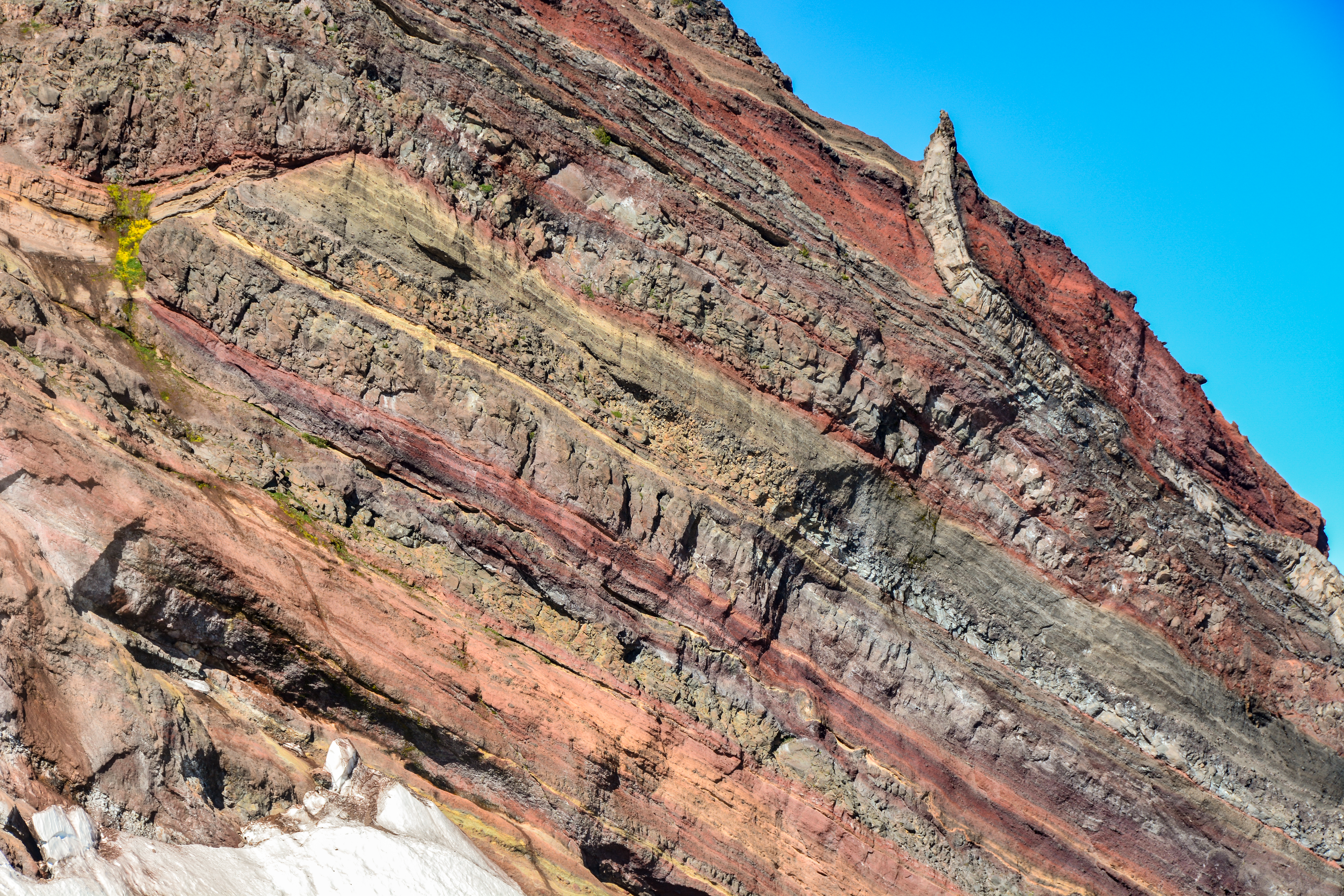
Michinmahuida () (alternate spellings Minchinmávida or Michimahuida) is a glaciated stratovolcano located in Los Lagos Region of Chile. It lies about 15 km east of Chaitén volcano, and was extensively covered in ash during the 2008 eruption of Chaitén. The stratovolcano lies above the regional Liquine-Ofqui Fault zone, and the ice-covered massif towers over the south portion of Pumalín Park. It has a summit elevation of 2,450 meters above sea level. See also * List of volcanoes in Chile * Chaitén * Chaitén (volcano) * List of Ultras of South America This is a list of the 209 ultra prominent peaks, or Ultras in South America. An ''Ultra'' is a mountain summit with a topographic prominence of or more. Guiana Highlands Sierra Nevada de Santa Marta, Cordillera Oriental, Cordillera de Mér ... References Sources * "Volcán Minchinmavida, Chile" on Peakbagger Mountains of Chile Stratovolcanoes of Chile Volcanoes of Los Lagos Region Holocene stratovo ... [...More Info...] [...Related Items...] OR: [Wikipedia] [Google] [Baidu] |
Ultra Prominent Peak
An ultra-prominent peak, or Ultra for short, is a mountain summit with a topographic prominence of or more; it is also called a P1500. The prominence of a peak is the minimum height of climb to the summit on any route from a higher peak, or from sea level if there is no higher peak. There are approximately 1,524 such peaks on Earth. Some well-known peaks, such as the Matterhorn and Eiger, are not Ultras because they are connected to higher mountains by high cols and therefore do not achieve enough topographic prominence. The term "Ultra" originated with earth scientist Steve Fry, from his studies of the prominence of peaks in Washington in the 1980s. His original term was "ultra major mountain", referring to peaks with at least of prominence. Distribution Currently, 1,518 Ultras have been identified above sea level: 639 in Asia, 356 in North America, 209 in South America, 120 in Europe (including 12 in the Caucasus), 84 in Africa, 69 in Oceania, and 41 in Antarctica. ... [...More Info...] [...Related Items...] OR: [Wikipedia] [Google] [Baidu] |
Chile
Chile, officially the Republic of Chile, is a country in the western part of South America. It is the southernmost country in the world, and the closest to Antarctica, occupying a long and narrow strip of land between the Andes to the east and the Pacific Ocean to the west. Chile covers an area of , with a population of 17.5 million as of 2017. It shares land borders with Peru to the north, Bolivia to the north-east, Argentina to the east, and the Drake Passage in the far south. Chile also controls the Pacific islands of Juan Fernández, Isla Salas y Gómez, Desventuradas, and Easter Island in Oceania. It also claims about of Antarctica under the Chilean Antarctic Territory. The country's capital and largest city is Santiago, and its national language is Spanish. Spain conquered and colonized the region in the mid-16th century, replacing Inca rule, but failing to conquer the independent Mapuche who inhabited what is now south-central Chile. In 1818, after declaring ... [...More Info...] [...Related Items...] OR: [Wikipedia] [Google] [Baidu] |
Andes
The Andes, Andes Mountains or Andean Mountains (; ) are the longest continental mountain range in the world, forming a continuous highland along the western edge of South America. The range is long, wide (widest between 18°S – 20°S latitude), and has an average height of about . The Andes extend from north to south through seven South American countries: Venezuela, Colombia, Ecuador, Peru, Bolivia, Chile, and Argentina. Along their length, the Andes are split into several ranges, separated by intermediate depressions. The Andes are the location of several high plateaus—some of which host major cities such as Quito, Bogotá, Cali, Arequipa, Medellín, Bucaramanga, Sucre, Mérida, El Alto and La Paz. The Altiplano plateau is the world's second-highest after the Tibetan plateau. These ranges are in turn grouped into three major divisions based on climate: the Tropical Andes, the Dry Andes, and the Wet Andes. The Andes Mountains are the highest m ... [...More Info...] [...Related Items...] OR: [Wikipedia] [Google] [Baidu] |
Stratovolcano
A stratovolcano, also known as a composite volcano, is a conical volcano built up by many layers (strata) of hardened lava and tephra. Unlike shield volcanoes, stratovolcanoes are characterized by a steep profile with a summit crater and periodic intervals of explosive eruptions and effusive eruptions, although some have collapsed summit craters called calderas. The lava flowing from stratovolcanoes typically cools and hardens before spreading far, due to high viscosity. The magma forming this lava is often felsic, having high-to-intermediate levels of silica (as in rhyolite, dacite, or andesite), with lesser amounts of less-viscous mafic magma. Extensive felsic lava flows are uncommon, but have travelled as far as . Stratovolcanoes are sometimes called composite volcanoes because of their composite stratified structure, built up from sequential outpourings of erupted materials. They are among the most common types of volcanoes, in contrast to the less common shield volcano ... [...More Info...] [...Related Items...] OR: [Wikipedia] [Google] [Baidu] |
Los Lagos Region
Los Lagos Region ( es, Región de Los Lagos , ''Region of the Lakes'') is one of Chile's 16 regions, which are first order administrative divisions, and comprises four provinces: Chiloé, Llanquihue, Osorno and Palena. The region contains the country's second largest island, Chiloé, and the second largest lake, Llanquihue. Its capital is Puerto Montt; other important cities include Osorno, Castro, Ancud, and Puerto Varas. The mainland portion of Los Lagos Region south of Reloncaví Sound (Palena Province) is considered part of Patagonia. Historically, the Huilliche have called this territory between Bueno River and Reloncaví Sound Futahuillimapu, meaning "great land of the south". The region hosts Monte Verde, one of the oldest archaeological sites of the Americas. The largest indigenous group of the region are the Huilliche who lived in the area before the arrival of the Spanish. The Spanish crown settled Chiloé Archipelago in 1567 Hanisch, Walter. ''La Isla de C ... [...More Info...] [...Related Items...] OR: [Wikipedia] [Google] [Baidu] |
Chaitén (volcano)
Chaitén is a volcanic caldera in diameter, west of the elongated ice-capped Michinmahuida volcano and northeast of the town of Chaitén, near the Gulf of Corcovado in southern Chile. The most recent eruptive phase of the volcano erupted on 2008. Originally, radiocarbon dating of older tephra from the volcano suggested that its last previous eruption was in 7420 BC ± 75 years. However, recent studies have found that the volcano is more active than thought. According to the Global Volcanism Program, its last eruption was in 2011. The caldera rim reaches above sea level. Before the current eruption, it was mostly filled by a rhyolite obsidian lava dome that reached a height of , partly devoid of vegetation. Two small lakes occupied the caldera floor on the west and north sides of the lava dome. The translucent grey obsidian which had erupted from the volcano was used by pre-Columbian cultures as a raw material for artifacts and has been found as far away as to the ... [...More Info...] [...Related Items...] OR: [Wikipedia] [Google] [Baidu] |
List Of Volcanoes In Chile
The Smithsonian Institution's Global Volcanism Program lists 105 volcanoes in Chile that have been active during the Holocene. using Chile, Chile-Peru, Chile-Bolivia and Chile-Argentina options, retrieved on 10 November 2013 The country's lists 90 active volcanoes. The volcanoes of the originate from the of the |
Chaitén
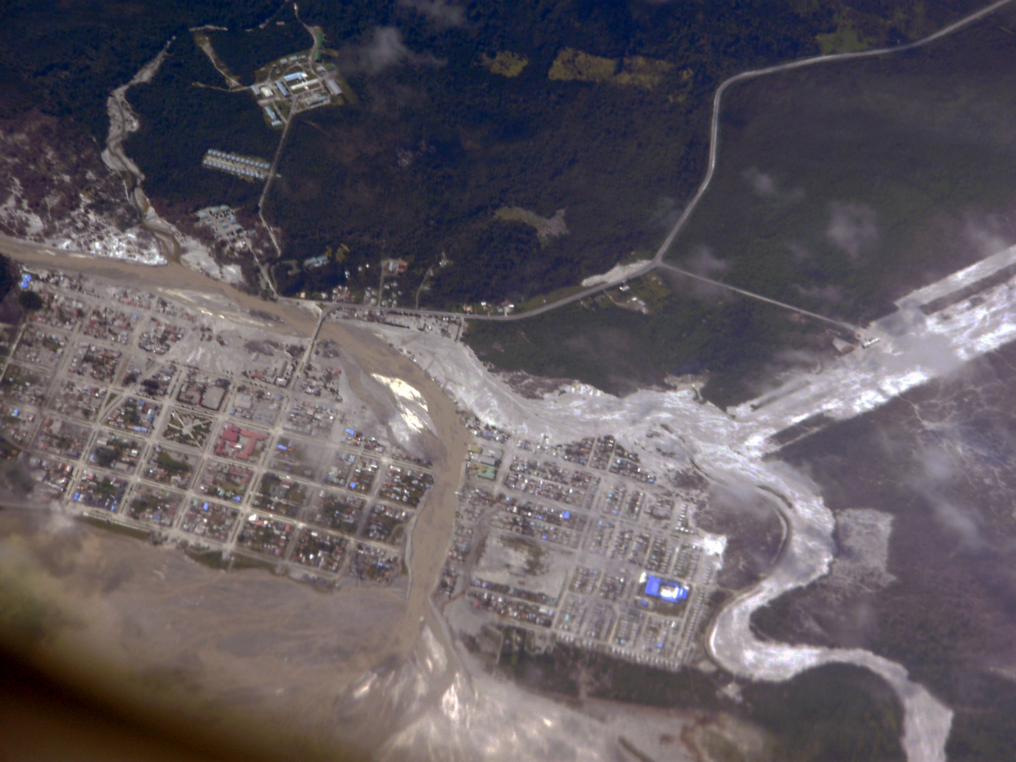
Chaitén (, ) is a Chilean town, commune and former capital of the Palena Province in Los Lagos Region. The town is north of the mouth of Yelcho River, on the east coast of the Gulf of Corcovado. The town is strategically close to the northern end of the Carretera Austral, where the highway goes inland. The Desertores Islands are part of the commune. Evacuation The town was evacuated in May 2008 when the Chaitén volcano erupted for the first time in more than 9,000 years. The eruption, which commenced May 2, became more violent on May 5, throwing up a high plume of ash and sulfurous steam that rose to , from which ashfall drifted across Patagonia and over the Atlantic Ocean. During 2005 small earthquakes occurred below Chaitén and the nearby Liquiñe-Ofqui Fault Zone. The town was completely flooded on May 12, 2008, after a lahar caused the banks of the Blanco River to overflow about on each side. Over the subsequent weeks, the river excavated a new course through C ... [...More Info...] [...Related Items...] OR: [Wikipedia] [Google] [Baidu] |
List Of Ultras Of South America
This is a list of the 209 ultra prominent peaks, or Ultras in South America. An ''Ultra'' is a mountain summit with a topographic prominence of or more. Guiana Highlands Sierra Nevada de Santa Marta, Cordillera Oriental, Cordillera de Mérida, and Coastal Range Cordillera Occidental and Cordillera Central Cordilleras of Ecuador Galápagos Cordillera Blanca and northern Peru Cordillera Oriental Cordillera Occidental Brazilian Highlands Puna de Atacama to Aconcagua Mid Argentina and Chile south of Aconcagua Northern Patagonia Southern Patagonia References Lists - South America {{Lists of Ultras |
.jpg)


