|
Mendip Way
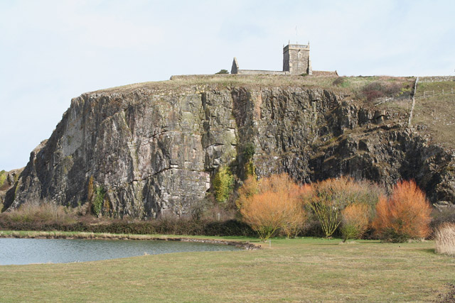
The Mendip Way is an long-distance footpath across the Mendip Hills from Weston-super-Mare to Frome. It is divided into two sections. The West Mendip Way was opened in 1979 and starts at the Bristol Channel at Uphill Cliff. It climbs the Mendip escarpment affording views over the Somerset Levels. It then crosses the central Mendip plateau leading down to Cheddar Gorge and on to Wells. Most of the western section is within the Mendip Hills Area of Outstanding Natural Beauty. From there the East Mendip Way continues through Shepton Mallet to Frome. The Mendip Way connects with the Macmillan Way, Monarch's Way, and Samaritans Way South West. The western trailhead of the Limestone Link is within of the Mendip Way near Shipham. Route description The Mendip Way starts at the village of Uphill on the southern outskirt of Weston-super-Mare. The route skirts Uphill Cliff, upon which the remains of a windmill and a Norman church are located, then crossing over the Bristol to ... [...More Info...] [...Related Items...] OR: [Wikipedia] [Google] [Baidu] |
Mendip Hills
The Mendip Hills (commonly called the Mendips) is a range of limestone hills to the south of Bristol and Bath in Somerset, England. Running from Weston-super-Mare and the Bristol Channel in the west to the Frome valley in the east, the hills overlook the Somerset Levels to the south and the Chew Valley and other tributaries of the Avon to the north. The hills give their name to the local government district of Mendip, which administers most of the area. The higher, western part of the hills, covering has been designated an Area of Outstanding Natural Beauty (AONB), which gives it a level of protection comparable to a national park. The hills are largely formed from Carboniferous Limestone, which is quarried at several sites. Ash–maple woodland, calcareous grassland and mesotrophic grassland which can be found across the Mendip Hills provide nationally important semi-natural habitats. With their temperate climate these support a range of flora and fauna including bi ... [...More Info...] [...Related Items...] OR: [Wikipedia] [Google] [Baidu] |
Limestone Link
The Limestone Link is a long-distance footpath in England, from the Mendip Hills in Somerset to Cold Ashton in Gloucestershire. It is marked by an ammonite waymarker. The Mendip section starts between Churchill and Rowberrow, near Dolebury Warren and travels roughly west to east, passing above the villages of Blagdon and Compton Martin, close to the northern boundary of the Mendip Area of Outstanding Natural Beauty; it then passes through West Harptree. It passes through Temple Cloud, Hallatrow and Camerton before turning north through Dunkerton and Southstoke, south of Bath. The path then follows Cam Brook to Midford and then follows Midford Brook before joining the Avon Walkway at the Dundas Aqueduct. It continues north alongside the River Avon and the Kennet and Avon Canal, past Claverton and the Claverton Pumping Station to Bathampton. Here it crosses the A4 and goes through Batheaston and then, following a stream, through Northend and St Catherine. The final par ... [...More Info...] [...Related Items...] OR: [Wikipedia] [Google] [Baidu] |
A38 Road
The A38, parts of which are known as Devon Expressway, Bristol Road and Gloucester Road, is a major A-class trunk road in England. The road runs from Bodmin in Cornwall to Mansfield in Nottinghamshire. It is long, making it the longest two-digit A road in England. It was formerly known as the ''Leeds–Exeter Trunk Road'', when this description also included the A61. Before the opening of the M5 motorway in the 1960s and 1970s, the A38 formed the main "holiday route" from the Midlands to Somerset, Devon and Cornwall. Considerable lengths of the road in the West Midlands closely follow Roman roads, including part of Icknield Street. Between Worcester and Birmingham the current A38 follows the line of a Saxon salt road; For most of the length of the M5 motorway, the A38 road runs alongside it as a single carriageway road. Route description Bodmin to Birmingham The road starts on the eastern side of Bodmin at a junction with the A30 before traversing the edge of the ... [...More Info...] [...Related Items...] OR: [Wikipedia] [Google] [Baidu] |
Strawberry Line Railway Walk
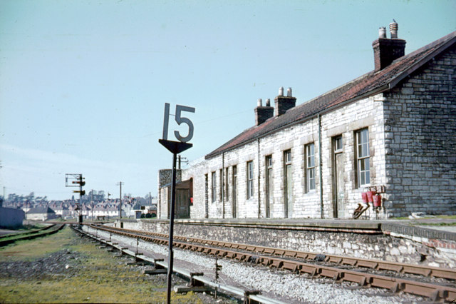
The Cheddar Valley line was a railway line in Somerset, England, running between Yatton and Witham. It was opened in parts: the first section connecting Shepton Mallet to Witham, later extended to Wells, was built by the East Somerset Railway from 1858. Later the Bristol and Exeter Railway built their branch line from Yatton to Wells, but the two lines were prevented for a time from joining up. Eventually the gap was closed, and the line became a simple through line, operated by the Great Western Railway. The line became known as ''The Strawberry Line'' because of the volume of locally-grown strawberries that it carried. It closed in 1963. Sections of the former trackbed have been opened as the ''Strawberry Line Trail'', which runs from Yatton to Cheddar. The southern section operates as a heritage railway using the name East Somerset Railway. History Main line railways Important inland market towns suddenly found themselves at a huge disadvantage when trunk railways connecte ... [...More Info...] [...Related Items...] OR: [Wikipedia] [Google] [Baidu] |
Crook Peak To Shute Shelve Hill
Crook Peak to Shute Shelve Hill is a 332.2 hectare (820.9 acre) geological and biological Site of Special Scientific Interest near the western end of the Mendip Hills, Somerset. The line of hills runs for approximately from west to east and includes: Crook Peak, Compton Hill, Wavering Down, Cross Plain and Shute Shelve Hill. Most of the site is owned by the National Trust, which bought in 1985, and much of it has been designated as common land. It was notified as an SSSI by Natural England in 1952. The ecology of the area includes ancient woodland and calcareous grassland which supports nationally rare species including the Cheddar pink. The underlying rocks are Carboniferous Limestone containing phreatic caves at Shute Shelve Cavern and Picken's Hole from which fossils dating from the Middle Devensian have been recovered. Description The site extends for some from west to east. Near its eastern end it is divided by a gap used by the A38 road and the disused Ched ... [...More Info...] [...Related Items...] OR: [Wikipedia] [Google] [Baidu] |
Compton Bishop
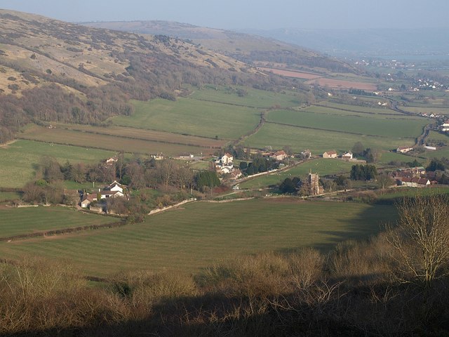
Compton Bishop is a small village and civil parish, at the western end of the Mendip Hills in the English county of Somerset. It is located close to the historic town of Axbridge. Along with the village of Cross and the hamlets of Rackley and Webbington it forms the parish of Compton Bishop and Cross. History It was listed in the Domesday Book of 1086 as ''Comtone''. It was the property of Giso, Bishop of Wells. The parish was part of the Winterstoke Hundred. The current manor house is a Grade II listed building and was built in the early 17th century. The parish includes the hamlet of Rackley which was a trading port on the River Axe in the Middle Ages following construction of a wharf in 1200. It now north of the River Axe as the course has been diverted, but on the Cheddar Yeo near the confluence. In 1324 Edward II confirmed it as a borough; however, by the end of the 14th century the port was in decline. In the 14th century a French ship sailed up the river and by 1388 ... [...More Info...] [...Related Items...] OR: [Wikipedia] [Google] [Baidu] |
Compton Bishop Valley
Compton may refer to: Places Canada * Compton (electoral district), a former Quebec federal electoral district * Compton (provincial electoral district), a former Quebec provincial electoral district now part of Mégantic-Compton * Compton, Quebec * Compton County, Quebec * Compton Creek, a tributary of the Adam River on Vancouver Island, British Columbia * Compton Island, in the Queen Charlotte Strait region of British Columbia * Compton Névé, a névé (icefield) in the Pacific Ranges, British Columbia ** Compton Glacier, a glacier in the Compton Névé, Pacific Ranges, British Columbia ** Compton Mountain, a mountain in the Compton Névé, Pacific Ranges, British Columbia England * Compton, Berkshire * Compton, Derbyshire, a location * Compton, Plymouth, Devon * Compton, South Hams, a location * Compton, Test Valley, a location * Compton, Hampshire, in Winchester district * Compton, Staffordshire, a location * Compton, Guildford, Surrey * Compton, Waverley, Surrey (ne ... [...More Info...] [...Related Items...] OR: [Wikipedia] [Google] [Baidu] |
M5 Motorway
The M5 is a motorway in England linking the Midlands with the South West England, South West. It runs from junction 8 of the M6 motorway, M6 at West Bromwich near Birmingham to Exeter in Devon. Heading south-west, the M5 runs east of West Bromwich and west of Birmingham through Sandwell Valley. It continues past Bromsgrove (and from Birmingham and Bromsgrove is part of the Birmingham Motorway Box), Droitwich Spa, Worcester, England, Worcester, Tewkesbury, Cheltenham, Gloucester, Bristol, Clevedon, Weston-super-Mare, Bridgwater, Taunton, terminating at junction 31 for Exeter. Congestion on the section south of the M4 motorway, M4 is common during the summer holidays, on Friday afternoons and bank holidays. Route The M5 quite closely follows the route of the A38 road. The two deviate slightly around Bristol and the area south of Bristol from junctions 16 to the Sedgemoor services north of junction 22. The A38 goes straight through the centre of Bristol and passes by Bristol Airp ... [...More Info...] [...Related Items...] OR: [Wikipedia] [Google] [Baidu] |
Loxton, North Somerset
Loxton is a village and civil parish in Somerset, England. It is close to the M5 motorway in the unitary authority of North Somerset. The parish includes the village of Christon and has a population of 192. History Loxton takes its name from the Lox Yeo River (once simply known as the Lox), on which it is situated. The village is mentioned in the Domesday book as Lochestone. The parish was part of the Winterstoke Hundred. The village has been populated since Norman times. Old mine-workings on the hills indicate that at one time mining was abundant, probably for calamine, lead, copper and more recently yellow ochre. During the construction of the M5 motorway a Roman or pre-Roman settlement was uncovered at Christon. Christon Court has medieval origins, but the current building dates from the 17th century. "The Loxton Murder" In 1954 the village came to national attention when Miss Noreen O'Connor, a nurse, killed Friederika Alwine Maria Buls by "plucking out" her eyes. She wa ... [...More Info...] [...Related Items...] OR: [Wikipedia] [Google] [Baidu] |
Bleadon
Bleadon is a village and civil parish in Somerset, England. It is about south of Weston-super-Mare and, according to the 2011 census, has a population of 1,079. History Bleadon was listed in the Domesday Book of 1086 as ''Bledone'', meaning 'coloured or variegated hill', from Old English ''bleo'' 'coloured' and ''dun''. The parish was part of the Winterstoke Hundred. Just to the north of the village is Bleadon Hill, a 13.52 hectare geological Site of Special Scientific Interest. There is evidence of agricultural use of the land in the medieval period and probably from at least the Bronze Age. The village cross and well are listed buildings. Bleadon lies on the River Axe and had been a small port, sometimes known as Lympsham Wharf, for many years, with the arrival of the railway in 1841 making this the furthest navigable point. It was last used, by the ketch ''Democrat'', in 1942. An Act of 1915 authorised the drainage of the river and installation of a flood gate at Bleado ... [...More Info...] [...Related Items...] OR: [Wikipedia] [Google] [Baidu] |
A370 Road
The A370 is a primary road in England running from the A4 Bath Road, near Bristol Temple Meads railway station to Weston-super-Mare before continuing to the village of East Brent in Somerset. A more direct route from Bristol to East Brent is the A38. Route Within Bristol urban area, the road begins at Bath Road roundabout, at the busy junction with A4 near Temple Meads. It then follows the new cut of River Avon west to Cumberland basin, via Bedminster. From here on, it begins to head south-westwards out of the city. It first bypasses Long Ashton, then passes through Flax Bourton, Backwell, Brockley, Cleeve, Congresbury and Hewish, beyond which it crosses the M5 motorway at Junction 21. The road then enters Weston-super-Mare: a dual carriageway extends most of the way, by passing the built-up area, including Junction 21 Enterprise Area to the east of the town. Previously the route of the A370 passed through Worle. On reaching the waterfront, the road turns south to run pa ... [...More Info...] [...Related Items...] OR: [Wikipedia] [Google] [Baidu] |
Bristol To Exeter Line
Bristol () is a city, ceremonial county and unitary authority in England. Situated on the River Avon, it is bordered by the ceremonial counties of Gloucestershire to the north and Somerset to the south. Bristol is the most populous city in South West England. The wider Bristol Built-up Area is the eleventh most populous urban area in the United Kingdom. Iron Age hillforts and Roman villas were built near the confluence of the rivers Frome and Avon. Around the beginning of the 11th century, the settlement was known as (Old English: 'the place at the bridge'). Bristol received a royal charter in 1155 and was historically divided between Gloucestershire and Somerset until 1373 when it became a county corporate. From the 13th to the 18th century, Bristol was among the top three English cities, after London, in tax receipts. A major port, Bristol was a starting place for early voyages of exploration to the New World. On a ship out of Bristol in 1497, John Cabot, a Venetian, be ... [...More Info...] [...Related Items...] OR: [Wikipedia] [Google] [Baidu] |


.jpg)


