|
Markland Wood
Markland Wood is a residential neighbourhood in Toronto, Ontario, Canada. It is located west of the central core, in the former suburb of Etobicoke and is the westernmost residential community in Toronto along Bloor Street West. It's located on the border of Mississauga and bounded by Etobicoke Creek to the west, Elmcrest Creek to the east, Burnhamthorpe to the North, and surrounded by the Markland Wood Golf Club; approximately 2/3 is north of Bloor Street, and 1/3 south. Markland Wood is part of the Etobicoke Centre riding for federal and provincial governments and Ward 2 for the municipal Toronto City Council, council. History Markland Wood, or Mark's Land, was purchased by Mark Cavotti from the Silverthorn family in September 1958. Development started in 1960 after the Conservation Authority determined the high water mark levels after Hurricane Hazel. Most of the single family houses in Markland Wood were completed by 1967, but several custom-built homes were built around Markl ... [...More Info...] [...Related Items...] OR: [Wikipedia] [Google] [Baidu] |
Toronto
Toronto ( ; or ) is the capital city of the Canadian province of Ontario. With a recorded population of 2,794,356 in 2021, it is the most populous city in Canada and the fourth most populous city in North America. The city is the anchor of the Golden Horseshoe, an urban agglomeration of 9,765,188 people (as of 2021) surrounding the western end of Lake Ontario, while the Greater Toronto Area proper had a 2021 population of 6,712,341. Toronto is an international centre of business, finance, arts, sports and culture, and is recognized as one of the most multicultural and cosmopolitan cities in the world. Indigenous peoples have travelled through and inhabited the Toronto area, located on a broad sloping plateau interspersed with rivers, deep ravines, and urban forest, for more than 10,000 years. After the broadly disputed Toronto Purchase, when the Mississauga surrendered the area to the British Crown, the British established the town of York in 1793 and later d ... [...More Info...] [...Related Items...] OR: [Wikipedia] [Google] [Baidu] |
Toronto Police Service
The Toronto Police Service (TPS) is a municipal police force in Toronto, Ontario, Canada, and the primary agency responsible for providing law enforcement and policing services in Toronto. Established in 1834, it was the first local police service created in North America and is one of the oldest police services in the English-speaking world. It is the largest municipal police service in Canada, and third largest police force in Canada after the Ontario Provincial Police (OPP) and the Royal Canadian Mounted Police (RCMP). With a 2021 budget of $1.1 billion, the Toronto Police Service ranks as the second largest expense of the City of Toronto's annual operating budget, after the Toronto Transit Commission (TTC). History 19th century 1834 Trading village, to 1845 Irish refugees From 1834 to 1859, the Toronto Police was a corrupt and notoriously political force, with its constables loyal to the local aldermen who personally appointed police officers in their own wards for ... [...More Info...] [...Related Items...] OR: [Wikipedia] [Google] [Baidu] |
Eatonville, Toronto
Eatonville is a neighbourhood in Toronto, Ontario, Canada. It is located west of the central core, in the former suburb of Etobicoke. Eatonville is bisected by Highway 427, with the community generally located north of Dundas Street West and south of Rathburn Road. Eatonville consists mainly of low density residential homes (constructed primarily in the 1950s east of Highway 427, and in the 1960s and 1970s west of Highway 427). The main arterial roads in the community, such as The West Mall, The East Mall and Burnhamthorpe Road, contain a mix of rental and condominium high-rise apartments and townhouses. Cloverdale Mall is in the neighbourhood, and there are community retail areas along Bloor Street West and Dundas Street West. History Eatonville began as a farm owned by Peter Shaver at the end of the 19th century. The farm was one of two purchased by the Eaton's department store in the 1890s (the other was in Georgetown, Ontario) to provide a reliable supply of milk for the st ... [...More Info...] [...Related Items...] OR: [Wikipedia] [Google] [Baidu] |
Eringate-Centennial-West Deane
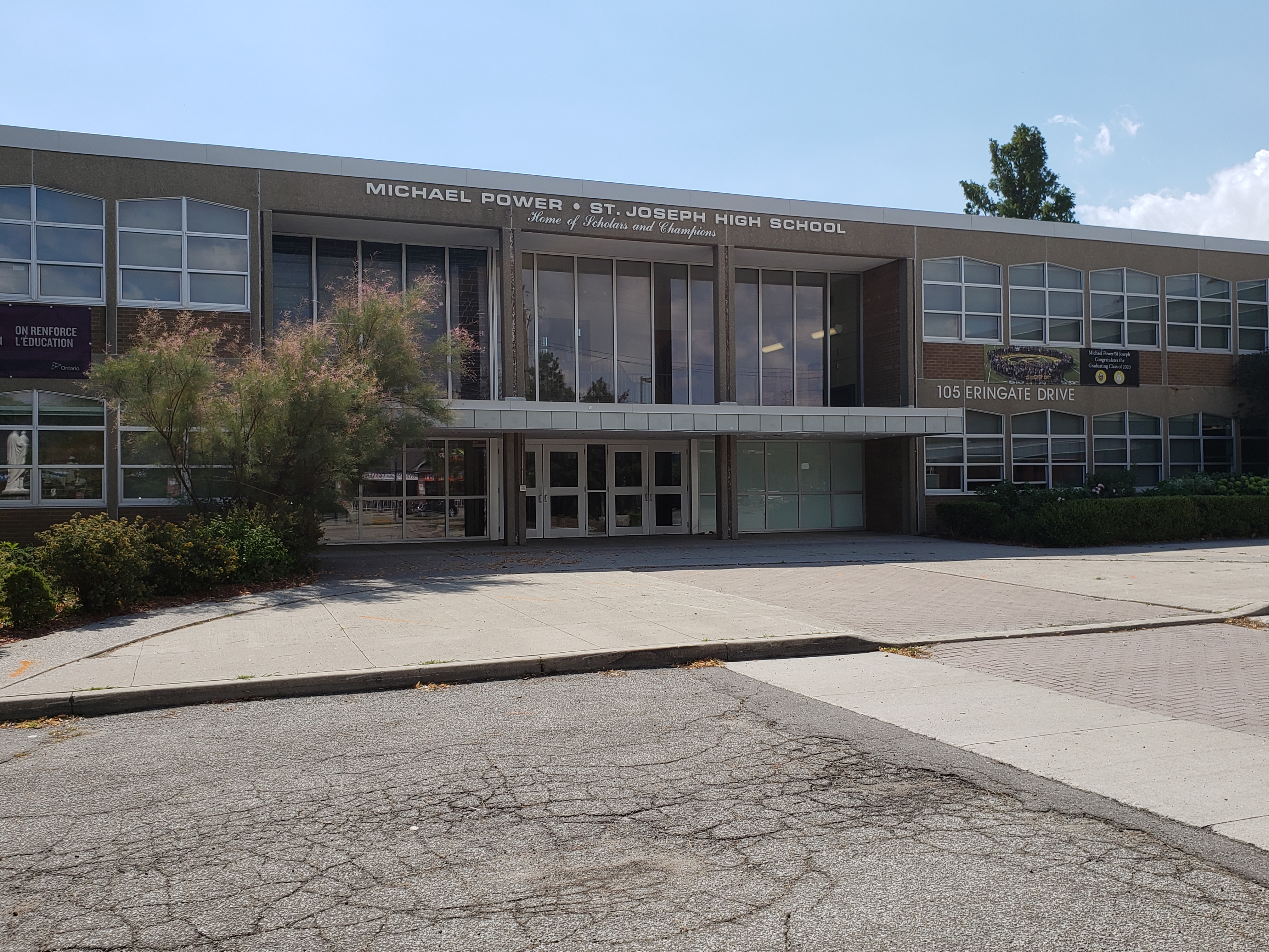
Eringate-Centennial-West Deane is a neighbourhood in the city of Toronto, Canada. Eringate-Centennial-West Deane borders the city of Mississauga. Location Eringate-Centennial-West Deane is a neighbourhood located in the north western corner of the city of Toronto, Ontario, Canada, in close proximity to Toronto Pearson International Airport, Pearson Airport and Ontario Highway 427, Highway 427. It is bounded on the west by Centennial Park (Toronto), Centennial Park and golf course, to the north by Eglinton Avenue West, on the east by Martin Grove Road, and on the south by Rathburn Road. The neighbourhood itself is fairly large, and encompasses several communities including West Deane Park and Centennial Park. History West Deane Park West Deane Park was farmland before the land was bought in the 1930s by construction magnate Percy Law. On this land, Law raised cattle and racehorses, built and maintained a storage depot for construction equipment and built a Colonial Revival arc ... [...More Info...] [...Related Items...] OR: [Wikipedia] [Google] [Baidu] |


