|
Ma On Shan (other)
Ma On Shan may refer to: * Ma On Shan (peak) ( zh, t=馬鞍山, s=马鞍山, l=saddle peak, links=no), a mountain in the New Territories of Hong Kong * Ma On Shan (town), a New Town in the New Territories on the foot of Ma On Shan mountain * Ma On Shan line, now part of Tuen Ma line, a railway line in Hong Kong * Ma On Shan station, an elevated train station in Hong Kong * Ma On Shan Village, a historic mining village in Hong Kong See also * * Ma'anshan (), a city in Anhui Province, People's Republic of China * Maanshan Nuclear Power Plant in Pingtung County, Taiwan {{disambiguation, geo ... [...More Info...] [...Related Items...] OR: [Wikipedia] [Google] [Baidu] |
Ma On Shan (peak)
Ma On Shan (; literally: Horse Saddle Peak) is a saddle-shaped peak in east of Tolo Harbour in the New Territories of Hong Kong. With a height of 702 metres (2,303 ft), it stands among the ten highest mountains in Hong Kong. The mountain borders Sha Tin and Tai Po districts. Beneath the west face of the mountain along Tolo Harbour, the Ma On Shan new town extension, administratively part of Sha Tin, is named after the hill. It ends north in Wu Kai Sha. A group of villages located east of the peak is named Shap Sze Heung and the harbour of Three Fathoms Cove. Geography Ma On Shan can be distinguished by the west face which looks like a saddle, and "Ma On Shan" can be translated as "horse saddle mountain". Nine streams flow down from Ma On Shan, with the biggest located on the southwest slope of Ma On Shan, near Ma On Shan Village. Geology Ma On Shan is formed by Volcanic rocks, much like many of the tallest mountains in Hong Kong, such as Tai Mo Shan. So ... [...More Info...] [...Related Items...] OR: [Wikipedia] [Google] [Baidu] |
Ma On Shan (town)
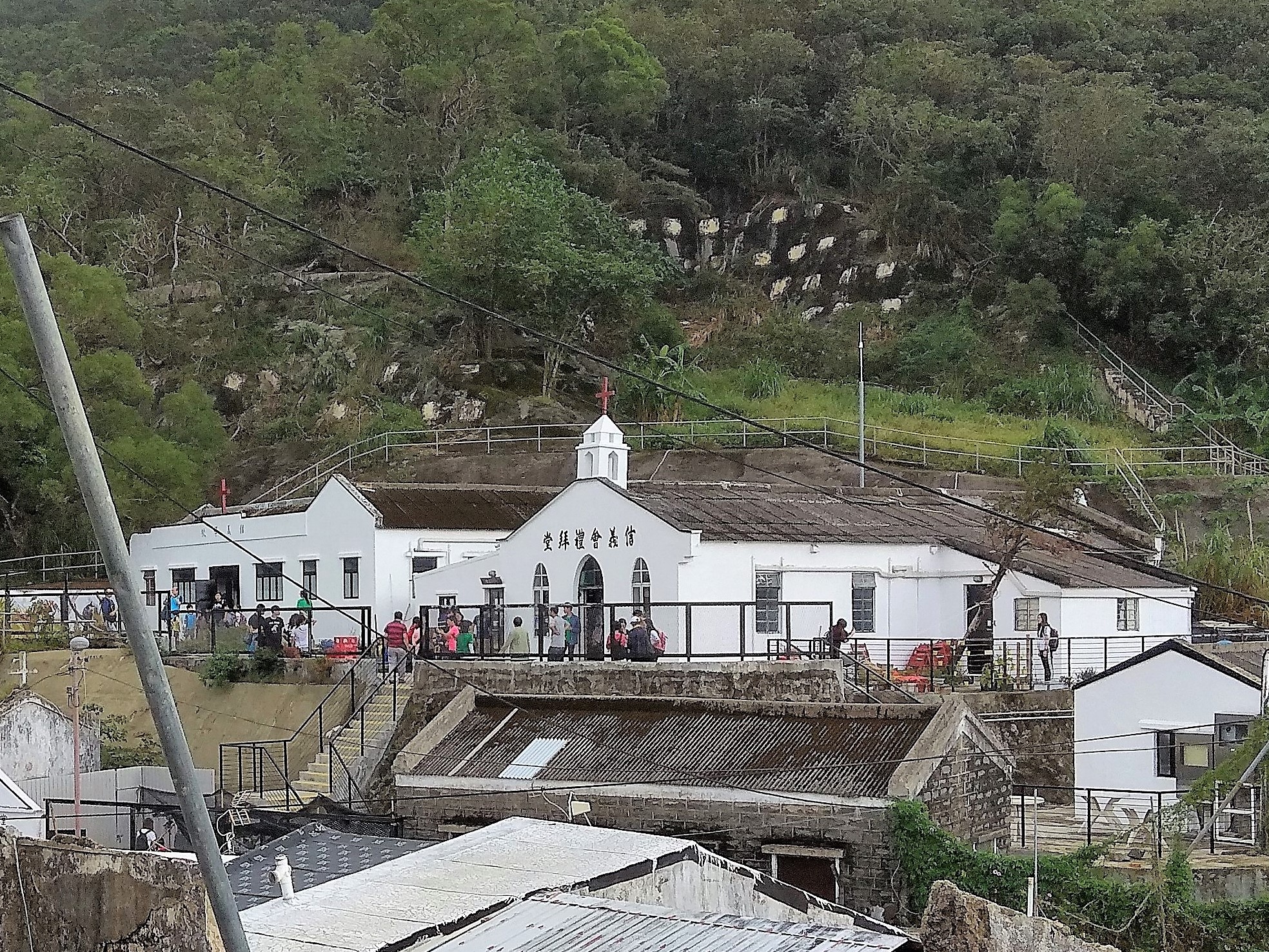
Ma On Shan is a new town along the eastern coast of Tolo Harbour in the New Territories of Hong Kong. Although it was initially an extension of Sha Tin New Town, it has its own town centre and various government facilities, and is now classified as a separate new town in government reports. Administratively, it belongs to Sha Tin District. Geography Ma On Shan is located by the west face of the twin peaks of Ma On Shan, which can be translated as "horse saddle mountain". The town is built on the strip between Tolo Harbour and Ma On Shan mountain. The north end of the town reaches the settlement of Wu Kai Sha and the southern Tai Shui Hang. History The original Ma On Shan Village still houses around 80 families. Yan Kwong Lutheran Church, one of two original churches established during the area's mining heyday, was revitalised in around 2014 as a centre to highlight the history and culture of the old village. Deep inside the slope of Ma On Shan was an iron mine. Due ... [...More Info...] [...Related Items...] OR: [Wikipedia] [Google] [Baidu] |
Ma On Shan Line
The Ma On Shan line () was a rapid transit line that formed part of the Mass Transit Railway (MTR) system in Hong Kong. Coloured brown on the MTR map, the line acted as a branch of the East Rail line that connects the new towns of Sha Tin and Ma On Shan in the northeastern New Territories. The railway was one of three built by the Kowloon-Canton Railway Corporation (KCRC), which named it as Ma On Shan Rail (, abbreviated as ). Since KCRC's merger of operations with the MTR Corporation on 2 December 2007, the line has been operated as part of the MTR network. The line was integrated into the Tuen Ma line Phase 1 on 14 February 2020 following the partial opening of the Sha Tin to Central Link. Overview and current status Construction of the Ma On Shan line began on 12 February 2001 and it fully opened for service on 21 December 2004, 3 days earlier than the proposed opening date. KCRC estimated the construction costs to be HK$10 billion. Over a thousand passengers took ... [...More Info...] [...Related Items...] OR: [Wikipedia] [Google] [Baidu] |
Ma On Shan Station
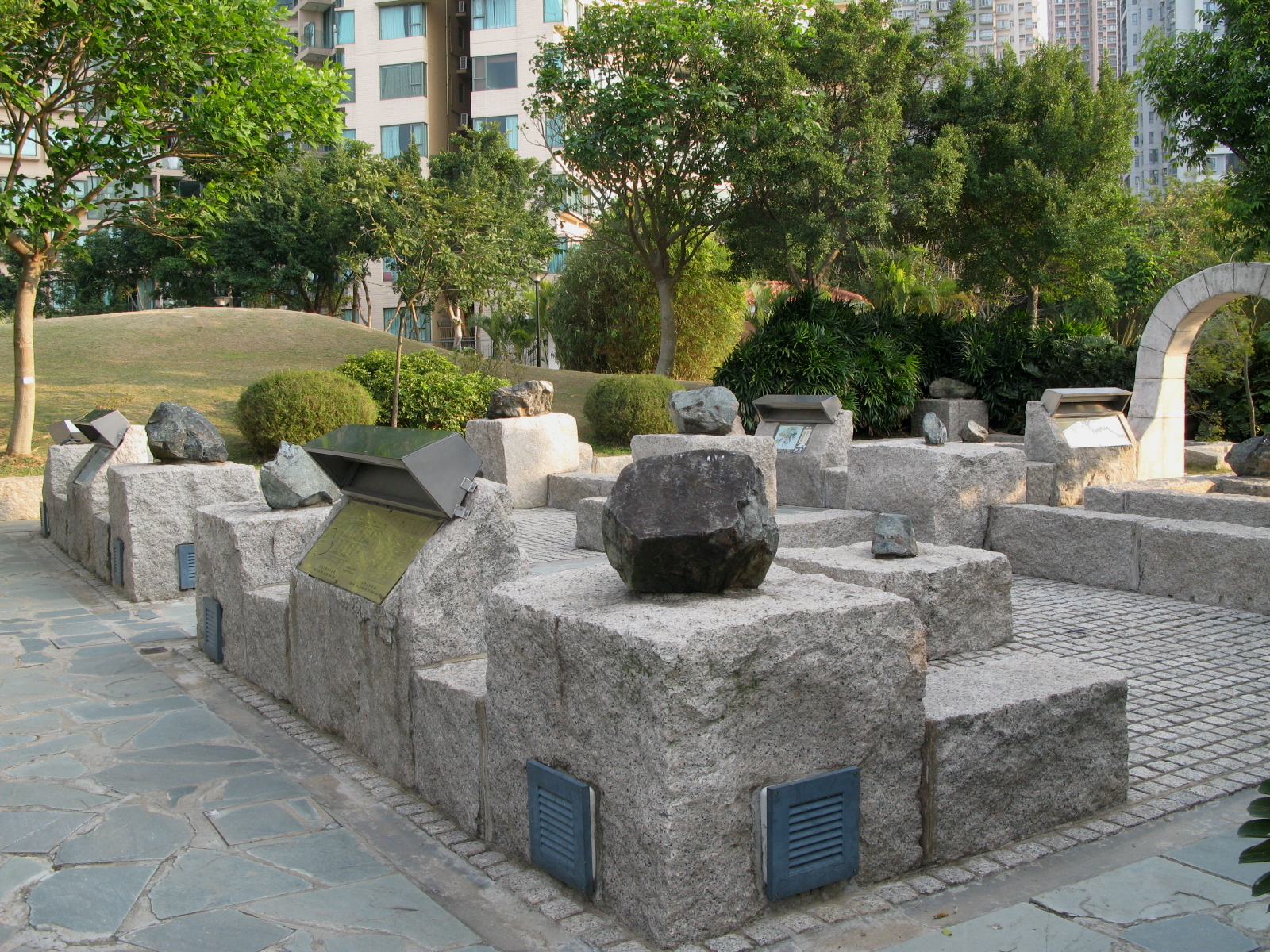
Ma On Shan () is an elevated station on the of Hong Kong Hong Kong ( (US) or (UK); , ), officially the Hong Kong Special Administrative Region of the People's Republic of China (abbr. Hong Kong SAR or HKSAR), is a city and special administrative region of China on the eastern Pearl River Delta i .... It is located above Sai Sha Road, at the town centre of Ma On Shan, between Sunshine City and Bayshore Towers. It also serves other residential areas like Kam Ying Court and Chung On Estate; it also serves over ten schools, and is in close proximity with Ma On Shan Park and other parks. The pattern featured on the platform pillar and glass barrier symbolizes the abandoned iron mine that used to be in Ma On Shan peak. History On 21 December 2004, Ma On Shan station opened with other KCR Ma On Shan Rail stations. On 14 February 2020, was extended south to a new terminus in , as part of the first phase of the Shatin to Central Link Project. The Ma On Shan Line w ... [...More Info...] [...Related Items...] OR: [Wikipedia] [Google] [Baidu] |
Ma On Shan Village
Ma On Shan Village or Ma On Shan Tsuen () is a mining village in the hills of Ma On Shan, Sha Tin District, Hong Kong. The village grew around the activity of the Ma On Shan Iron Mine, which reached its peak during the 1950s-60s and ceased operation in 1976. It had historically two churches, St. Joseph's Church and Lutheran Yan Kwong Church. Administration Ma On Shan Tsuen is a recognized village under the New Territories Small House Policy. Demographics At its peak, after a rapid growth in the 1950s, the village had more than 10,000 inhabitants. The small village saw a large number of new arrivals after changes in the methods of iron ore mining were implemented in 1953. Nearly all of the new arrivals were refugees from Mainland China, who worked as miners and came to live in the area with their families.Antiquities Advisory Board. Historic Building AppraisalSt. Joseph's Church, Ma On Shan Tsuen Road/ref> The exploitation of the mine ended in 1976 and the miners subsequently ... [...More Info...] [...Related Items...] OR: [Wikipedia] [Google] [Baidu] |
Ma'anshan
Ma'anshan (), also colloquially written as Maanshan, is a prefecture-level city in the eastern part of Anhui province in Eastern China. An industrial city stretching across the Yangtze River, Ma'anshan borders Hefei to the west, Wuhu to the southwest, and Nanjing to the east. It is a satellite city of the Nanjing metropolitan area and is also a city in the Yangtze River Delta Economic Zone. As of the 2020 census, Ma'anshan was home to 2,159,930 inhabitants, of whom 1,253,960 lived in the built-up (or metro) area made of Huashan and Yushan urban districts and Dangtu County, which is largely urbanized. One can notice that Ma'anshan is now being conurbated with Nanjing making a combined built-up area of 8,419,252 inhabitants. After the August 2011 administrative re-regionalization of Anhui Province, its population rose to 2.16 million, as two additional counties (''He'' and ''Hanshan'') were placed under its administration. Administration The prefecture-level city of Ma'anshan ... [...More Info...] [...Related Items...] OR: [Wikipedia] [Google] [Baidu] |


