|
Luther Rose
The Luther seal or Luther rose is a widely recognized symbol for Lutheranism. It was the seal that was designed for Martin Luther at the behest of John Frederick of Saxony in 1530, while Luther was staying at the Coburg Fortress during the Diet of Augsburg. Lazarus Spengler, to whom Luther wrote his interpretation below, sent Luther a drawing of this seal. Luther saw it as a compendium or expression of his theology and faith, which he used to authorize his correspondence. Luther informed Philipp Melanchthon on 15 September 1530, that the Prince had personally visited him in the Coburg fortress and presented him with a signet ring, presumably displaying the seal.''LW'' 49, 356-359. Components of the seal connected to Luther earlier than 1530 A single rose had been known as Luther's emblem since 1520 when Wolfgang Stöckel in Leipzig published one of Luther’s sermons with a woodcut of the reformer. This was the first contemporary depiction of Martin Luther. Luther's doctor's ... [...More Info...] [...Related Items...] OR: [Wikipedia] [Google] [Baidu] |
Byzantine Rite Lutheranism
Eastern Lutheranism (also known as Byzantine Lutheranism or Byzantine Rite Lutheranism) refers to Lutheran churches, such as those of Ukraine and Slovenia, that use a form of the Byzantine Rite as their liturgy. It is unique in that it is based on the Eastern Christian rite used by the Eastern Orthodox Church, while incorporating theology from the Divine Service contained in the ''Formula Missae'', the base texts for Lutheran liturgics in the West. The Byzantine Lutheran Rite includes the '' filioque'' in the Niceno-Constantinopolitan Creed, albeit placing it in brackets. Eastern Lutherans use the Julian calendar for the calendar and thus observe feast days and liturgical seasons, such as Great Lent, in a fashion similar to Orthodox customs. As such, many Byzantine Lutheran holy days are shared with those of the Eastern Orthodox Church The Eastern Orthodox Church, also called the Orthodox Church, is the second-largest Christian church, with approximately 220 million b ... [...More Info...] [...Related Items...] OR: [Wikipedia] [Google] [Baidu] |
Heraldic Charges
In heraldry, a charge is any emblem or device occupying the field of an '' escutcheon'' (shield). That may be a geometric design (sometimes called an '' ordinary'') or a symbolic representation of a person, animal, plant, object, building, or other device. In French blazon, the ordinaries are called ''pièces'', and other charges are called ''meubles'' (" hemobile nes). The term ''charge'' can also be used as a verb; for example, if an escutcheon depicts three lions, it is said to be ''charged with three lions''; similarly, a crest or even a charge itself may be "charged", such as a pair of eagle wings ''charged with trefoils'' (as on the coat of arms of Brandenburg). It is important to distinguish between the ordinaries and divisions of the field, as that typically follow similar patterns, such as a shield ''divided'' "per chevron", as distinct from being ''charged with'' a chevron. While thousands of objects found in religion, nature, mythology, or technology have appeared ... [...More Info...] [...Related Items...] OR: [Wikipedia] [Google] [Baidu] |
Christian Symbols
Christian symbolism is the use of symbols, including archetypes, acts, artwork or events, by Christianity. It invests objects or actions with an inner meaning expressing Christian ideas. The symbolism of the early Church was characterized by being understood by initiates only, while after the legalization of Christianity in the Roman Empire during the 4th century more recognizable symbols entered in use. Christianity has borrowed from the common stock of significant symbols known to most periods and to all regions of the world. Only a minority of Christian denominations have practiced Aniconism, or the avoidance or prohibition of types of images. These include early Jewish Christians sects, as well as some modern denominations such as Baptists that prefer to some extent not to use figures in their symbols due to the Decalogue's prohibition of idolatry. Early Christian symbols Cross and crucifix ✝︎ The shape of the cross, as represented by the letter T, came to ... [...More Info...] [...Related Items...] OR: [Wikipedia] [Google] [Baidu] |
Greifenstein
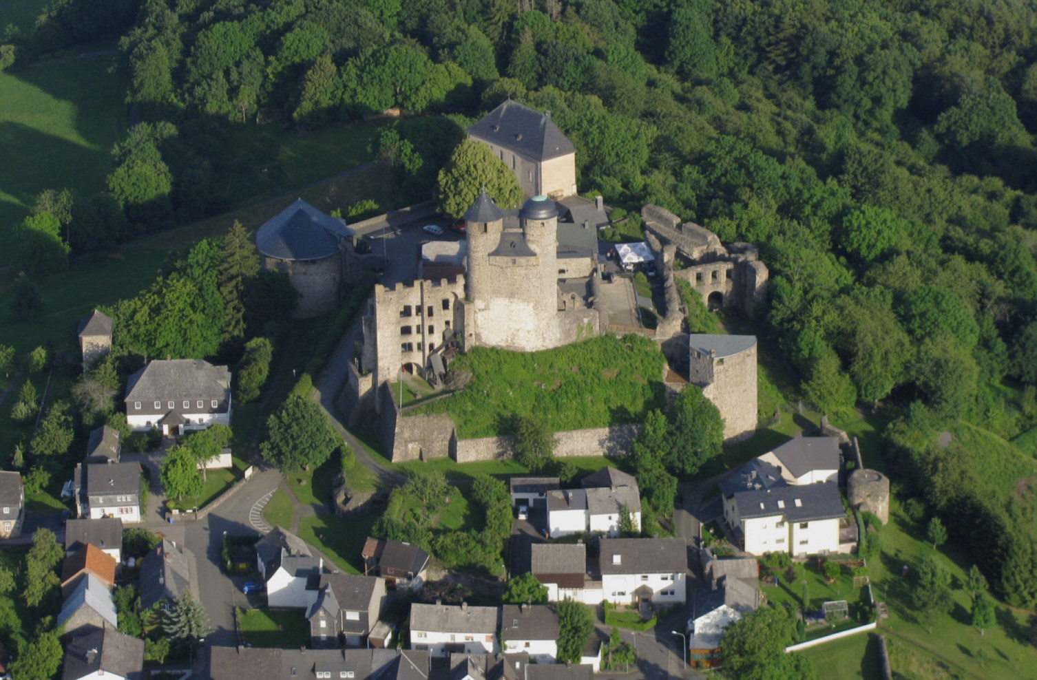
Greifenstein is a municipality in the Lahn-Dill-Kreis in Hesse, Germany. Its administrative seat is Beilstein. Greifenstein covers 67.43 km² on the eastern slope of the Westerwald range. It was named for the castle of the same name in the constituent community of the same name. This is the site of the German Bell Museum (''Deutsches Glockenmuseum''), which holds about 50 bells that show the historical development of bell pouring and manufacture. Geography Neighbouring communities Greifenstein borders in the northwest on the community of Driedorf, in the north on the town of Herborn and the community of Sinn, in the east on the community of Ehringshausen Ehringshausen is a municipality in the Lahn-Dill-Kreis in Hesse, Germany. Geography Location Ehringshausen lies in the valley of the Dill between Wetzlar and Herborn. Neighbouring communities Ehringshausen borders in the north on the community ..., in the south on the town of Leun (all in the Lahn-Dill-Kreis) an ... [...More Info...] [...Related Items...] OR: [Wikipedia] [Google] [Baidu] |
Ramsau Am Dachstein
Ramsau am Dachstein is a municipality in the district of Liezen, state of Styria, Austria. It is also the name of the elevated plateau between the Dachstein range and the Enns valley on which this municipality is located. The appendage ''am Dachstein'' is added to distinguish the municipality from others of the same name existing in Austria. It is usually omitted in common speech. Geography Ramsau am Dachstain is situated between the Dachstein range of mountains in the north and the Enns valley in the south. While the Dachstein range contains peaks up to 2,995 m (9,826 ft) and the towns of the Enns valley, such as Schladming, lie at around 700 m (2,300 ft) above sea level, the Ramsau plateau is a comparatively level piece of land at an elevation of around 1,100 m (3,600 ft). Towards the north, some hills at the foot of the mountain range rise up to 1,700 m (5,600 ft). At approximately 75 km² (29 sq mi), the plateau is an exceptional geological feature ... [...More Info...] [...Related Items...] OR: [Wikipedia] [Google] [Baidu] |
Arriach
Arriach ( sl, Arjoh) is a municipality in the district of Villach-Land in the Austrian state of Carinthia. Geography Situated within the Nock Mountains range of the Gurktal Alps, about north of the city of Villach, Arriach houses the geographical centre of the state of Carinthia. The commune is a state-recognised health resort, its economy mainly depends on tourism. The municipal area consists of the four cadastral communities: Arriach proper, Innerteuchen, Laastadt, and Sauerwald. Neighboring municipalities History The parish of ''Ovriach'' was first mentioned in a 1207 deed. In early modern times, the remote area was a centre of Crypto-protestantism in the Duchy of Carinthia. The present-day municipality was established in 1850; the Sauerwald community joined in 1898. Religion According to a 2001 census 68.8% of the population were Protestants, which is the highest percentage of all Carinthian municipalities. Therefore, the Four Evangelists parish church, a Neo-Gothic bu ... [...More Info...] [...Related Items...] OR: [Wikipedia] [Google] [Baidu] |
Neuendettelsau
Neuendettelsau is a local authority in Middle Franconia, Germany. Neuendettelsau is situated 20 miles southwest of Nuremberg and 12 miles east of Ansbach. Since 1947 it has a Lutheran seminary ( ''Augustana Hochschule''). Diakonie Neuendettelsau Reverend Wilhelm Löhe (1808–1872) founded in 1854 an institute for deaconesses. The ''Diakonie Neuendettelsau'' is one of today’s major independent Christian institutions for social welfare work in Germany and the biggest such enterprise in Bavaria. More than 5,800 employees at numerous institutions in Neuendettelsau and other regions all over Southern Germany and in other European countries take care of the people they are responsible for. Politics The mayor is Christoph Schmoll ( SPD), elected in March 2020. Sister city * Treignac (France), since 1996 Notable people * Karl-Friedrich Beringer, choirmaster of the Windsbacher Knabenchor :de:Windsbacher Knabenchor * Johann Konrad Wilhelm Loehe, Lutheran Lutheranism is o ... [...More Info...] [...Related Items...] OR: [Wikipedia] [Google] [Baidu] |
Wain (Württemberg)
Wain () is a village and municipality in the district of Biberach in Baden-Württemberg in Germany Germany,, officially the Federal Republic of Germany, is a country in Central Europe. It is the second most populous country in Europe after Russia, and the most populous member state of the European Union. Germany is situated betwe .... References Biberach (district) Württemberg {{Biberach-geo-stub ... [...More Info...] [...Related Items...] OR: [Wikipedia] [Google] [Baidu] |
Rodgau
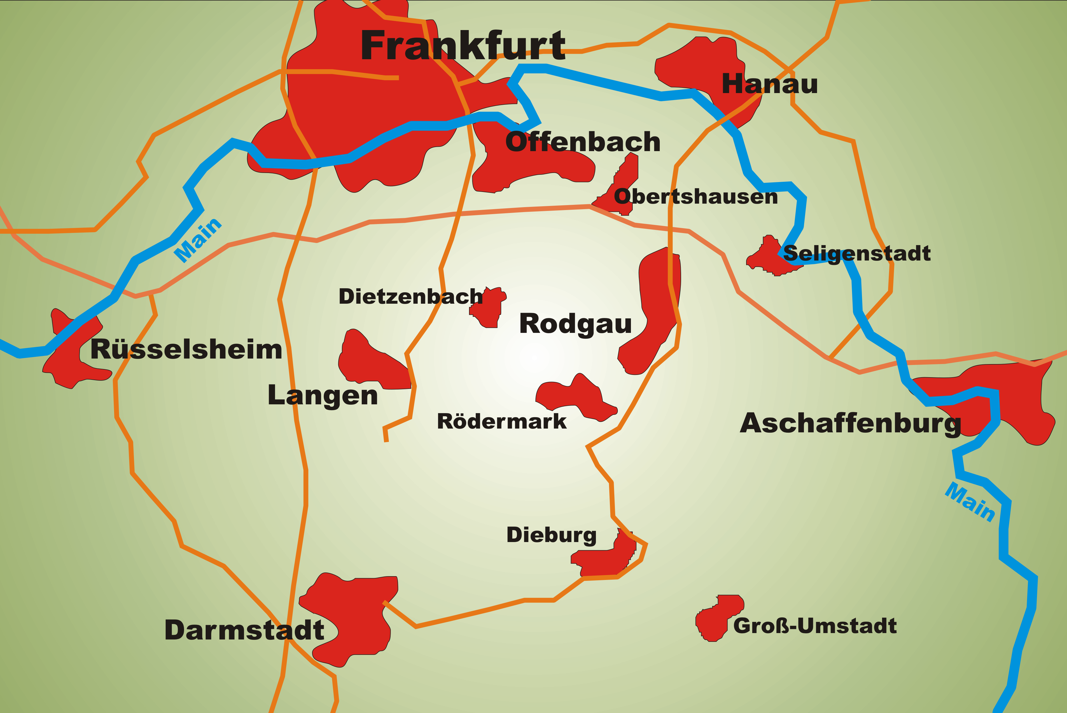
Rodgau is a town in the Offenbach district in the ''Regierungsbezirk'' of Darmstadt in Hesse, Germany. It lies southeast of Frankfurt am Main in the Frankfurt Rhine Main Region and has the greatest population of any municipality in the Offenbach district. It came into being in 1979 when the greater community of Rodgau was raised to town, after having been formed through a merger of five formerly self-administering communities in the framework of municipal reform in Hesse in 1977. The current constituent communities’ history reaches back to the 8th century. Geography Location Rodgau is part of the metropolitan area known as the Rhein-Main-Gebiet in German, one of Germany's economically strongest areas. The fiftieth parallel of north latitude (50°N) passes right through Puiseaux-Platz (square) in Nieder-Roden. The town lies on the so-called ''Untermainebene'', or Lower Main Plain, the northern outlying part of the Rhine rift. The flat land around Rodgau is set against hi ... [...More Info...] [...Related Items...] OR: [Wikipedia] [Google] [Baidu] |
Kirchberg-Thening
Kirchberg-Thening is a municipality in the district Linz-Land in the Austrian state of Upper Austria. Population References Cities and towns in Linz-Land District {{UpperAustria-geo-stub ... [...More Info...] [...Related Items...] OR: [Wikipedia] [Google] [Baidu] |


