|
Lugton
Lugton is a small village or hamlet in East Ayrshire, Scotland with a population of 80 people. The A736 road runs through on its way from Glasgow, to the north, to Irvine in North Ayrshire. Uplawmoor is the first settlement on this 'Lochlibo Road' to the north and Burnhouse is to the south. The settlement lies on the Lugton Water which forms the boundary between East Ayrshire and East Renfrewshire as well as that of the parishes of Dunlop and Beith. History In the 1830s the village consisted of only four houses: the hotel or inn, the smithy, and two toll houses. In 1845 the ''New Statistical Account'' records six other houses where ''spiritous liquors'' were sold. The road up from Uplawmoor was called the Lochlibo Road on the 1860s OS. The Lugton Inn was sadly destroyed by fire in the early 2000s. The name 'Lugton' is not marked on Timothy Pont's map of 1604.Pont, Timothy (1604). ''Cuninghamia.'' Pub. Blaeu in 1654. Some of the Lugton area farms are indicated, with Waterlan ... [...More Info...] [...Related Items...] OR: [Wikipedia] [Google] [Baidu] |
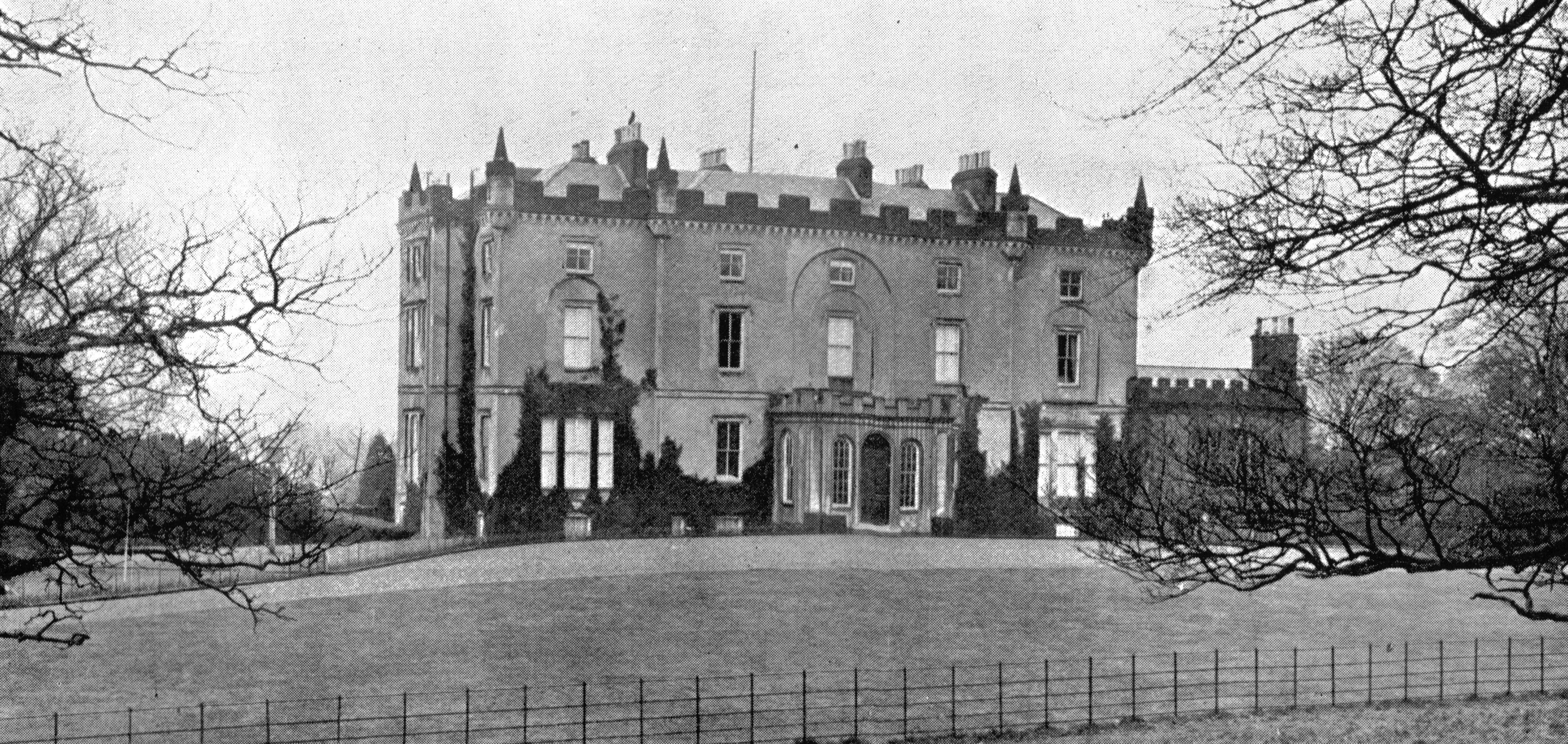
Lugton Inn, 19th Century
Lugton is a small village or hamlet in East Ayrshire, Scotland with a population of 80 people. The A736 road runs through on its way from Glasgow, to the north, to Irvine, North Ayrshire, Irvine in North Ayrshire. Uplawmoor is the first settlement on this 'Lochlibo Road' to the north and Burnhouse is to the south. The settlement lies on the Lugton Water which forms the boundary between East Ayrshire and East Renfrewshire as well as that of the parishes of Dunlop, East Ayrshire, Dunlop and Beith. History In the 1830s the village consisted of only four houses: the hotel or inn, the smithy, and two toll houses. In 1845 the ''New Statistical Account'' records six other houses where ''spiritous liquors'' were sold. The road up from Uplawmoor was called the Lochlibo Road on the 1860s OS. The Lugton Inn was sadly destroyed by fire in the early 2000s. The name 'Lugton' is not marked on Timothy Pont's map of 1604.Pont, Timothy (1604). ''Cuninghamia.'' Pub. Blaeu in 1654. Some of the Lug ... [...More Info...] [...Related Items...] OR: [Wikipedia] [Google] [Baidu] |
Lugton Water
The Lugton Water, the largest tributary of the River Garnock, runs from Loch Libo (395 feet above sea-level) in Uplawmoor, through Lugton and the parishes of Neilston, Beith, Dunlop, Stewarton and Kilwinning. The Lugton joins the Garnock below the tidal limit, shortly after passing through Eglinton Country Park, developed around the ancient estate of the Earl of Eglinton. Timothy Pont refers to it as the 'Ludgar' or 'Lugdurr'.Dobie, James D. (ed Dobie, J.S.) (1876). ''Cunninghame, Topographized by Timothy Pont'' 1604–1608, with continuations and illustrative notices. Pub. John Tweed, Glasgow. P. 313. Loch Libo in the 14th century was referred to as ''Loch le Bog Syde'' in a charter, meaning the ''Bogside Loch''. Paterson, James (1863-66). ''History of the Counties of Ayr and Wigton''. V. III - Cunninghame. J. Stillie. Edinburgh. P. 215. The course through Eglinton Park has been greatly through the construction of several weirs, canalisation, 'loops' infilled, small loch ... [...More Info...] [...Related Items...] OR: [Wikipedia] [Google] [Baidu] |
Auchentiber
The hamlet of Auchentiber (Scottish Gaelic, ''Achadh an Tiobair'') is in North Ayrshire, Parish of Kilwinning, Scotland. Auchentiber is northeast of Kilwinning on the Lochlibo Road, from the hamlet of Burnhouse and from the village of Barrmill. Grid Ref. NS3647. Some new housing has been built, but the settlement is still very much a hamlet. The settlement is on the Lugton Water, which runs into the River Garnock after running through Montgreenan and Eglinton Country Park in Irvine. Introduction Auchentiber lies on the old toll roads from Ayr () to Glasgow (), and Irvine to Glasgow with a junction for Kilwinning and a nearby country road leading to Bloak, Aiket Castle, Bonshaw, the Kilbrides and ultimately to Stewarton. The main part of the village is now on a "cul de sac", however previously lanes, footpaths and fords gave through routes to Fergushill Hall, the Stewarton road and back up to the Glasgow or "Lochlibo Road" via Bentfauld farm. A lane branches off at Bloak ... [...More Info...] [...Related Items...] OR: [Wikipedia] [Google] [Baidu] |
Burnhouse
Burnhouse, sometimes known locally as The Trap from "Man Trap", is a small village or hamlet in North Ayrshire, Parish of Beith, Scotland. It lies on a crossroads of old B706 and the more recent A736 Lochlibo Road, between Lugton and Torranyard. History Roy's map of 1747 records the settlement of Burnhouse on the Beith to Kilmarnock road, the Lochlibo Road did not exist at the time. Armstrong's map of 1775 still does not mark the Lochlibo Road as it had not yet been constructed. The 1828 John Thomson's map is the first to show Burnhouse as a crossroads with the newly constructed Lochlibo Road and a Cross Roads Inn. It also shows a "square" of roads on the west side of the village that are no longer present, although the old ford on the Bungle Burn near the Burnhouse Manor Hotel entrance is still discernible. The settlement lay within the old Barony of Giffen; the castle no longer exists. The Trap The "Trap" is a contraction of "Man Trap" or "Trap 'Em"Jamieson, Page 18 because ... [...More Info...] [...Related Items...] OR: [Wikipedia] [Google] [Baidu] |
Lugton Railway Station
Lugton railway station was a railway station serving the hamlet of Lugton, East Ayrshire, Scotland. The station was originally part of the Glasgow, Barrhead and Kilmarnock Joint Railway. History The station opened on 27 March 1871,Butt, page 151 and closed permanently to passengers on 7 November 1966. Today the line still open as part of the Glasgow South Western Line. Current operations Today the line to Beith (now singled and heavily overgrown) is still in existence until just before the site of Barrmill railway station, where it then heads south along the original route of the Lanarkshire and Ayrshire Railway until it reaches DM Beith Barrmill is a small village in North Ayrshire, Scotland about east of Beith on the road to Burnhouse and Lugton. Locally it is known as the ''Barr''.Reid, Donald L. (2009). ''Discovering Matthew Anderson. Policeman-Poet of Ayrshire''. Beith : .... DM Beith reportedly no longer require the rail connection and its removal at Lugton has ... [...More Info...] [...Related Items...] OR: [Wikipedia] [Google] [Baidu] |
Dunlop, East Ayrshire
Dunlop (; sco, Dunlap, gd, Dùn Lob or gd, Dùn Lùib) is a village and parish in , Scotland. It lies on the A735, north-east of Stewarton, from . The road runs on to Lugton and the B706 enters the village from and [...More Info...] [...Related Items...] OR: [Wikipedia] [Google] [Baidu] |
Glasgow, Barrhead And Kilmarnock Joint Railway
The Glasgow, Barrhead and Kilmarnock Joint Railway was a railway jointly owned by the Caledonian Railway and the Glasgow and South Western Railway, completed in 1873, and giving the latter a shorter access to its Carlisle main line. A branch to Beith was also built. It was formed by extending the earlier independent Glasgow, Barrhead and Neilston Direct Railway, which is also described here; that line was taken over by the joint company. The main line between Glasgow and Kilmarnock continues in operation at the present day. The station at Neilston was closed, and the locality is served by a different line. History Glasgow, Barrhead and Neilston Direct Railway The Glasgow, Barrhead and Neilston Direct Railway (GB&NDR) was authorised on 4 August 1845 to build its line of nine miles (15 km) with a capital of £150,000. It was to run from a terminal on the south side of Glasgow to Crofthead, near Neilston. The location was the centre of several local industries, in the val ... [...More Info...] [...Related Items...] OR: [Wikipedia] [Google] [Baidu] |
Halket Loch
Halket Loch' also known as Halkhead or Halketh, was situated in the mid-Ayrshire clayland near Lugton. It is visible as a surface depression in pastureland, sometimes partially flooded, situated in a low-lying area close to farms and dwellings of East, North and Middle Halket and Craighead in the Parish of Dunlop, East Ayrshire, Scotland. The loch was natural, sitting in a hollow created by glaciation. The loch waters drained via the Glazert Water that joins the Annick Water. History Gabriel Porterfield and his wife Jean Maxwell had a conjunct liferent of 'Halketh' and its loch on a charter of Robert Montgomerie of Hessilhead, dated 24 May 1634.Paterson, Page 236 In 1648 the loch was held by John Porterfield of Hapland, as heir to his father Gabriel.Paterson, Page 237 The loch was later inherited by his brother Alexander on 5 October 1653. The lands and Loch of Halket later lay within the Barony of Robertland as recorded by a charter under the Great Seal of 8 July 1676.Dobie, ... [...More Info...] [...Related Items...] OR: [Wikipedia] [Google] [Baidu] |
A736 Road
The A736 road in Scotland runs between Renfrew and Irvine. Route The route begins at the A8 in Renfrew, near Braehead. It heads south through the Crookston area of Glasgow and the Hurlet junction with the A726, before heading south into East Renfrewshire. It enters Barrhead where it passes through the town centre before leaving to the southwest. It passes through the Levern Valley, by the large Crofthead Mill and villages of Neilston and Uplawmoor. The road enters East Ayrshire, passing Lugton and the A735 to Kilmarnock before passing into North Ayrshire. It passes through the small settlements of Burnhouse, Auchentiber and Torranyard. It arrives in northern Irvine, passing through the large Stanecastle Roundabout, coming into the town centre of Irvine before meeting the A737 at a large T-junction. References External links *A736at SABRE A sabre ( French: �sabʁ or saber in American English) is a type of backsword with a curved blade associated with the light ... [...More Info...] [...Related Items...] OR: [Wikipedia] [Google] [Baidu] |
Torranyard
Torranyard is a small village or hamlet in North Ayrshire, Parish of Kilwinning, Scotland. It lies between the settlements of Auchentiber and Irvine on the A736 Lochlibo Road. History Torranyard is a hamlet at what is now a crossroads on the Irvine to Glasgow A736 'Lochlibo Road', previous to the main road's construction, circa 1820, it sat on the toll road that ran from Kilwinning and Irvine via Benslie to Glasgow, passing Loch Libo at Uplawmoor en route. Roy's map of 1747 records the settlement of 'Turringyard' near Auchenharvie Castle . The 1897 25 inch to the mile OS map records a 'Tour Inn' opposite the old Torranyard Toll, now the Torranyard Tabdoori. . It was recorded as 'Turnyard' in 1775, 'Tirranyard' on Thomson's 1820 map and in 1832. The Montgreenan estate is nearby and the site of the old Girgenti house and surviving tower are nearby on the Cunninghamhead road. The meaning of 'Tour' in Scots is 'Tower', as in the prominent Auchenharvie castle tower nearby. A Yar ... [...More Info...] [...Related Items...] OR: [Wikipedia] [Google] [Baidu] |
Chapeltoun
Chapeltoun is an estate on the banks of the Annick Water in East Ayrshire, a rural area of Scotland famous for its milk and cheese production and the Ayrshire or Dunlop breed of cattle. Templeton and the Knights Templar The feudal allocation of tenements to the vassals of the overlord, such as Hugh de Morville, was carried out very carefully, with the boundaries being walked and carefully recorded.Dillon, William J. (1950). The Origins of Feudal Ayrshire. Ayr Arch Nat Hist Soc V.3. p. 73. The term 'ton' at this time was added to the site of the dwelling house, not necessarily a grand stone-built structure, which was bounded by a wall or fence. The tenements were held in a military tenure, the land being in exchange for military assistance to the overlord. In later years the military assistance could be exchanged for financial payment. The name Templeton may have arisen due to lands here being given by the overlord to a vassal. The site of the original dwelling is unknown, La ... [...More Info...] [...Related Items...] OR: [Wikipedia] [Google] [Baidu] |
East Ayrshire
East Ayrshire ( sco, Aest Ayrshire; gd, Siorrachd Àir an Ear) is one of thirty-two council areas of Scotland. It shares borders with Dumfries and Galloway, East Renfrewshire, North Ayrshire, South Ayrshire and South Lanarkshire. The headquarters of the council are located on London Road, Kilmarnock. With South Ayrshire and the mainland areas of North Ayrshire, it formed the former county of Ayrshire. The wider geographical region of East Ayrshire has a population of 122,100 at the last 2011 census, making it the 16th most populous local authority in Scotland. Spanning a geographical area of , East Ayrshire is the 14th-largest local authority in Scotland in terms of geographical area. The majority of the population of East Ayrshire live within and surrounding the main town, Kilmarnock, having a population of over 46,000 people at the 2011 census. Other large population areas in East Ayrshire include Cumnock, the second-largest town in terms of population and area, and small ... [...More Info...] [...Related Items...] OR: [Wikipedia] [Google] [Baidu] |


