|
Llanidan
Llanidan is a community in the south of Anglesey, Wales which includes the village of Brynsiencyn (). The parish is along the Menai Strait, about 4 miles north-east of Caernarfon (across the strait). The parish church of St Nidan is near the A4080 highway, a little to the east of Brynsiencyn. The ruins of an earlier parish church survive. History Possible site of Roman invasions On the basis of field names it has been suggested that the Roman army under Suetonius Paulinus landed here in 60, and again in 78 under Agricola, overcoming the Ordovices of north-west Wales and Anglesey, at a spot known as Bryn Beddau, (Hill of Graves in Welsh). In 1867 it was suggested that the local field names "Maes Hir Gad" (Area of long battle) and "Cae Oer Waedd" (Field of cold or bitter lamentation) may indicate the site of these battles Roman coastal settlement Near Tai Cochion house, excavation and geophysical survey has revealed part of a Roman settlement of unusual layout, and on the ... [...More Info...] [...Related Items...] OR: [Wikipedia] [Google] [Baidu] |
Old Church Of St Nidan, Llanidan
The Old Church of St Nidan, Llanidan is a medieval church in the community of Llanidan, in Anglesey, North Wales, close to the Menai Strait. The first church on the site was established in the 7th century by St Nidan, the confessor of the monastery at Penmon, Anglesey, but the oldest parts of the present structure, are now closed and partly ruined, date from the 14th century. In about 1500 the church was enlarged by the addition of a second nave on the north side, separated from the earlier nave by an arcade of six arches. During 1839 till 1843 a new church was built nearby to serve the local community, partly due to the cost of repairing the old church. Much of the building was subsequently demolished, leaving only part of the western end and the central arcade. The decision was condemned at the time by Harry Longueville Jones, a clergyman and antiquarian, who lamented the "melancholy fate" of what he called "one of the largest and most important hurchesin the island o ... [...More Info...] [...Related Items...] OR: [Wikipedia] [Google] [Baidu] |
St Nidan's Church, Llanidan
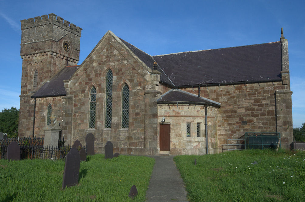
St Nidan's Church, Llanidan is a 19th-century parish church near the village of Brynsiencyn, in Anglesey, north Wales. Built between 1839 and 1843, it replaced the Old Church of St Nidan, Llanidan, which needed significant repair, providing a place of Anglican worship nearer to the village than the old church. Some items were moved here from the old church, including the 13th-century font, two bells from the 14th and 15th century, and a reliquary thought to hold the remains of St Nidan. The tower at the west end has been described as "top heavy" and looking like "a water tower". The church is still used for worship by the Church in Wales, one of five in a group of parishes in the south of Anglesey. It is a Grade II listed building, a national designation given to "buildings of special interest, which warrant every effort being made to preserve them", in particular because it is regarded as "a distinctive example of pre-archaeological gothic revival work." The 19th-century cle ... [...More Info...] [...Related Items...] OR: [Wikipedia] [Google] [Baidu] |
Bro Rhosyr
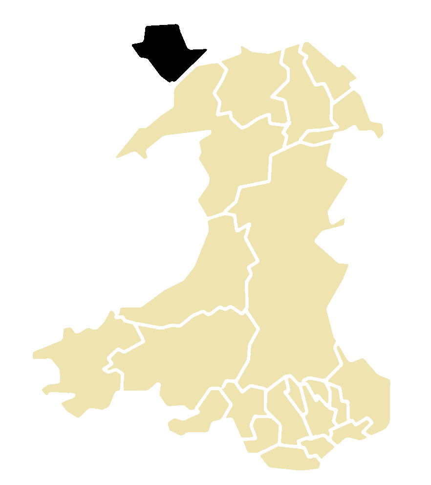
Bro Rhosyr is an electoral ward in the south of Anglesey, Wales, created in 2012. Bro Rhosyr includes the communities of Llanidan (Brynsiencyn), Llanfihangel Ysgeifiog ( Gaerwen), Llanddaniel-fab and Llangristiolus. The ward elects two county councillors to the Isle of Anglesey County Council. Bro Aberffraw ward lies to the southwest while the Aethwy ward lies to the northeast. Canolbarth Môn borders to the north. Bro Rhosyr was created following the Isle of Anglesey electoral boundary changes in 2012, which created 11 multi-councillor wards from 40 single-councillor wards. The new ward replaced the former Llanidan county ward and parts of the wards of Bodffordd, Bodorgan and Llanfihangel Ysgeifiog which had each elected their own county councillor. Elections results Following the inaugural May 2013 county elections the ward was represented by two Independent Independent or Independents may refer to: Arts, entertainment, and media Artist groups * Independents (artis ... [...More Info...] [...Related Items...] OR: [Wikipedia] [Google] [Baidu] |
Anglesey
Anglesey (; cy, (Ynys) Môn ) is an island off the north-west coast of Wales. It forms a principal area known as the Isle of Anglesey, that includes Holy Island across the narrow Cymyran Strait and some islets and skerries. Anglesey island, at , is the largest in Wales, the seventh largest in Britain, largest in the Irish Sea and second most populous there after the Isle of Man. Isle of Anglesey County Council administers , with a 2011 census population of 69,751, including 13,659 on Holy Island. The Menai Strait to the mainland is spanned by the Menai Suspension Bridge, designed by Thomas Telford in 1826, and the Britannia Bridge, built in 1850 and replaced in 1980. The largest town is Holyhead on Holy Island, whose ferry service with Ireland handles over two million passengers a year. The next largest is Llangefni, the county council seat. From 1974 to 1996 Anglesey was part of Gwynedd. Most full-time residents are habitual Welsh speakers. The Welsh name Ynys M ... [...More Info...] [...Related Items...] OR: [Wikipedia] [Google] [Baidu] |
Foryd Bay
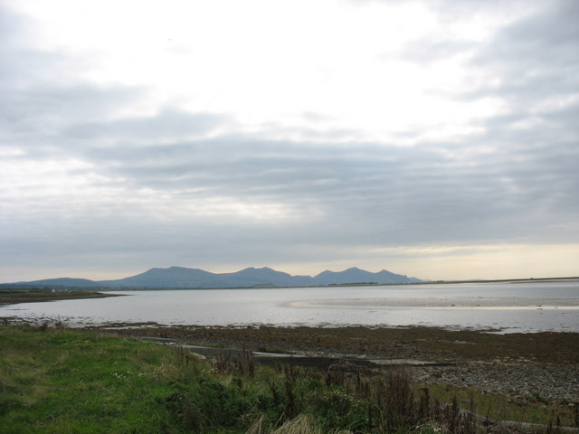
Y Foryd (meaning 'the estuary' or 'the inlet'), also known as Foryd Bay, is a tidal bay in Gwynedd, Wales. It is located at the south-western end of the Menai Strait, about two miles south-west of Caernarfon. Several rivers flow into the bay and there are large areas of mudflats and salt marsh. A shingle spit partly blocks the mouth of the bay. At the north-western end is Fort Belan, built during the 18th century. Aerial photography in the drought of 2018 identified rectangular structures possibly of Roman age, at Glan y Mor, oslightly raised ground adjacent to the shoreline This layout is very unusual in Roman Wales; it is rectilinear but has no defences and is otherwise unlike the military Roman sites in Wales, nor does it resemble the native defended settlements with their roundhouses and irregular outlines, nor the occasional villas. It is similar to the buildings and ditched enclosures excavated on the other side of the Menai Strait at Tai Cochion. To the south is a rec ... [...More Info...] [...Related Items...] OR: [Wikipedia] [Google] [Baidu] |
Sedgefield
Sedgefield is a market town and civil parish in County Durham, England. It had a population of 5,211 as at the 2011 census. It has the only operating racecourse in County Durham. History Roman A Roman 'ladder settlement' was discovered by Channel Four's ''Time Team'' programme in 2003, in fields just to the west of Sedgefield. It consisted of rows of parallel crofts and workshops on either side of a north–south trackway, creating a ladder-like layout, which could be securely dated by the many finds of Roman coins. Hunting During the 1800s, it was a hunting centre, dubbed 'the Melton of the North'. Hunter Ralph Lambton had his headquarters at Sedgefield: the humorous writer, Robert Smith Surtees, who lived at Hamsterley Hall, was a friend of his. On 23 February 1815, Lord Darlington wrote: 'Mr Ralph Lambton was out with some gentlemen from Sedgefield, and a most immense field.' Winterton The town was known in the area because of Winterton Hospital. This was an isolation ... [...More Info...] [...Related Items...] OR: [Wikipedia] [Google] [Baidu] |
2013 Isle Of Anglesey County Council Election
An election to the Isle of Anglesey County Council was held as part of the 2013 United Kingdom local elections and took place on 2 May 2013. Anglesey was the only Welsh authority voting in 2013, the election having been postponed from 2012 by the Welsh Government, in order to allow an electoral review to take place. The next full council election took place on 4 May 2017. Boundary review Under The Isle of Anglesey (Electoral Arrangements) Order 2012, thirty seats (a reduction from the previous 40) were created, from eleven (previously 40) electoral divisions, by the Local Government Boundary Commission for Wales. Legislation.gov.uk Overall results Turnout for the election was 50.5% of eligible voters.[...More Info...] [...Related Items...] OR: [Wikipedia] [Google] [Baidu] |
United Kingdom Census 2011
A census of the population of the United Kingdom is taken every ten years. The 2011 census was held in all countries of the UK on 27 March 2011. It was the first UK census which could be completed online via the Internet. The Office for National Statistics (ONS) is responsible for the census in England and Wales, the General Register Office for Scotland (GROS) is responsible for the census in Scotland, and the Northern Ireland Statistics and Research Agency (NISRA) is responsible for the census in Northern Ireland. The Office for National Statistics is the executive office of the UK Statistics Authority, a non-ministerial department formed in 2008 and which reports directly to Parliament. ONS is the UK Government's single largest statistical producer of independent statistics on the UK's economy and society, used to assist the planning and allocation of resources, policy-making and decision-making. ONS designs, manages and runs the census in England and Wales. In its capacity a ... [...More Info...] [...Related Items...] OR: [Wikipedia] [Google] [Baidu] |
Llanddaniel Fab
Llanddaniel Fab (or Llanddaniel-fab) is a village and community in Anglesey, Wales. At the 2001 census it had a population of 699, increasing to 776 at the 2011 census. It is near the prehistoric monument of Bryn Celli Ddu which was constructed in the late Neolithic period. In the east of the community, by the Menai Strait, stands the country seat of the Marquess of Anglesey, Plas Newydd, parts of which date from the 14th century. The house has been owned by the National Trust since 1976. In the 16th century the poet Catrin ferch Gruffudd ap Hywel lived here. Her Welsh poems are preserved and they include an Awdl with a religious theme written in 1555. During the 2001 United Kingdom foot-and-mouth crisis, many sheep and cattle were slaughtered in the area. The village has its own community council and its county council representative is Hywel Eifion Jones, who has held the post since May 1999. Amenities include a post office, primary school (Ysgol Parc y Bont), and a 12 ... [...More Info...] [...Related Items...] OR: [Wikipedia] [Google] [Baidu] |
Wards And Electoral Divisions Of The United Kingdom
The wards and electoral divisions in the United Kingdom are electoral districts at sub-national level, represented by one or more councillors. The ward is the primary unit of English electoral geography for civil parishes and borough and district councils, the electoral ward is the unit used by Welsh principal councils, while the electoral division is the unit used by English county councils and some unitary authorities. Each ward/division has an average electorate of about 5,500 people, but ward population counts can vary substantially. As of 2021 there are 8,694 electoral wards/divisions in the UK. England The London boroughs, metropolitan boroughs and non-metropolitan districts (including most unitary authorities) are divided into wards for local elections. However, county council elections (as well as those for several unitary councils which were formerly county councils, such as the Isle of Wight and Shropshire Councils) instead use the term ''electoral division''. In ... [...More Info...] [...Related Items...] OR: [Wikipedia] [Google] [Baidu] |
Rhosyr (cantref)
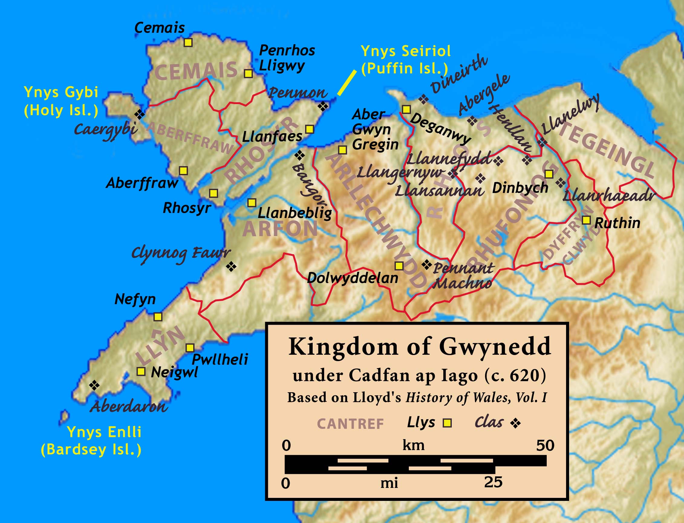
Rhosyr was the name of one of the three medieval cantrefs (meaning ''a hundred towns'') on the island of Anglesey, north Wales, in the Kingdom of Gwynedd. It lay on the southern side of the island facing the Menai Strait which separates Anglesey from the mainland. There are indications that Rhosyr existed as far back as the 6th century and the period of St Caffo and King Maelgwn Gwynedd Maelgwn Gwynedd ( la, Maglocunus; died c. 547Based on Phillimore's (1888) reconstruction of the dating of the '' Annales Cambriae'' (A Text).) was king of Gwynedd during the early 6th century. Surviving records suggest he held a pre-eminent positio .... The cantref stretched inland from the Menai Strait to the tidal Maltreath estuary, controlling the dry land route through Anglesey, hence held a strategic position.Rhosyr: Its History and Topography in the Age of the Welsh Princes, pp. 8-10 The township of Rhosyr, in the south of the cantref, was of military importance for controlling access to th ... [...More Info...] [...Related Items...] OR: [Wikipedia] [Google] [Baidu] |
Cantref
A cantref ( ; ; plural cantrefi or cantrefs; also rendered as ''cantred'') was a medieval Welsh land division, particularly important in the administration of Welsh law. Description Land in medieval Wales was divided into ''cantrefi'', which were themselves divided into smaller ''cymydau'' (commotes). The word ''cantref'' is derived from ''cant'' ("a hundred") and ''tref'' ("town" in modern Welsh, but formerly used for much smaller settlements). The ''cantref'' is thought to be the original unit, with the commotes being a later division. ''Cantrefi'' could vary considerably in size: most were divided into two or three commotes, but the largest, the ''Cantref Mawr'' (or "Great Cantref") in Ystrad Tywi (now in Carmarthenshire) was divided into seven commotes. History The antiquity of the ''cantrefi'' is demonstrated by the fact that they often mark the boundary between dialects. Some were originally kingdoms in their own right; others may have been artificial units created later. ... [...More Info...] [...Related Items...] OR: [Wikipedia] [Google] [Baidu] |


