|
List Of Sites And Monuments In Kenya
This is a list of sites and monuments of historic value that are maintained by the National Museums of Kenya. Historic sites See also * List of museums in Kenya References External links * *{{cite web , title = Overview, work =Kenya Wildlife Service , url=http://www.kws.go.ke/content/overview-0 , accessdate=2010-10-11 Museums in Kenya Natural history museums Kenya Monumnts * Kenya ) , national_anthem = " Ee Mungu Nguvu Yetu"() , image_map = , map_caption = , image_map2 = , capital = Nairobi , coordinates = , largest_city = Nairobi ... Sites and monuments ... [...More Info...] [...Related Items...] OR: [Wikipedia] [Google] [Baidu] |
National Museums Of Kenya
The National Museums of Kenya (NMK) is a state corporation that manages museums, sites and monuments in Kenya. It carries out heritage research, and has expertise in subjects ranging from palaeontology, archeology, ethnography and biodiversity research and conservation. Its headquarters and the National Museum ( Nairobi National Museum) are located on Museum Hill, near Uhuru Highway between Central Business District and Westlands in Nairobi. The National Museum of Kenya was founded by the East Africa Natural History Society (E.A.N.H.S.) in 1910; the society's main goal has always been to conduct an ongoing critical scientific examination of the natural attributes of the East African habitat. The museum houses collections, and temporary and permanent exhibits. Today the National Museum of Kenya manages over 22 regional museums, many sites, and monuments across the country.NMK, "National Museums of Kenya," 2006-03-31, Museums.or.ke, webMuseumsOR/ref> Nairobi National Museum o ... [...More Info...] [...Related Items...] OR: [Wikipedia] [Google] [Baidu] |
Lamu
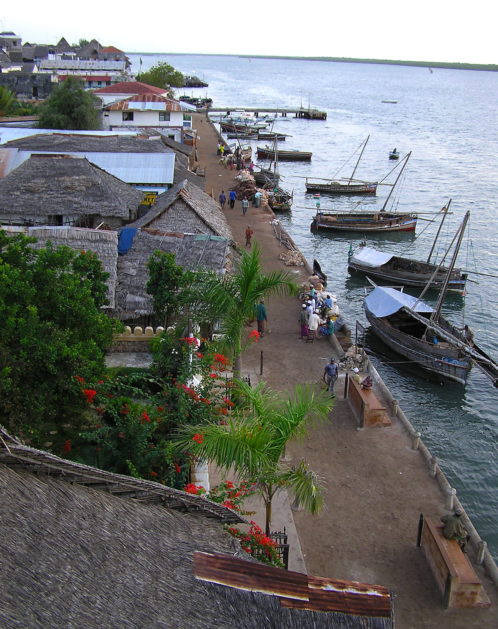
Lamu or Lamu Town is a small town on Lamu Island, which in turn is a part of the Lamu Archipelago in Kenya. Situated by road northeast of Mombasa that ends at Mokowe Jetty, from where the sea channel has to be crossed to reach Lamu Island. It is the headquarters of Lamu County and a UNESCO World Heritage Site. The town contains the Lamu Fort on the seafront, constructed under Fumo Madi ibn Abi Bakr, the sultan of Pate, and was completed after his death in the early 1820s. Lamu is also home to 23 mosques, including the Riyadha Mosque, built in 1900, and a donkey sanctuary. History Early history The original name of the town is Amu, which the Arabs termed Al-Amu (آامو) and the Portuguese "Lamon". The Portuguese applied the name to the entire island as Amu was the chief settlement. Lamu Town on Lamu Island is Kenya's oldest continually inhabited town, and was one of the original Swahili settlements along coastal East Africa. It is believed to have been established ... [...More Info...] [...Related Items...] OR: [Wikipedia] [Google] [Baidu] |
Fort Ternan
Fort Ternan is a small town in Kericho County, Kenya, located 50 kilometres east of Kisumu and five kilometres east of Koru. It is named after Col. Trevor Ternan C.M.G.D.S.O. Fort Ternan is located at the western border of the former Rift Valley Province.Rough Guide Map of Kenya Fort Ternan forms a ward of Kipkelion West Constituency and Kipsigis town council. Fort Ternan is also a location in the Chilchila division. Transport It is served by a railway station on the branch line to Kisumu on the national railway system. The railway is heavily graded in the vicinity of this station. The Highway Construction running From Nakuru To Kisumu through Londiani has connected the town to Kericho and Kisumu. There are local road leading to highly productive highland areas like Kipsinende, Cherara, Kokwet, Chepkechei, Koisagat, Chepkitar, Lelu etc. Paleontology Fossils of the specimen Kenyapithecus were first found by Louis Leakey in Fort Ternan in 1962. There is a prehistoric site and ... [...More Info...] [...Related Items...] OR: [Wikipedia] [Google] [Baidu] |
Mai Mahiu
Maai Mahiu is a town in Kenya's Nakuru County that means "hot water" in native Kikuyu language. Maai Mahiu has a train station as well as an inland container depot on the Nairobi–Malaba Standard Gauge Railway The Nairobi–Malaba Standard Gauge Railway (SGR) is the project of standard-gauge railway that should connect Kenya's capital city of Nairobi to Malaba, at the international border with Uganda. The Nairobi–Malaba SGR was to connect other st ..., which was inaugurated in October 2019. References {{reflist Populated places in Nakuru County ... [...More Info...] [...Related Items...] OR: [Wikipedia] [Google] [Baidu] |
Marsabit County
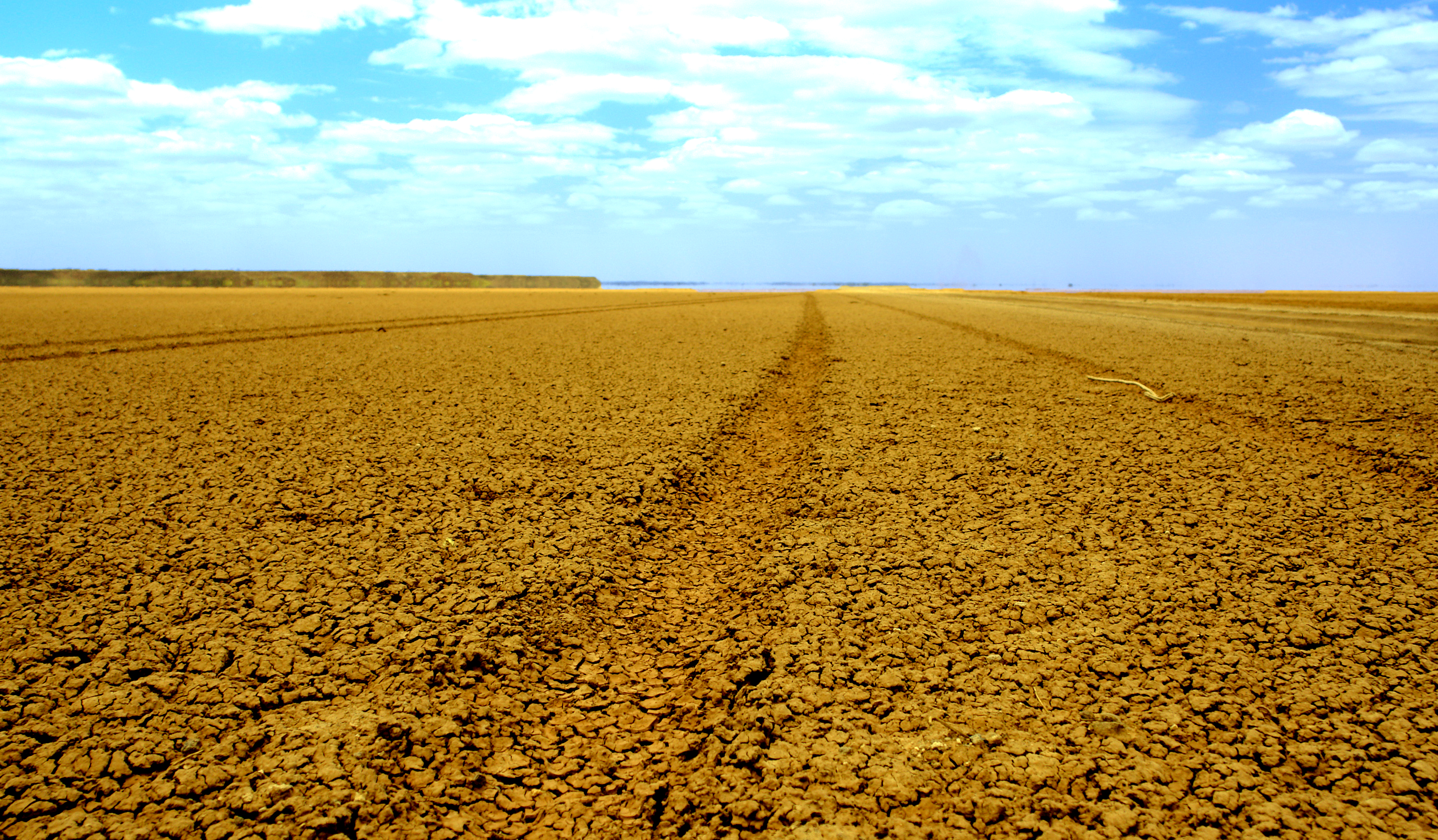
Marsabit County is a county in Kenya. Covering a surface area of 66,923.1 square kilometres. Marsabit is the second largest county in Kenya. Its capital is Marsabit and its largest town Moyale. According to the 2019 census, the county has a population of 459,785. It is bordered to the North by Ethiopia, to the West by Turkana County to the South by Samburu County and Isiolo County, and to the East by Wajir County. Geography The county is located in central north Kenya. It borders the eastern shore of Lake Turkana. Important topographical features are: Ol Donyo Ranges () in the southwest, Mount Marsabit () in the central part of the county, Hurri Hills () in the northeastern part of the county, Mount Kulal () in the northwest and the mountains around Sololo-Moyale escarpment (up to ) in the northeast. The Chalbi Desert makes up much of the center region of the county. Physical and tropical features The county is made of an extensive plain lying above sea level which gent ... [...More Info...] [...Related Items...] OR: [Wikipedia] [Google] [Baidu] |
Marsabit
Marsabit is a town in the northern Marsabit County in Kenya. It is situated in the former Eastern Province and is almost surrounded by the Marsabit National Park. The town is located east of the centre of the East African Rift at an elevation of between 1300 and 1400 metres. It serves as the capital of Marsabit County, and lies southeast of the Chalbi Desert in a forested area known for its volcanoes and crater lakes and others. Overview Marsabit is an outpost of urban civilization in the desert of northern Kenya. The town is situated on an isolated extinct volcano, Mount Marsabit, which rises almost a kilometer above the desert. The hills here are heavily forested, in contrast to the desert beyond, with their own "insular" eco-system. The town has a population of about 5,000. The town is mainly inhabited by the Cushitic-speaking Borana Oromo people. There are also very few Nilotic Turkana and Bantu Ameru residents. Additionally, there are also few non-Cushitic-speaking tr ... [...More Info...] [...Related Items...] OR: [Wikipedia] [Google] [Baidu] |
Sibiloi National Park
Sibiloi National Park lies on the northeastern shore of Lake Turkana in northern Kenya. Established in 1973 by the government of Kenya for the protection of wildlife and paleontologist sites there, it covers and is internationally known for its fossils. It was listed as a UNESCO World Heritage Site in 1997 as a part of Lake Turkana National Parks. Sibiloi National Park is located on the wild and rugged shores of Lake Turkana – the cradle of mankind - Sibiloi is home to important archaeological sites including Koobi Fora where the fossil remains have contributed more to the understanding of human evolution than any other site in the continent. The area is characterized by semi-desert habitat and open plains flanked by volcanic formations including Mount Sibiloi, where the remains of a petrified forest can be seen. Background The park was named for Mount Sibiloi in view at Alia Bay on the south perimeter. There also is located the park headquarters of the Kenya Wildlife Servic ... [...More Info...] [...Related Items...] OR: [Wikipedia] [Google] [Baidu] |
Lanet
Lanet is a commune in the Aude department in south-western France France (), officially the French Republic ( ), is a country primarily located in Western Europe. It also comprises of overseas regions and territories in the Americas and the Atlantic, Pacific and Indian Oceans. Its metropolitan area .... Geography The commune is located in the Corbières Massif. The village lies in the middle of the commune, on the right bank of the Orbieu, which flows northwest through the commune. Population See also * Communes of the Aude department References Communes of Aude Aude communes articles needing translation from French Wikipedia {{Aude-geo-stub ... [...More Info...] [...Related Items...] OR: [Wikipedia] [Google] [Baidu] |
Migori County
Migori County is a county in the former Nyanza Province of southwestern Kenya. It is located in Southwestern Kenya and borders Homa Bay County (North), Kisii County (North E), Narok (South East), Tanzania (West and South) and Lake Victoria to the West. The county also borders Uganda via Migingo Island in Lake Victoria. The county is headquartered by Migori town, which is also its largest town. The Kenya National Census of 2019 indicated that Migori County had a population of 1,116,436 compared to 917, 170 in 2009 Census. Migori County is located in the sugar belt wetlands of Western Kenya and is mostly at the heart of the African tropics. However, the county enjoys a pleasant climate because of high altitude which modifies the climate alongside the cool breeze from Lake Victoria. Demographically, Migori County is the most diverse region of Nyanza after Kisumu. The inhabitants include AbaSuba people, Joluo, Abakuria, Abagusii, Abaluhya, Somalis, Indians, Arabs, Agikuyu and Nub ... [...More Info...] [...Related Items...] OR: [Wikipedia] [Google] [Baidu] |
Kadem
Kadem (also ) is a defunct measurement unit used in the Ottoman Empire The Ottoman Empire, * ; is an archaic version. The definite article forms and were synonymous * and el, Оθωμανική Αυτοκρατορία, Othōmanikē Avtokratoria, label=none * info page on book at Martin Luther University) .... Kadem means "foot" and during the last years of the Ottoman Empire 1 kadem was set to be in accordance with the British unit of length. But before the reign of Ottoman Sultan Selim III (r. 1789–1807), kadem had a different definition. Its value was either 36.6666 cm. or 37.8869 cm. During the Atatürk's Reforms metric system was adopted in Turke ... [...More Info...] [...Related Items...] OR: [Wikipedia] [Google] [Baidu] |
Thimlich Ohinga
Thimlich Ohinga is a complex of stone-built ruins in Migori county, Nyanza Kenya, in East Africa. It is the largest one of 138 sites containing 521 stone structures that were built around the Lake Victoria region in Kenya. These sites are highly clustered. F. za Odede. Secrets in stone. Who built the stone settlements of Nyanza Province. Kenya Past and Present, Volume 36, Issue 1, Jan 2006, p. 67 - 72. Available from: https://journals.co.za/content/kenya/36/1/AJA02578301_479 The main enclosure of Thimlich Ohinga has walls that vary from 1 to 3 meters in thickness, and 1 to 4.2 meters in height.The Mystery of Thimlich Ohinga Fort on Lake Victoria 2011-03-16, The Star The structures were built from undressed blocks, rocks, and stones set in place without mor ... [...More Info...] [...Related Items...] OR: [Wikipedia] [Google] [Baidu] |
Samburu County
Samburu County is a county in the former Rift Valley Province, Kenya. It covers an area of roughly 21,000 km2 (8,000 mi2) in northern Kenya where the Samburu, Turkana and many other tribes live. It stretches north from the Wuaso Ng'iro River to the south of Lake Turkana. According to the 2019 census, the county has a population of 310,327. Within Samburu County are the towns of Maralal (capital and largest town), Baragoi, Archers Post, South Horr, Wamba, Lodosoit, and Kisima. It also includes the Samburu National Reserve, Bisanadi National Reserve, and Buffalo Springs National Reserve, Mount Ng'iro, Ndoro Mountains, Mathews Range (Ol Doinyo Lenkiyo), Kirisia Hills, and Loroki Forest. The main access road to Samburu County is the A4 road from Rumuruti-Maralal-Baragoi, which as of 2019 was being tarmaced from Rumuruti up to Maralal. There is a town named Samburu in Kwale County also in Kenya ) , national_anthem = " Ee Mungu Nguvu Yetu"( ... [...More Info...] [...Related Items...] OR: [Wikipedia] [Google] [Baidu] |


