|
Lautite
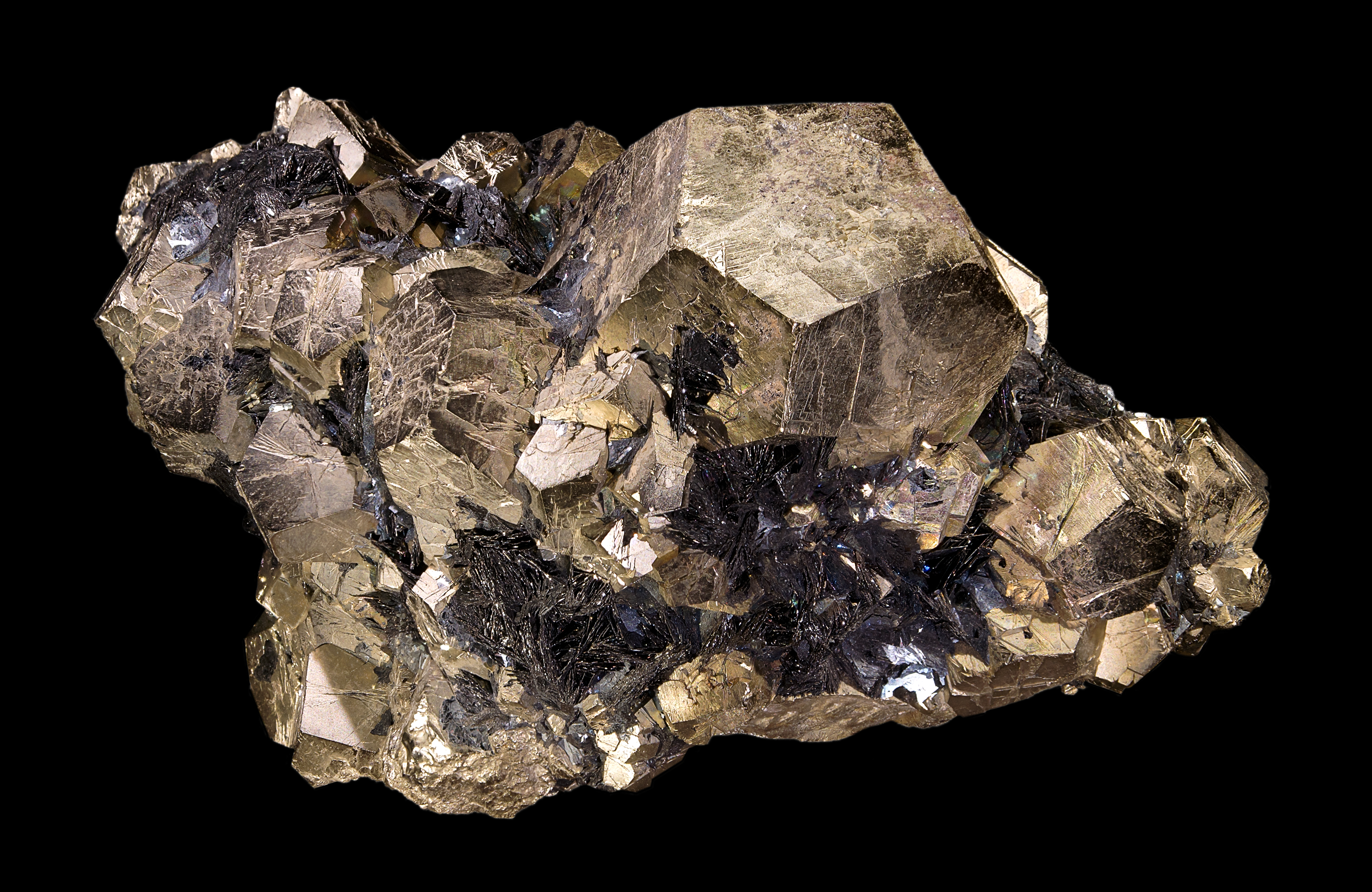
Lautite is a rare mineral belonging to the class of sulfides and sulfosalts with the general formula CuAsS. It is orthorhombic and is known to form up to 2.3 cm long prismatic or flat crystals. It is also found as grains or masses. First identified by Friedrich August Frenzel in 1880 in the Rudolphschacht mine near Lauta in Saxony, it was named after its type locality.Frenzel, A. (1880). XIX. Mineralogisches. Zeitschrift für Kristallographie, Mineralogie und Petrographie, 3(6), 504-516. Lautite is formed in veins under hydrothermal conditions at medium temperatures. Depending on the locality it is found accompanied by arsenic, tennantite, proustite, chalcopyrite, galenite, and baryte (in the type locality); by kutinaite and paxite (in Nieder-Beerbach); or by arsenic, bismuth, tennantite, loellingite, rammelsbergite, proustite, and quartz (in Sainte-Marie-aux-Mines). Aside from the type locality, the mineral is found in other places in the Ore Mountains, in Sankt ... [...More Info...] [...Related Items...] OR: [Wikipedia] [Google] [Baidu] |
Sulfide Minerals
The sulfide minerals are a class of minerals containing sulfide (S2−) or disulfide (S22−) as the major anion. Some sulfide minerals are economically important as metal ores. The sulfide class also includes the selenides, the tellurides, the arsenides, the antimonides, the bismuthinides, the sulfarsenides and the sulfosalts.http://www.minerals.net/mineral/sort-met.hod/group/sulfgrp.htm Minerals.net Dana Classification, SulfidesKlein, Cornelis and Cornelius S. Hurlbut, Jr., 1986, ''Manual of Mineralogy'', Wiley, 20th ed., pp 269-293 Sulfide minerals are inorganic compounds. Minerals Common or important examples include: * Acanthite *Chalcocite *Bornite *Galena * Sphalerite * Chalcopyrite * Pyrrhotite * Millerite * Pentlandite * Covellite * Cinnabar * Realgar *Orpiment * Stibnite *Pyrite * Marcasite * Molybdenite Sulfarsenides: *Cobaltite *Arsenopyrite * Gersdorffite Sulfosalts: * Pyrargyrite * Proustite *Tetrahedrite * Tennantite * Enargite ... [...More Info...] [...Related Items...] OR: [Wikipedia] [Google] [Baidu] |
Friedrich August Frenzel
Friedrich August Frenzel (24 May 1842 – 27 August 1902) was a German mineralogist. He was born in a miner's family in Freiberg, Saxony. In 1861 he was awarded a scholarship which enabled him to study mineralogy at Bergakademie Freiberg. There he attracted the attention of August Breithaupt who asked him to help with organising the mineralogical collections of the academy and with testing mineral samples, and to assist in the professor's mineralogical research. In 1865 Frenzel finished his studies and was awarded the title of a mining inspector. From then on, he worked for 25 years as a chemist in the metallurgical laboratories. He also lectured at the Bergakademie. One of his best known works is the mineralogical encyclopedia for the Kingdom of Saxony (''Mineralogisches Lexicon Für Das Königreich Sachsen''), which contains descriptions of 723 minerals found in Saxony, information on their physical properties and chemical compositions, and descriptions of the corresponding loc ... [...More Info...] [...Related Items...] OR: [Wikipedia] [Google] [Baidu] |
Lauta (Marienberg)
Lauta is a village in the Saxon town of Marienberg in the German district of Erzgebirgskreis. Geography Lauta lies about 2 kilometres northwest of Marienberg in the Ore Mountains. Southwest of Lauta lies the high Dreibrüderhöhe, southeast of the village is the high Lautaer Höhe.Until the opening of the Marienberg ring road in 2007 the B 174 federal road from Chemnitz to Reitzenhain passed through the village. Since then it has run past Lauta to the north and east. There is a road to Lauterbach, the ''Kreisstraße'' 8131. History Lauta was first mentioned in 1434 as ''die Lute''. Mining started in 1523 with ''Bauernzeche'' pit on the ore vein '' Bauer Morgengang''. Following the Protestant Reformation Lauta became part of Lauterbach parish in 1539, and on 1 October 1875 it became part of Marienberg parish. By way of reciprocation, some mine buildings near Rittersberg and two mine buildings which used to belong to Niederlauterstein, together with 27 inhab ... [...More Info...] [...Related Items...] OR: [Wikipedia] [Google] [Baidu] |
Schenkenzell
Schenkenzell is a village in the district of Rottweil, in Baden-Württemberg, Germany. The town is twinned with Schenkon Schenkon is a municipality in the district of Sursee in the canton of Lucerne in Switzerland. Geography Schenkon has an area of . Of this area, 67.8% is used for agricultural purposes, while 17% is forested. Of the rest of the land, 14.8% is set ... in Switzerland. References External links Schenkenzell pictures Rottweil (district) {{Rottweil-geo-stub ... [...More Info...] [...Related Items...] OR: [Wikipedia] [Google] [Baidu] |
Hausach
Hausach (; gsw, label= Low Alemannic, Huusä) is a town in the Ortenaukreis, in western Baden-Württemberg, Germany. History Hausach was founded in the 13th century, below Husen Castle. In the 14th century, it became a possession of the County of Fürstenberg, who gave the town its charter and maintained a residence in it. In 1806, Hausach was mediatized to the Grand Duchy of Baden. The town was assigned in 1813 to the district of Haslach, but in 1857 was reassigned to the district of Wolfach. In 1939, that district was reorganized as . On 1 Jul 1971, the town of Einbach was incorporated into Hausach. As a result of the , Hausach was assigned to the Ortenau district. Geography The township ('' Stadt'') of Hausach is part of the Ortenau district of Baden-Württemberg, in the Federal Republic of Germany. It is physically located in the Central Black Forest, at the center of the valley of the Kinzig. the elevation above sea level in the municipal area ranges from a high o ... [...More Info...] [...Related Items...] OR: [Wikipedia] [Google] [Baidu] |
Odenwald
The Odenwald () is a low mountain range in the German states of Hesse, Bavaria and Baden-Württemberg. Location The Odenwald is located between the Upper Rhine Plain with the Bergstraße and the ''Hessisches Ried'' (the northeastern section of the Rhine rift) to the west, the Main and the Bauland (a mostly unwooded area with good soils) to the east, the Hanau-Seligenstadt Basin – a subbasin of the Upper Rhine Rift Valley in the Rhine-Main Lowlands – to the north and the Kraichgau to the south. The part south of the Neckar valley is sometimes called the ''Kleiner Odenwald'' ("Little Odenwald"). The northern and western Odenwald belong to southern Hesse, with the south stretching into Baden. In the northeast, a small part lies in Lower Franconia in Bavaria. Geology The Odenwald, along with other parts of the Central German Uplands, belongs to the Variscan, which more than 300 million years ago in the Carboniferous period ran through great parts of Europe. The cause o ... [...More Info...] [...Related Items...] OR: [Wikipedia] [Google] [Baidu] |
Harz
The Harz () is a highland area in northern Germany. It has the highest elevations for that region, and its rugged terrain extends across parts of Lower Saxony, Saxony-Anhalt, and Thuringia. The name ''Harz'' derives from the Middle High German word ''Hardt'' or ''Hart'' (hill forest). The name ''Hercynia'' derives from a Celtic name and could refer to other mountain forests, but has also been applied to the geology of the Harz. The Brocken is the highest summit in the Harz with an elevation of above sea level. The Wurmberg () is the highest peak located entirely within the state of Lower Saxony. Geography Location and extent The Harz has a length of , stretching from the town of Seesen in the northwest to Eisleben in the east, and a width of . It occupies an area of , and is divided into the Upper Harz (''Oberharz'') in the northwest, which is up to 800 m high, apart from the 1,100 m high Brocken massif, and the Lower Harz (''Unterharz'') in the east which is up to aro ... [...More Info...] [...Related Items...] OR: [Wikipedia] [Google] [Baidu] |
Sankt Andreasberg
Sankt Andreasberg is a former town in the district of Goslar, in Lower Saxony, Germany. Since 1 November 2011, it is part of the town Braunlage. It is situated in the Harz, approximately 7 km west of Braunlage proper, and 20 km east of Osterode am Harz. History Sankt Andreasberg was founded in the 1480s. It was first mentioned in a letter from the Count Heinrich zu Stolberg to Dietrich von Witzlebenon on 3 November 1487. The establishment of the village took place around the market. The first silver mines are assumed to be the St. Andrews Cross Mine (german: Grube St. Andreaskreuz) at the foot of the ''Beerberg'' and the St. Andrews Mine (''Grube St. Andreas'') by the market. In 1521, St. Andreasberg received the right to mine from Counts Heinrich and Ernst von Hohenstein. It was proclaimed in Mansfelder Land and in the mining areas of Saxony and miners were invited to dig for silver and other metals. Natural monuments The area around Sankt Andreasberg is especi ... [...More Info...] [...Related Items...] OR: [Wikipedia] [Google] [Baidu] |
Sainte-Marie-aux-Mines
Sainte-Marie-aux-Mines (; ; Alsatian: ''Màrkìrisch'') is a commune in the Haut-Rhin department and Grand Est region of north-eastern France. Geography Sainte-Marie-aux-Mines is located in the massif of the Vosges Mountains, where it occupies the V-shaped valley of the . Nearby Lorraine is accessible by road over the (772 m) or the Tunnel Maurice-Lemaire (reopened, following a major upgrade, in October 2008). The (903 m) leads to the Col du Bonhomme and to the Route des Crêtes (''Road of the Ridges''). The Col du Haut de Ribeauvillé (742 m, 2,412 feet) gives direct access to Ribeauvillé, situated to the southeast. Sélestat in the Bas Rhin, a much more substantial commercial and political focus for the region, is just to the east, along the Liepvrette valley. Sainte-Marie-aux-Mines is surrounded on both sides of the valley by high mountains. The Lièpvrette River, which was formerly called ''Landbach'', separates the town into two parts, and, formerly, into two dif ... [...More Info...] [...Related Items...] OR: [Wikipedia] [Google] [Baidu] |
Quartz
Quartz is a hard, crystalline mineral composed of silica ( silicon dioxide). The atoms are linked in a continuous framework of SiO4 silicon-oxygen tetrahedra, with each oxygen being shared between two tetrahedra, giving an overall chemical formula of SiO2. Quartz is the second most abundant mineral in Earth's continental crust, behind feldspar. Quartz exists in two forms, the normal α-quartz and the high-temperature β-quartz, both of which are chiral. The transformation from α-quartz to β-quartz takes place abruptly at . Since the transformation is accompanied by a significant change in volume, it can easily induce microfracturing of ceramics or rocks passing through this temperature threshold. There are many different varieties of quartz, several of which are classified as gemstones. Since antiquity, varieties of quartz have been the most commonly used minerals in the making of jewelry and hardstone carvings, especially in Eurasia. Quartz is the mineral defini ... [...More Info...] [...Related Items...] OR: [Wikipedia] [Google] [Baidu] |

.jpg)


