|
Langdale
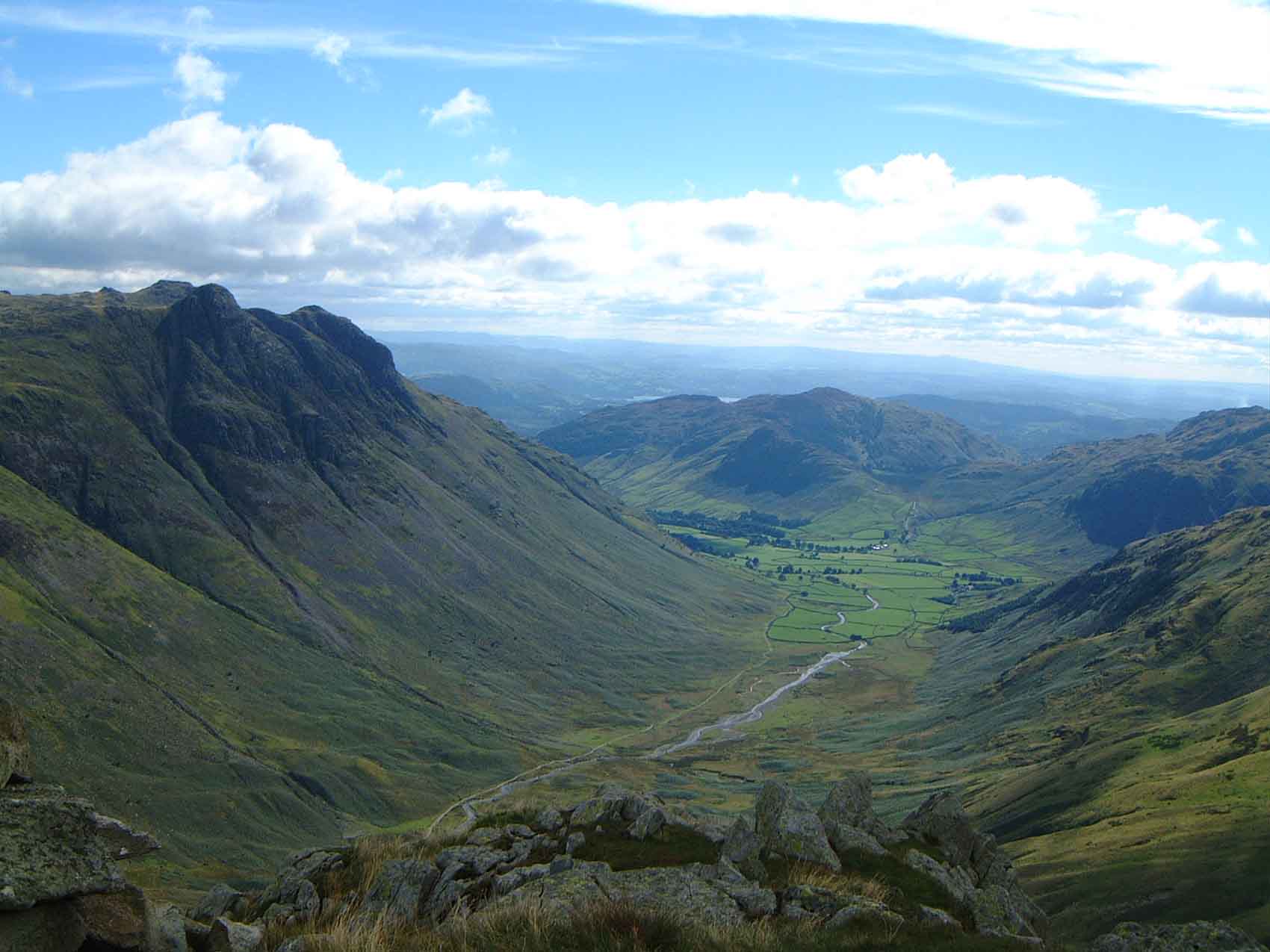
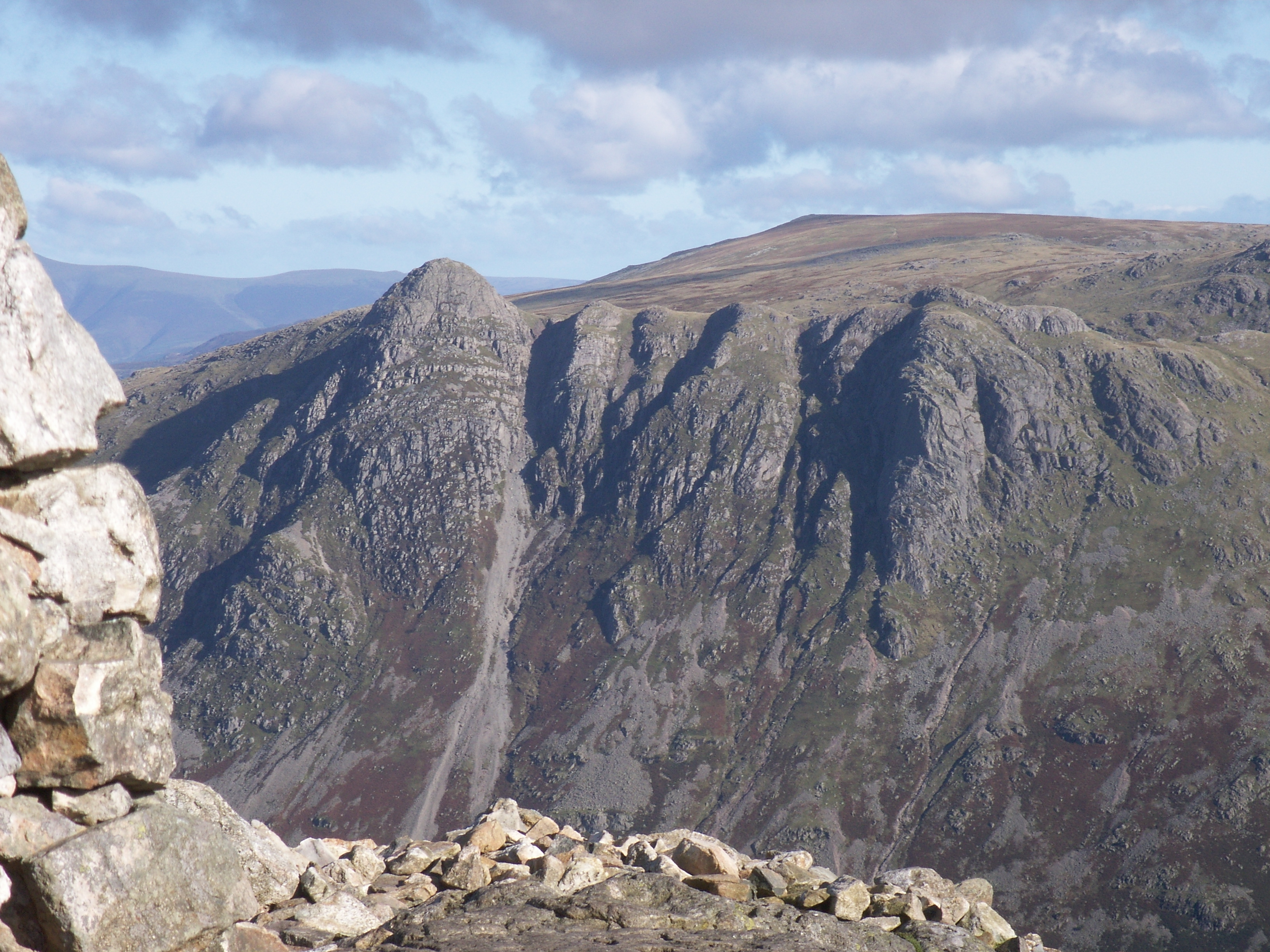
Great Langdale is a valley in the Lake District National Park in North West England, the epithet Great distinguishing it from the neighbouring valley of Little Langdale. Langdale is also the name of a valley in the Howgill Fells, elsewhere in Cumbria. It is a popular location for hikers, climbers, fell-runners, and other outdoor enthusiasts who are attracted by the many fells ringing the head of the valley. Among the best-known features of Great Langdale are the Langdale Pikes, a group of peaks on the northern side of the dale. England's highest mountain, Scafell Pike, can be climbed by a route from Langdale. Langdale has views of, in particular, Dungeon Ghyll Force waterfall, Harrison Stickle, and Pike of Stickle. Great Langdale was an important site during the Neolithic period for producing stone axes and was also one of the centres of the Lakeland slate industry. History Great Langdale is known to archaeologists as the source of a particular type of Neolithic polished ... [...More Info...] [...Related Items...] OR: [Wikipedia] [Google] [Baidu] |
Little Langdale
Little Langdale is a valley in the Lake District, England, containing Little Langdale Tarn and a hamlet also called Little Langdale. A second tarn, Blea Tarn, is in a hanging valley between Little Langdale and the larger Great Langdale to the north. Little Langdale is flanked on the south and southwest by Wetherlam and Swirl How, and to the north and northwest by Lingmoor Fell and Pike of Blisco. The valley descends to join with Great Langdale above Elter Water. Description Langdale was previously known as ''Langdene'' meaning 'far away wooded valley' and referring to its distance along the flint route from Whitley Bay. Historically Little Langdale was at the intersection of packhorse routes leading to Ravenglass, Whitehaven, Keswick, Penrith & Carlisle, Ambleside, Hawkshead, and Coniston, Ulverston, Broughton-in-Furness and Barrow in Furness. Slater's Bridge which crosses the River Brathay in 3 spans supported by a large mid-stream boulder and stone causeways ... [...More Info...] [...Related Items...] OR: [Wikipedia] [Google] [Baidu] |
Langdale Axe Industry
The Langdale axe industry (or factory) is the name given by archaeologists to a Neolithic centre of specialised stone tool production in the Great Langdale area of the English Lake District. (For accompanying material seSupplement 1of same volume). The existence of the site, which dates from around 4,000–3,500 BC, was suggested by chance discoveries in the 1930s. More systematic investigations were undertaken by Clare Fell and others in the 1940s and 1950s, since when several field surveys of varying scope have been carried out. Typical finds include reject axes, rough-outs and blades created by knapping large lumps of the rock found in the scree or perhaps by simple quarrying or opencast mining. Hammerstones have also been found in the scree and other lithic debitage from the industry such as blades and flakes. The area has outcrops of fine-grained greenstone or hornstone suitable for making polished stone axes. Such axes have been found distributed across Great ... [...More Info...] [...Related Items...] OR: [Wikipedia] [Google] [Baidu] |
Harrison Stickle
Harrison Stickle is a fell in the central part of the English Lake District, situated above Great Langdale. The fell is one of the three (although the number is debated) fells which make up the picturesque Langdale Pikes, the others being Pike of Stickle and Loft Crag. Together they make up one of the most picturesque, and probably the best-known, mountain groups in the District. A "stickle" is a hill with a prominent rocky top. Topography The Langdale Pikes form a raised rocky parapet around the southern and eastern edges of a high tableland centred upon Thunacar Knott. Harrison Stickle is the high point of this system and its crags fall south and east from the summit, presenting an arresting view from the valley floor 2,000 ft below, or from further afield. To the north, the main ridge of the central fells passes over Thunacar Knott before climbing to High Raise. The craggy eastern face of this ridge continues north as far as Harrison's near neighbour, Pavey Ark, visua ... [...More Info...] [...Related Items...] OR: [Wikipedia] [Google] [Baidu] |
Pike Of Stickle
Pike of Stickle, also known as Pike o’ Stickle, is a fell in the English Lake District. It reaches a height of 709 metres (2,326 feet) and is situated in the central part of the national park in the valley of Great Langdale. The fell is one of three fells which make up the picturesque Langdale Pikes (the others being Harrison Stickle and Loft Crag), one of the best-known areas in Lakeland. A "stickle" is a hill with a steep prominent rocky top, while a "pike" is a hill with a peaked summit, the name being therefore partly tautological. Topography The Langdale Pikes form a raised rocky parapet around the southern and eastern edges of a high tableland centred upon Thunacar Knott. Pike of Stickle stands at the western end of this system and its crags fall south from the summit, presenting an arresting view from the valley floor 2,000 ft below, or from further afield. Loft Crag stands next along the rampart, with Thorn Crag and Harrison Stickle further to the ... [...More Info...] [...Related Items...] OR: [Wikipedia] [Google] [Baidu] |
Cumbria
Cumbria ( ) is a ceremonial and non-metropolitan county in North West England, bordering Scotland. The county and Cumbria County Council, its local government, came into existence in 1974 after the passage of the Local Government Act 1972. Cumbria's county town is Carlisle, in the north of the county. Other major settlements include Barrow-in-Furness, Kendal, Whitehaven and Workington. The administrative county of Cumbria consists of six districts ( Allerdale, Barrow-in-Furness, Carlisle, Copeland, Eden and South Lakeland) and, in 2019, had a population of 500,012. Cumbria is one of the most sparsely populated counties in England, with 73.4 people per km2 (190/sq mi). On 1 April 2023, the administrative county of Cumbria will be abolished and replaced with two new unitary authorities: Westmorland and Furness (Barrow-in-Furness, Eden, South Lakeland) and Cumberland ( Allerdale, Carlisle, Copeland). Cumbria is the third largest ceremonial county in England by ... [...More Info...] [...Related Items...] OR: [Wikipedia] [Google] [Baidu] |
Elterwater
Elterwater is a village in the English Lake District and the county of Cumbria. The village lies half a mile (800 m) north-west of the lake of Elter Water, from which it derives its name. Both are situated in the valley of Great Langdale. Elterwater Bridge is a Grade II listed structure dating to at least the 18th century. Economic activity In the past, the principal industries have been farming, quarrying for slate and gunpowder manufacture. The first two activities continue, while evidence of the latter survives in the grounds of the Langdale Estate, a holiday development founded in the 1930s and redeveloped as a timeshare in the 1980s. In the present day, tourism is a principal source of income and the village is popular with fell-walkers. Art In the 1880s, the Guild of St George founded by John Ruskin revived small-scale linen spinning and weaving in Langdale, at a cottage in Elterwater, led by Albert Fleming and Marion Twelves and continued by Elizabeth Pepper. The ... [...More Info...] [...Related Items...] OR: [Wikipedia] [Google] [Baidu] |
Chapel Stile
Chapel Stile is a village in Cumbria, England, located approximately 5 miles northwest of Ambleside, within the Langdale valley. It contains a school, Holy Trinity church, the Co-op and the Wainwrights' Inn (formerly The Langdale Hotel), and a quarry is located in the vicinity. Couples who choose to get married at the church are traditionally 'tied in' during the service. The local children tie up the church gates and the newlyweds are only released when coins (of small denomination) are thrown to said children. The Co-op has been established for well over a hundred years. Chapel Stile also gives access to the Langdale Pikes Great Langdale is a valley in the Lake District National Park in North West England, the epithet Great distinguishing it from the neighbouring valley of Little Langdale. Langdale is also the name of a valley in the Howgill Fells, elsewhere i ..., Pike o' Stickle and Harrison Stickle. Other notable fells nearby are Pavey Ark, Bowfell and Pike o' Bl ... [...More Info...] [...Related Items...] OR: [Wikipedia] [Google] [Baidu] |
Scafell Pike
Scafell Pike () is the highest and the most prominent mountain in England, at an elevation of above sea level. It is located in the Lake District National Park, in Cumbria, and is part of the Southern Fells and the Scafell massif. Scafell Pike forms part of the inactive Scafells volcano. Etymology and name history The name ''Scafell'' is believed by some to derive from the Old Norse ''skalli fjall'', meaning either the fell with the shieling or the fell with the bald summit, and is first recorded in 1578 in the corrupted form ''Skallfield''. An alternative derivation is from the Old Norse "skagi", meaning a cape, headland, promontory or peninsula – so giving an etymology that aligns with Skaw in Shetland. It originally referred to Scafell, which neighbours Scafell Pike.Dorothy Wordsworth's ascent of Scafell Pike, 1818, http://www.pastpresented.ukart.com/eskdale/wordsworth1.htm What are now known as Scafell Pike, Ill Crag, and Broad Crag were collectively called either ... [...More Info...] [...Related Items...] OR: [Wikipedia] [Google] [Baidu] |
Ambleside
Ambleside is a town and former civil parish, now in the parish of Lakes, in Cumbria, in North West England. Historically in Westmorland, it marks the head (and sits on the east side of the northern headwater) of Windermere, England's largest natural lake. In the Lake District National Park, it is south of the highest road pass in the Lake District, Kirkstone Pass and both places are the meeting point of well-marked paths and mountain hiking trails. In 2020 it had an estimated population of 2596. In 1961 the parish had a population of 2562. Economy Local government services Ambleside is co-administered by South Lakeland District Council and in minor matters forms part of the Lakes civil parish. The other main co-administration is Cumbria County Council. Ambleside was formerly a township, in 1866 Ambleside became a civil parish in its own right until it was abolished on 1 April 1974 to form Lakes. From 1894 to 1935, Ambleside formed its own urban district. Tourist amen ... [...More Info...] [...Related Items...] OR: [Wikipedia] [Google] [Baidu] |
Cup And Ring Mark
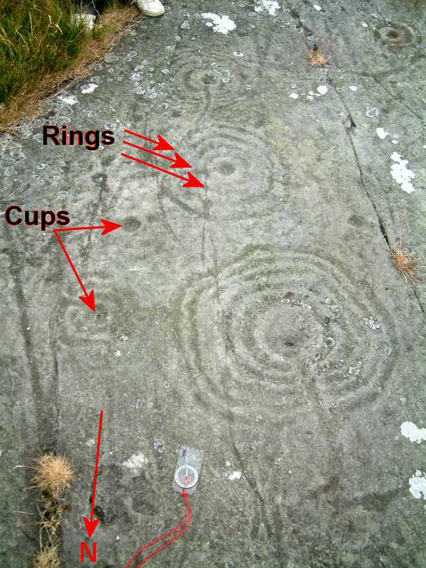
Cup and ring marks or cup marks are a form of prehistoric art found in the Atlantic seaboard of Europe (Ireland, Wales, Northern England, Scotland, France (Brittany), Portugal, and Spain (Galicia) – and in Mediterranean Europe – Italy (in Alpine valleys and Sardinia), Azerbaijan and Greece (Thessaly and Irakleia (Cyclades)), as well as in Scandinavia (Denmark, Sweden, Norway and Finland) and in Switzerland (at Caschenna in Grisons). Similar forms are also found throughout the world including Australia, Gabon, Greece, Hawaii, India ( Daraki-Chattan), Israel, Mexico, Mozambique and the Americas. The oldest known forms are found from the Fertile Crescent to India. They consist of a concave depression, no more than a few centimetres across, pecked into a rock surface and often surrounded by concentric circles also etched into the stone. Sometimes a linear channel called a gutter leads out from the middle. The decoration occurs as a petroglyph on natural boulders and outcrops a ... [...More Info...] [...Related Items...] OR: [Wikipedia] [Google] [Baidu] |
Howgill Fells
The Howgill Fells are uplands in Northern England between the Lake District and the Yorkshire Dales, lying roughly within a triangle formed by the towns of Sedbergh and Kirkby Stephen and the village of Tebay.The Howgill Fells in Cumbria ''www.visitcumbria.com'' The name Howgill derives from the word ''haugr'' meaning a hill or barrow, plus ''gil'' meaning a narrow valley. Geography The Howgill Fells are bounded by the (and the |
Slate Industry
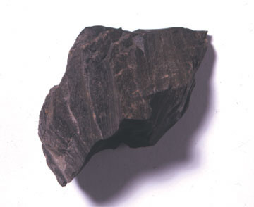
The slate industry is the industry related to the extraction and processing of slate. Slate is either quarried from a ''slate quarry'' or reached by tunneling in a ''slate mine''. Common uses for slate include as a roofing material, a flooring material, gravestones and memorial tablets, and for electrical insulation. Slate mines are found around the world. 90% of Europe's natural slate used for roofing originates from the Slate Industry in Spain.European Association of Mining Industries website retrieved on 26/01/2010 The major slate mining region in the United Kingdom is ; in Co ... [...More Info...] [...Related Items...] OR: [Wikipedia] [Google] [Baidu] |


.jpg)

