|
Llanidan
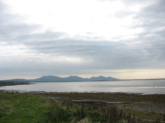
Llanidan is a community in the south of Anglesey, Wales which includes the village of Brynsiencyn (). The parish is along the Menai Strait, about 4 miles north-east of Caernarfon (across the strait). The parish church of St Nidan is near the A4080 highway, a little to the east of Brynsiencyn. The ruins of an earlier parish church survive. History Possible site of Roman invasions On the basis of field names it has been suggested that the Roman army under Suetonius Paulinus landed here in 60, and again in 78 under Agricola, overcoming the Ordovices of north-west Wales and Anglesey, at a spot known as Bryn Beddau, (Hill of Graves in Welsh). In 1867 it was suggested that the local field names "Maes Hir Gad" (Area of long battle) and "Cae Oer Waedd" (Field of cold or bitter lamentation) may indicate the site of these battles Roman coastal settlement Near Tai Cochion house, excavation and geophysical survey has revealed part of a Roman settlement of unusual layout, and on the ... [...More Info...] [...Related Items...] OR: [Wikipedia] [Google] [Baidu] |
Old Church Of St Nidan, Llanidan
The Old Church of St Nidan, Llanidan is a medieval church in the community of Llanidan, in Anglesey, North Wales, close to the Menai Strait. The first church on the site was established in the 7th century by St Nidan, the confessor of the monastery at Penmon, Anglesey, but the oldest parts of the present structure, are now closed and partly ruined, date from the 14th century. In about 1500 the church was enlarged by the addition of a second nave on the north side, separated from the earlier nave by an arcade of six arches. During 1839 till 1843 a new church was built nearby to serve the local community, partly due to the cost of repairing the old church. Much of the building was subsequently demolished, leaving only part of the western end and the central arcade. The decision was condemned at the time by Harry Longueville Jones, a clergyman and antiquarian, who lamented the "melancholy fate" of what he called "one of the largest and most important hurchesin the island of A ... [...More Info...] [...Related Items...] OR: [Wikipedia] [Google] [Baidu] |
St Nidan's Church, Llanidan
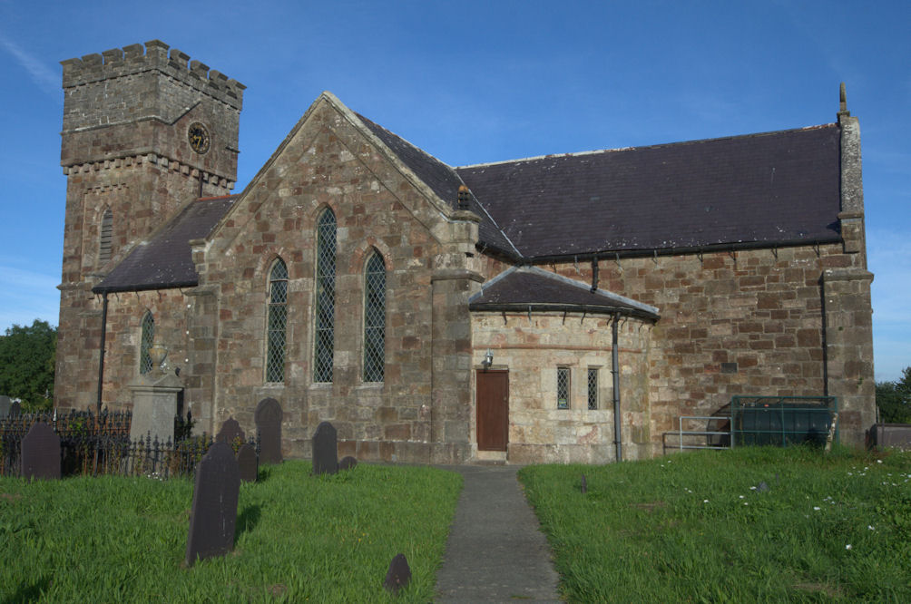
St Nidan's Church, Llanidan is a 19th-century parish church near the village of Brynsiencyn, in Anglesey, north Wales. Built between 1839 and 1843, it replaced the Old Church of St Nidan, Llanidan, which needed significant repair, providing a place of Anglican worship nearer to the village than the old church. Some items were moved here from the old church, including the 13th-century font, two bells from the 14th and 15th century, and a reliquary thought to hold the remains of St Nidan. The tower at the west end has been described as "top heavy" and looking like "a water tower". The church is still used for worship by the Church in Wales, one of five in a group of parishes in the south of Anglesey. It is a Grade II listed building, a national designation given to "buildings of special interest, which warrant every effort being made to preserve them", in particular because it is regarded as "a distinctive example of pre-archaeological gothic revival work." The 19th-century c ... [...More Info...] [...Related Items...] OR: [Wikipedia] [Google] [Baidu] |
Bro Rhosyr
Bro Rhosyr is an electoral ward in the south of Anglesey, Wales, created in 2012. Bro Rhosyr includes the communities of Llanidan (Brynsiencyn), Llanfihangel Ysgeifiog (Gaerwen), Llanddaniel-fab and Llangristiolus. The ward elects two county councillors to the Isle of Anglesey County Council. Bro Aberffraw ward lies to the southwest while the Aethwy ward lies to the northeast. Canolbarth Môn borders to the north. Bro Rhosyr was created following the Isle of Anglesey electoral boundary changes in 2012, which created 11 multi-councillor wards from 40 single-councillor wards. The new ward replaced the former Llanidan county ward and parts of the wards of Bodffordd, Bodorgan and Llanfihangel Ysgeifiog which had each elected their own county councillor. Elections results Following the inaugural May 2013 county elections the ward was represented by two Independent Independent or Independents may refer to: Arts, entertainment, and media Artist groups * Independents (artist ... [...More Info...] [...Related Items...] OR: [Wikipedia] [Google] [Baidu] |
Anglesey
Anglesey (; cy, (Ynys) Môn ) is an island off the north-west coast of Wales. It forms a Local government in Wales, principal area known as the Isle of Anglesey, that includes Holy Island, Anglesey, Holy Island across the narrow Cymyran Strait and some islets and Skerry, skerries. Anglesey island, at , is the list of islands of Wales, largest in Wales, the list of islands of the British Isles, seventh largest in Britain, List of islands in the Irish Sea, largest in the Irish Sea and second most populous there after the Isle of Man. Isle of Anglesey County Council administers , with a 2011 census population of 69,751, including 13,659 on Holy Island. The Menai Strait to the mainland is spanned by the Menai Suspension Bridge, designed by Thomas Telford in 1826, and the Britannia Bridge, built in 1850 and replaced in 1980. The largest town is Holyhead on Holy Island, whose ferry service with Ireland handles over two million passengers a year. The next largest is Llangefni, the cou ... [...More Info...] [...Related Items...] OR: [Wikipedia] [Google] [Baidu] |
Foryd Bay
Y Foryd (meaning 'the estuary' or 'the inlet'), also known as Foryd Bay, is a tidal bay in Gwynedd, Wales. It is located at the south-western end of the Menai Strait, about two miles south-west of Caernarfon. Several rivers flow into the bay and there are large areas of mudflats and salt marsh. A shingle spit partly blocks the mouth of the bay. At the north-western end is Fort Belan, built during the 18th century. Aerial photography in the drought of 2018 identified rectangular structures possibly of Roman age, at Glan y Mor, oslightly raised ground adjacent to the shoreline This layout is very unusual in Roman Wales; it is rectilinear but has no defences and is otherwise unlike the military Roman sites in Wales, nor does it resemble the native defended settlements with their roundhouses and irregular outlines, nor the occasional villas. It is similar to the buildings and ditched enclosures excavated on the other side of the Menai Strait at Tai Cochion. To the south is a rectan ... [...More Info...] [...Related Items...] OR: [Wikipedia] [Google] [Baidu] |
Sedgefield Sedgefield is a market town and civil parish in County Durham, England. It had a population of 5,211 as at the 2011 census |


