|
Lake Afdera
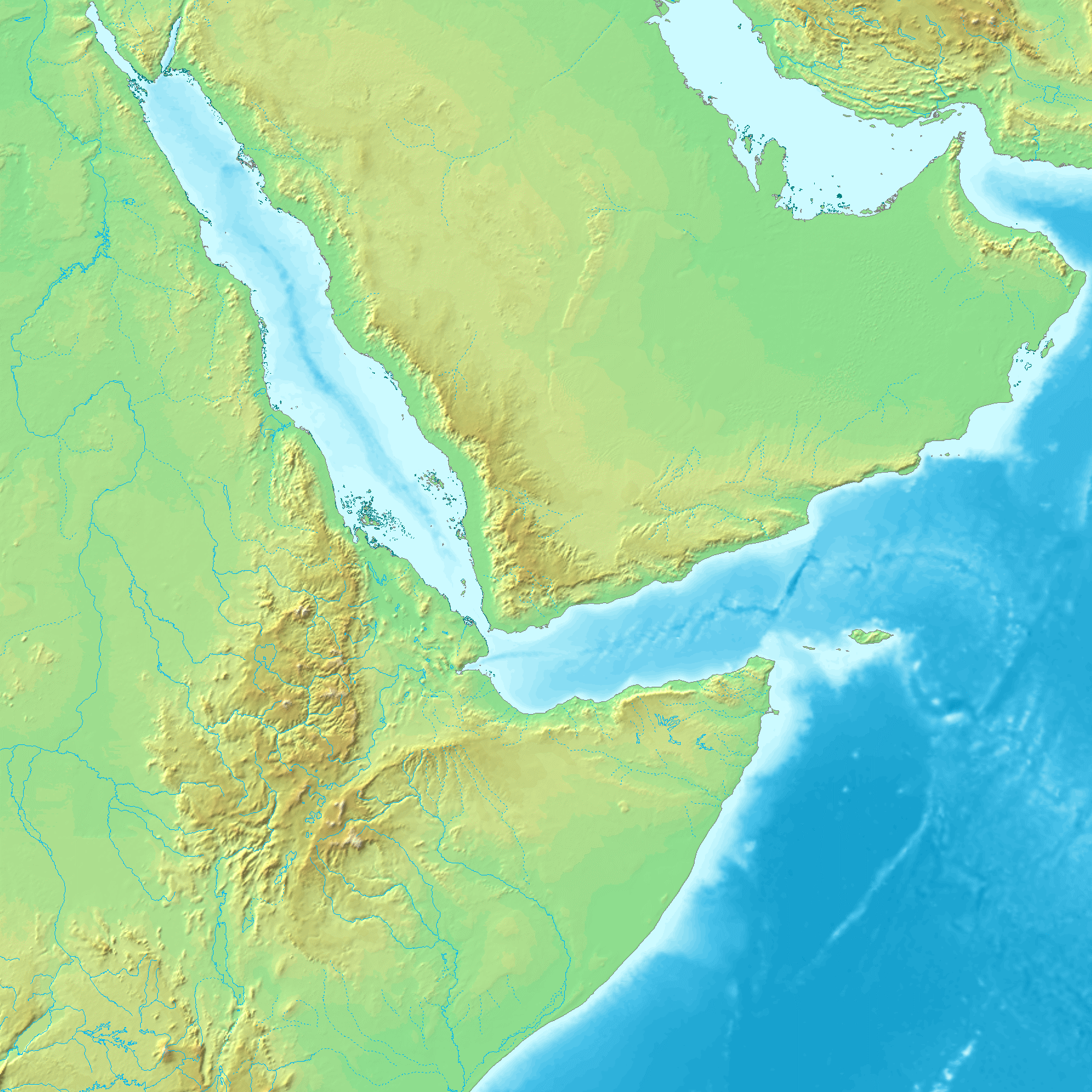
Lake Afrera (in Italian Lake Giuletti) is a hypersaline lake in northern Ethiopia. Located in Kilbet Rasu, Afar Region, it is one of the lakes of the Danakil Depression. It has a surface of and holds 2.4 km3 of brine. The maximal depth of Lake Afdera is 80 m in the northern basin and 76 m in the southern basin. No major river drain the lake. It is fed by hot springs along the shores of the lakes. It is also known as Lake Giulietti, the name Raimondo Franchetti gave it after the Italian explorer Giuseppe Maria Giulietti was slain by Afars southwest of the lake. Another name for this body of water is Lake Egogi (or Egogi Bad), which is the name L. M. Nesbitt's Afar guide gave it when the Italian explorer became the first European to see it in 1928. The single island in Lake Afrera, Franchetti Island (also known as "Deset"), located in the southern part of the lake, is considered the lowest-lying island in the world. Unlike other saline lakes in Ethiopia (e.g., Lakes Abijatta, ... [...More Info...] [...Related Items...] OR: [Wikipedia] [Google] [Baidu] |
Afar Depression
The Afar Triangle (also called the Afar Depression) is a geological depression caused by the Afar triple junction, which is part of the Great Rift Valley in East Africa. The region has disclosed fossil specimens of the very earliest hominins; that is, the earliest of the human clade, and it is thought by some paleontologists to be the cradle of the evolution of humans. The Depression overlaps the borders of Eritrea, Djibouti and the entire Afar Region of Ethiopia; and it contains the lowest point in Africa, Lake Assal, Djibouti, at below sea level. The Awash River is the main waterflow into the region, but it runs dry during the annual dry season, and ends as a chain of saline lakes. The northern part of the Afar Depression is also known as the Danakil Depression. The lowlands are affected by heat, drought, and minimal air circulation, and contain the hottest places (year-round average temperatures) of anywhere on Earth. The Afar Triangle is bordered as follows (see the to ... [...More Info...] [...Related Items...] OR: [Wikipedia] [Google] [Baidu] |
Danakilia Franchettii
''Danakilia franchettii'' is a species of cichlid fish endemic to the saline Lake Afrera and nearby swamps in Ethiopia. It was the only member of the genus ''Danakilia'' until the description of '' D. dinicolai'' in 2010. The species is listed as endangered, due to water abstraction and mining of salt in the lake. The specific name honours the Italian explorer Raimondo Franchetti Baron Raimondo Franchetti has been the name of more than one Italian people, Italian Baron, of the noble Franchetti family. The Franchettis were an Italian Jewish family who, from the 18th century onwards, were one of the wealthiest families in t ... (1889-1935), who organised, at his own expense, the expedition that collected type. References Endemic fauna of Ethiopia franchettii Fish of Ethiopia Fish described in 1931 {{Tilapiini-stub ... [...More Info...] [...Related Items...] OR: [Wikipedia] [Google] [Baidu] |
Tat Ali
Tat Ali is a low Holocene shield volcano located in the northern part of the Afar Region of Ethiopia. This elevation is characterized as having an elongated summit depression that has produced a variety of rock types, ranging from basalts to pantellerites. NNW-SSE-trending fissures cutting the volcano have fed basaltic lava flows; those NE of Lake Afrera are of prehistoric date. Late-stage volcanism produced youthful basaltic lava flows on the floor of the summit depression, which is also the site of prominent fumarolic activity. Tat Ali, Erta Ale, Alu and other Ethiopian highlands are together known as the Danakil Alps.Handbook of Lithium and Natural Calcium Chloride By Donald E. Garrett See also * List of volcanoes in Ethiopia This is a list of volcanoes in Ethiopia. It includes both active and extinct vents. See also * List of mountains in Ethiopia * Geography of Ethiopia * Lists of volcanoes References {{Global Volcanism Program Lists of landforms of Eth ... R ... [...More Info...] [...Related Items...] OR: [Wikipedia] [Google] [Baidu] |
Erta Ale Range
Erta Ale Range is the most important axial volcanic chain of the Afar Depression, Afar Region, Ethiopia. It consists mostly of shield volcanoes. The active volcano Erta Ale is a prominent feature of the range. The highest volcano of the range is Ale Bagu, with an elevation of above sea level. Other named peaks (with their elevations) include Alu (Ethiopia), Alu (), Dalaffilla () and Borale Ale (). Erta Ale This volcano of Erta Ale is the most active in Ethiopia and rises to at its highest point. It is one of many shield volcanoes in the area and is wide with a elliptical summit containing many steep pit pit crater, craters. Its perpetually active pit craters are renowned for their churning lava lakes. See also *Danakil Alps *Geography of Ethiopia *List of volcanoes in Ethiopia References Further reading Mountain ranges of Ethiopia Natural disasters in Ethiopia Afar Region {{volcanology-stub ... [...More Info...] [...Related Items...] OR: [Wikipedia] [Google] [Baidu] |
Addis Fortune
''Addis Fortune'' (also known as ''Fortune'') is a private and independent newspaper based in Addis Ababa, Ethiopia Ethiopia, officially the Federal Democratic Republic of Ethiopia, is a landlocked country located in the Horn of Africa region of East Africa. It shares borders with Eritrea to the north, Djibouti to the northeast, Somalia to the east, Ken .... Overview It is the largest English-language weekly in the country. Its circulation is often quoted at a meager 7,500 copies per week in a country with a population of 100 million. However, its rival, ''Capital'', which is also based in Addis Ababa, recently claimed to have topped ''Fortune'' in circulation in a project launched to celebrate its ten-year anniversary. Fortune still claims to be the largest circulating paper in its category, surpassing all others in the competition by an average of 60%. Its current editor-in-chief is Hagos Gebreamlak. History The newspaper was first issued in the year 2000. Making it ... [...More Info...] [...Related Items...] OR: [Wikipedia] [Google] [Baidu] |
Sulfuric Acid
Sulfuric acid (American spelling and the preferred IUPAC name) or sulphuric acid (English in the Commonwealth of Nations, Commonwealth spelling), known in antiquity as oil of vitriol, is a mineral acid composed of the elements sulfur, oxygen, and hydrogen, with the molecular formula . It is a colorless, odorless, and Viscosity, viscous liquid that is Miscibility, miscible with water. Pure sulfuric acid does not occur naturally due to its Dehydration reaction, strong affinity to water vapor; it is Hygroscopy, hygroscopic and readily absorbs water vapor from the Atmosphere of Earth, air. Concentrated sulfuric acid is a strong oxidant with powerful dehydrating properties, making it highly corrosive towards other materials, from rocks to metals. Phosphorus pentoxide is a notable exception in that it is not dehydrated by sulfuric acid but, to the contrary, dehydrates sulfuric acid to sulfur trioxide. Upon addition of sulfuric acid to water, a considerable amount of heat is releas ... [...More Info...] [...Related Items...] OR: [Wikipedia] [Google] [Baidu] |
2011 Nabro Eruption
The 2011 Nabro eruption was an eruption of the Nabro stratovolcano in the Southern Red Sea Region of Eritrea, which began on 12 June 2011 after a series of earthquakes. The eruption killed seven and possibly a further 31 people and is estimated to be the highest altitude injection of sulfur dioxide (SO2) ever observed by satellite. The Mount Pinatubo eruption 20 years earlier emitted ten times more SO2. The ash cloud from the eruption reached altitudes which disrupted airline traffic in the region. Until the eruption began, the volcano had no records of historical eruptions. Gallery Image:Nabro Volcano ash cloud 2011-06-13, Eritrea.jpg, Satellite image of Ethiopia/ Eritrea showing the ash plume from Nabro on 13 June 2011. Image:Eruption_at_Nabro_Volcano,_Eritrea,_06-19-2011.jpg, False color image from 19 June 2011 showing extent of lava flow on that date. Image:Activity_at_Nabro_volcano,_Eritrea_06-19-2011.jpg, True color image from 19 June 2011 showing area affected by tephra ... [...More Info...] [...Related Items...] OR: [Wikipedia] [Google] [Baidu] |
Ethiopian Mineral Resources Development Enterprise
Ethiopians are the native inhabitants of Ethiopia, as well as the global diaspora of Ethiopia. Ethiopians constitute several component ethnic groups, many of which are closely related to ethnic groups in neighboring Eritrea and other parts of the Horn of Africa. The first documented use of the name "Ethiopia" from Greek name , was in the 4th century during the reign of Aksumite king Ezana. There were three ethnolinguistic groups in the Kingdom of Aksum; Semitic, Cushitic, and Nilo-Saharan (ancestors of the modern-day Kunama and Nara). The Kingdom of Aksum remained a geopolitically influential entity until the decline of its capital — also named Axum — beginning in the 7th century. Nevertheless, the core Aksumite civilization was preserved and continued into the successive Zagwe dynasty. By this time, new ethnic groups emerged – the Tigrayans and Amharas. During the Solomonic period, the latter established major political and cultural influence in the Horn of Africa. I ... [...More Info...] [...Related Items...] OR: [Wikipedia] [Google] [Baidu] |
Rock Salt
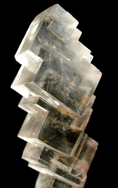
Halite ( ), commonly known as rock salt, is a type of salt, the mineral (natural) form of sodium chloride ( Na Cl). Halite forms isometric crystals. The mineral is typically colorless or white, but may also be light blue, dark blue, purple, pink, red, orange, yellow or gray depending on inclusion of other materials, impurities, and structural or isotopic abnormalities in the crystals. It commonly occurs with other evaporite deposit minerals such as several of the sulfates, halides, and borates. The name ''halite'' is derived from the Ancient Greek word for "salt", ἅλς (''háls''). Occurrence Halite dominantly occurs within sedimentary rocks where it has formed from the evaporation of seawater or salty lake water. Vast beds of sedimentary evaporite minerals, including halite, can result from the drying up of enclosed lakes and restricted seas. Such salt beds may be hundreds of meters thick and underlie broad areas. Halite occurs at the surface today in playas in reg ... [...More Info...] [...Related Items...] OR: [Wikipedia] [Google] [Baidu] |
Pupfish
Pupfish are a group of small killifish belonging to ten genera of the family Cyprinodontidae of ray-finned fish. Pupfish are especially noted for being found in extreme and isolated situations. They are primarily found in North America, South America, and the Caribbean region. As of August 2006, 120 nominal species and 9 subspecies were known. Several pupfish species are extinct and most extant species are listed. In the U.S., the most well-known pupfish species may be the Devils Hole pupfish, native to Devils Hole on the Nevada side of Death Valley National Park. Since 1995 the Devils Hole pupfish has been in a nearly steady decline, where it was close to extinction at 35–68 fish in 2013. The common name is said to derive from the mating habits of the males, whose activities vaguely resemble puppies at play; Carl L. Hubbs, a prominent ichthyologist and one of the first people to take an interest in them, coined the name after he observed their "playful" circling and tusslin ... [...More Info...] [...Related Items...] OR: [Wikipedia] [Google] [Baidu] |


